Hello everyone, and good day to you! Here is your CCN Weather update for Wednesday April 23, 2025.
This weather update is sponsored by Freedom Insurance of Whiteville. Protect what matters most with Freedom Insurance. Life can be full of surprises, but with Freedom Insurance, you will always be prepared. Whether it’s your home, car, business, or health, we provide customized coverage to keep you and your family safe. Contact Freedom today at 910-640-2828!
STATISTICS for Tuesday 4/22/2025
High: 87.1°F at 2:54 PM (Normal 76)
Low: 62.6°F at 4:46 AM (Normal 51)
Precip: 0.00 IN
View real-time data from the weather station at College Street Weather Station.
Here’s today’s Bottom Line
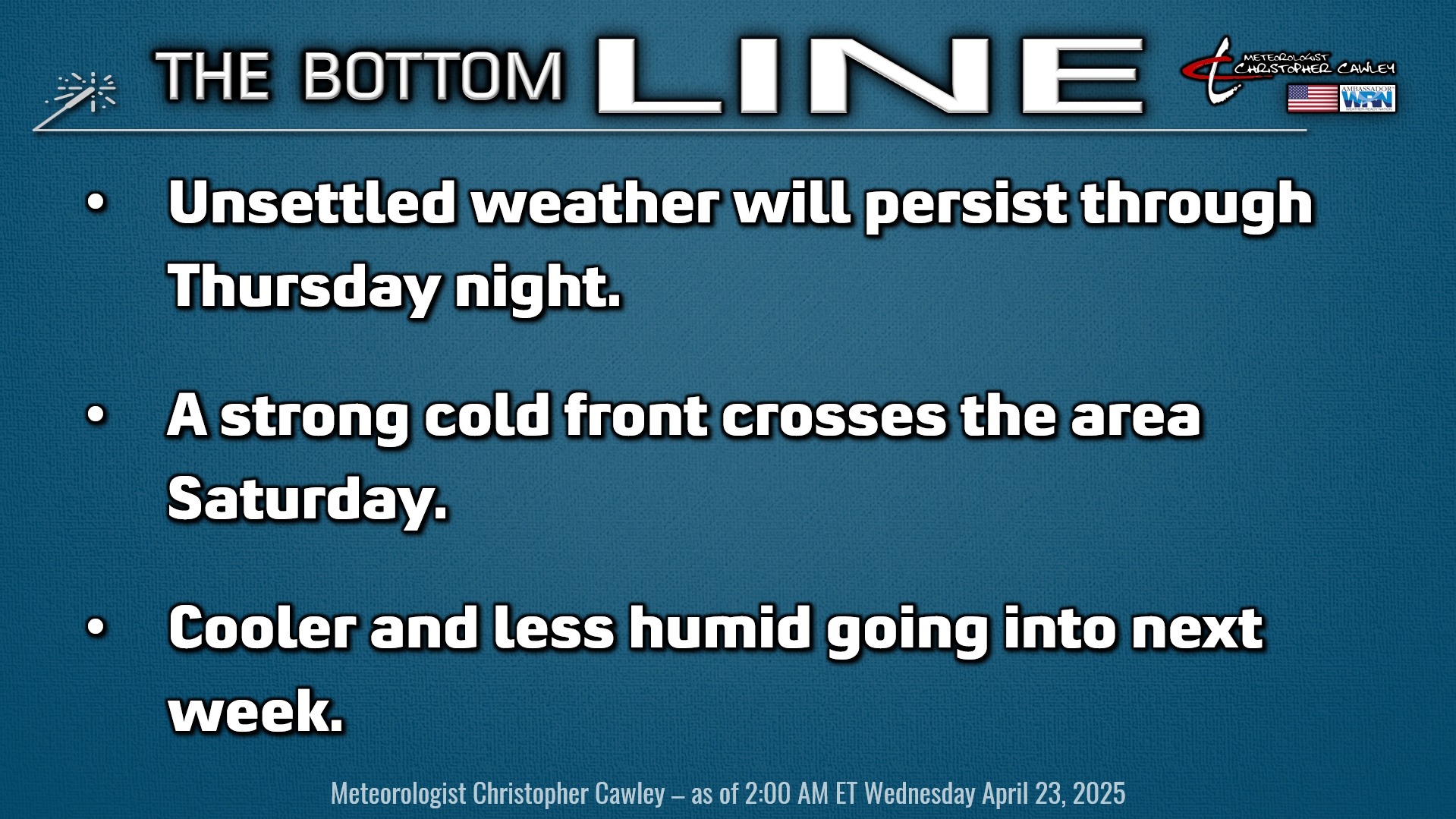
“Scattered showers and thunderstorms” are the 4 words (abbreviated SSaT) that we can use to describe our weather today through Thursday night. And I could honestly leave this report right now and call it good.
But let’s be a bit more thorough.
A cold front will be stalled just inland from the coast, roughly along route 17 and then curving to a west-to-east orientation across South Carolina.
That front will go absolutely nowhere through late Thursday night as it gradually “washes out,” or kind of falls apart.
A center of high pressure farther north of the front and a center of high pressure much farther south and east will keep that frontal boundary in place. A west- to southwesterly wind flow will keep very moist air in place while the front itself acts as a trigger for the development of the aforementioned SSaT.
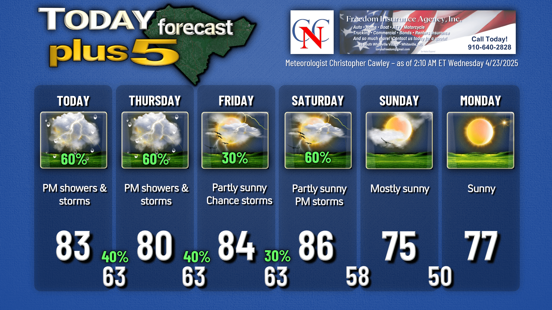
For today expect considerable cloudiness throughout the day, with the storm chances ramping up later this afternoon. I believe that the majority of the day will remain dry in most areas, although some places may get a shower or two at any given time. These SSaT will tend to dissipate during the evening hours, during the loss of the heating of the day, leaving us with mostly cloudy and humid conditions overnight.
Not everyone will see rainfall. Some folks may see a whole lot of it. That is the hit-and-miss nature of this kind of event.
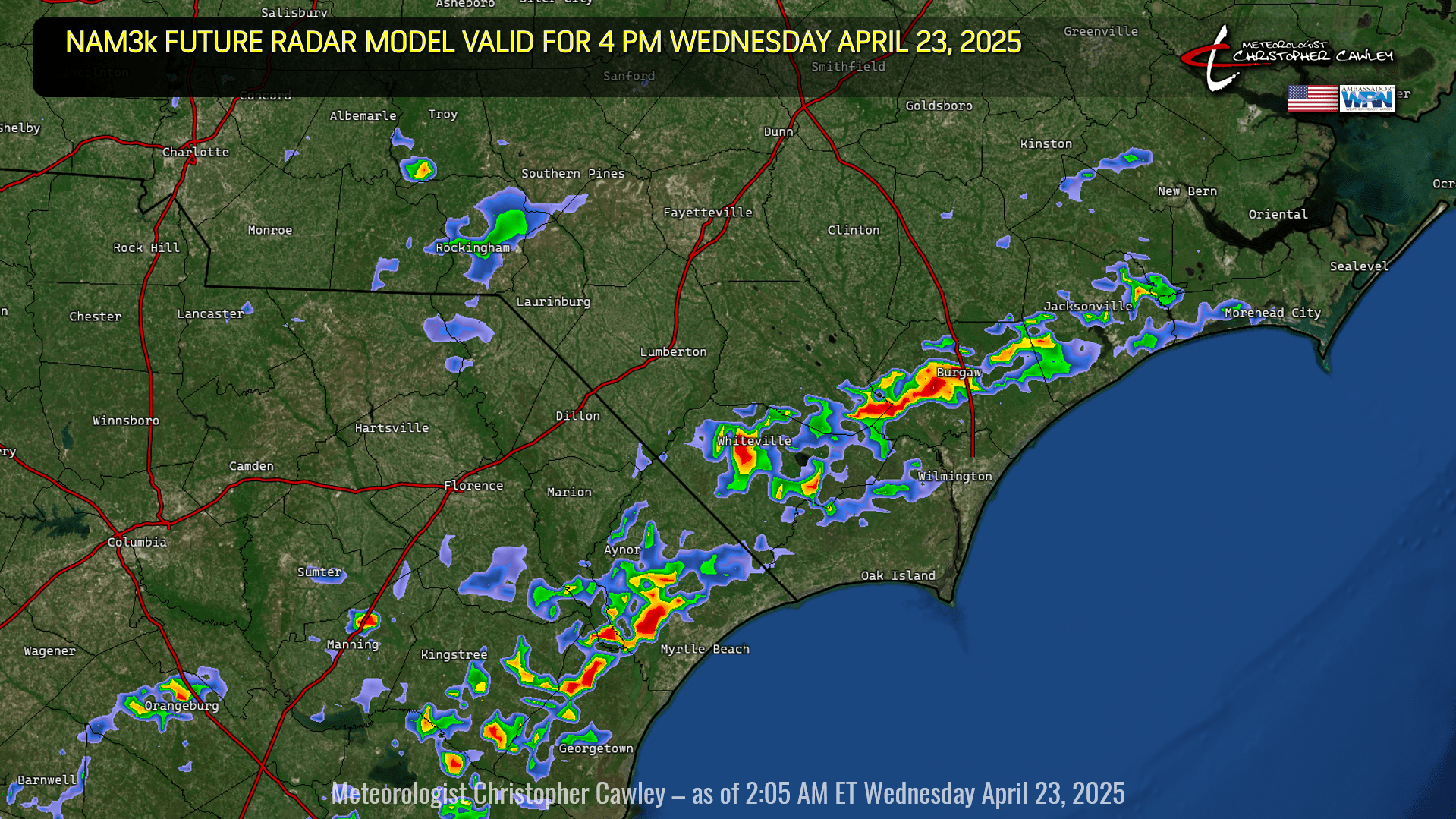
Here is the future radar model valid for 4 PM this afternoon. This is a model of what the radar COULD look like.
Wash, rinse, and repeat for Thursday. Clouds, a few breaks of sunshine, and then the threat for SSaT during the afternoon and evening.
We’ll see more in the way of sunshine on your Friday as that frontal boundary kind of fades away, but you might still want to keep the umbrella handy as an ISOLATED shower/storm may develop during the afternoon hours.
A true-blue cold front will approach and move through the area on Saturday, with the frontal passage likely taking place late in the afternoon or early evening hours. This will bring an even more moist southerly wind flow with unstable air in place and the likelihood of a line of showers and thunderstorms ahead of the front. Severe weather is doubtful at this time but will be something I’ll keep an eye on.
Much cooler and less humid air arrives for Sunday and Monday. If you’re a fan of summer heat and humidity, hang in there as the modeling points to an upward trend in those departments once we turn the calendar to May. If you’re NOT a fan of the heat, well, Sunday and Monday are your days to, as my mentor Meteorologist Rich Lupia would say, “get out and enjoy it.”
Here is your Freedom Insurance Today-plus-Five Forecast:
That’s going to do it for today’s report. As always, thank you for reading and for supporting Columbus County News. Have a great day!
–CCN Meteorologist Christopher Cawley