YnCCN Weather Update for Friday July 11, 2025.
This weather update is sponsored by Freedom Insurance of Whiteville. No weather worries with Freedom Insurance. For home, car, boat, or whatever you need, Freedom can provide customized coverage to keep you and your family safe. Contact Freedom today at 910-640-2828!
Here’s today’s Bottom Line
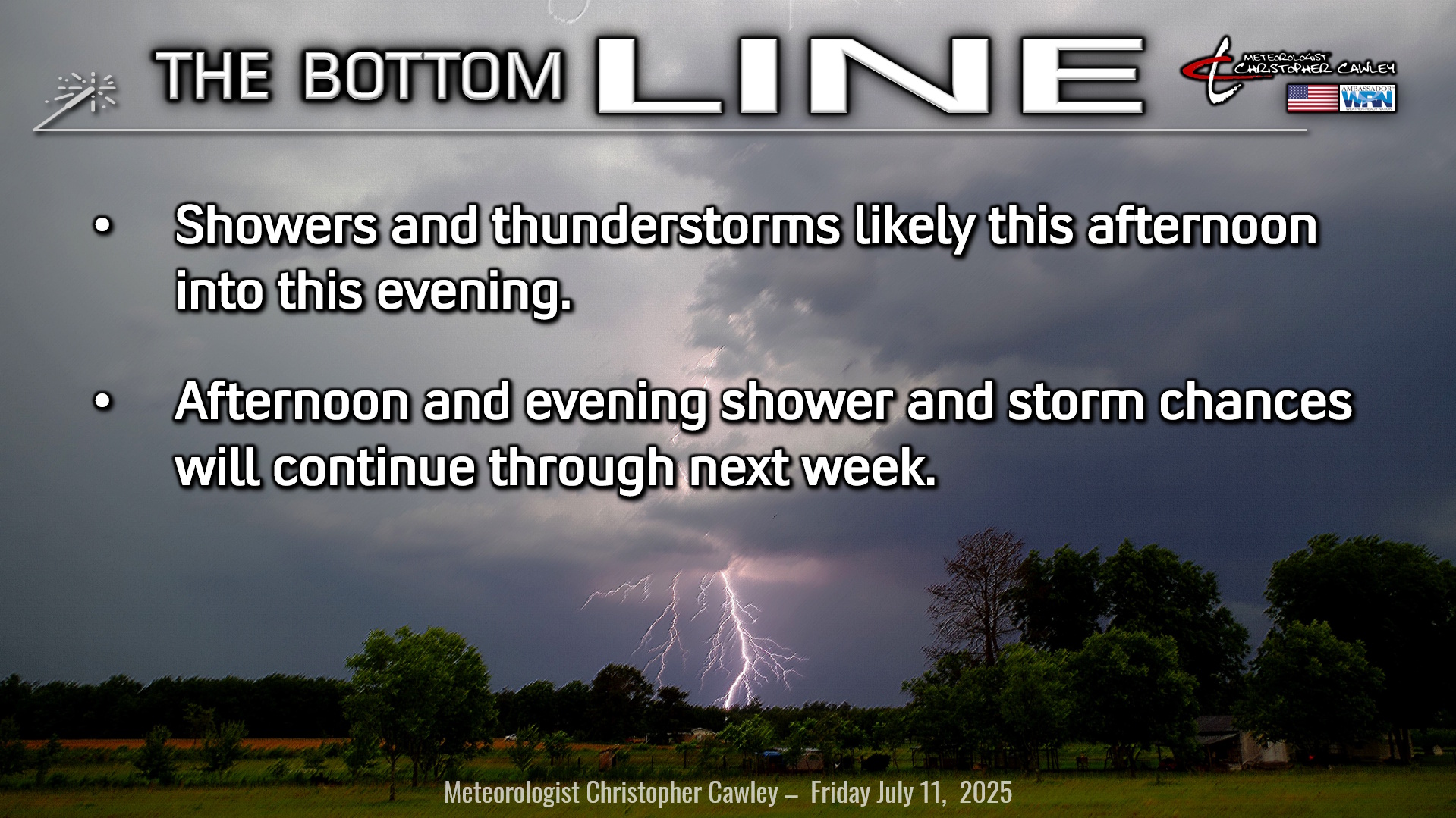
Broad, weak generalized “troughiness” in our atmosphere will continue to interact with the sea-breeze and Piedmont troughs, and will maintain the potential for afternoon and evening showers and thunderstorms today… honestly right through next week… although today and Sunday appear to be the best chances for storms.
As they did yesterday evening, these storms will produce locally intense rainfall leading to isolated short-term flooding. However, several days of repeated activity over the same area could result in a cumulative impact by Sunday.
Storms this afternoon and on Saturday afternoon could produce some damaging wet downburst winds, so stay alert for possible warnings.
Storms will also be incredible lightning-producers.
A bit of a northwesterly wind flow should develop by Sunday around an upper-level high pressure ridge to our south. This could produce some more organized thunderstorm activity at some point during the afternoon and evening. An approaching cold front (if you want to call it that) suggests this will be the best day for organized activity. The frontal boundary loitering about the area Monday and Tuesday could also provide triggers for more organized development. Outside of these more enhanced triggers, daily afternoon showers and storms are possible at any given point and time.
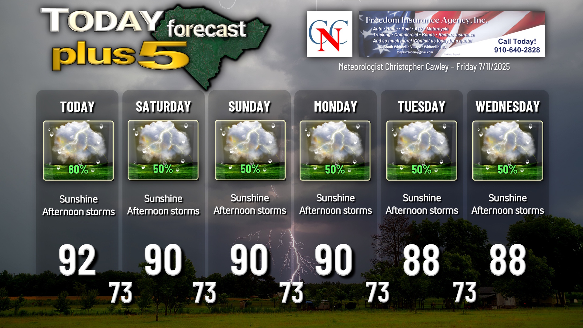
So in summary, I can’t guarantee any completely “dry” days right through the end of next week. For the graphic, I went with a “cut-and-paste” for each day — sunshine, 50% risk for afternoon and evening thunderstorms. I’m not going to try to micromanage the percentages.
TROPICAL UPDATE: Global modeling continues to imply that something might come together in the northern Gulf after July 15th. This is just speculation based on model trends, but the NWS CPC also has that area outlined for a 20% probability of something coming together in the July 15-20 timeframe. In the meantime, no tropical development is expected. The official NHC forecast is no development during the next 7 days.
Here is your Freedom Insurance Today-plus-Five Forecast:
–Meteorologist Christopher Cawley