CCN Weather Update for Friday July 25, 2025.
This weather update is sponsored by Freedom Insurance of Whiteville. No weather worries with Freedom Insurance. For home, car, boat, or whatever you need, Freedom can provide customized coverage to keep you and your family safe. Contact Freedom today at 910-640-2828!
View real-time data from the weather station at College Street Weather Station.
Here’s today’s Bottom Line
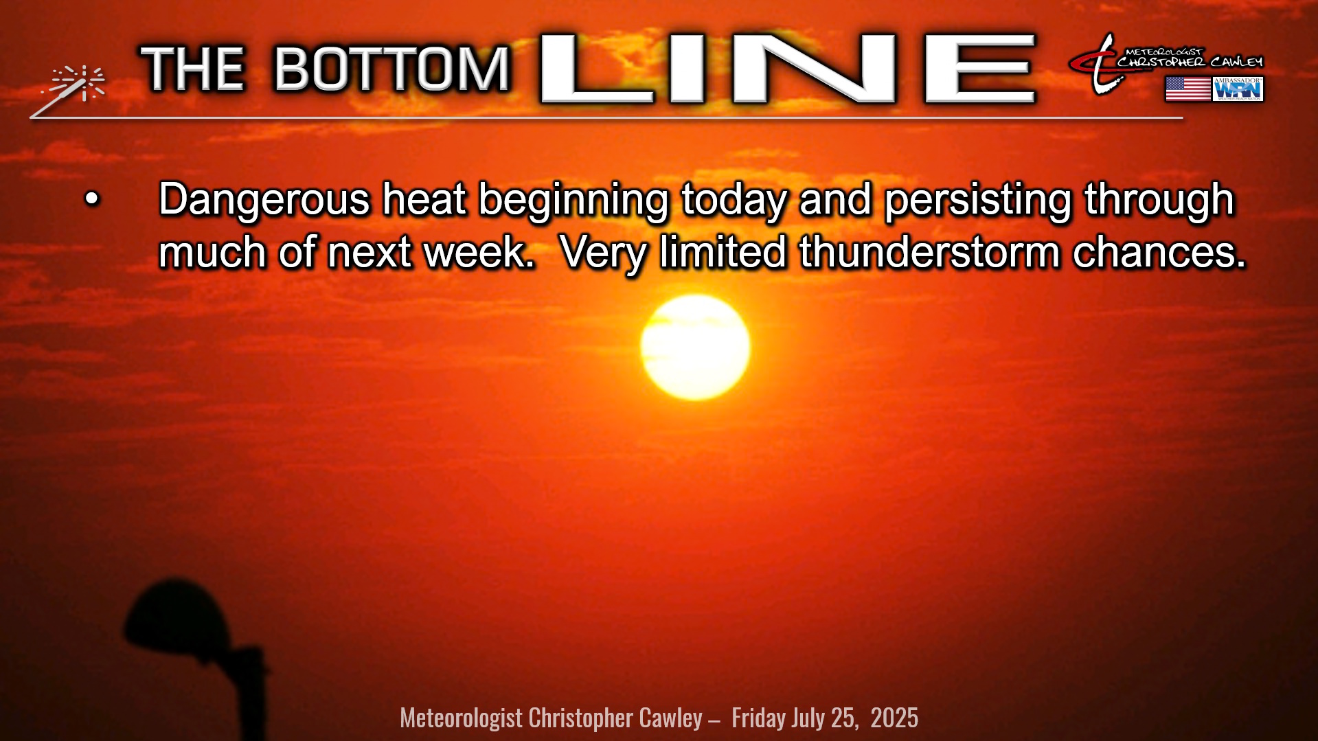
DANGEROUS, PROLONGED HEAT WAVE BEGINS TODAY.
An unusually strong high pressure ridge over the area will bring dry skies, unrelenting sunshine, unrelenting heat, nearly zero thunderstorm chances today through the weekend and well into next week.
These temps are no joke, folks.
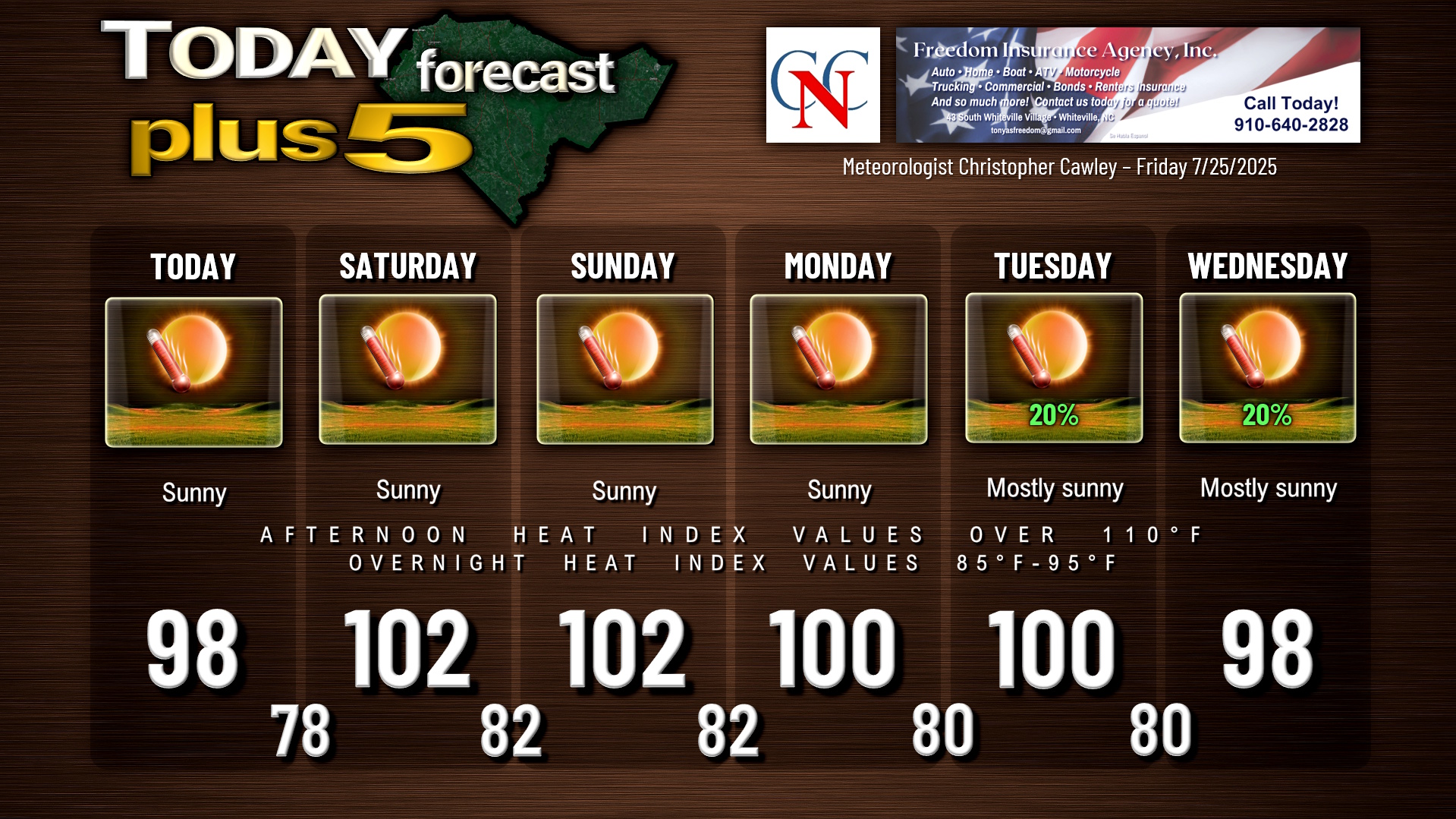
- Highs today will be in the 96-100 range.
- Highs Saturday and Sunday will be in the 100-104 range.
- Highs Monday and Tuesday will be around 100.
- Highs Wednesday and Thursday will be in the upper 90s.
These are actual highs, NOT the heat index.
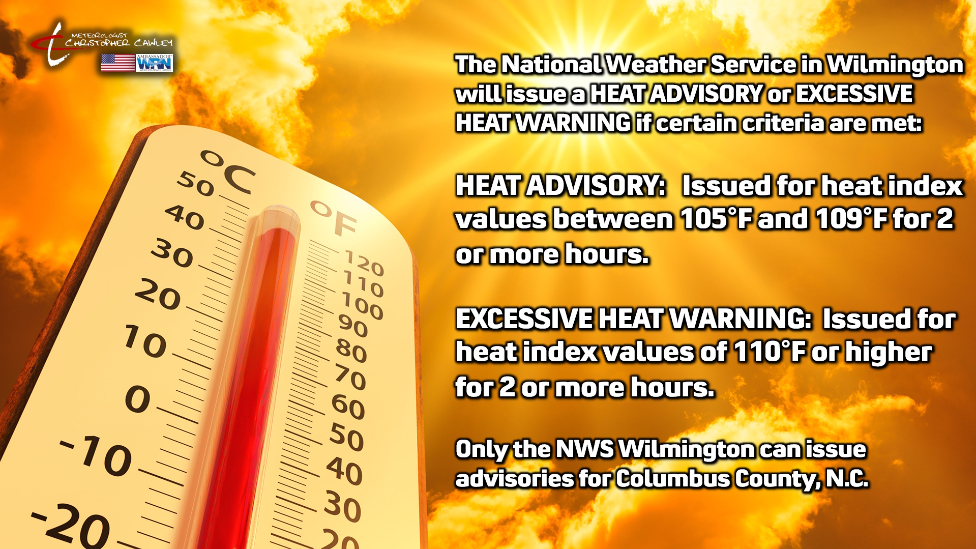
Heat index values will be in the 108-113+ range straight through the forecast period. NWS will advertise heat index values at the airports, which is great, but nobody lives there. My heat index forecast of 108-113+ is for the locations where people actually live and work.
There will be little to no relief during the overnight hours. Lows will be a few ticks either side of 80 for the most part. With humidity levels in the 90% to 100% range during the nighttime hours, heat index values will still range between 85-95 during the night. Nearly calm winds means no air flow through open windows.
There is hint in the modeling that by Thursday the high pressure ridge starts to loosen its grip and a rather significant cold front crosses the area. Should this be the case, severe weather is almost a certainty given the multiple days of immense heat and instability over the area. That will need to be watched.
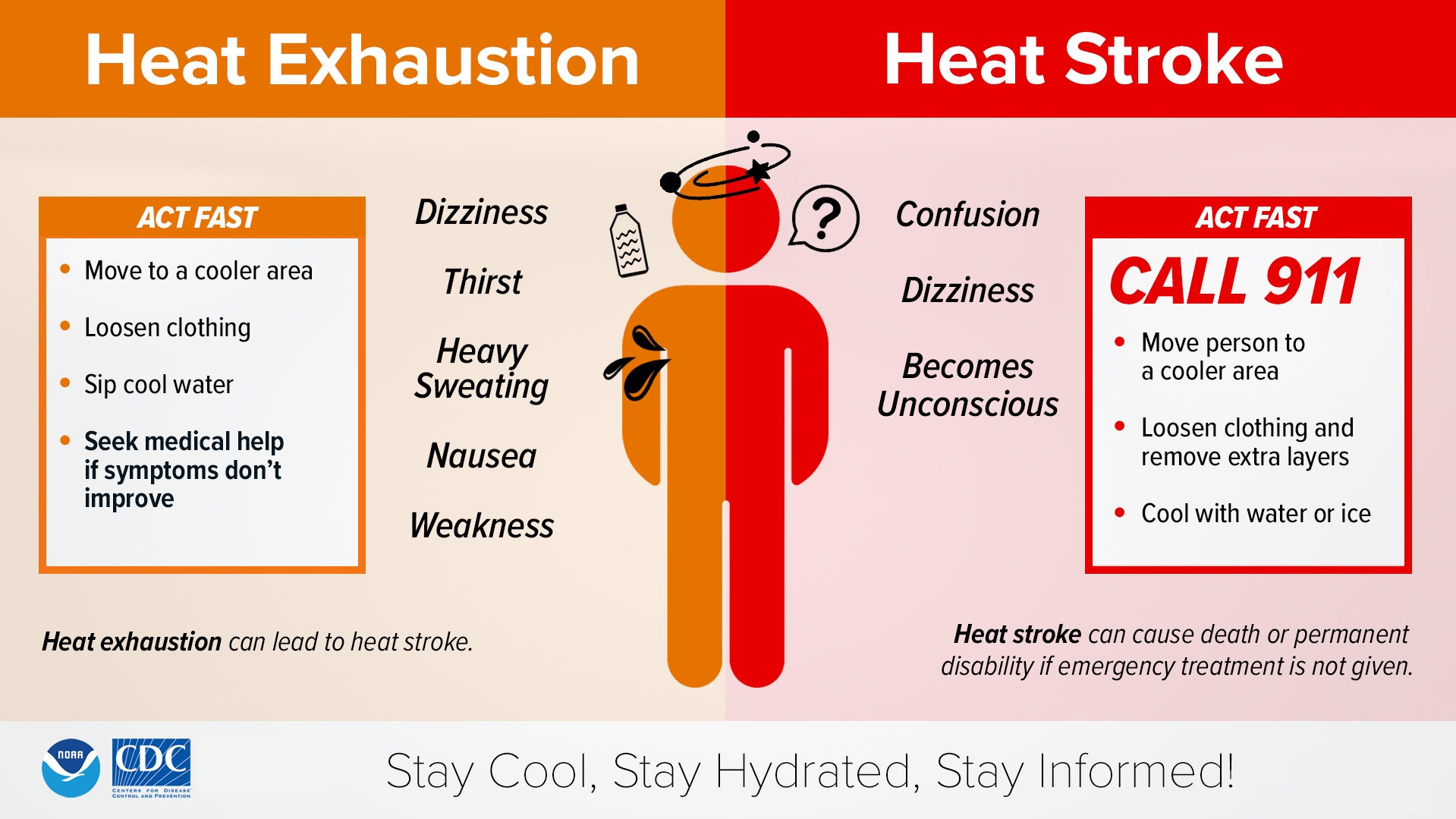
Please, please take precautions with the heat. It’s not a joke, like I said, and heat exposure is one of the top weather-related killers.
Pay attention to symptoms of heat exhaustion and heat stroke.
Heat stroke is a medical emergency and requires a 911 call.
The NWS has a heat advisory posted for today, and will likely go with extreme heat warnings over the weekend.
TROPICAL OUTLOOK: A broad, disorganized area of low pressure continues to move along the Gulf coast. This has a 10% chance of developing into a tropical system before eventually making landfall over the east coast of Texas. Once it makes landfall, that’s it for that. Otherwise, nothing of interest in the tropics.
Here is your Freedom Insurance Today-plus-Five Forecast:
–Meteorologist Christopher Cawley