CCN Weather Update for Friday August 8, 2025.
This weather update is sponsored by Freedom Insurance of Whiteville. No weather worries with Freedom Insurance. For home, car, boat, or whatever you need, Freedom can provide customized coverage to keep you and your family safe. Contact Freedom today at 910-640-2828!
Here’s Today’s Bottom Line
Our forecast through the weekend is known in the business as a “persistence forecast.” There simply aren’t many changes to talk about. High pressure remains unchallenged and wedged into areas from the northeast in a pattern much more typical in the wintertime. A light onshore/northeast wind flow at the surface will have a deep southwesterly, moist flow riding up and over (warmer air rises)…. this leads to fairly extensive cloud cover over the area. Another in a series of shortwaves, or simple atmospheric disturbances, will approach from the northwest today but with the cloud cover the instability is not very impressive. The southwesterly moisture, though, is robust and whatever showers and storms that develop today will again be slow moving and capable of producing locally intense rainfall. I think the coverage will be quite similar to yesterday — scattered in nature. Showers and storms taper off during the evening hours leaving us with variably cloudy skies, along with patchy drizzle and fog overnight.
No real changes in our weather pattern for Saturday and Sunday as the high-pressure wedge dominates. “Cooler” northeast wind flow at the surface will be overrun by deep southerly moisture leading to a good bit of cloudiness (some sunshine as well) along with scattered showers and thunderstorms. Like today, these storms should taper off pretty quickly after sunset leaving us with scattered clouds and the full moon overnight.
Change begins to take shape as we go into next week. A couple of stronger frontal systems provide the “push” needed to FINALLY break up the high-pressure wedge. The fronts won’t get to North Carolina, so while we won’t have much in the way of change in daily shower and thunderstorm chances, what DOES change are the temperatures, which will start trending upward. Look for highs in the lower 90s by the middle of next week.
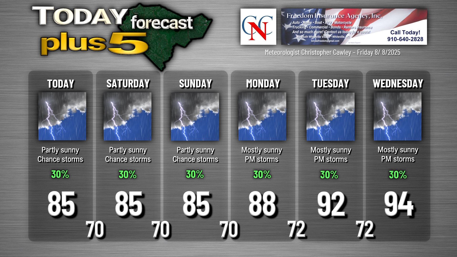
The forecast graphic below looks worse than things will actually be. Today, Saturday, and Sunday will feature a mix of sunshine and clouds with scattered showers and thunderstorms. Monday through Wednesday are likely to be mostly sunny with isolated to widely scattered afternoon storms.
Tropics: A weak surface low well offshore will continue to drift northeast and away from the mainland. While the NHC maintains a low chance for tropical development, it will have no impacts here.
Another system being watched for likely development exists in the central Atlantic Ocean. This has a 60% probability of developing into a tropical system. Whatever develops will likely curve northward and roam the open ocean, having no impacts on the mainland USA.
Here is your Freedom Insurance Today-plus-Five Forecast:
–Meteorologist Christopher Cawley