CCN Weather Update for Monday August 18, 2025.
This weather update is sponsored by Freedom Insurance of Whiteville. No weather worries with Freedom Insurance. For home, car, boat, or whatever you need, Freedom can provide customized coverage to keep you and your family safe. Contact Freedom today at 910-640-2828!
Here’s today’s Bottom Line
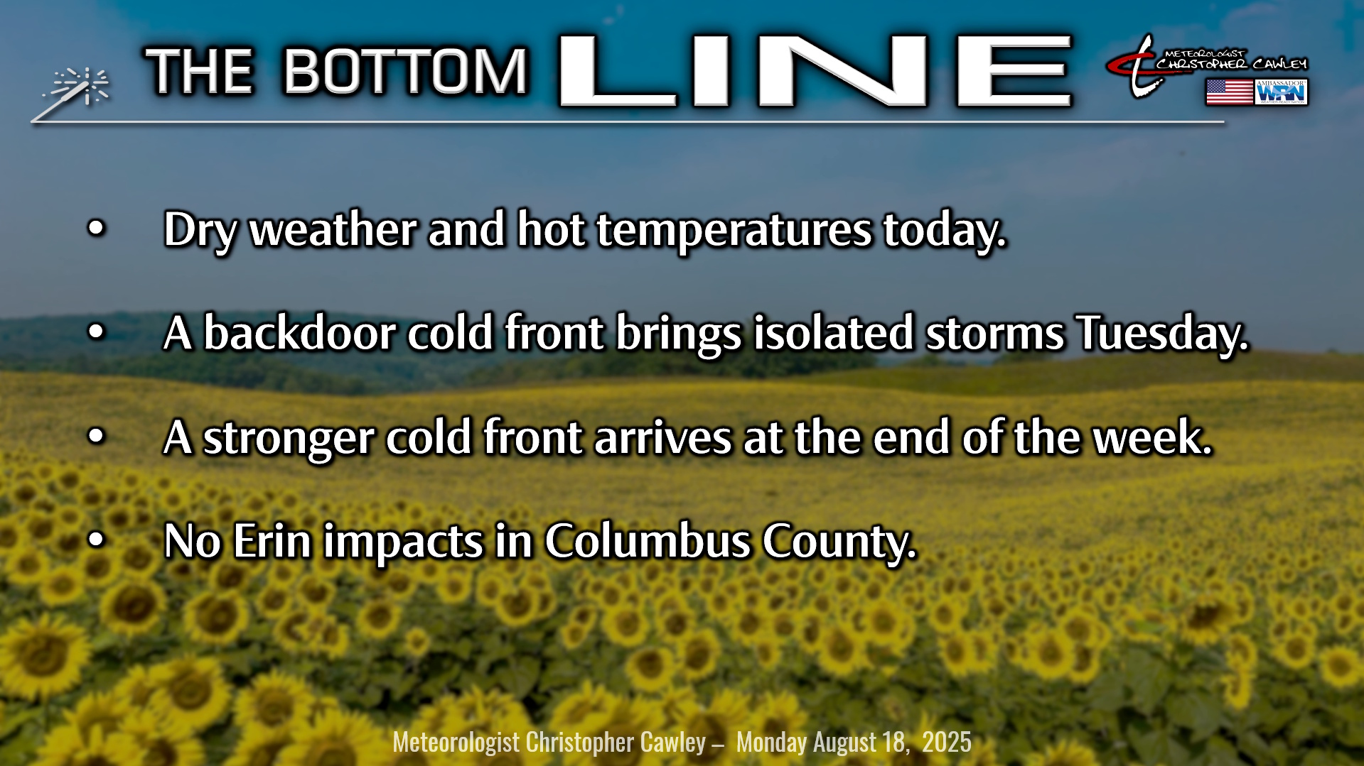
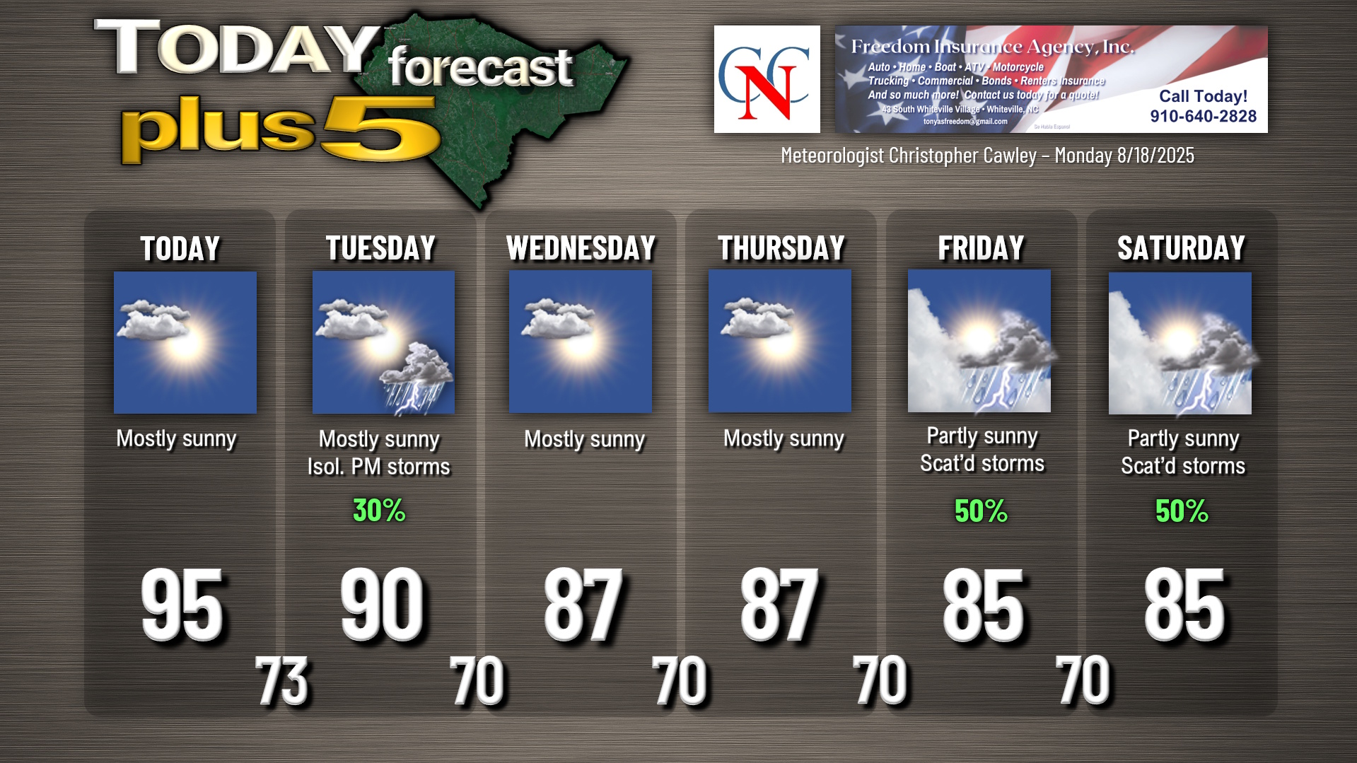
High pressure centered over the NC/TN region will bring HOT temperatures to the area today with plenty of sunshine. Expect our highs to crest in the mid 90s with heat index values in the 100- to 105-degree range. No heat advisories have been issued, but folks, it’s gonna be a hot day.
A weak cold front drops down from the north tonight and gets kind of “hung up” over central/eastern NC during the day on Tuesday. This will likely provide the lift needed to generate an isolated — key word is ISOLATED — shower or thunderstorm tomorrow afternoon or early evening. Highs will be around 90.
High pressure reestablishes control over the area for Wednesday and Thursday, leaving us with dry conditions, mostly sunny skies, and seasonable temperatures. There may be some periods of high clouds on Wednesday into Wednesday night from Hurricane Erin, but that will be the extent of her impacts to Columbus County.
A southerly push of moisture takes place late in the week ahead of a rather strong cold front for this time of year. The front itself arrives by the weekend and we’ll see a return to unsettled weather with at least scattered showers and thunderstorms Friday through Saturday (and probably into Sunday as well). Daytime temperatures a little bit lower than seasonal norms.
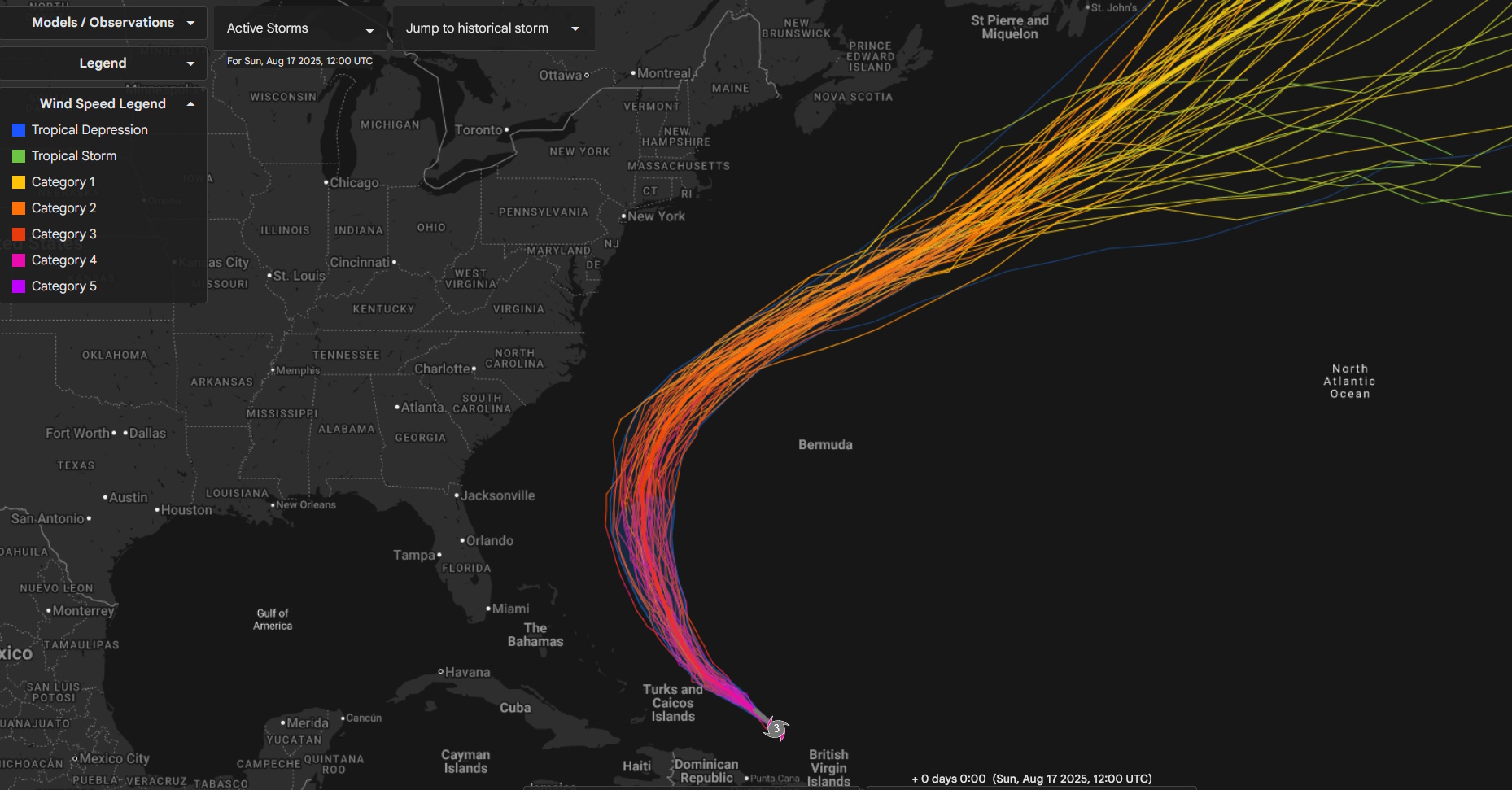
Tropics: Hurricane Erin has undergone multiple eyewall replacement cycles and is no longer the category 5 monster that we saw over the weekend. I have never seen a storm go from “tropical storm” strength to “category 5” strength in a matter of 24 hours. What a storm.
Erin is a massively huge storm, just colossal in size. Fortunately, there is very tight consensus on all modeling that she will stay comfortably out to sea, but there will still be impacts to our local beaches.
Ocean wave heights near the center of the storm may reach 100 feet (!!). That will translate to large waves at our beaches and possibly some overwash along the beach roads. Deadly rip currents are a guarantee as well. This week will not be the best week to go to the beach, that is for certain.
Again, no direct impacts in Columbus County from Erin. Maybe a few extra clouds Wednesday afternoon but that’ll be about it.
Our friends in the OBX, however, will see some impacts, and Dare County has issued a mandatory evacuation of Hatteras Island; there is likely to be complete overwash with the huge waves caused by Erin.
View the latest National Hurricane Center details on Hurricane Erin by clicking HERE.
After Erin, our attention turns to another wave that has moved off of the African coast. It’s currently located near the Cabo Verde Islands and is still fairly disorganized. Gradual development of this system is expected and the NHC has a 40% probability of a tropical depression forming within the next 7 days.
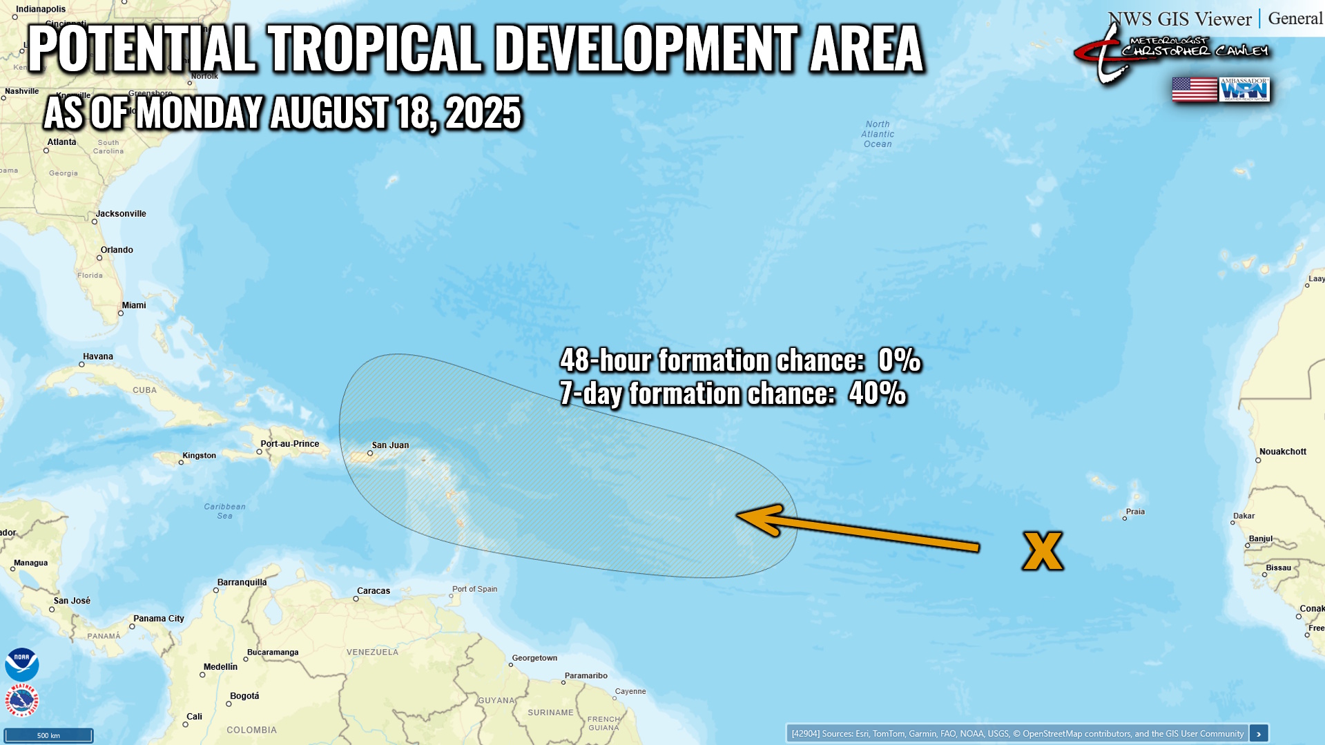
Despite what people INSIST on sharing on social media (I guess they didn’t learn with Erin), it is entirely too soon to even begin to speculate what will become of this system. Erin has done a very good job of churning up the waters and this could impact how this second storm develops. Absolutely nothing to worry about at this time.
Here is your Freedom Insurance Today-plus-Five Forecast:
–Meteorologist Christopher Cawley