CCN Weather Update for Monday September 22, 2025.
This weather update is sponsored by Freedom Insurance of Whiteville. No weather worries with Freedom Insurance. For home, car, boat, or whatever you need, Freedom can provide customized coverage to keep you and your family safe. Contact Freedom today at 910-640-2828!
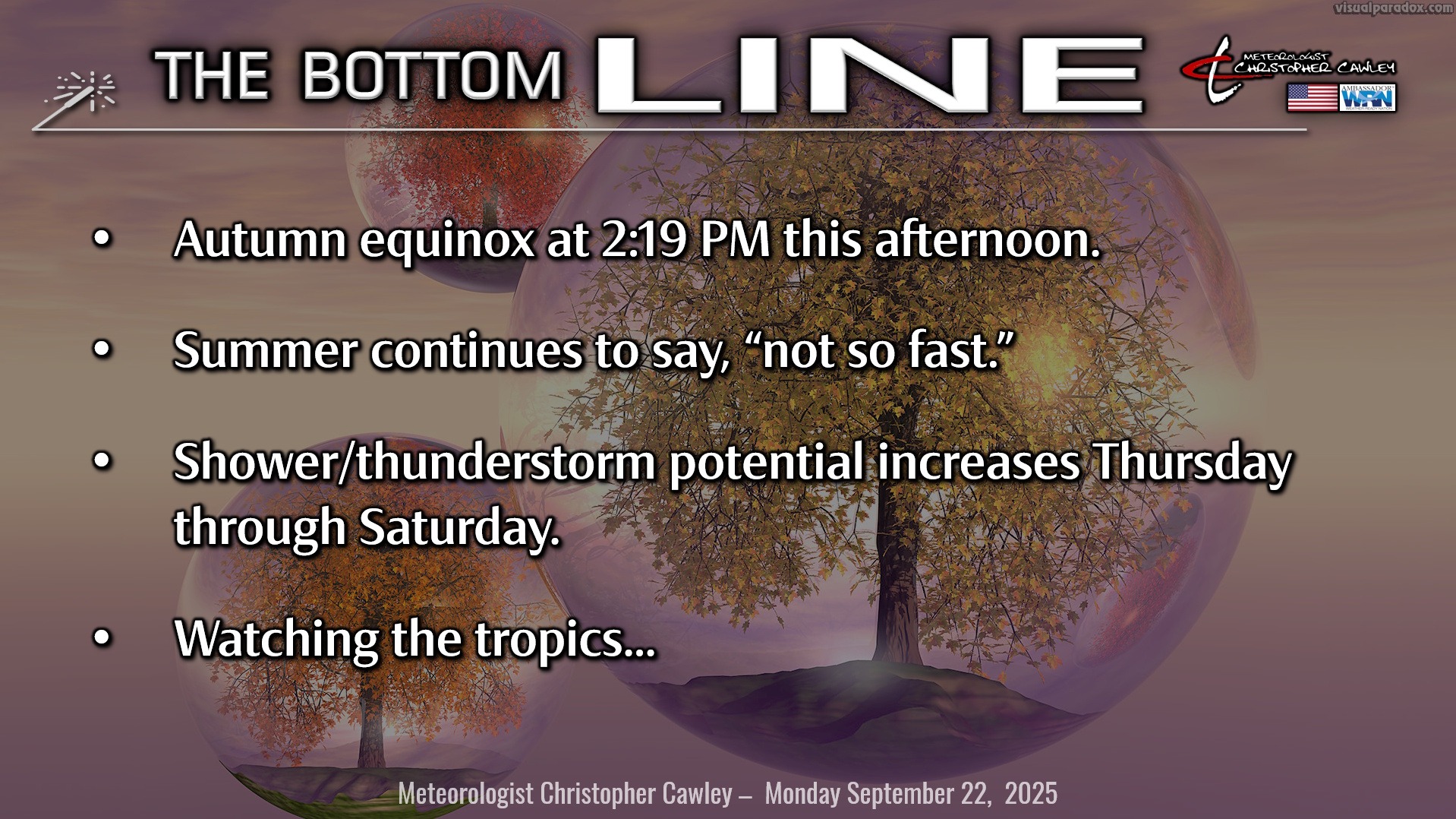
Here’s today’s Bottom Line
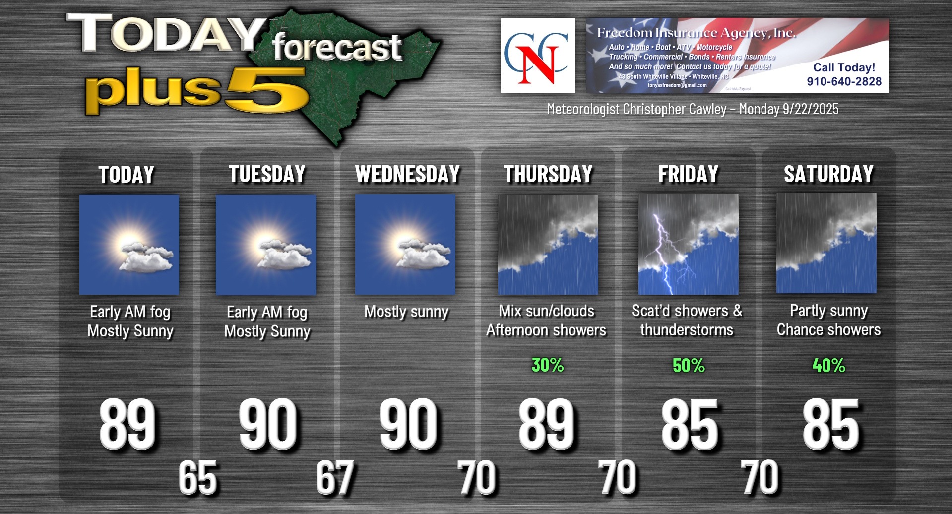
Today is the autumnal equinox … but it’s going to feel like anything BUT autumn across Columbus County as strong high pressure maintains full control through Wednesday. Some patchy fog this morning will give way to a mix of sunshine and clouds for today as our highs rise to the upper 80s. General humidity levels start to increase today making it feel much more “hot” than previous days.
Highs Tuesday, Wednesday, and Thursday will be a degree or two either side of 90 with, once again, a mix of sunshine and clouds after some early morning fog. Shower chances increase later Thursday… keep reading.
Meanwhile, a complex area of low pressure will start to organize over western Texas extending to central Oklahoma by Wednesday, connected by a frontal boundary northward through Illinois, New York, and to the coast of Maine. This low will combine to one centralized area over Indiana by Thursday morning. Deep southerly moisture pumps in and we’ll see an increase in shower/thunderstorm threat developing Thursday afternoon, but especially Thursday night through Friday night.
The front advances slowly toward the Carolinas on Friday… and by Saturday morning should be draped from near NYC southward through central NC/SC to coastal Georgia to off the west coast of Florida. Modeling suggests another low forming on this front over central South Carolina.
The front clears the coast by Sunday… but there is some question about the front’s interaction with a possible (heavy emphasis on the word POSSIBLE) tropical system off the US east coast… see below.
Again… much-needed rain in the form of showers and thunderstorms is likely for the area Thursday evening through Saturday this week. I don’t think we’re looking at a LOT of rain but anything, at this point, is good. On my weather station here in the city of Whiteville, we’ve had ONE day… ONE… with precipitation this entire month.
TROPICS: Click HERE to view the very latest on Hurricane Gabrielle. She is currently located over the central subtropical Atlantic a few hundred miles southeast of Bermuda.
Gabrielle will pose zero risk to the United States, other than dangerous rip currents at our local beaches.
Next up in Gabrielle’s rear-view mirror will probably become the “H” storm … Humberto. This is currently being impacted by some dry air and shear, but conditions are expected to become much more favorable for development later this week. NHC gives this a 10/60 percent risk for development.
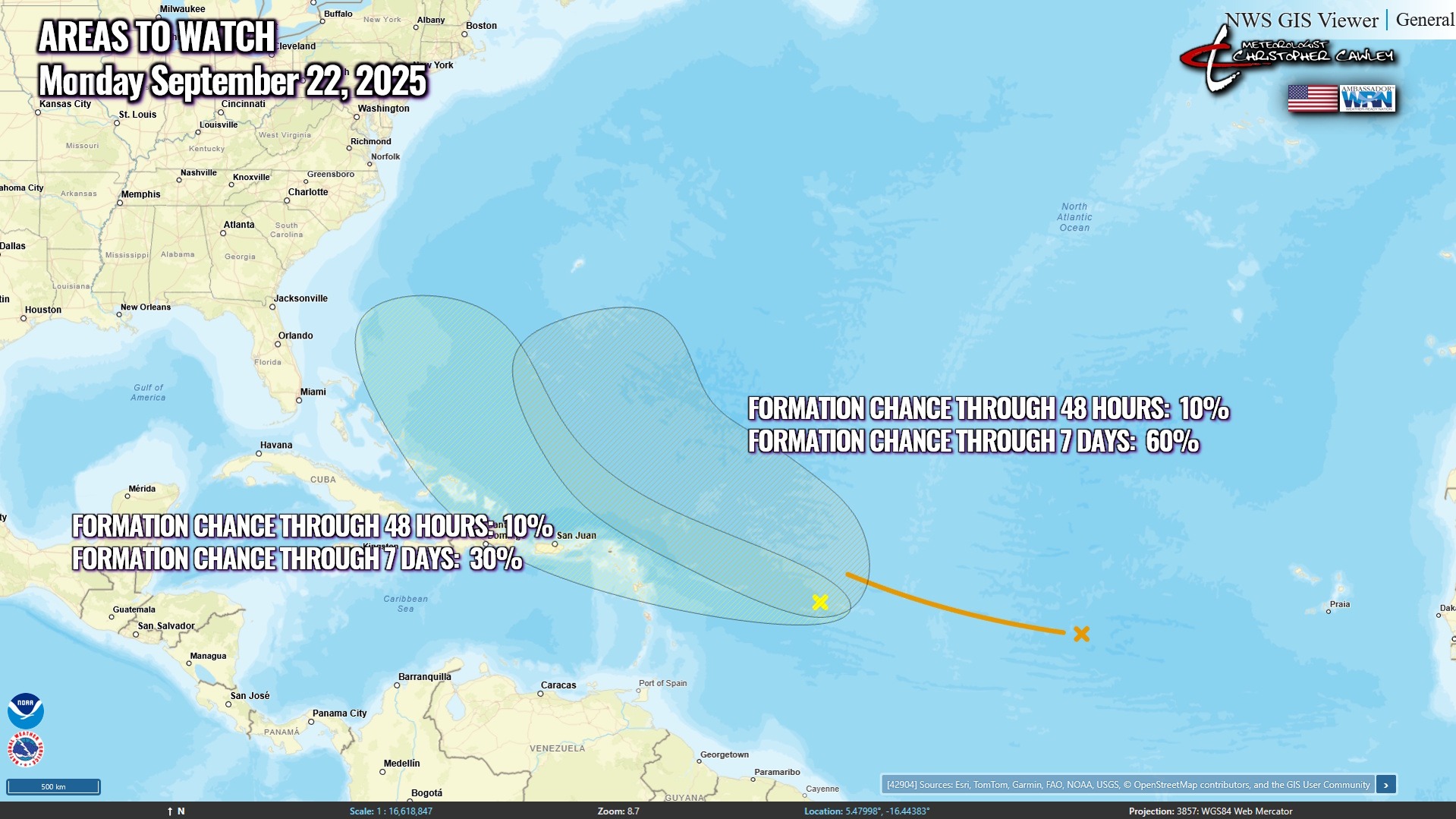
Finally, the NHC is monitoring yet another possible area of development farther to the west, giving it a 10/30 probability. This system is … interesting … and some of the longer-range guidance shows a system developing and skirting the NC Outer Banks in the Sunday/Monday timeframe. The modeling isn’t taking into account the frontal boundary that will likely be pushing off the coast at the same time, so I’m not giving it much credence at this point. The system is currently fairly disorganized and is moving rather quickly, and conditions are only marginally conducive for slow development, according to the NHC. Definitely going to be watching this system. The ultimate outcome of this is the placement of the aforementioned frontal boundary, which would work to “steer” whatever develops away from the coast. Lots of variables at play here, so stay tuned!
Here is your Freedom Insurance Today-plus-Five Forecast:
–Meteorologist Christopher Cawley