CCN Weather Update for Saturday September 13, 2025.
This weather update is sponsored by Freedom Insurance of Whiteville. No weather worries with Freedom Insurance. For home, car, boat, or whatever you need, Freedom can provide customized coverage to keep you and your family safe. Contact Freedom today at 910-640-2828!
Here’s today’s Bottom Line
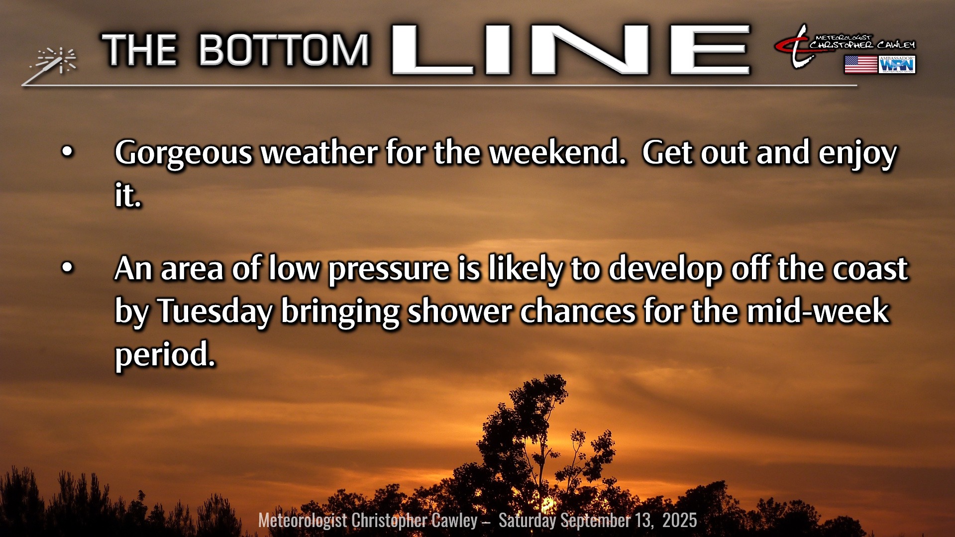
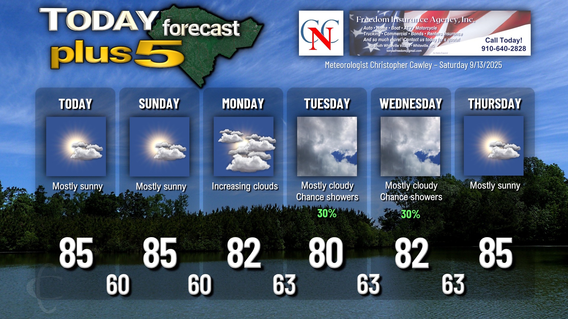
A picture-perfect weekend on tap for the area thanks to high pressure in firm control. Seasonable temps in the lower to middle 80s with low humidity values … lows in the upper 50s to lower 60s … I can’t see any reason to not “get out and enjoy it,” as my mentor would say.
In a rather significant change from yesterday’s reports, global modeling is coming together on agreement that a wave of low pressure is likely to form off the coast sometime Monday or early Tuesday, and gradually pulling away by Wednesday. While high pressure will try to maintain control, the modeling is in pretty good agreement that the low will spin closer to the coast, therefore bringing rain chances to the area. Enough warm Atlantic moisture might lift “up and over” relatively cooler air trapped at the surface that a decent coverage of rainfall may exist over central NC with more showery conditions closer to the coast. I think it’s still a bit too early to pin down what exactly is likely from this low. This results in a rather low-confidence forecast for late Monday through Wednesday. The biggest key will be where the low moves, how close to the coast does it come, before pulling away. I put in 30% shower chances for Tuesday and Wednesday but that might have to be upped depending on the evolution of this system. As of right now, intermittent showers may occur late Monday night into early Wednesday, but again, more significant steady rainfall may be in the offing for Tuesday. We’ll just have to wait and see on that one.
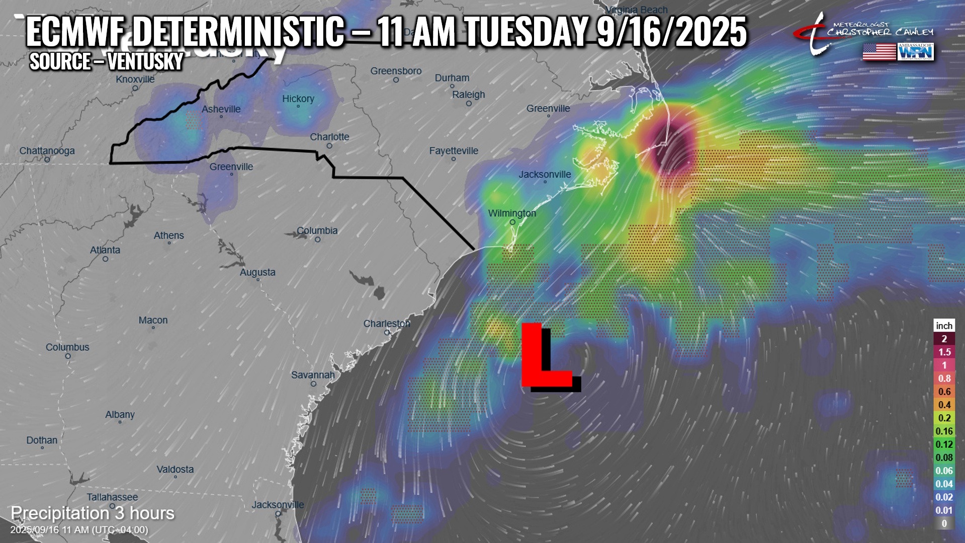
I should add that this system is not going to be tropical in any way, shape, or form as it will be forming on that old lingering frontal boundary that moved through here several days ago.
TROPICS: A tropical wave off the west coast of Africa is currently very disorganized… but will move into an area that is favored for slow development. The NHC gives this area a 40% chance of development within the next 7 days. It should be noted, however, that strong shear exists over a large portion of the Atlantic and this system has a bit of a challenge ahead when it comes to development.
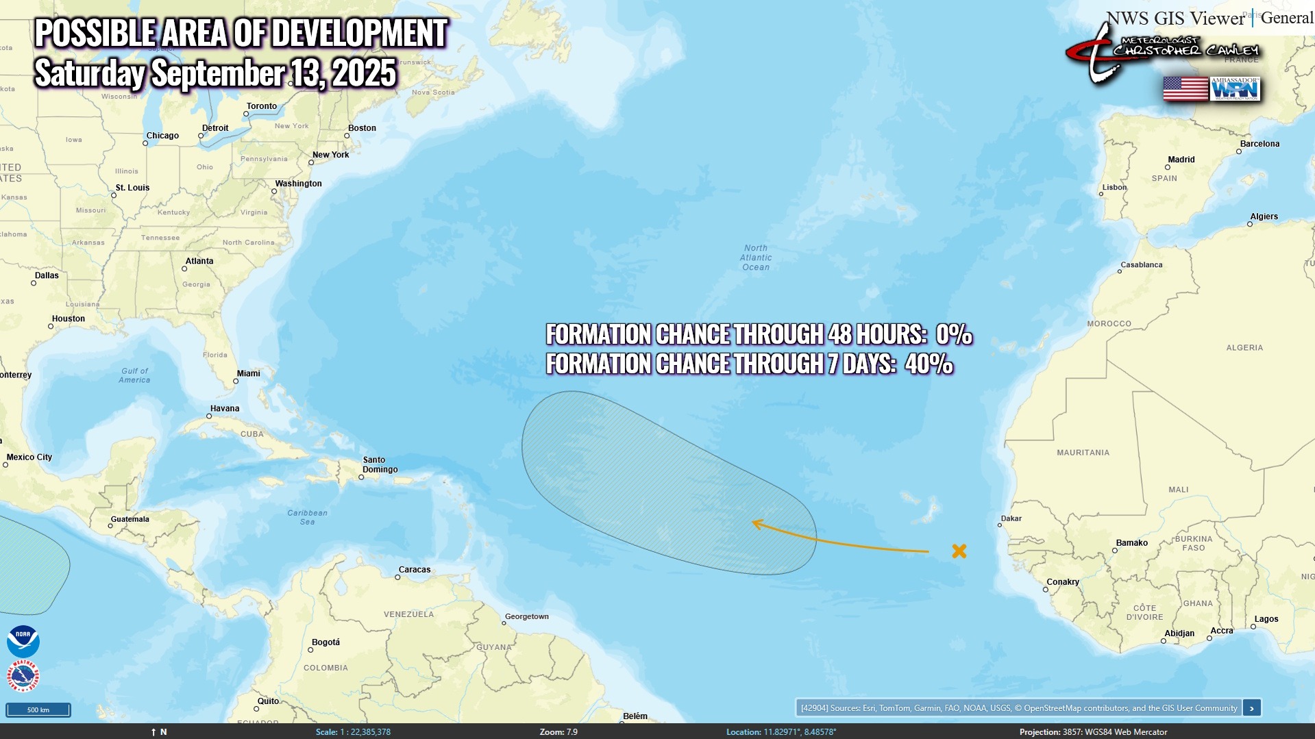
No tropical threats to the Carolinas for at least the next 10 days.
Here is your Freedom Insurance Today-plus-Five Forecast:
–Meteorologist Christopher Cawley