CCN Weather Update for Thursday September 18, 2025.
This weather update is sponsored by Freedom Insurance of Whiteville. No weather worries with Freedom Insurance. For home, car, boat, or whatever you need, Freedom can provide customized coverage to keep you and your family safe. Contact Freedom today at 910-640-2828!
Here’s today’s Bottom Line
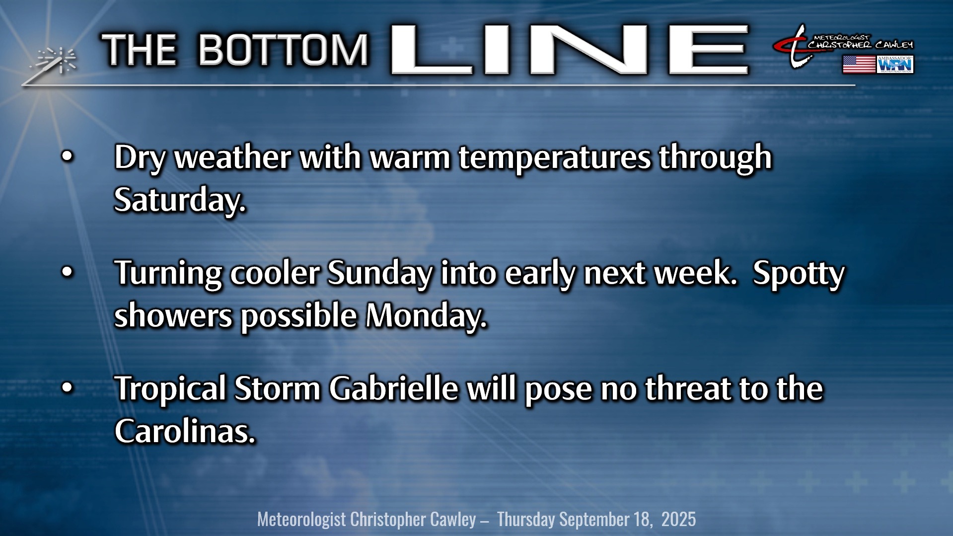
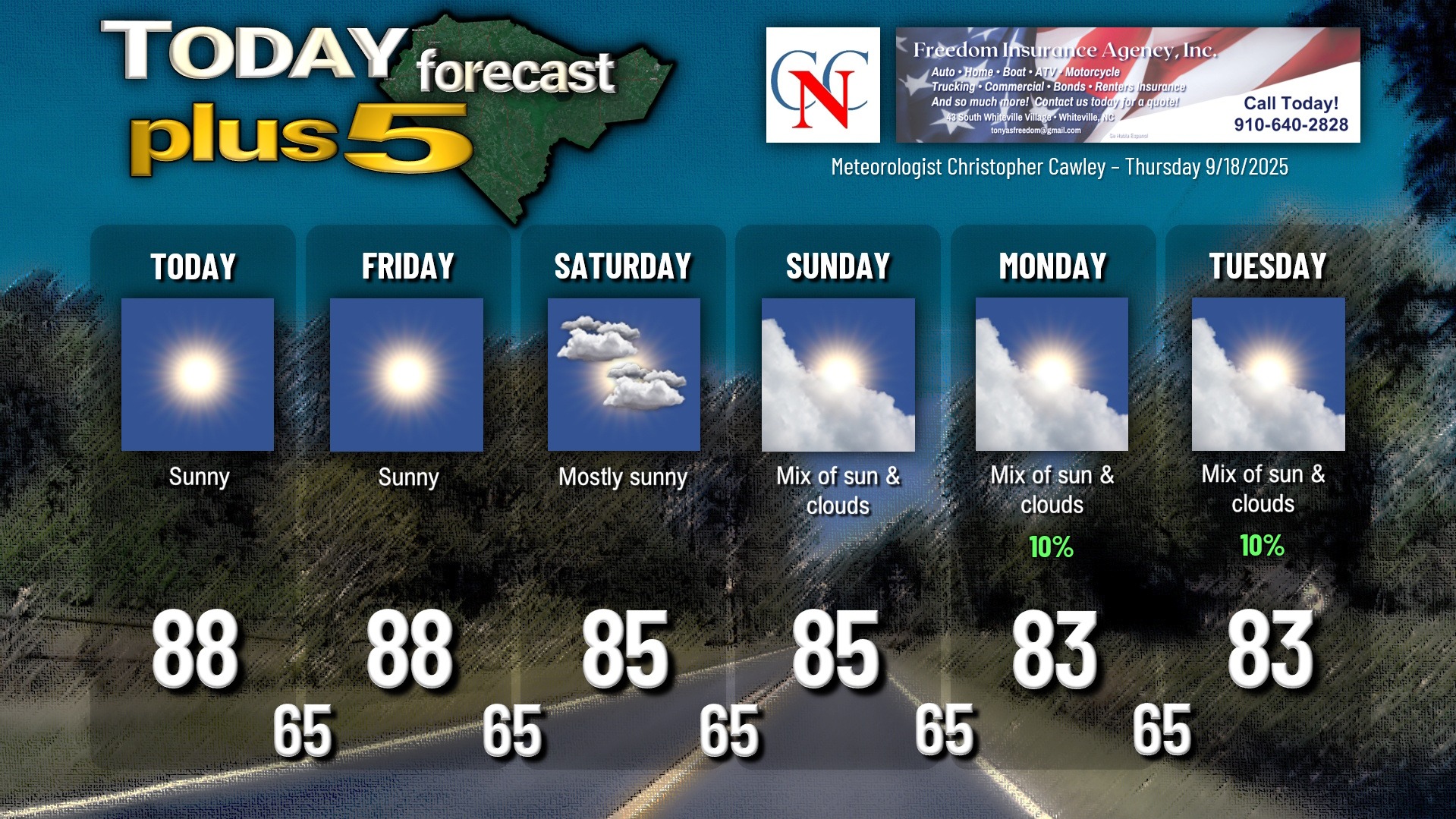
Strong, sprawling high pressure will remain positioned over the NC/TN/VA border area today into Friday. It will then slip to our south by late Friday allowing a bit of a backdoor cold front to drop south over the area Saturday.
The frontal passage itself will be remarkably unremarkable, barely noticeable. High pressure centered off the coast of New England will have a lobe extend down in another “wedge”-type pattern over the state on Sunday. This will lead to more in the way of clouds, and maybe (maybe) a few showers over the area Sunday into Monday. I think the better chance for showers comes along the coast and on Monday but it’s a possibility in Columbus County as well.
But until then… we’re high-and-dry with warmer-than-normal temperatures and manageable humidity. Enjoy.
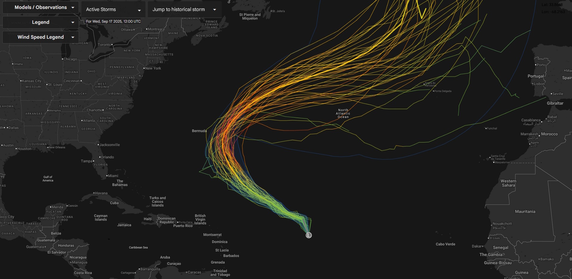
TROPICS: Click HERE to view the very latest on Tropical Storm Gabrielle. No matter when you read this blog, you’ll have the latest from the OFFICIAL source… not some anonymous social media user.
The latest model analysis shows that Gabrielle will be an ocean-runner hurricane, and despite what some people want to post on social media, she will pose zero threat to the mainland United States.
The next kind of overlapping area of tropical waves off the coast of Africa is being watched by the NHC. There’s a low (10%-20%) chance that they develop over the next 7 days, so that’s nothing really to worry about right now.
There are still no threats to the Carolinas for the foreseeable future.
Here is your Freedom Insurance Today-plus-Five Forecast:
–Meteorologist Christopher Cawley