CCN Weather Update for Tuesday September 9, 2025.
This weather update is sponsored by Freedom Insurance of Whiteville. No weather worries with Freedom Insurance. For home, car, boat, or whatever you need, Freedom can provide customized coverage to keep you and your family safe. Contact Freedom today at 910-640-2828!
Here’s today’s Bottom Line
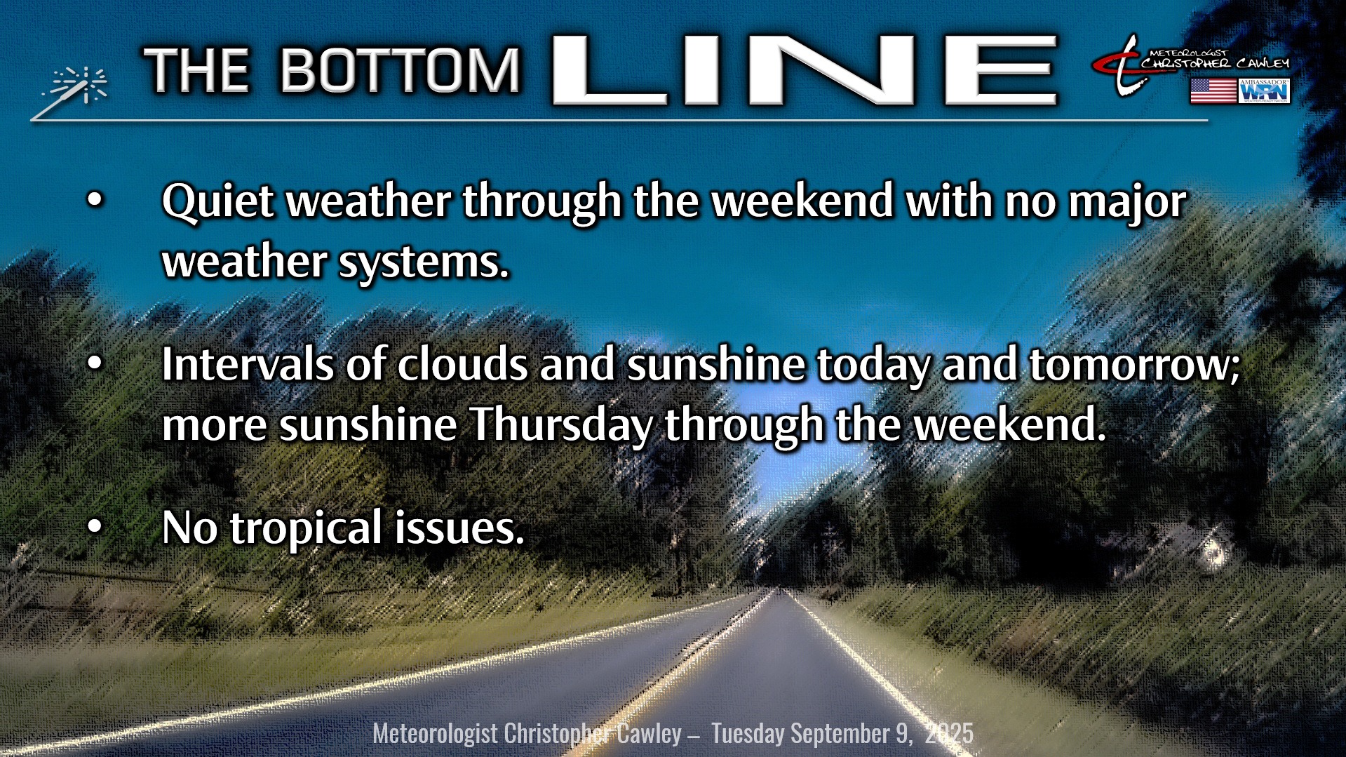
Unusually quiet weather conditions will persist through the weekend. A stalled frontal boundary will remain offshore while inland high pressure continues to wedge southward into our area. A northerly wind flow will keep our temps a few degrees below normal over the next couple of days.
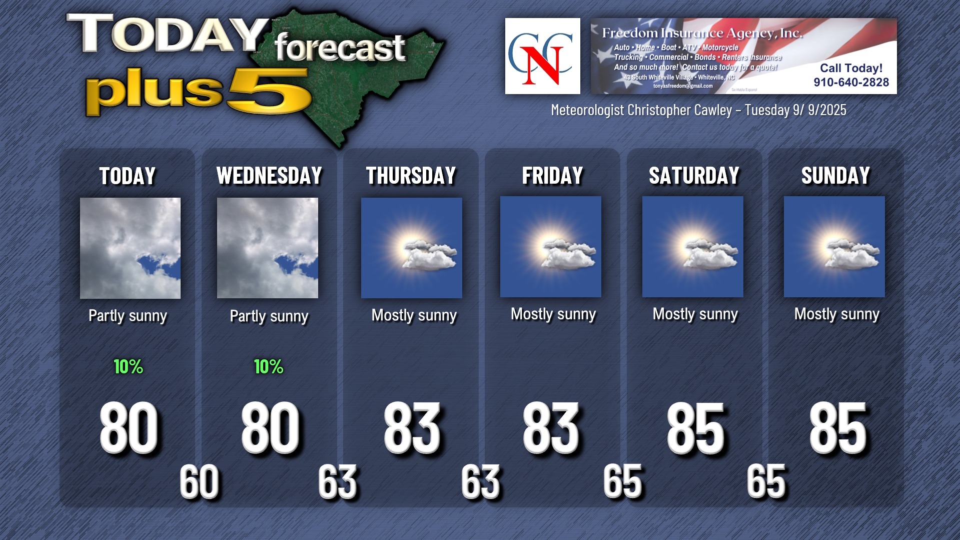
A weak area of low pressure is expected to move north/east along the offshore front and could kick up an isolated shower or two along the state line and as you go into Brunswick county toward the beaches. I think most of us across the county, especially west of US-701, should remain dry today and Wednesday with partly to mostly cloudy skies. I did put a “10%” on the graphic below … just in case we happen to have a super-isolated spotty light rain shower. But I highly doubt it.
The front remains stalled offshore into the weekend with high pressure becoming centered overhead by the end of the week. Dry weather with seasonable temps will continue. A few waves of low pressure may develop along the front, but I think the high pressure will easily overpower those, keeping any effects offshore.
TROPICS:
No tropical threats are identified by the National Hurricane Center, and there are no tropical threats to the Carolinas through at least the next 10 days to 2 weeks. It’s almost unheard of to have this lack of tropical activity as we approach the statistical peak of the season. No complaints!
Here is your Freedom Insurance Today-plus-Five Forecast:
–Meteorologist Christopher Cawley