


CCN Weather Update for Thursday October 2, 2025.
This weather update is sponsored by Freedom Insurance of Whiteville. No weather worries with Freedom Insurance. For home, car, boat, or whatever you need, Freedom can provide customized coverage to keep you and your family safe. Contact Freedom today at 910-640-2828!
Here’s today’s Bottom Line
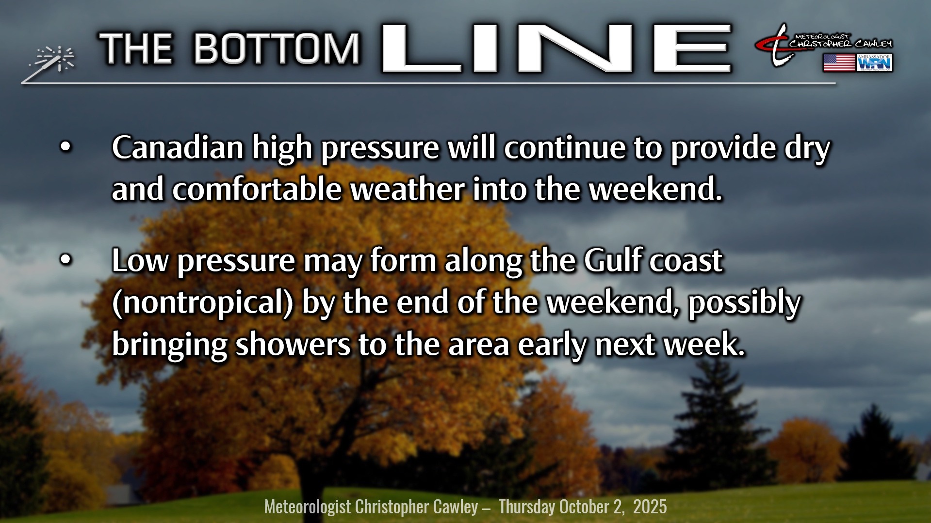
Strong Canadian high pressure extending down the eastern seaboard will keep us high-and-dry through the weekend. The high will tend to build east/southeast and by the weekend should be extending from Long Island southward through central NC.
Meanwhile a frontal boundary will exist, extending along the Gulf coast from southern Louisiana eastward, curving toward central Florida, and then off the Florida coast. Some of the modeling suggests an area of low pressure may spin up on the western end of the front (along the Gulf coast) … at this time it would be nontropical in nature … and lift slowly along the coast early next week. Not all of the modeling is sold on this scenario, but if it does occur, we’ll see more in the way of cloudiness Monday and Tuesday with a few spotty showers possible.
TROPICS: After impacting Bermuda with winds and rain, Hurricane Imelda is expected to continue east then northeast into the colder north Atlantic Ocean. She will take on “post-tropical” characteristics while remaining hurricane strength for a day or so and then will weaken with increasing latitude.
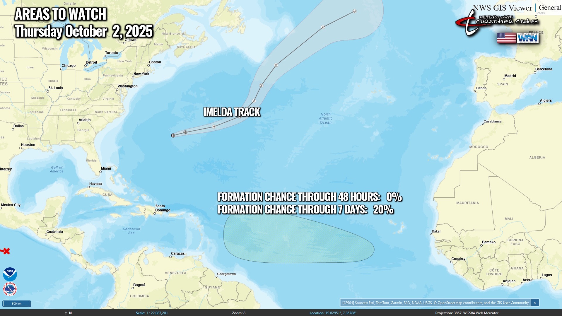
Now that we’ve had a minute to take a breath, the next area is now being watched by the NHC. A couple of fairly disorganized systems are likely to come together in the area outlined in yellow on the map… this area is marginally favorable for development over the next week or so.
No threats to the Carolinas for the foreseeable future.
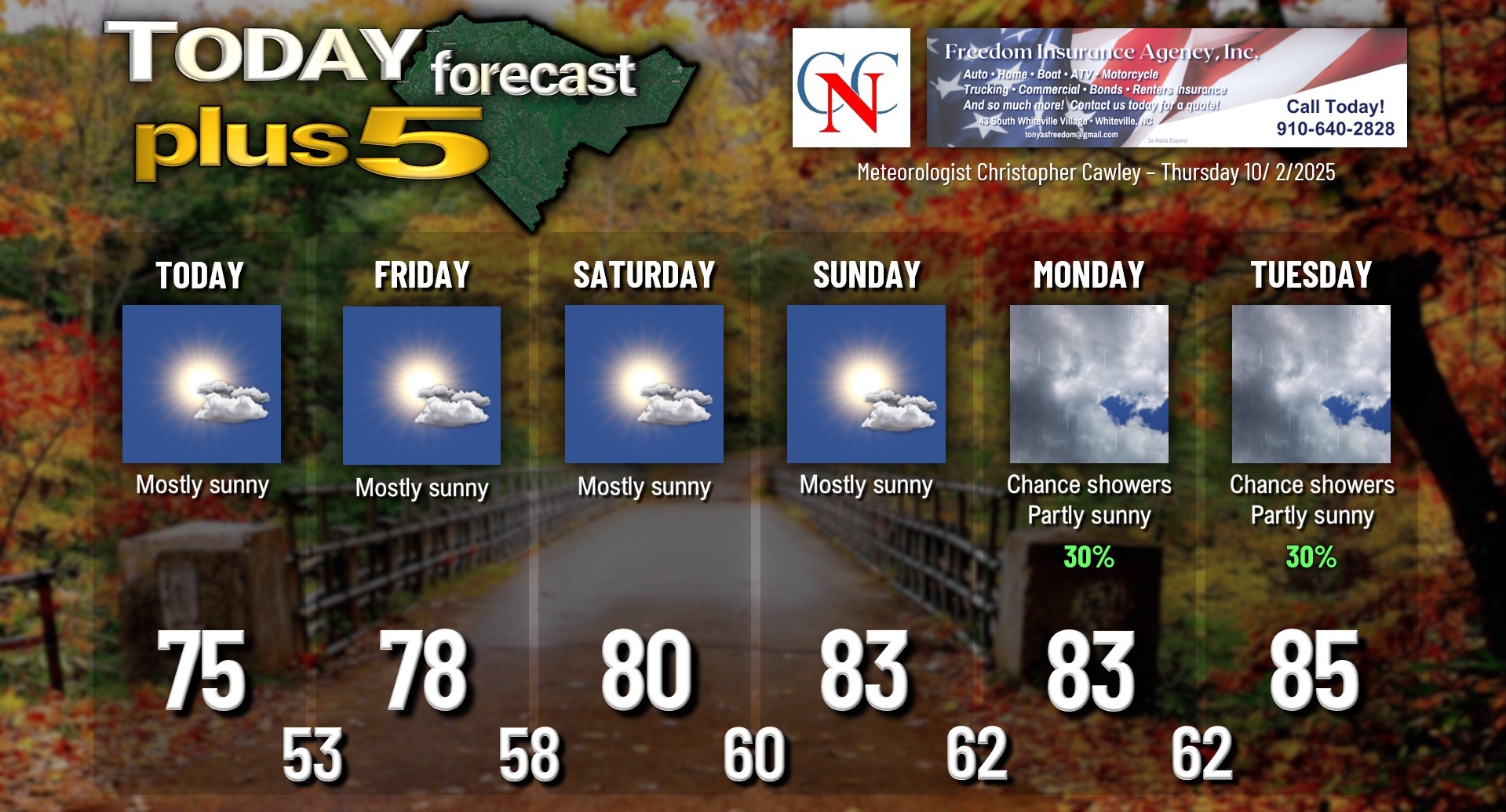
Here is your Freedom Insurance Today-plus-Five Forecast:
–Meteorologist Christopher Cawley

