

CCN Weather Update for Wednesday October 8, 2025.
This weather update is sponsored by Freedom Insurance of Whiteville. No weather worries with Freedom Insurance. For home, car, boat, or whatever you need, Freedom can provide customized coverage to keep you and your family safe. Contact Freedom today at 910-640-2828!
Here’s today’s Bottom Line
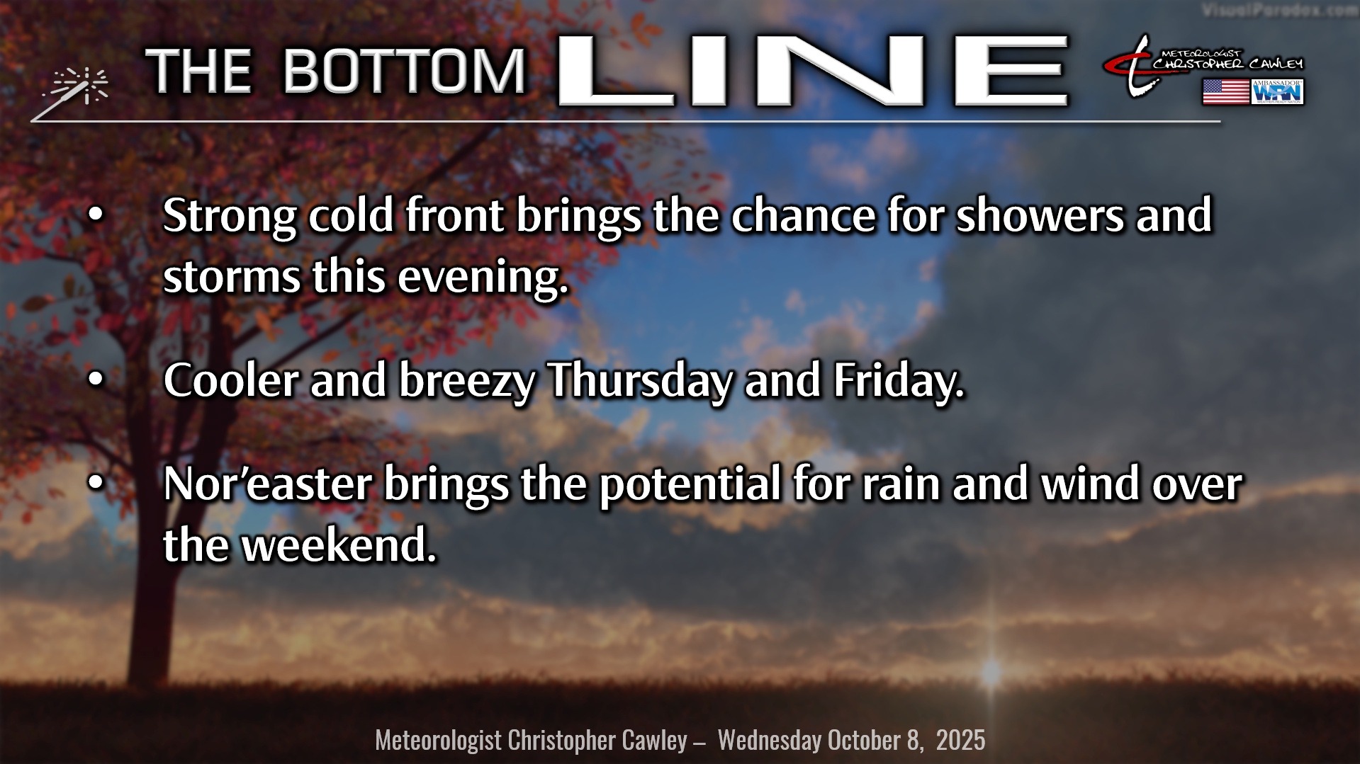
A strong cold front will cross the area this evening. Warm and rather humid conditions can be expected today ahead of this front. Increasing clouds with thunderstorm chances developing late this afternoon and lasting through the evening.
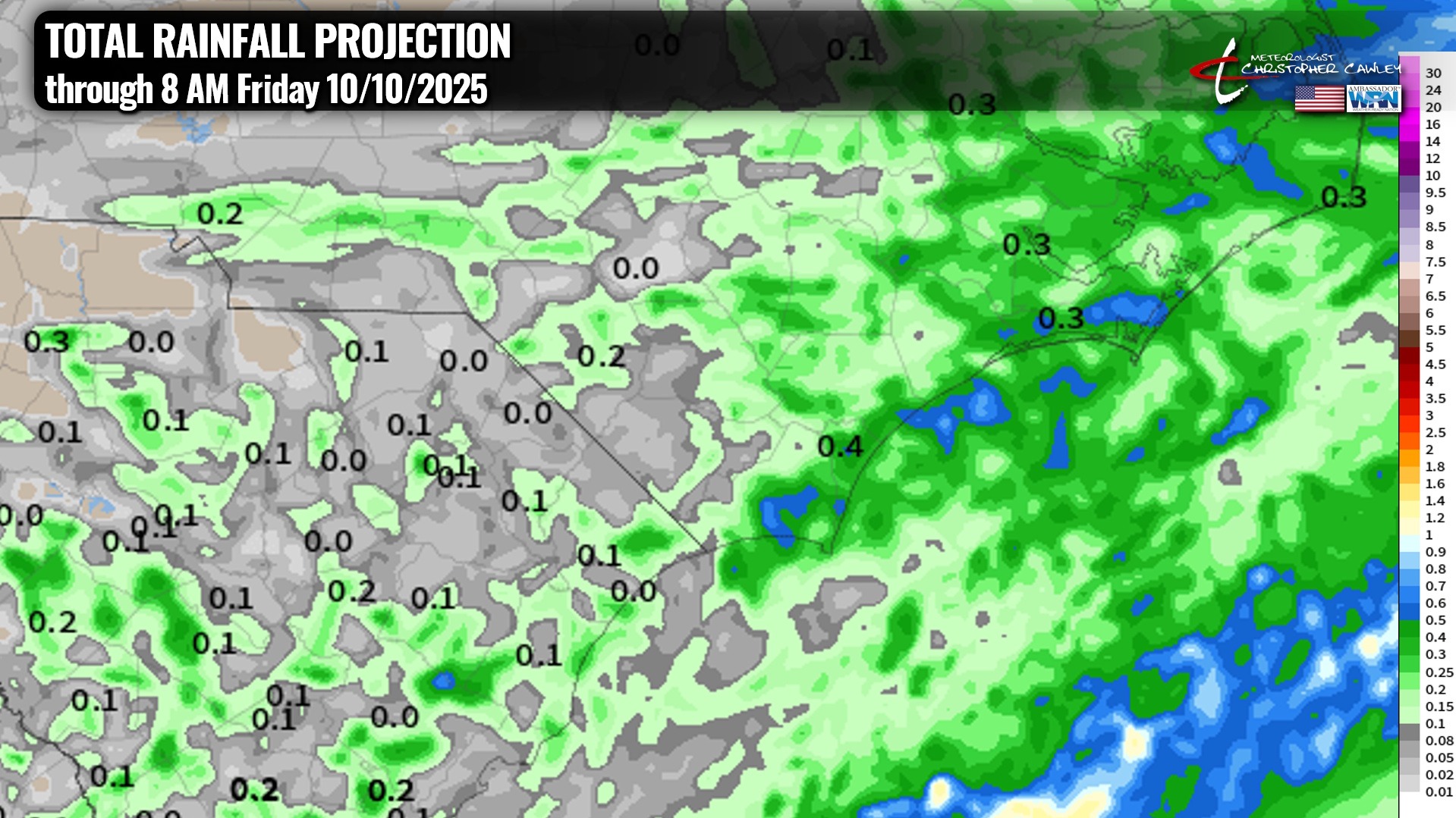
The high-res modeling shows … honestly not an awful lot … as the front moves through before midnight. Scattered showers and thunderstorms ahead of and along the front with clearing skies afterwards. The map below shows the model blend projected total rainfall, and folks, it ain’t a whole lot.
It will turn much cooler during the overnight tonight… temps at the bus stop tomorrow morning will likely be in the upper 50s, with a gusty northeast wind.
Thursday will be mostly sunny and quite a bit cooler. A strong “pressure gradient” between the frontal boundary just offshore and high pressure to our north means gusty northeast winds continue through the day. Those winds will continue into Thursday night.
Then all eyes turn back to the frontal boundary lingering offshore. A strong jet is likely to dive south and east, and this is expected to spin up quite the low-pressure center just off the GA/SC coast by late Friday. This is going to be extratropical (nontropical) in nature, more of a Nor’easter than a tropical system. At any rate, there is a lot of variance in the deterministic and the ensemble models as to where this system will go. Several have it pushing quickly out to sea while others have it riding up the coast and absolutely hammering the Outer Banks.
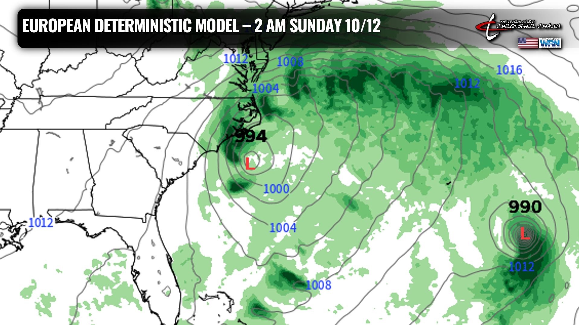
In terms of OUR weather from this, right now I’m going with 50% chance for rain Friday night through Sunday. This lack of confidence is based on the uncertainty with regards to the storm track. A storm track farther offshore means little to no rain here, while a storm track closer to the coast obviously means much higher rain chances. Either way, I do expect breezy to windy conditions Friday night through Sunday with a good deal of cloudiness no matter what… and temps running a good bit below seasonal normal values.
High pressure then builds in for next week with temps gradually returning to where they should be this time of year.
TROPICS: Tropical Storm Jerry will pose absolutely no threat to any land masses whatsoever. If you’d like to keep up with Jerry, here’s the link from the National Hurricane Center.
Meanwhile, a little low pressure off of the Yucatan Peninsula will move inland over southern Mexico either late tonight or early Thursday. NHC says this has a 10% chance for development into a tropical depression, but it won’t be over the water long enough to really make a difference.
There are no tropical threats to the Carolinas. The weekend Nor’easter is not going to be tropical.
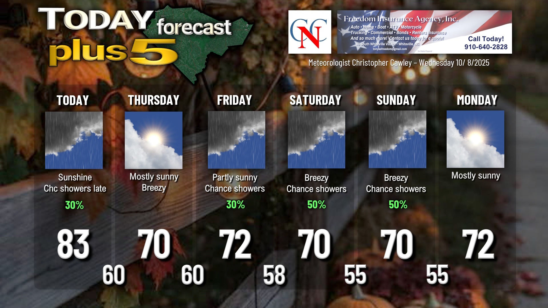
Here is your Freedom Insurance Today-plus-Five Forecast:
–Meteorologist Christopher Cawley