

CCN Weather Update for Wednesday December 10, 2025.
This weather update is sponsored by Freedom Insurance of Whiteville. You can trust Freedom Insurance to give you clear blue skies when it comes to home, car, boat, or whatever insurance you need. Let Freedom provide customized coverage to keep you and your family safe. Contact Freedom today at 910-640-2828!
Here’s today’s Bottom Line
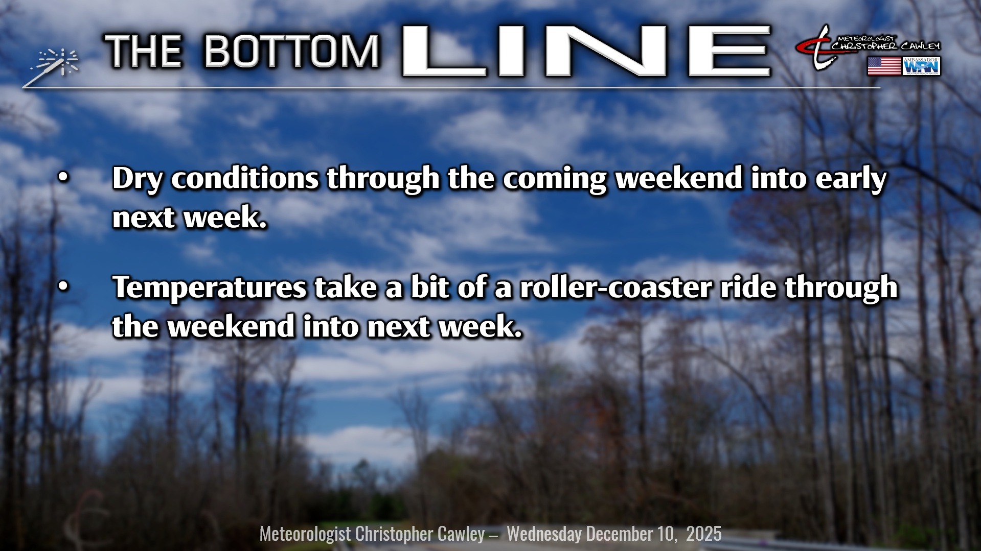
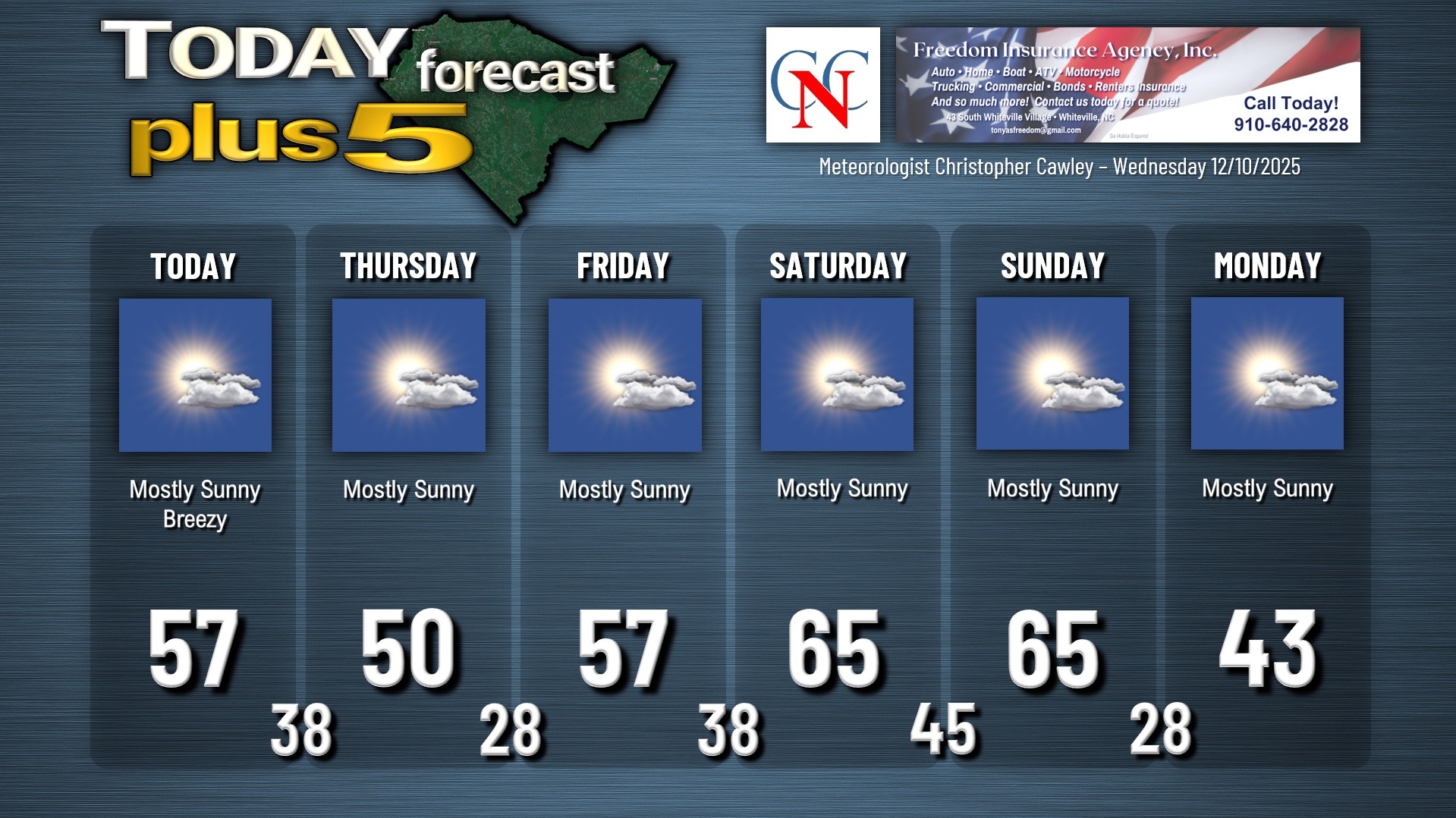
We’re having a heat wave today… or at least that’s what it’s going to feel like when compared to the way temps have been the last couple of weeks. Highs will be… right where they should be for this time of year… in the upper 50s to around 60 with lots of sunshine.
A cold front will drop south over the area late this afternoon, and this will bring in chilly air for Thursday. Aside from a wind shift and cooler temps, there will be little “sensible weather” impacts from the frontal passage.
A warm front will lift from south to north over the area early on Friday. This is something that wasn’t showing on any of the modeling over the past few days. This will usher in seasonable temps for Friday, followed by temps pushing well into the 60s for Saturday and Sunday. The weekend is going to be absolutely gorgeous with mostly sunny skies.
Strong cold front eventually arrives by late Sunday. Arctic air comes pouring in on northwest winds with temps plummeting Sunday night … and highs Monday in the lower to middle 40s. The “brrrr” will be back in town, folks, but the model blends imply that it’ll be a short visit before another warm-up later next week. Potential exists for above-normal temps all the way to Christmas. No snow in sight.
Here is your Freedom Insurance Today-plus-Five Forecast:
–Meteorologist Christopher Cawley