CCN Weather Update for Monday January 12, 2026.
This weather update is sponsored by Freedom Insurance of Whiteville. You can trust Freedom Insurance to give you clear blue skies when it comes to home, car, boat, or whatever insurance you need. Let Freedom provide customized coverage to keep you and your family safe. Contact Freedom today at 910-640-2828!
Here’s today’s Bottom Line:

Hello readers and welcome to today’s weather update!
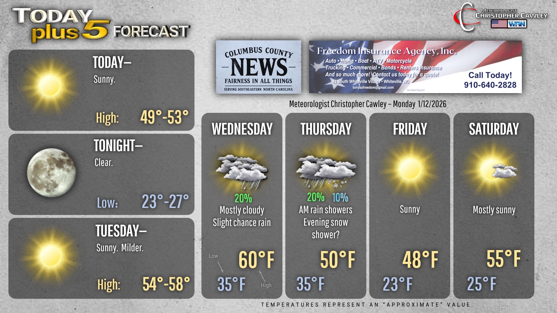
Quiet conditions, albeit kinda cold, for today and tonight as Canadian high pressure crests overhead. This high moves offshore for Tuesday allowing temperatures to push back up to seasonal normal values.
A complicated scenario starts to take shape for the Wednesday-Thursday timeframe. Milder air starts to infiltrate the area Tuesday night. We’ll be about 10 degrees warmer Wednesday morning than on Tuesday.
A series of boundaries (troughs) on both the northern jet stream and the southern jet stream will impact our weather Wednesday and Thursday. A southern-stream trough will push off the southeast coast Wednesday into Wednesday night. This will result in some cloudiness and patchy/scattered light rain showers. Temps will be fairly mild on Wednesday, near 60 degrees.
At the surface, an area of low pressure is likely to develop over the central Carolinas, with a cold front pushing through early on Thursday. This brings the potential for another round of rain showers on Thursday morning.
An upper-level (upper atmosphere) trough will be pinwheeling around an area of low pressure off to the north, and will move through the area Thursday afternoon into Thursday night. Modeling suggests this will be rather energetic… but the question is how much moisture will exist for possible snow. Modeling has a lot of trouble resolving situations like these, but if you recall back in early November we had an area of light snow zip through the area … this situation is remarkably similar in set-up. So I have (reluctantly) put in my forecast the 10% chance for an evening snow shower on Thursday. Certainly nothing that is going to stick or accumulate more than a trace, so no adverse impacts are anticipated. Nope, we’re not waking up on Friday to a winter wonderland. But you might look out the window around suppertime Thursday and see snowflakes flying.
Highs on Thursday will be around 50, but that’ll come by lunchtime. Temps will be falling through the 40s during the afternoon. It’ll become rather blustery as well, so all-in-all Thursday is not going to be a nice day.
Thursday night/early Friday will be very cold with lows bottoming out in the lower 20s on Friday morning. The upper trough pushes off the Outer Banks Friday morning and Canadian high pressure then builds in. Despite full sunshine on Friday, highs will only be in the upper 40s.
Warmer air starts to push into the area by the weekend as the next storm system approaches. A front crosses the region late Saturday into Sunday, and while a wave of low pressure appears to pop on that front, I think it’ll be too far offshore to bring any impacts here. Any precipitation this weekend will be of the liquid variety.
That’ll do it for today’s blog. Thank you for reading! Here’s your Freedom Insurance Today-plus-Five Forecast!
–Meteorologist Christopher Cawley