

Columbus County News Weather Update for Monday October 5, 2026.
This weather update is sponsored by Freedom Insurance of Whiteville. Trust Freedom Insurance to give you clear blue skies when it comes to home, car, boat, or whatever insurance you need. Let Freedom provide customized coverage to keep you and your family safe. Contact Freedom today at 910-640-2828!
Here’s today’s Bottom Line
“What happened to all the rain?” Legitimate question. Unlike other media outlets, I believe in accountability. This is yet another case where modeling got it wrong, entirely wrong. The frontal boundary pushed offshore much earlier than anticipated (hence the cooler temps and cloudy skies on Sunday). The wave of low pressure that formed on the front was weak and nearly all the rain stayed offshore.
Part of the problem with modeling is unfortunately related to politics… and the reduced weather balloon launches across the country related to budget restrictions to NOAA. I’m not going to get into a political discussion here, and I’m not saying that’s exclusively why the forecast busted, but it is part of the story.
Very simply put, weather model information is generated by data received from weather balloon launches all over the world. The balloons are launched at the exact same time every day (in UTC-based time). That data is fed into the computers that run all of the various models. Budget cuts to NOAA have resulted in fewer launches, especially across the eastern United States.
But that’s not the only story here. We (meteorologists) simply got it wrong. Not only myself, but NWS and other local media outlets. The front pushed farther south and east and the precip stayed offshore. It is what it is.
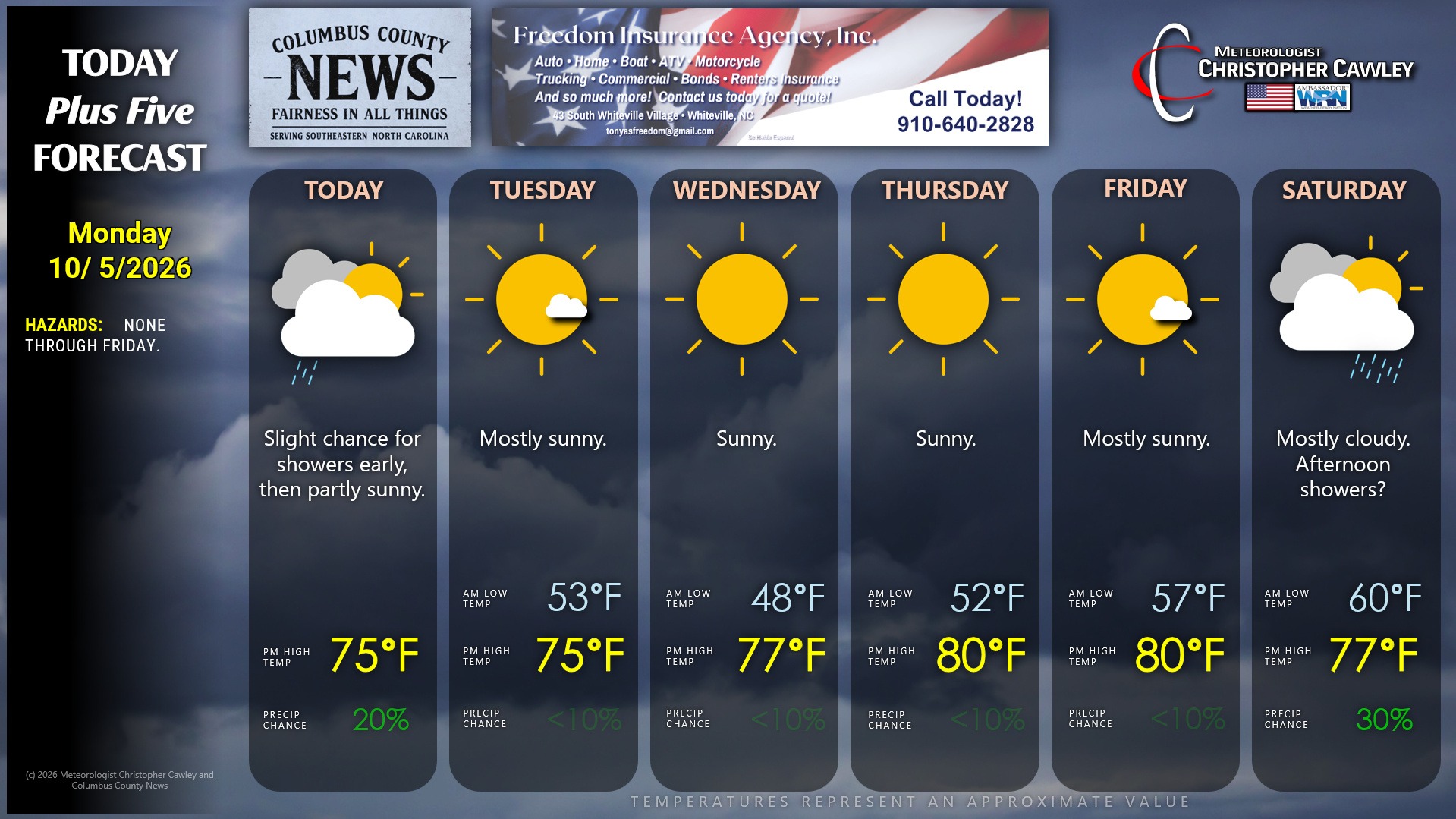
A few scattered showers are possible early this morning but I expect to see a slow decrease in clouds… with lots of sunshine for the rest of the work week. We’ll have very pleasant temps this week with low humidity. Early morning lows will likely dip into the upper 40s early Wednesday.
Then our attention turns to the tropics…
TROPICS: An area of low pressure is expected to develop in the southwest Gulf. This may develop into a tropical depression or even a tropical storm as it lifts to the northeast over the course of the work week.
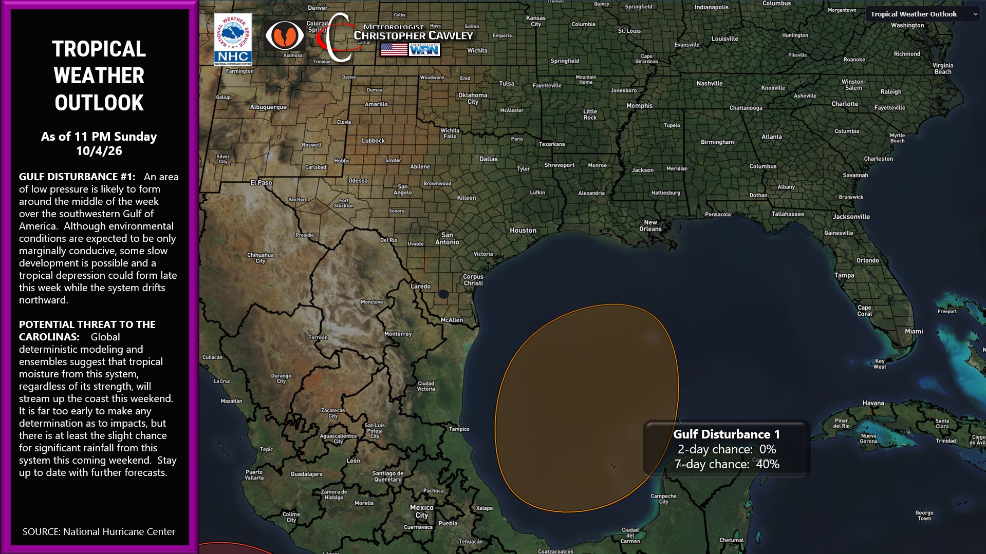
Regardless of the development, global, regional modeling, including deterministic and ensembles, expect abundant moisture to stream northeast up the coast by this weekend, as shown here.
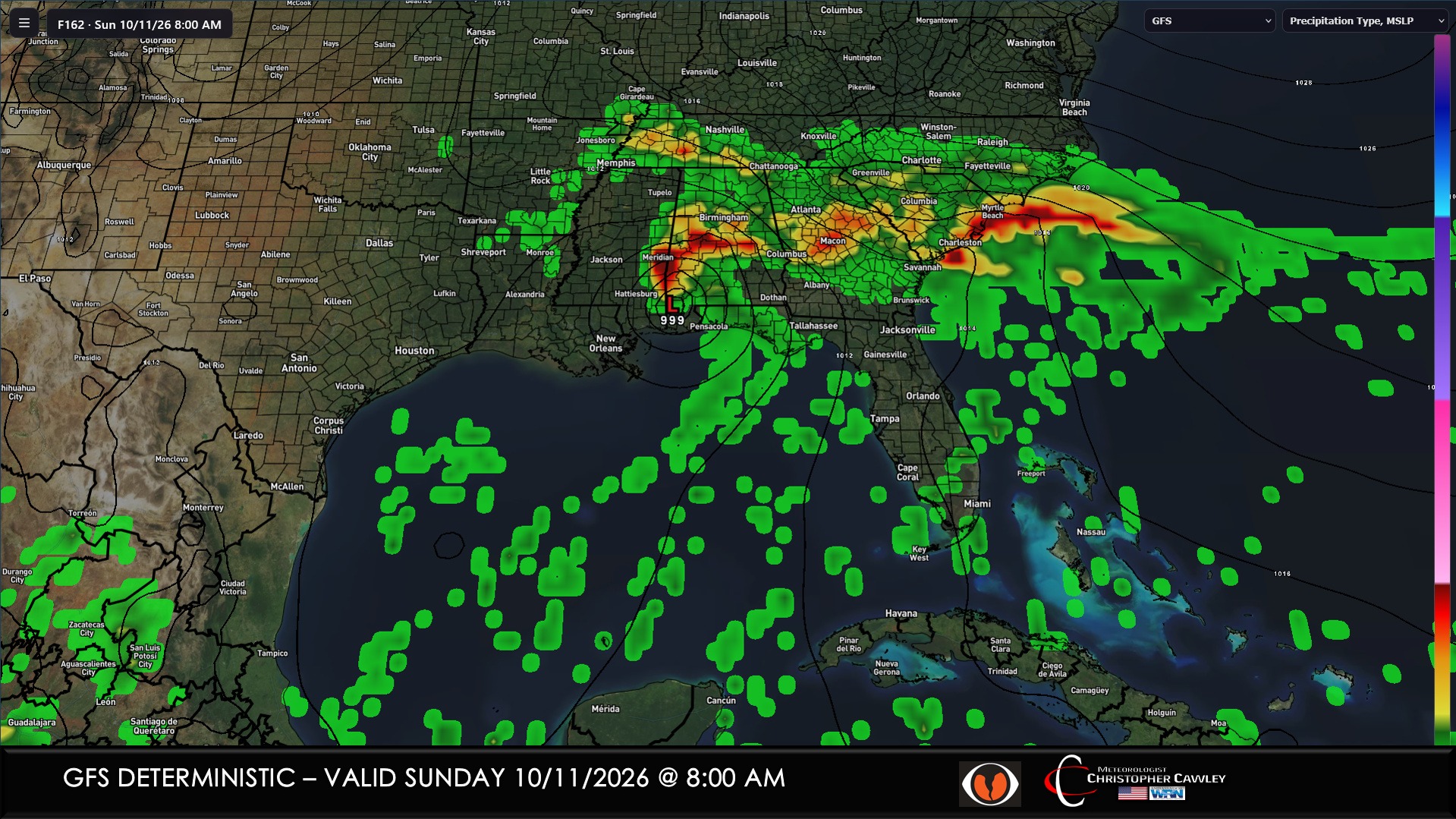
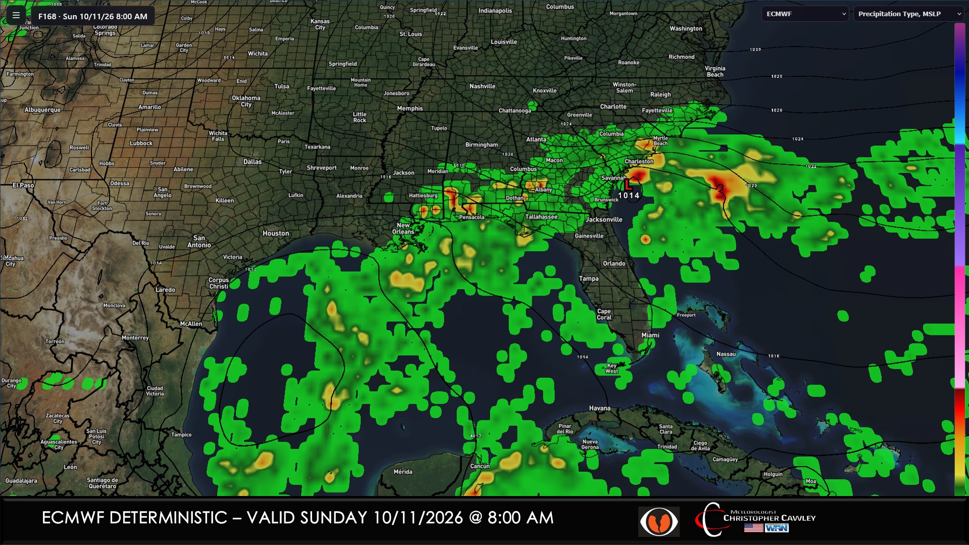
If you look carefully, you can see that the GFS and the Euro have the main low pressure center in two very different places. There simply isn’t enough information known at this time, which makes sense as we’re talking about a system that hasn’t yet even developed.
Regardless what you might see on social media, it’s simply too soon to speculate on any impacts. There’s no guarantee a system even forms. So at this time I’m putting a 30% chance for rain on Saturday, with the understanding that things can (and likely will) change as we work through the week. “Stay tuned.”
Here is your Freedom Insurance Today-plus-Five Forecast:
–Meteorologist Christopher Cawley