
Columbus County News Weather Update for the weekend of October 17-18, 2026.
This weather update is sponsored by Freedom Insurance of Whiteville. Trust Freedom Insurance to give you clear blue skies when it comes to home, car, boat, or whatever insurance you need. Let Freedom provide customized coverage to keep you and your family safe. Contact Freedom today at 910-640-2828!
Here’s today’s Bottom Line
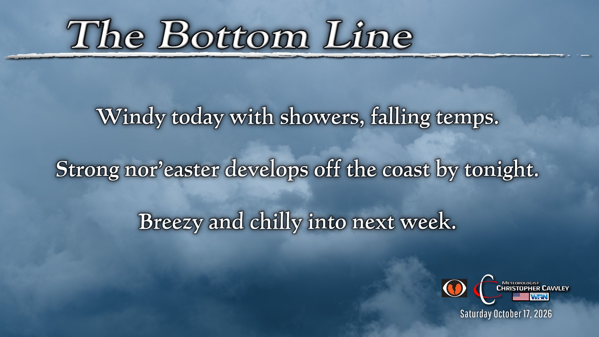
In the matter of a few days our forecast has gone from tranquil and quiet this weekend to a significant nor’easter developing off the coast bringing windy and unseasonably cold conditions.
A STRONG cold front will push offshore by early this morning. It’s quite breezy out there, and those winds will continue through the day.
Periods of mainly light rain are expected today as a cold, blustery northerly flow settles in over the area. Rainfall amounts are not likely to be anything eye-popping, maybe a few tenths of an inch at the most through today.
The bigger issues for the remainder of the weekend are a) plummeting temperatures, and b) a massive nor’easter developing off the coast.
Temperatures: We’ve already had our high temps for today. We were in the 70s after midnight … and we’re not going to see temps in the 70s again through at least Tuesday. By the time you sit down to supper tonight, we’ll be around 50 degrees… with that gusty north wind continuing.
We’ll fall into the lower 40s by early Sunday… and despite considerable sunshine through at least early afternoon, I don’t think we’ll get much higher than 60 — if even that. (That’s normal for late December, not mid-October.)
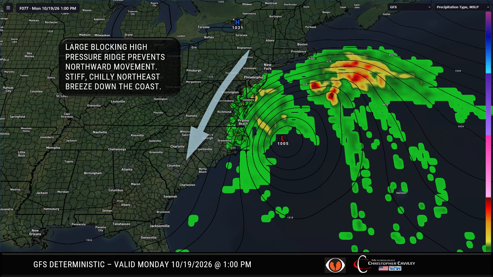
Nor’easter: Low pressure will rapidly develop on the front offshore this afternoon through tonight. With a huge blocking high pressure ridge over upstate New York, this nor’easter really won’t have a forward path for a couple of days. It will likely wobble and meander offshore through at least Monday before being kind of steered northeast away from the shore.
Direct impacts to Columbus and Bladen counties from the nor’easter will be minimal. Gusty winds are likely to continue through at least Monday. Instability over the area could allow for the development of showers Sunday afternoon, and these showers may include hail (or even graupel, which is half-melted, half-frozen snow).
It’s going to be blustery and rather cold on Sunday, as mentioned above. With the winds, the wind chill temps could be in the 40s to lower 50s through the day. I can’t believe I’m writing “wind chill” after temps in the 90s just 2 days ago.
The Outer Banks and extreme eastern North Carolina are likely to receive significant impacts from this storm, in terms of rain, wind, coastal flooding, beach erosion, rip currents, etc. If you have friends or family in those areas, might want to check in on them.
This weekend probably won’t be the best for going to the beach. Besides the fact that it’s going to be cold, beach conditions will feature dangerous rip current risks and general beach hazards… especially east-facing beaches.
Monday will be partly sunny, blustery, and continued chilly. Temps will struggle into the lower 60s.
This nor’easter may continue to linger into the midweek period… there are discrepancies in the modeling. If it does, you can expect chilly temps and breezy conditions to continue. I believe it will push off to the east-northeast and out to sea, which would result in slightly milder temps up to around 70 by midweek.
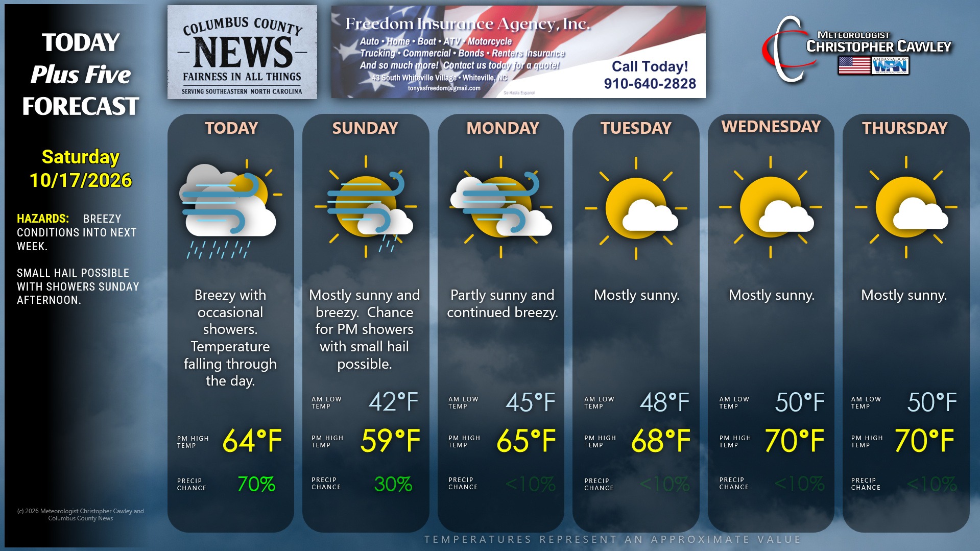
Here is your Freedom Insurance Today-plus-Five Forecast:
–Meteorologist Christopher Cawley