CCN Weather Update for Wednesday June 18, 2025.
This weather update is sponsored by Freedom Insurance of Whiteville. When severe weather strikes, with Freedom Insurance you will always be prepared. For home, car, boat, or whatever you need, Freedom can provide customized coverage to keep you and your family safe. Contact Freedom today at 910-640-2828!
High temperature at College Street for Tuesday was 95.6°F.
View real-time data from the weather station at College Street Weather Station.
Here’s today’s Bottom Line
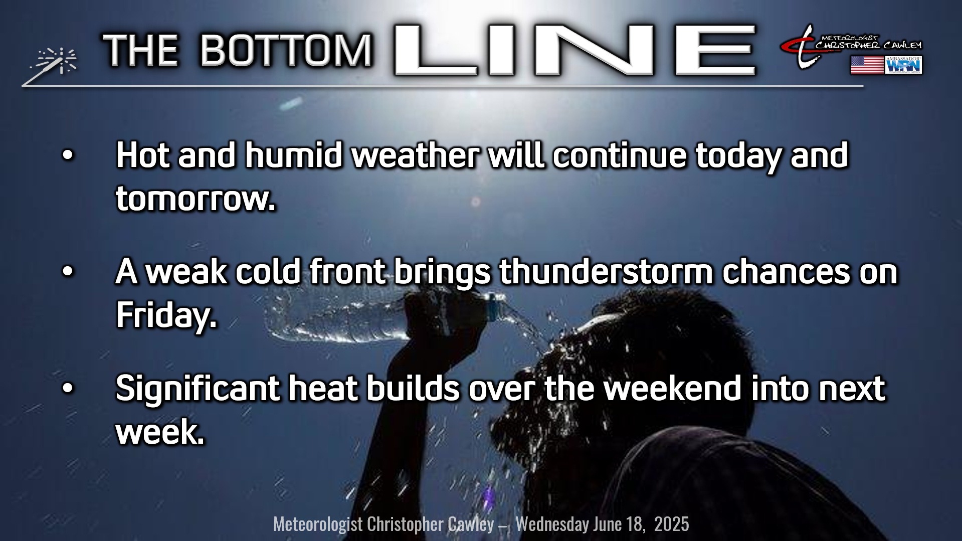
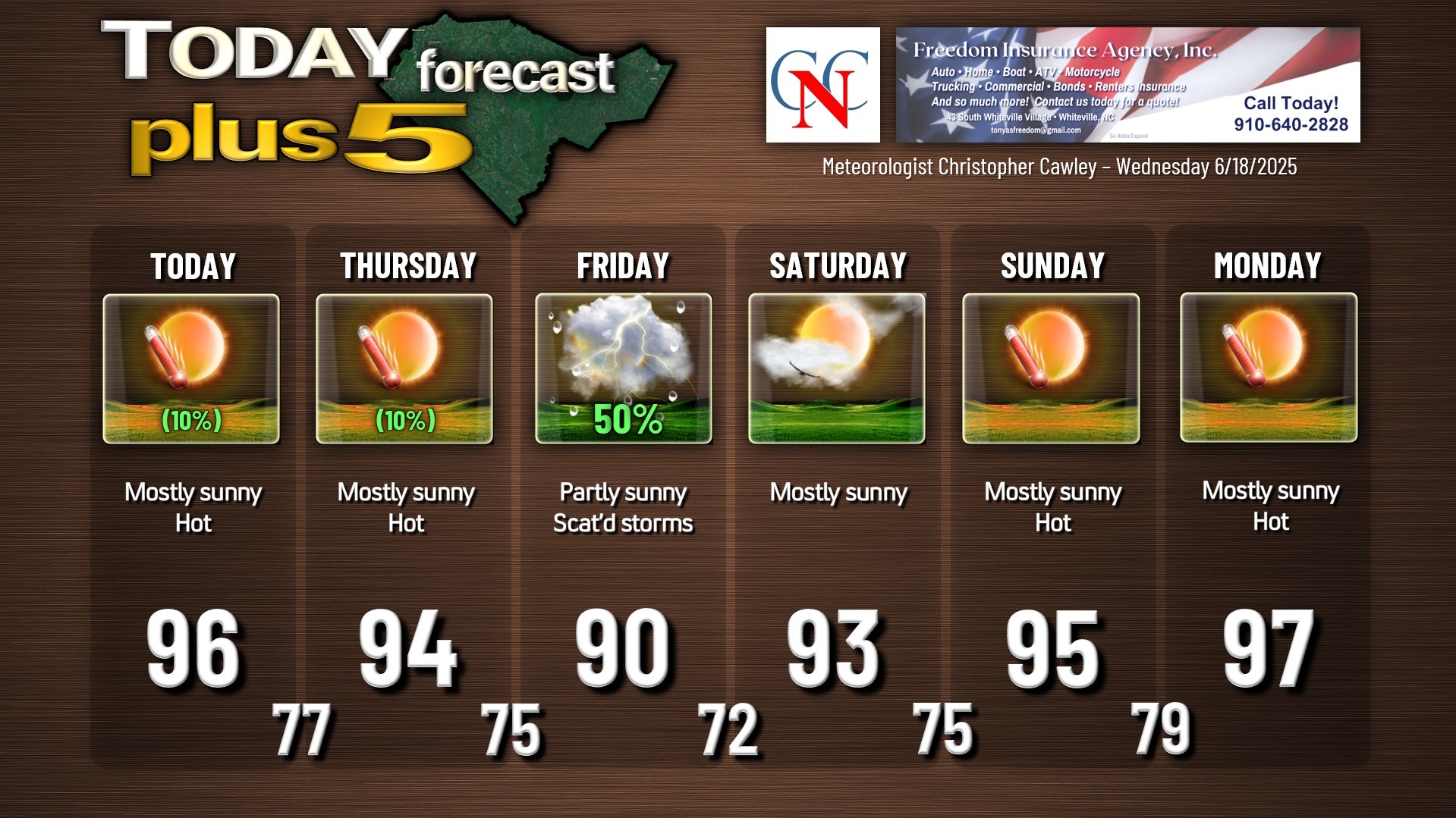
Sunshine and heat. Lots of heat. It’s all thanks to typical summertime Bermuda high pressure, with the western periphery over the eastern Carolinas. This will lead to reduced thunderstorm chances, lots of sunshine, and hot temperatures today and tomorrow.
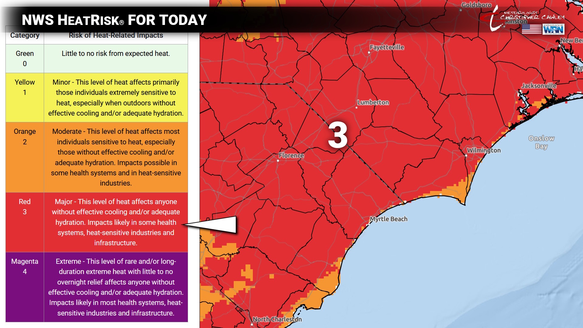
Today’s highs will be 94°F-98°F with heat index values being just below NWS heat advisory criteria of 105°F (at the airport). Heat index values in town, where people live, will be in the 102°F-106°F range. NWS Heat Risk has all of the eastern Carolinas under the level 3, “Major” category today.
Temperatures on Thursday will be similar — highs 93°F-97°F with heat index values 100°F-105°F in town.
A weak little cold front will drop across the area on Friday. This will result in scattered thunderstorm activity, similar to what we experienced most of last week. Dry air rapidly starts to build in later Friday afternoon, cutting off the storm chances. Clouds and thunderstorms lead to slightly “cooler” temps on Friday with highs “only” around 90°F.
Then our attention focuses on a building heat ridge in the middle- and upper-levels of the atmosphere over the weekend and into next week. Surface high pressure directly underneath will produce a significant sinking motion to the air. This means storm chances drop to near zero, lots of clear skies, and even hotter temperatures than what we’re experiencing now.
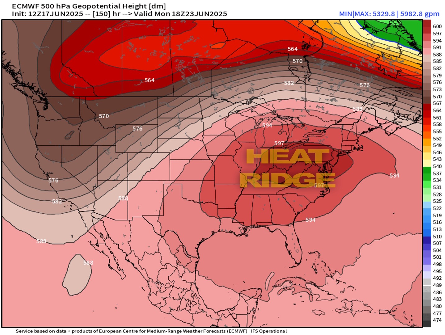
Air rotates in a clockwise fashion around high pressure. This results in a sinking motion to the air within the center of the high, almost like how water circles and goes down a drain. Sinking air is compressed, and compressed air gets hotter and hotter in temperature. Our highs Sunday into early next week will likely reach the upper 90s with very low rain chances.
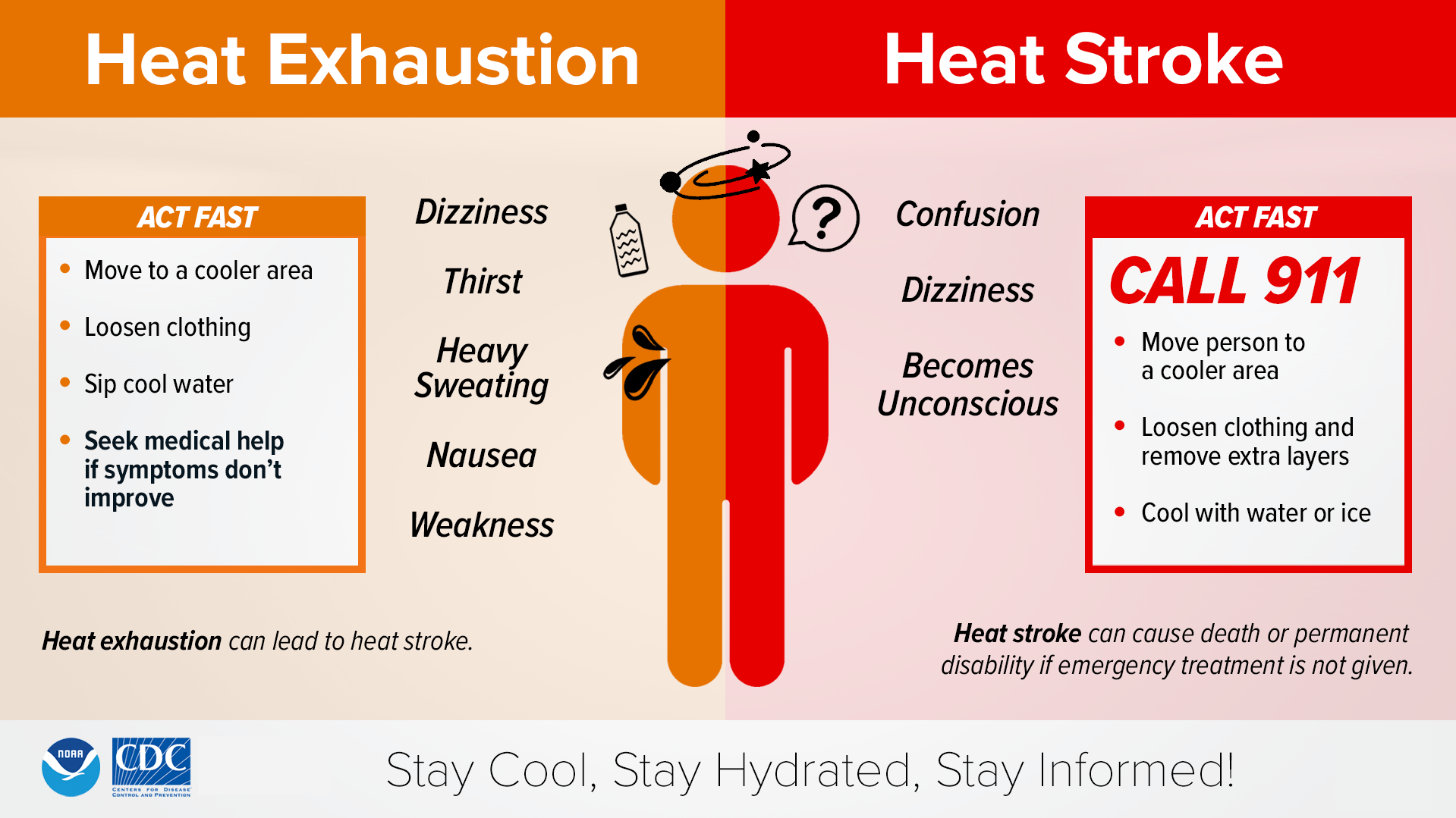
Remember the symptoms of heat exhaustion and heat stroke. This can happen to anyone, regardless of age, activity level, physical fitness, etc. “I can handle the heat,” until that moment you can’t.
Consider rescheduling any strenuous outdoor activities to early morning or late-afternoon. If you must be outdoors during peak heating, wear lightweight, loose-fitting clothing, take frequent water/Gatorade breaks. Avoid alcohol and sodas as they’re dehydrating.
Heat stroke is a medical emergency — call 911.
TROPICAL OUTLOOK: Lots of high pressure ridging over the tropical Atlantic. There is an abundance of shower and thunderstorm activity over the central Caribbean Sea but none of it is organized. There is a weak wave departing the west coast of Africa, but again, nothing organized. No tropical development expected over the next 7 days.
Here is your Freedom Insurance Today-plus-Five Forecast:
–Meteorologist Christopher Cawley