

CCN Weather Update for Tuesday October 7, 2025.
This weather update is sponsored by Freedom Insurance of Whiteville. No weather worries with Freedom Insurance. For home, car, boat, or whatever you need, Freedom can provide customized coverage to keep you and your family safe. Contact Freedom today at 910-640-2828!
Here’s today’s Bottom Line
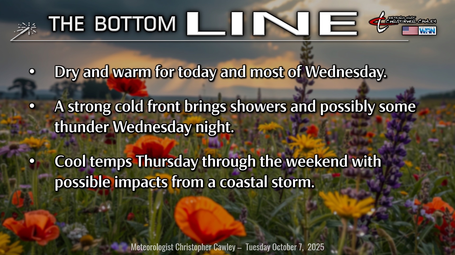
The only thing to talk about for the local weather scene is the cold front that will cross the area late Wednesday night… and potentially the season’s first big Nor’easter developing this weekend.
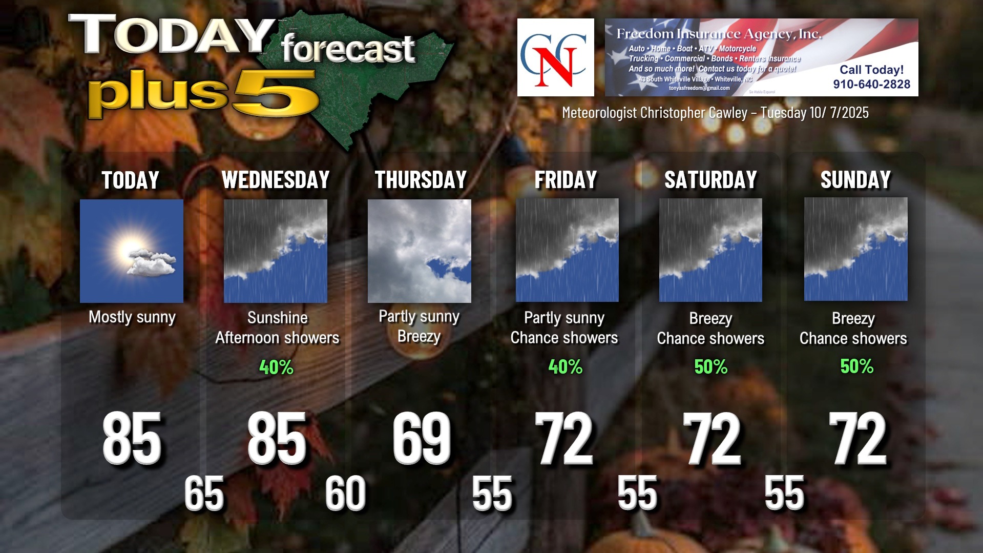
High pressure will retreat off the coast today allowing a strong cold front to start it’s approach. We’ll be mostly sunny and warm for today with highs in the mid 80s.
The front starts to bear down on the area by Wednesday afternoon. Clouds will be on the increase, and a few showers are possible later in the afternoon.
Showers… and a chance for thunder… come Wednesday night with the frontal passage. The front appears to have much more moisture than originally thought, and rainfall amounts could approach half an inch. Not drought-busting, but at least more rain than originally thought.
Colder, Canadian air invades the area on Thursday, and while we’ll see increasing sunshine, our highs will struggle to reach the 70-degree mark.
A secondary trough (basically a “dip” kind of disturbance in the middle levels of the atmosphere) rotates through on Friday. The modeling is scant with rainfall but historically these could produce some showers, so I’m going to put a chance for showers in our forecast for Friday afternoon into the evening.
Meanwhile the cold front lingers offshore, and all available modeling shows an area of low pressure rapidly spinning up on this front. The low isn’t likely to be tropical; in fact, it could be the season’s first Nor’easter. It’s still kind of uncertain how close to the coast this will be. A storm track along the coast could throw some chilly conditions and showers in here over the weekend, whereas a more offshore storm track just means breezy conditions with some cloudiness.
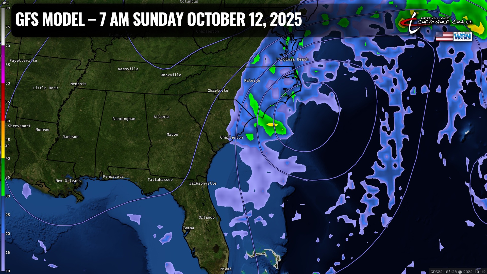
A storm track along the coast could be big trouble for our friends in the Outer Banks.
Anyway, for now I’m going with a 50/50 shot for showers Saturday and Sunday, but that could change either for better or worse as we get closer to the weekend.
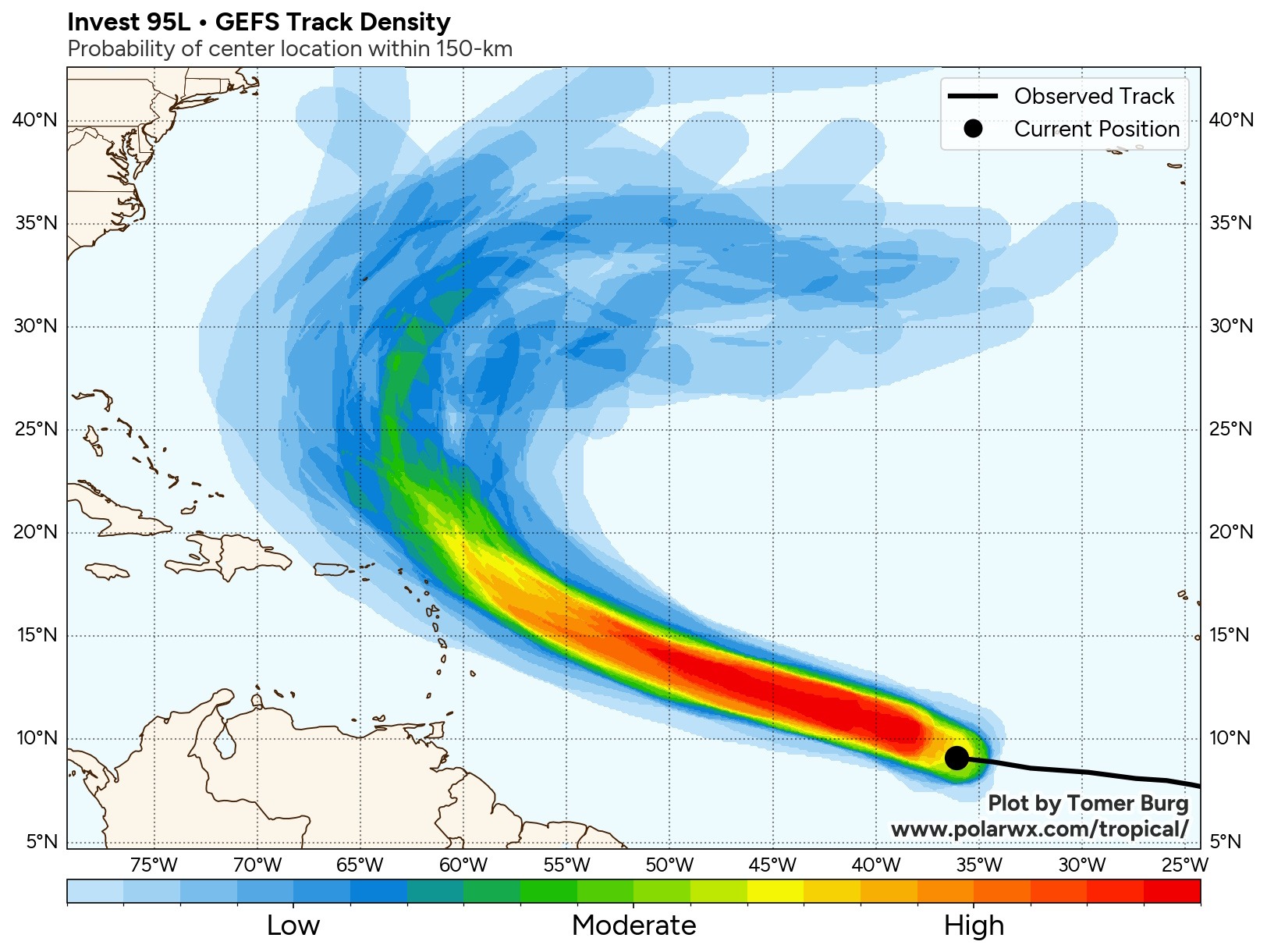
TROPICS: What will undoubtedly become “Jerry” is taking shape across the central tropical Atlantic. The modeling… and the overall surface features… point to a “curve” with the storm staying over the open ocean through it’s life cycle.
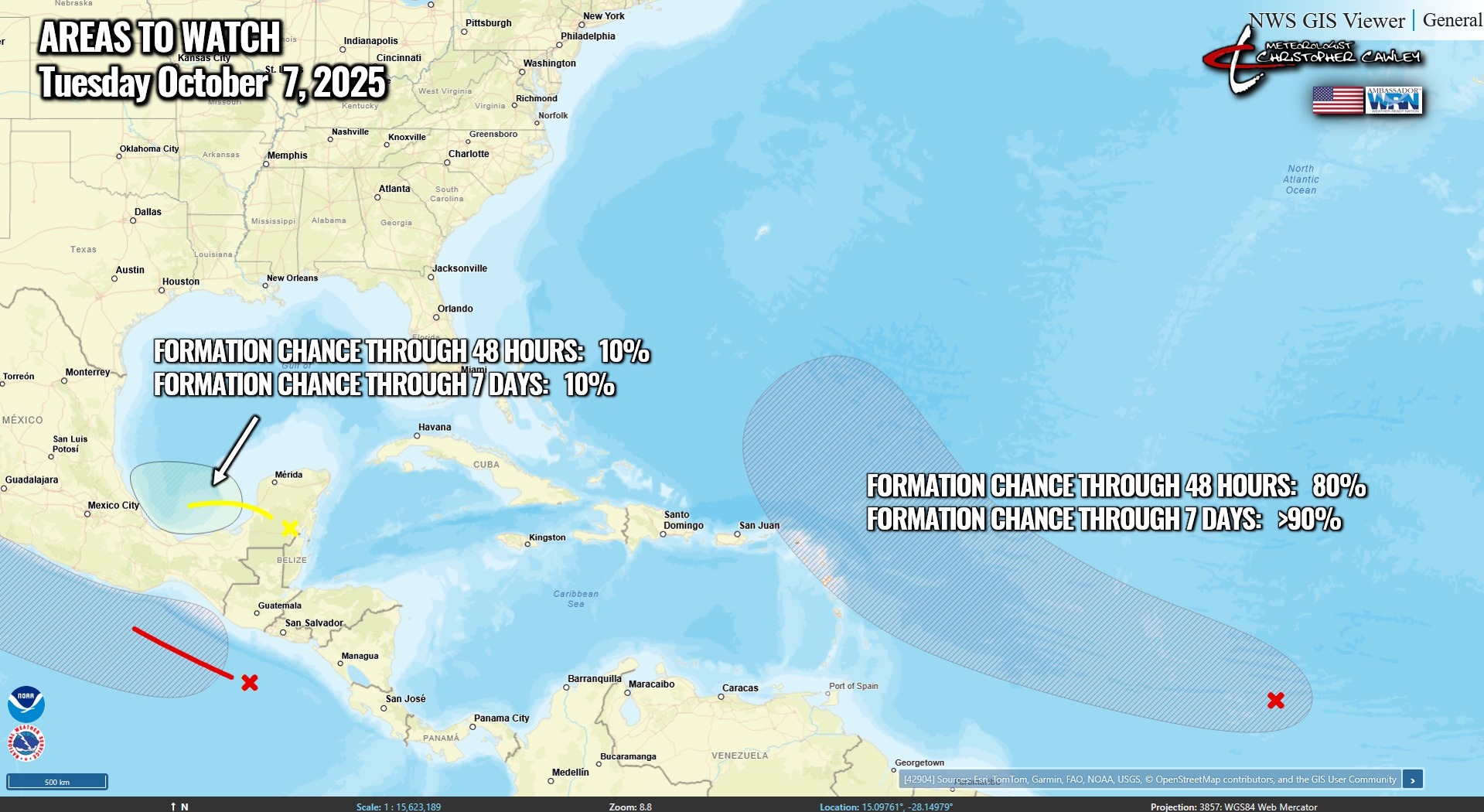
A new area being monitored between the Yucatan peninsula and Mexico has a 10% chance for development. An area of low pressure will drift across the water and move inland into Mexico. I don’t think it’ll have enough “time” over the open water to develop into anything significant.
As mentioned, the area of low pressure expected to develop off the Carolina coast this weekend is likely to be cold-core in nature, not tropical. Therefore, there are no tropical threats to the Carolinas.
Here is your Freedom Insurance Today-plus-Five Forecast:
–Meteorologist Christopher Cawley