

CCN Weather Update for Saturday October 11, 2025.
This weather update is sponsored by Freedom Insurance of Whiteville. No weather worries with Freedom Insurance. For home, car, boat, or whatever you need, Freedom can provide customized coverage to keep you and your family safe. Contact Freedom today at 910-640-2828!
Here’s today’s Bottom Line
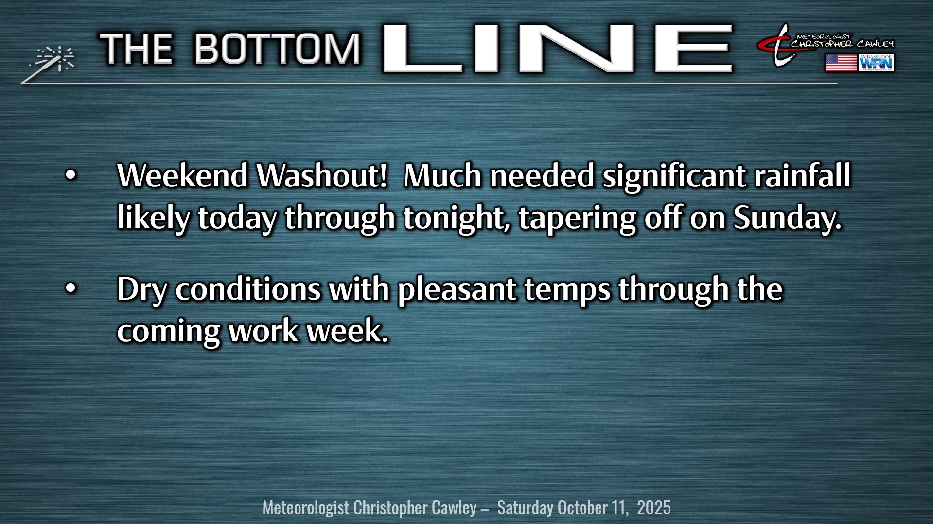
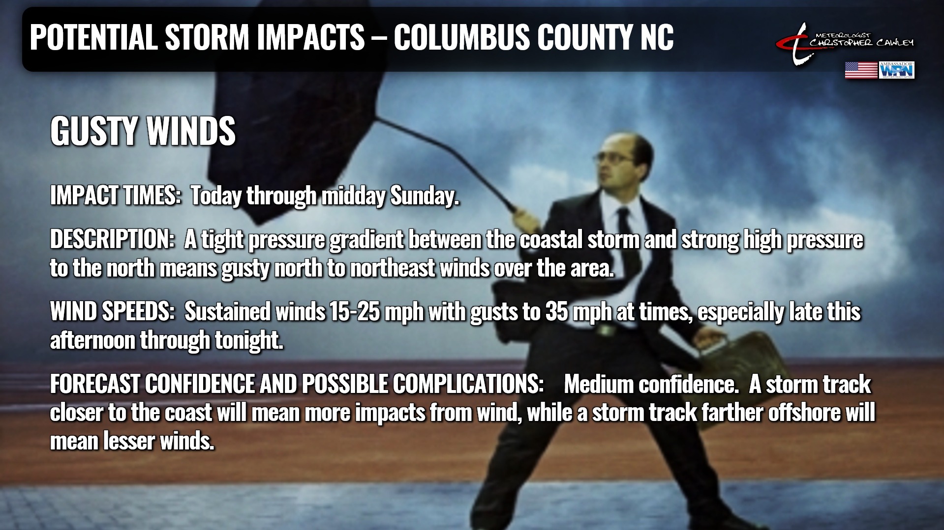
The weekend washout is here. A fairly large coastal storm (while technically by meteorological definition NOT a nor’easter, but we’re calling it one anyway) will bring wind and rain impacts to Columbus County this weekend. Much needed rainfall!
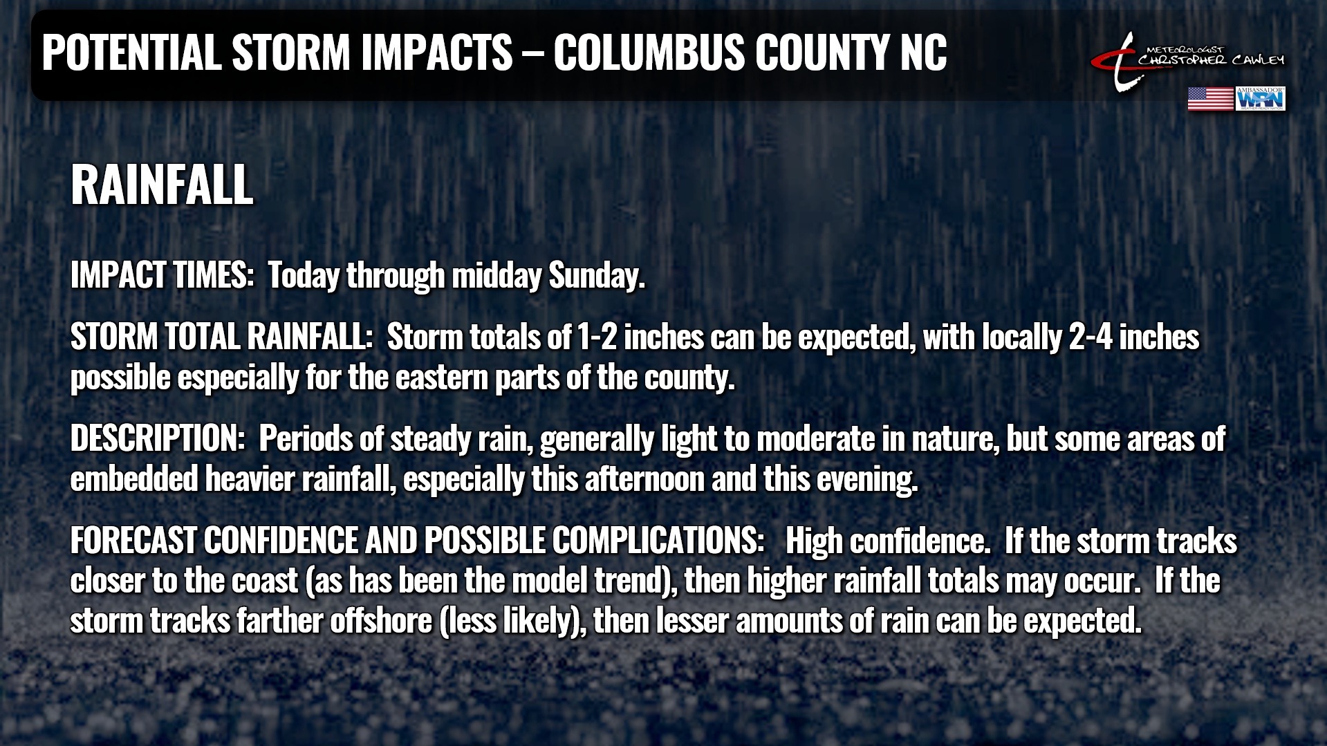
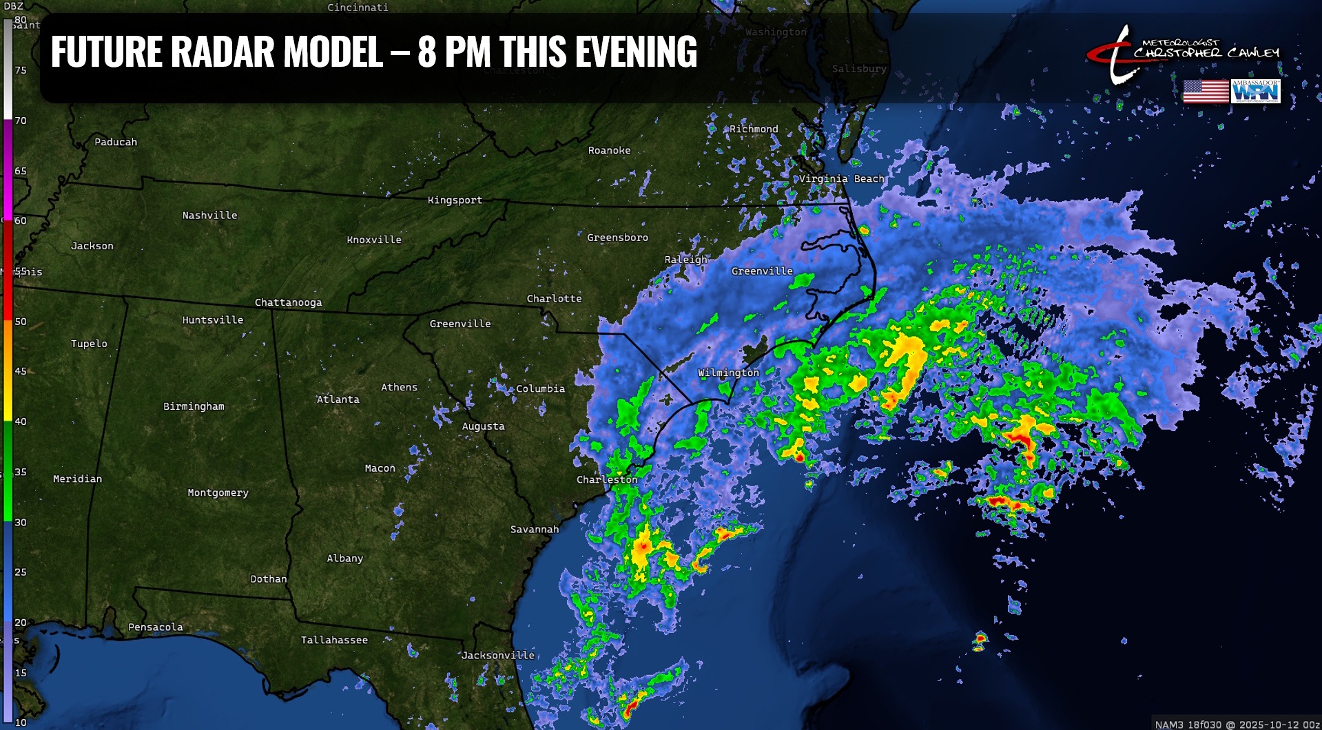
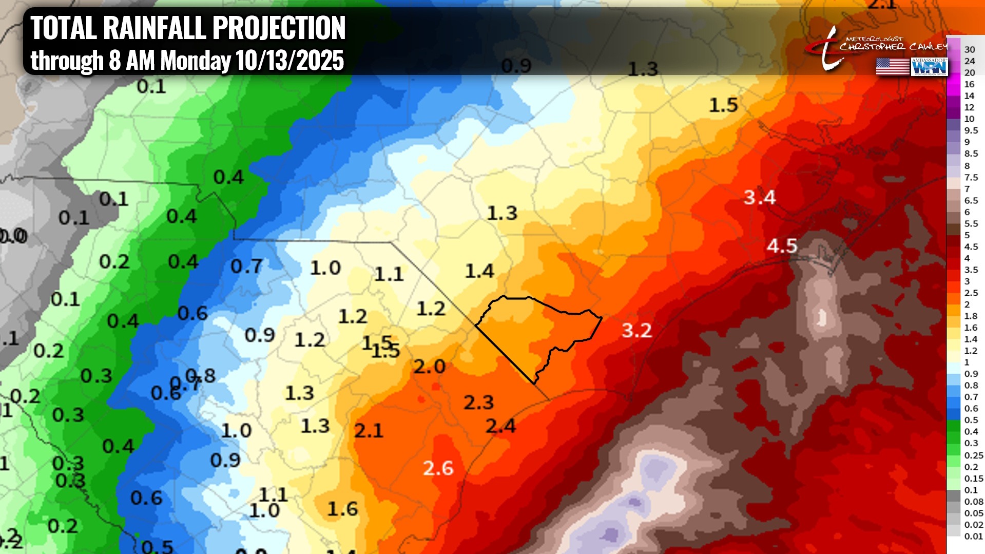
This is very beneficial rainfall, and with the dry antecedent conditions I don’t expect any widespread flooding concerns. That being said, watch out for standing areas of water in the usual locations, especially this afternoon through tonight. Use caution if you’re traveling.
If you’re going to the fair… umbrella required. You’re going to get wet.
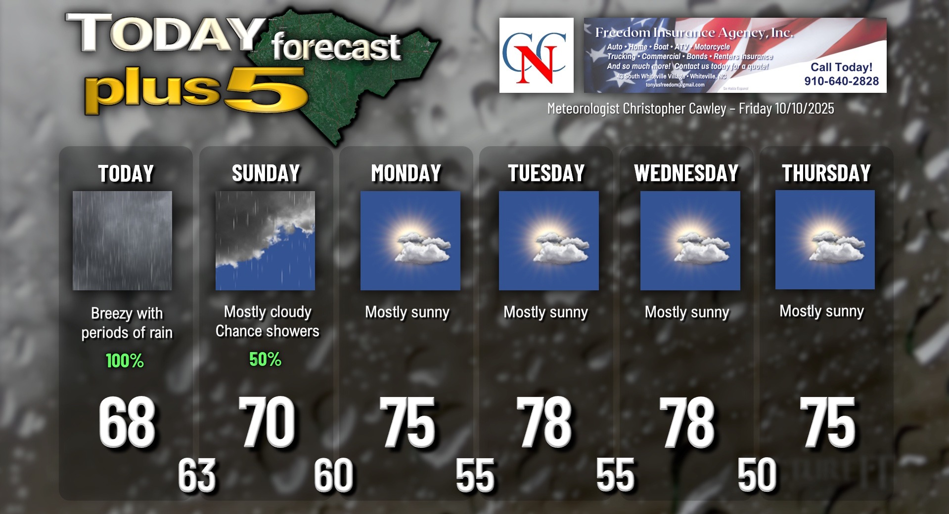
After the storm pulls away on Sunday, high pressure builds into the area for the first half of next week with pleasantly warm temps in the upper 70s. The next cold front moves through with very little fanfare late Wednesday afternoon, with slightly cooler temps for Thursday. Some modeling suggests we’ll see lows dipping into the 40s early Friday and Saturday mornings…
TROPICS: Two tropical systems… Jerry and what WAS Karen… are in the Atlantic. Karen didn’t stick around long as she is now “post-tropical” over colder north Atlantic waters. She’s quite the gale-force low, nonetheless.
Jerry has begun a northward movement and at this time is expected to stay tropical storm strength throughout his life cycle. He’ll lift to the south/east of Bermuda before making a hard right turn and encountering dry air and plenty of shear… and that’ll be that for him.
There are no tropical threats to the Carolinas for the foreseeable future.
Here is your rainy Freedom Insurance Today-plus-Five Forecast:
–Meteorologist Christopher Cawley