CCN Weather Update for Wednesday June 17, 2026
This weather update is sponsored by Freedom Insurance of Whiteville. Trust Freedom Insurance to give you clear blue skies when it comes to home, car, boat, or whatever insurance you need. Let Freedom provide customized coverage to keep you and your family safe. Contact Freedom today at 910-640-2828!
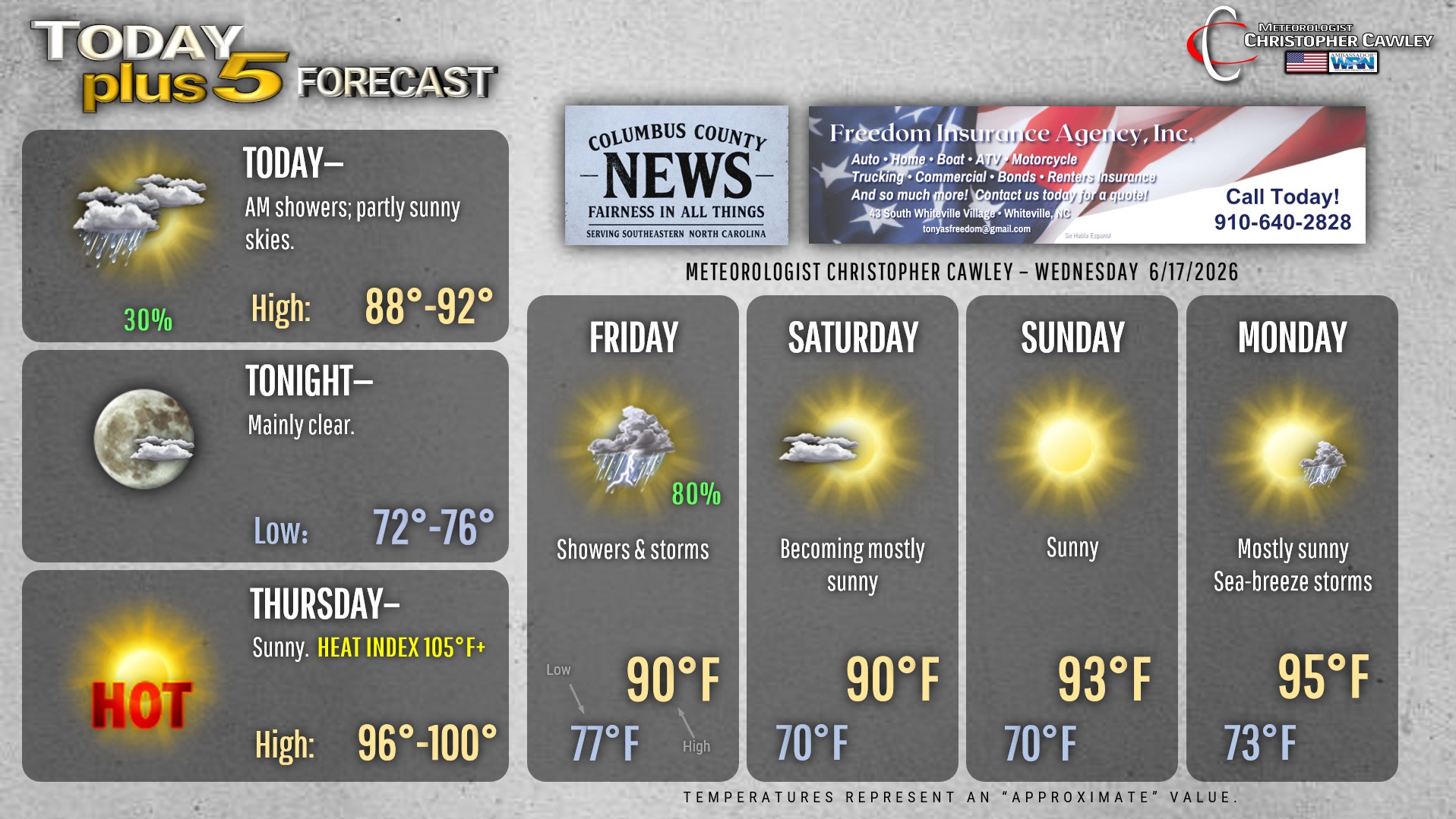
Here’s today’s Bottom Line
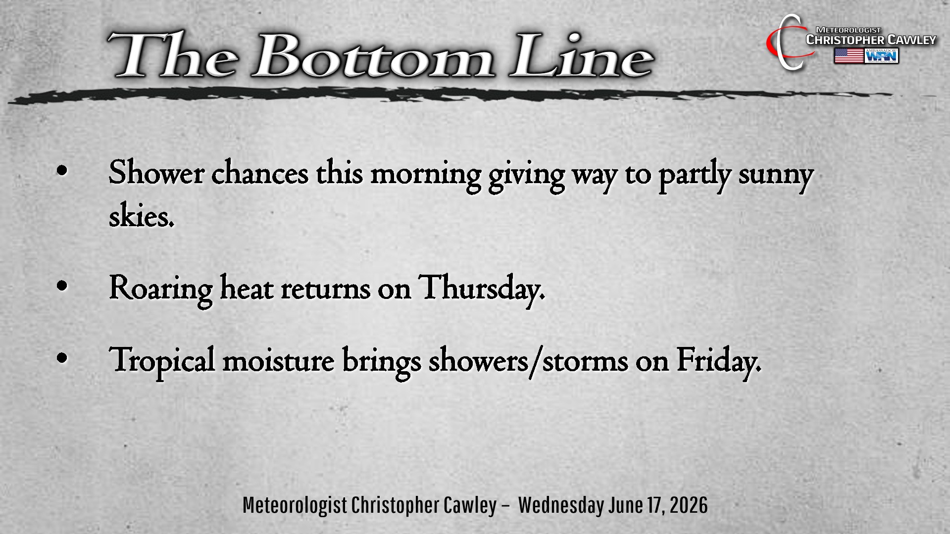
Two big points to talk about in this morning’s report. The heat on Thursday … followed by a cold front and tropical moisture moving in on Friday.
Scorching Thursday. Atlantic high pressure at the surface, along with a high pressure ridge higher in the atmosphere, will come together nicely to bring dangerous heat into the area on Thursday. High temperatures should cruise toward the Misery Mark of 100 degrees… with heat index values easily cruising past the advisory criteria of 105. Heat index values may briefly flirt with heat warning criteria of 110.
Fortunately the blistering heat is only for one day.
Thursday night and Friday: A cold front will push southward across the area while remnants of the first tropical system of the season lifts quickly over the area. Uncertainties surround the severe weather threat that could occur late Thursday into Friday… and there are uncertainties with regard to the track of the tropical remnant low. The European deterministic shows the remnant low crossing pretty much directly over Columbus County around lunchtime on Friday.
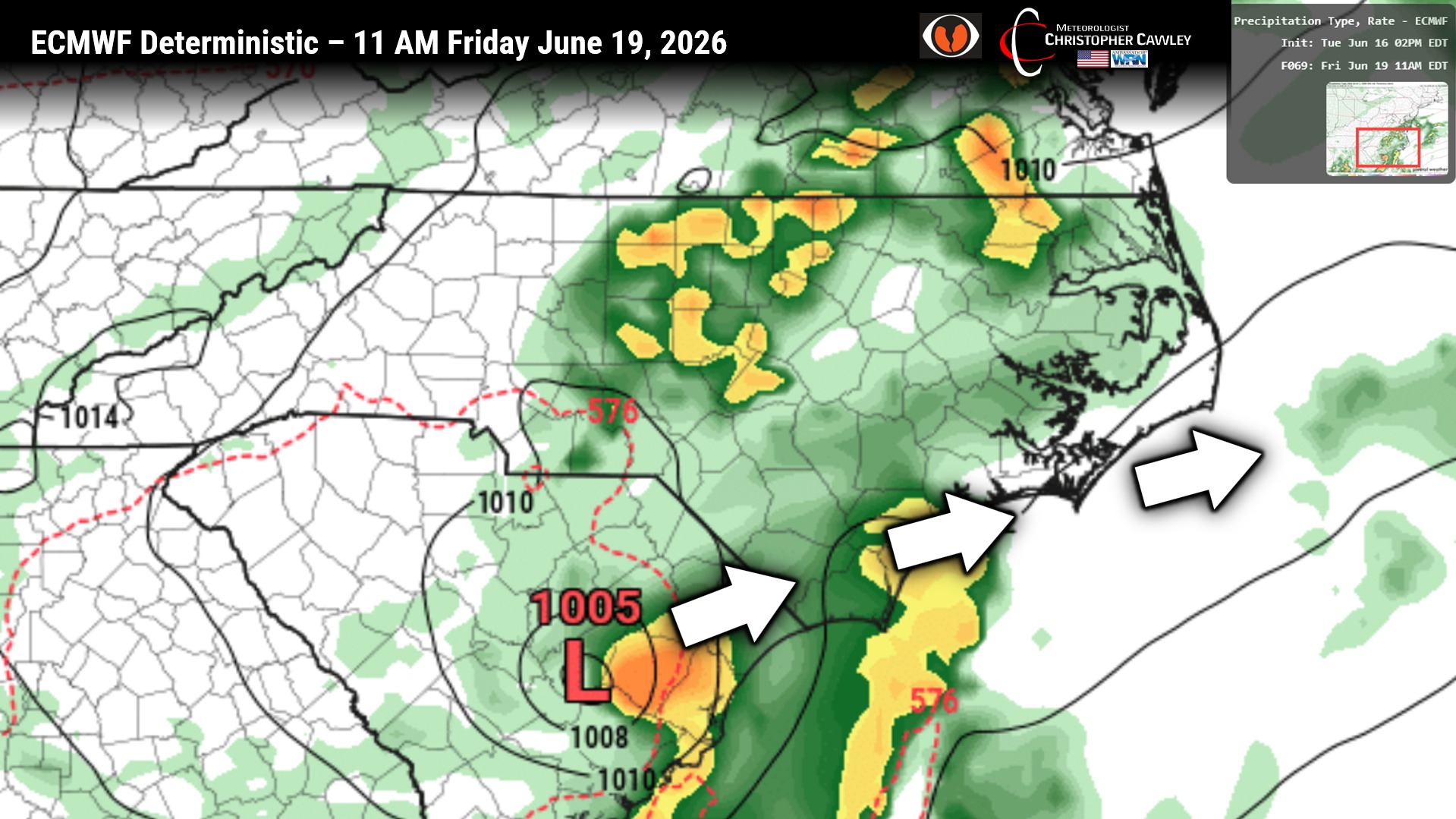
At least scattered (if not numerous) showers and storms can be expected late Thursday through Friday night. Modeling is … a bit strange with regards to rainfall totals. The model blend “only” shows between three-quarters and one inch of rain for the event:
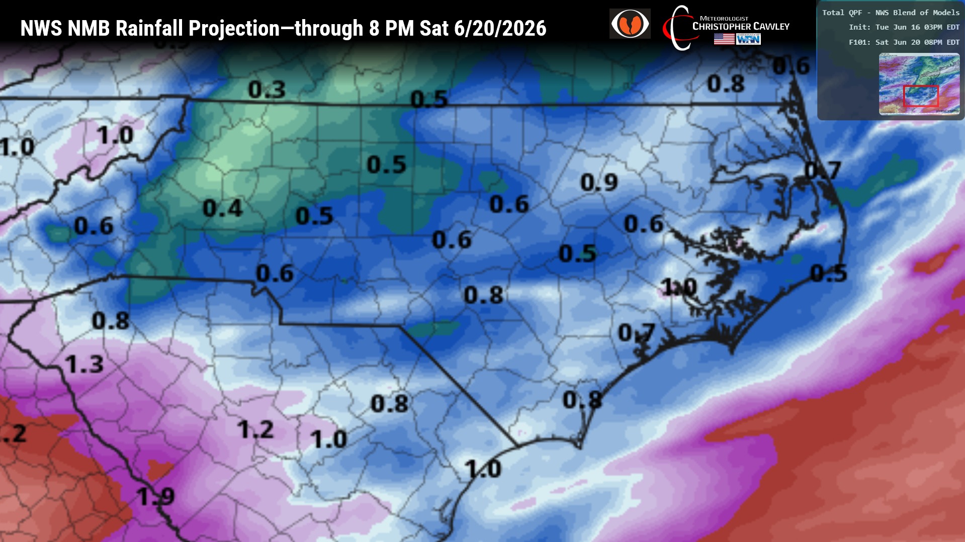
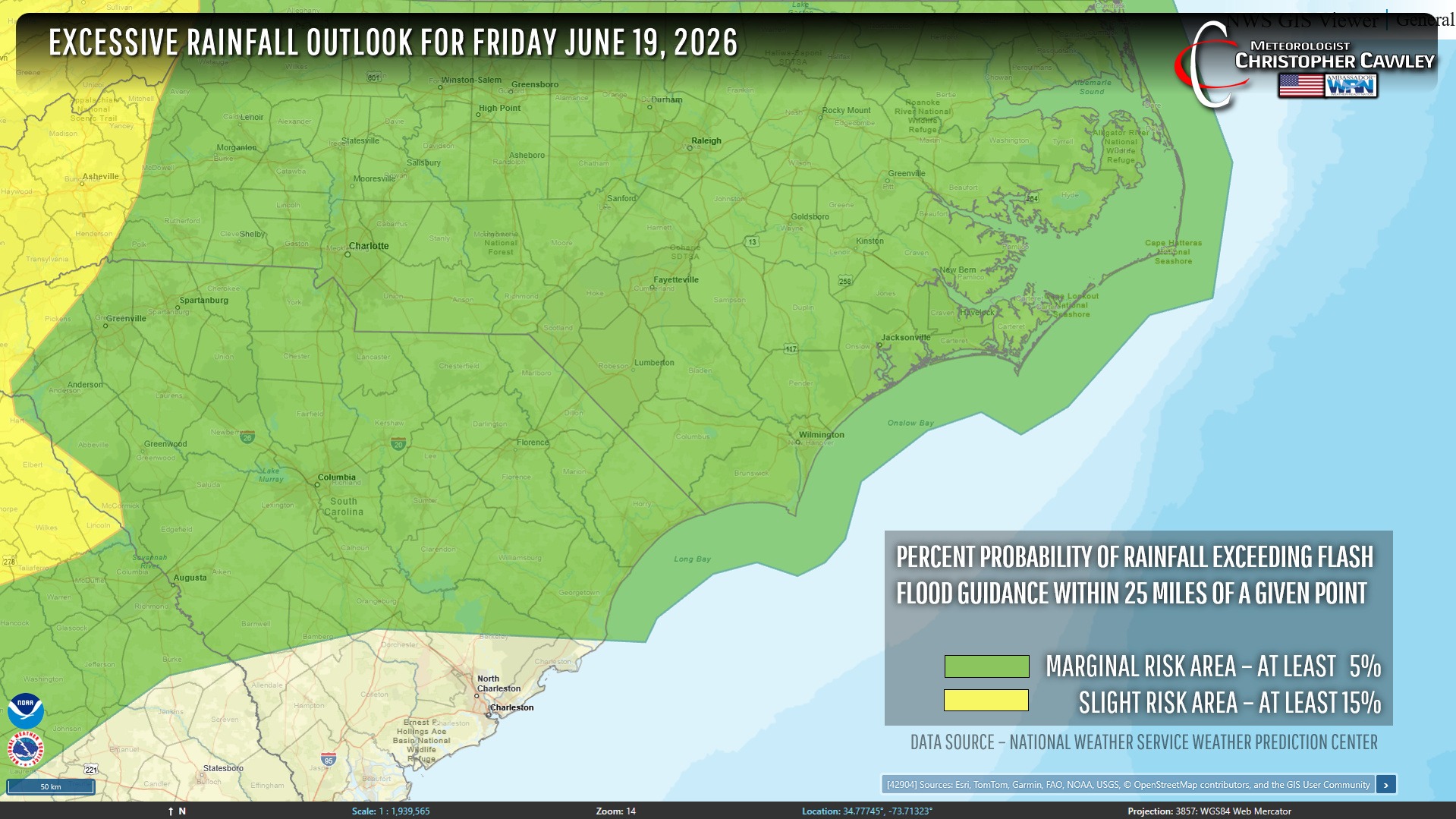
The NWS WPC has essentially all of central and eastern North Carolina under a “marginal risk” for rainfall exceeding flash flood guidance. I believe rainfall amounts are going to be highly variable over the area… with some areas receiving half an inch or less while other areas could receive significant amounts, depending on thunderstorm locations (which is impossible to predict).
Oh… and a severe weather threat especially late Thursday. If everything lines up just right, there is the potential for severe thunderstorms to develop late Thursday and Thursday night. Damaging winds would be the most important thing to worry about, with an isolated tornado threat. I’m just not quite “sold” on that quite yet… again… everything has to line up just right.
So the long-and-the-short is Thursday will be blistering hot, and then potentially stormy late in the day into the night. Friday features scattered to numerous showers and storms.
Things calm down by the weekend with building heat once again into next week.
Here is your Freedom Insurance Today-plus-Five Forecast:
–Meteorologist Christopher Cawley