CCN Weather Update for Tuesday November 25, 2025
This weather update is sponsored by Freedom Insurance of Whiteville. Trust Freedom Insurance to give you clear blue skies when it comes to home, car, boat, or whatever insurance you need. Let Freedom provide customized coverage to keep you and your family safe. Contact Freedom today at 910-640-2828!
Here’s today’s Bottom Line
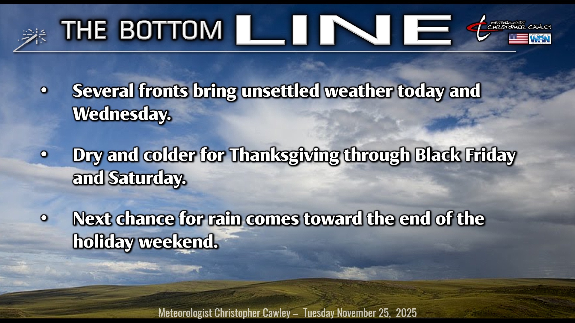
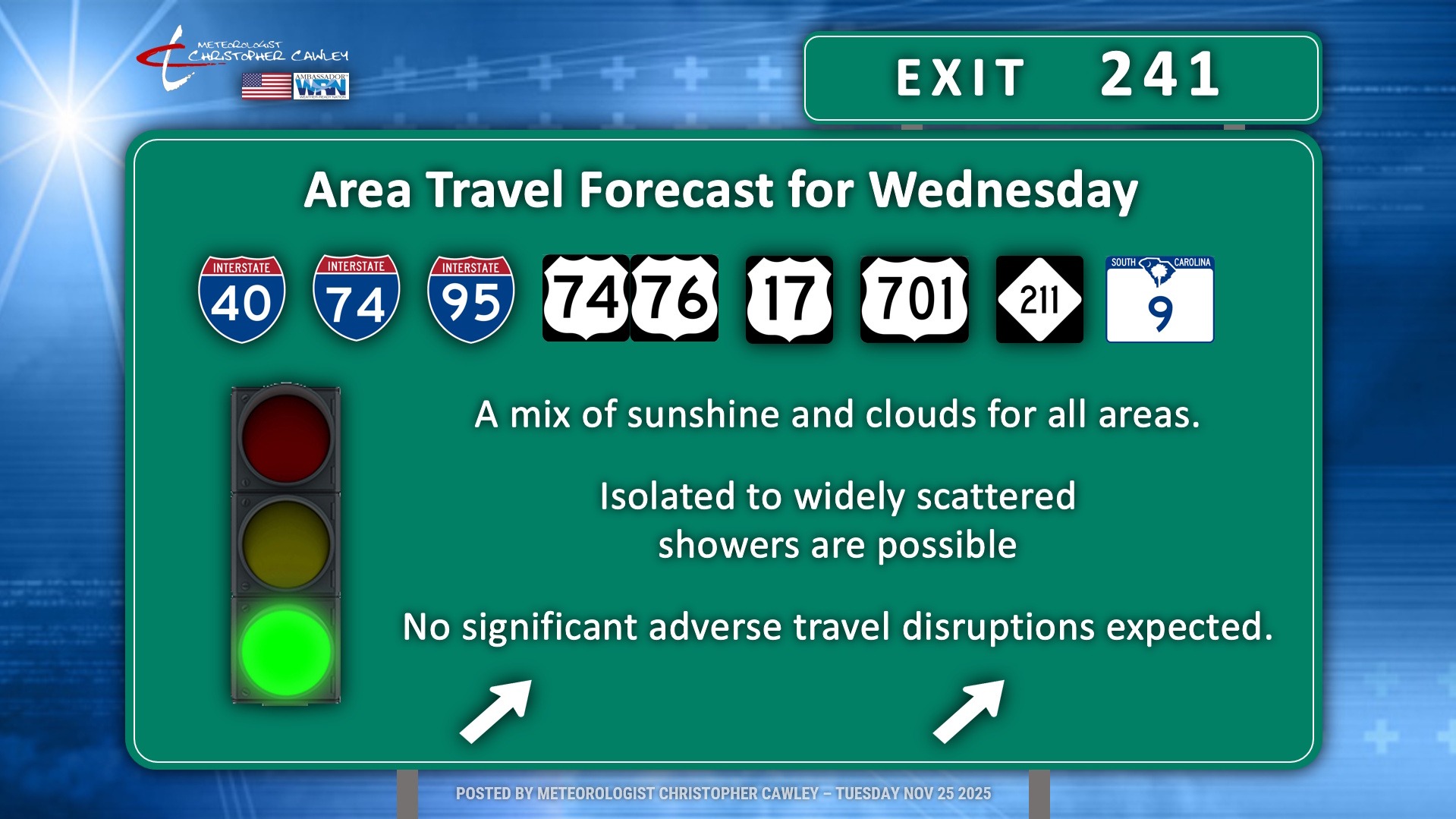
As noted in The Bottom Line, we’ll have a bit of unsettled weather across the area today, tonight, and Wednesday. This won’t be significant, though, and I don’t anticipate any significant travel worries for Wednesday.
Let’s break it down.
For today, a warm front will lift north over the area bringing clouds and a chance for showers. We’ll see some breaks of sunshine as well, so on the whole we’ll go with a “mix of sunshine and clouds.” Showers should generally be light and widely scattered. Temps this afternoon after the warm front moves through will jump into the upper 70s.
Tonight will be unseasonably warm and humid with mostly cloudy skies. A few spotty showers are possible as well but nothing widespread is expected. Temps will only fall to around 60.
Wednesday will feature the passage of two cold fronts. The first front will move through during the morning hours with relatively little fanfare… a few spotty showers possible. The second front, a much stronger Arctic front, will cross the area around suppertime. Fortunately this will also feature little fanfare. Highs Wednesday will be around 80… but the temps will drop, drop, drop behind the front. We’ll be around 40 early Thanksgiving morning with some brisk northwest winds.
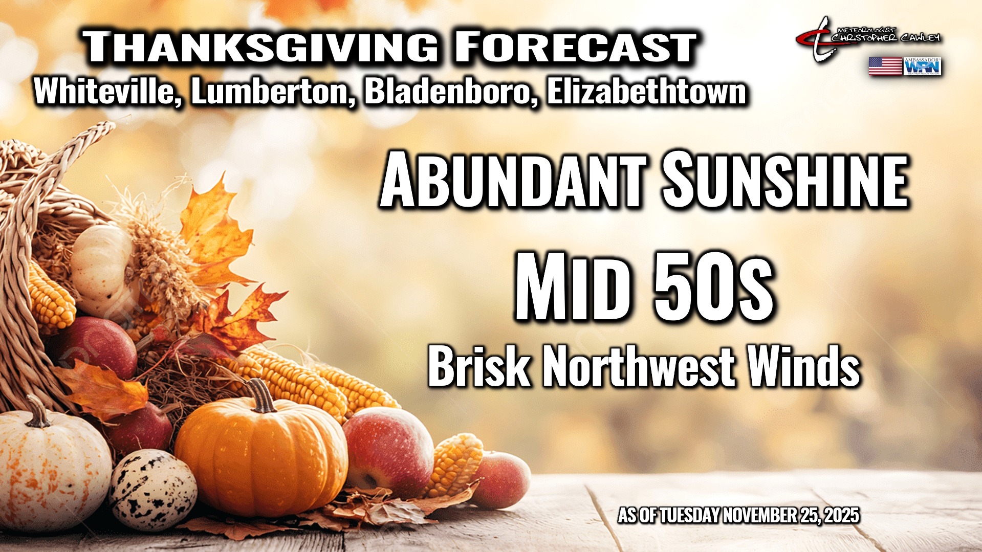
Those northwest winds continue on Thanksgiving day, but we’ll have unlimited sunshine. Strong Canadian high pressure will be in place Thanksgiving, Black Friday, and Saturday. The high pressure moves directly overhead late Thanksgiving night through Friday and Saturday, before shifting offshore by Sunday.
A DEEP, HARD FREEZE is possible Thanksgiving night, and is LIKELY Friday night into Saturday. Lows will fall to between 28-32 early Friday… and will be between 23-27 early Saturday. Highs on Black Friday will be closer to normal for mid-January, and will struggle into the lower 50s for Saturday.
The high pushes offshore for Sunday and warmer air starts to push in ahead of the next weather system. Clouds will be on the increase for Sunday, with the next chance for rain Sunday night into Monday.
Here is your Freedom Insurance Today-plus-Five Forecast:

–Meteorologist Christopher Cawley