CCN Weather Update for Sunday March 8, 2026.
This weather update is sponsored by Freedom Insurance of Whiteville. You can trust Freedom Insurance to give you clear blue skies when it comes to home, car, boat, or whatever insurance you need. Let Freedom provide customized coverage to keep you and your family safe. Contact Freedom today at 910-640-2828!
Here’s today’s Bottom Line:
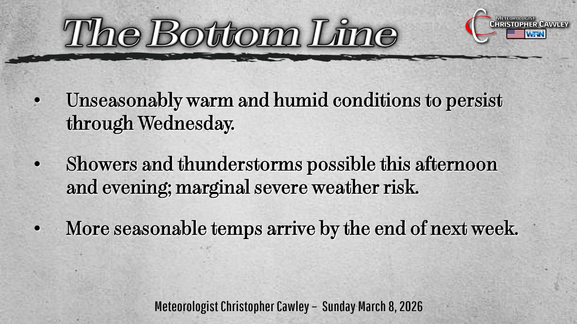
Unseasonably warm and humid conditions will prevail through next Wednesday. That’s the “big picture.”
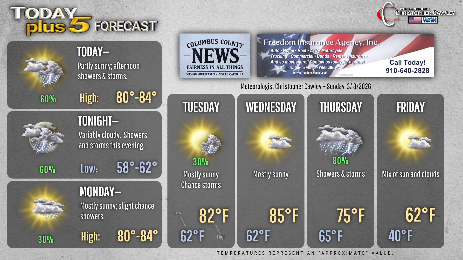
A weak frontal boundary will drop south and east over the state today. This will bring the threat for showers and thunderstorms later this afternoon through this evening. The NWS Storm Prediction Center has much of eastern NC under a “marginal risk” for severe weather. On the whole I don’t expect any true severe weather here; perhaps an isolated damaging wind gust or some isolated marginally severe hail, but that will be the exception, not the rule.
There may be some lightning this evening so watch out for that if you have any outdoor plans.
Otherwise typical mid-May weather conditions will prevail through Wednesday.
Then …. change is in the air … as on Thursday a strong cold front crosses the area and crushes the Bermuda high ridge. This will bring some much-needed rain to the area for Thursday, and possibly some thunder depending on the timing of the frontal passage. It’s too early to call at this point whether or not we’ll experience any severe weather… just something I’ll be keeping my eye on.
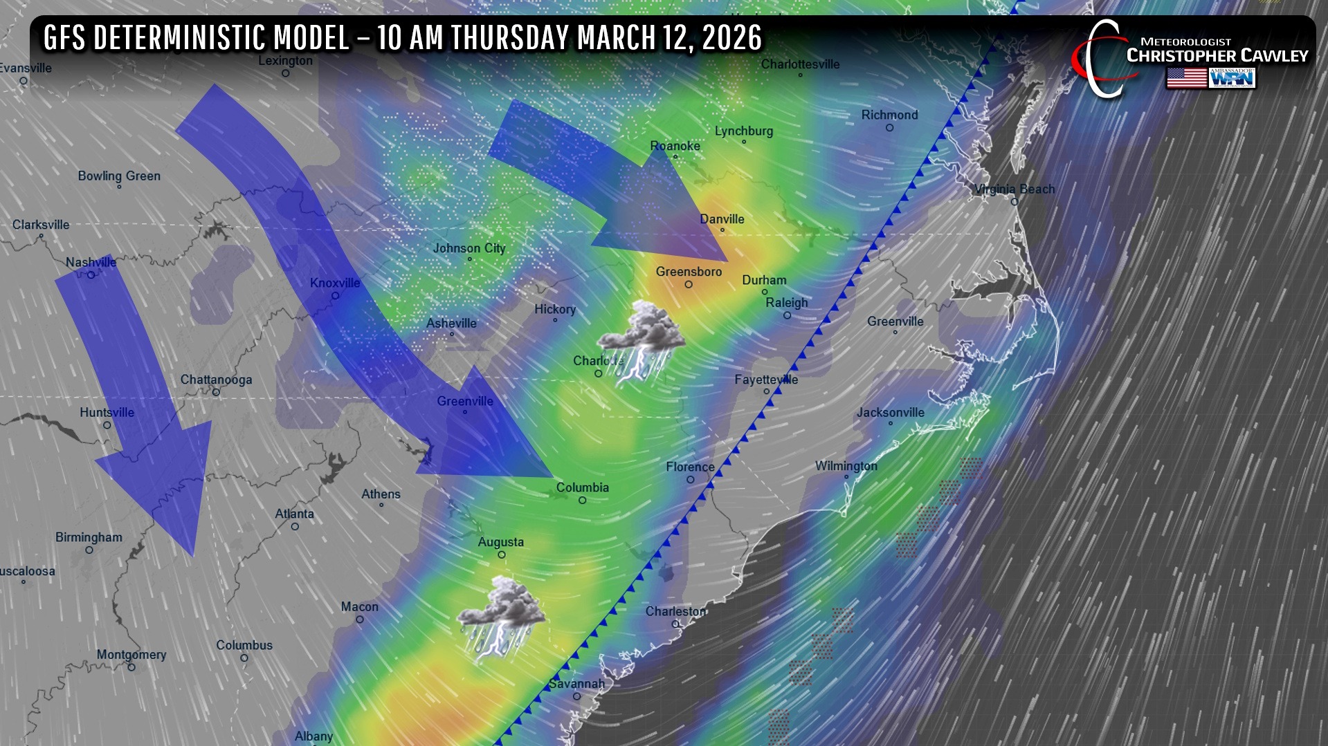
Temps on Friday will be a rather shock to our system in the wake of the frontal boundary… but actually those temps are where they SHOULD BE this time of year.
I’ll be watching the period between March 18-22 for the potential — POTENTIAL — for frost. Too early to make a definitive call.
Here’s your Freedom Insurance Today-plus-Five Forecast!
–Meteorologist Christopher Cawley