CCN Weather Update for Thursday May 7, 2026
This weather update is sponsored by Freedom Insurance of Whiteville. Trust Freedom Insurance to give you clear blue skies when it comes to home, car, boat, or whatever insurance you need. Let Freedom provide customized coverage to keep you and your family safe. Contact Freedom today at 910-640-2828!
Here’s today’s Bottom Line
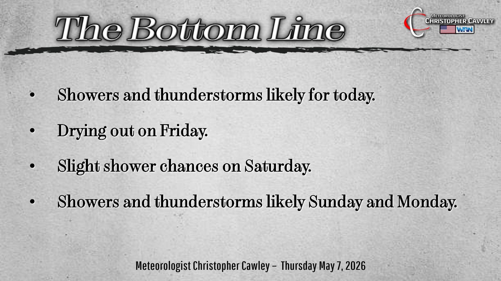
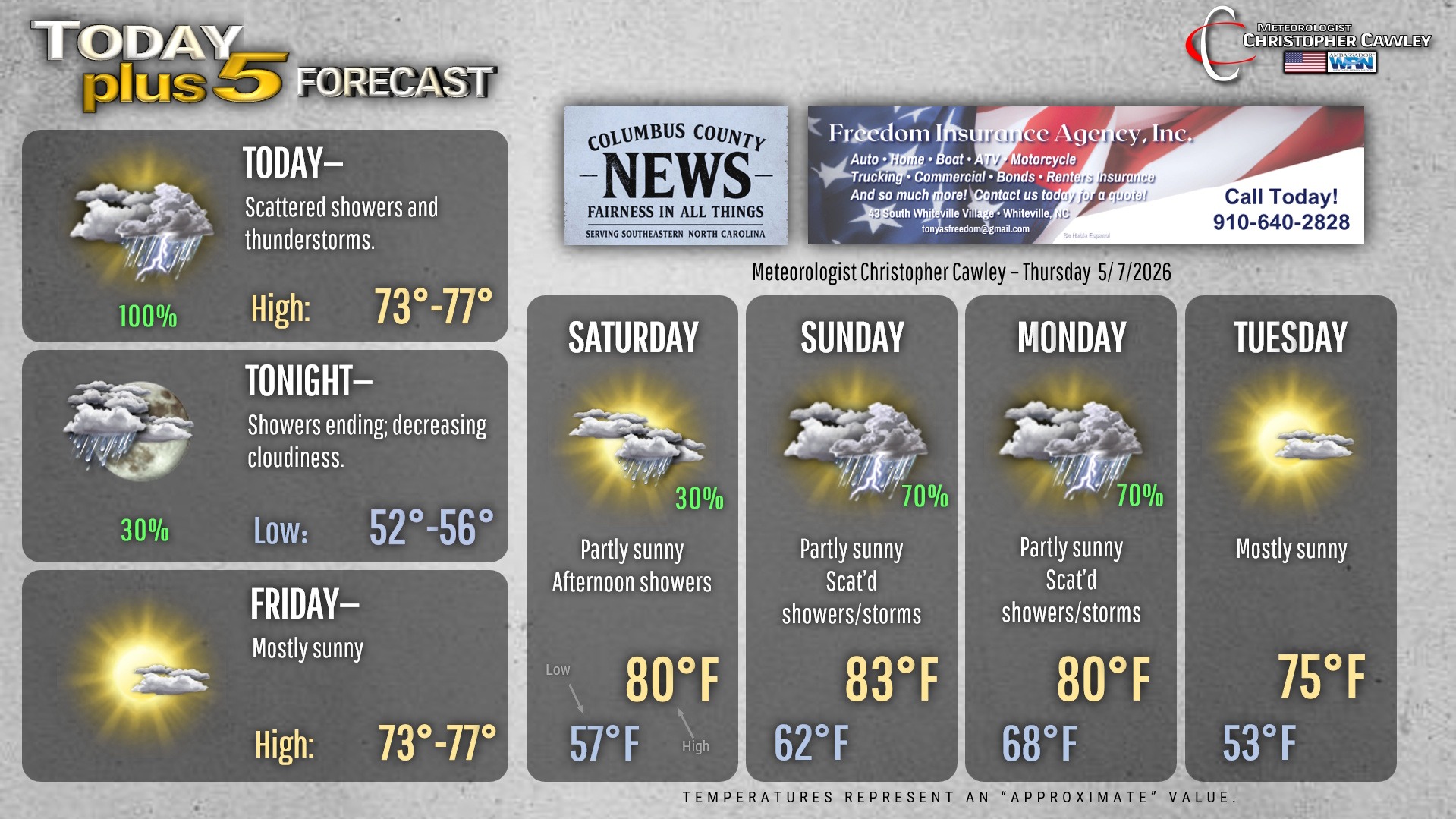
Good rainfall chances for today, likely coming in two waves. Strengthening upper-level energy will support a mass of showers and thunderstorms moving through the area through this morning. Severe weather risk appears to be quite low as instability and lightning probabilities are more focused to our south.
The rain tapers off and we should have a few hours of dry time before rain chances increase again by the mid-afternoon hours. This will be in the form of more scattered showers and storms. The actual cold front then moves through this evening with showers wrapping up before midnight.
Rainfall projections are between a third and a half inch of rain today. The showers and thunderstorms should be scattered in nature, and while most of us will get some rain today, there may be some who get left out.
Friday should be a dry day… probably the last guaranteed dry day until sometime next week.
The details are really murky at this time, and honestly the forecast confidence is … quite low. There is zero consistency within the modeling of some upper-level disturbances pushing through the area late Saturday through Monday. I’m going with a good chance for showers and thunderstorms Sunday and Monday before another cold front sweeps through the area. The devil is in the details, and there’s some time to monitor the trends and go from there. If you’re making weekend plans, Saturday should be the better day of the two.
Here is your Freedom Insurance Today-plus-Five Forecast:
–Meteorologist Christopher Cawley