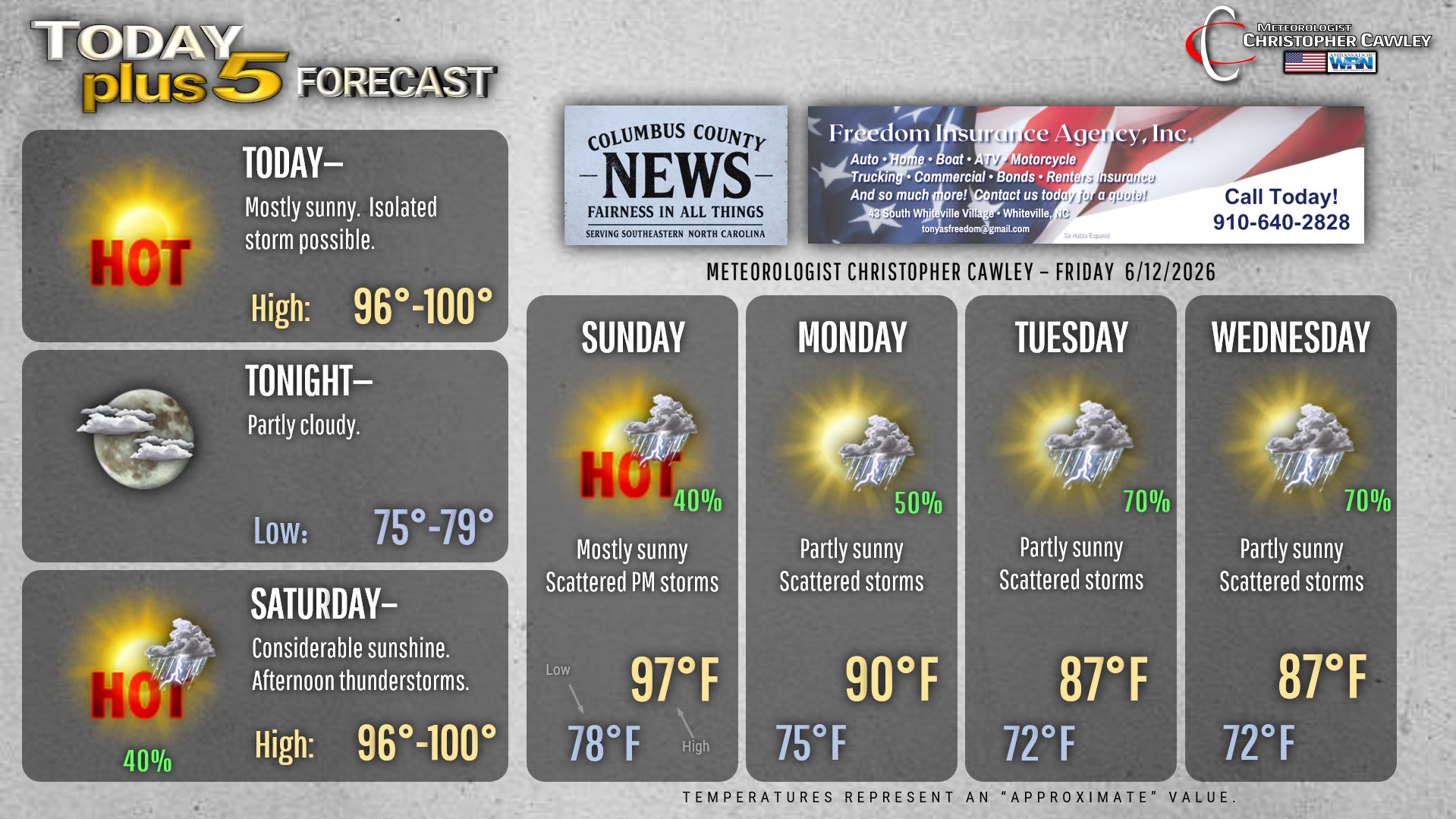
CCN Weather Update for Friday June 12, 2026
This weather update is sponsored by Freedom Insurance of Whiteville. Trust Freedom Insurance to give you clear blue skies when it comes to home, car, boat, or whatever insurance you need. Let Freedom provide customized coverage to keep you and your family safe. Contact Freedom today at 910-640-2828!
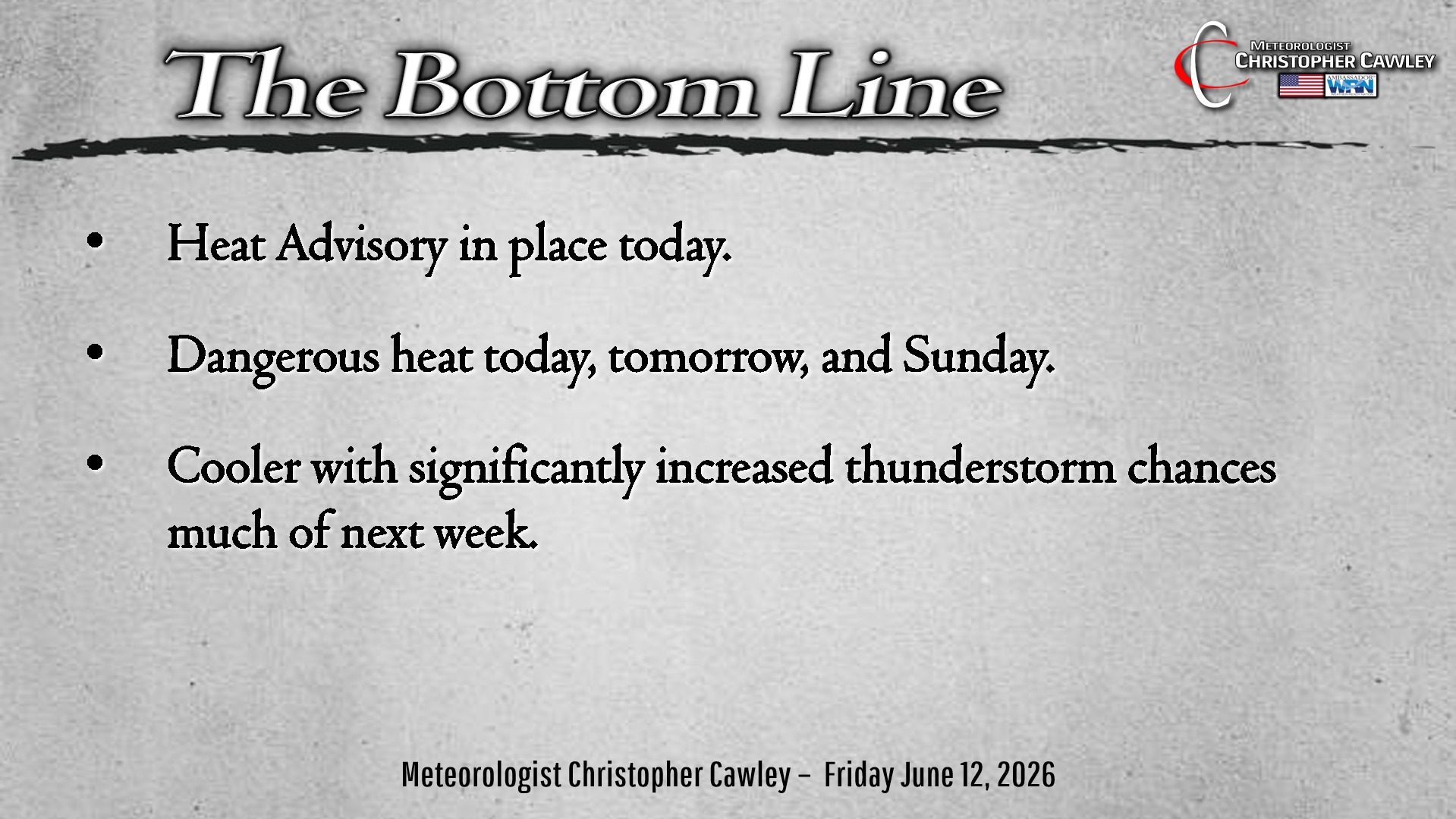
Here’s today’s Bottom Line
Ridging high pressure, both offshore and to our west, will bring striking heat and humidity to the area through the weekend.
The hottest temps of the year are likely to occur today through Sunday thanks to this ridge. A heat advisory is in place for today.
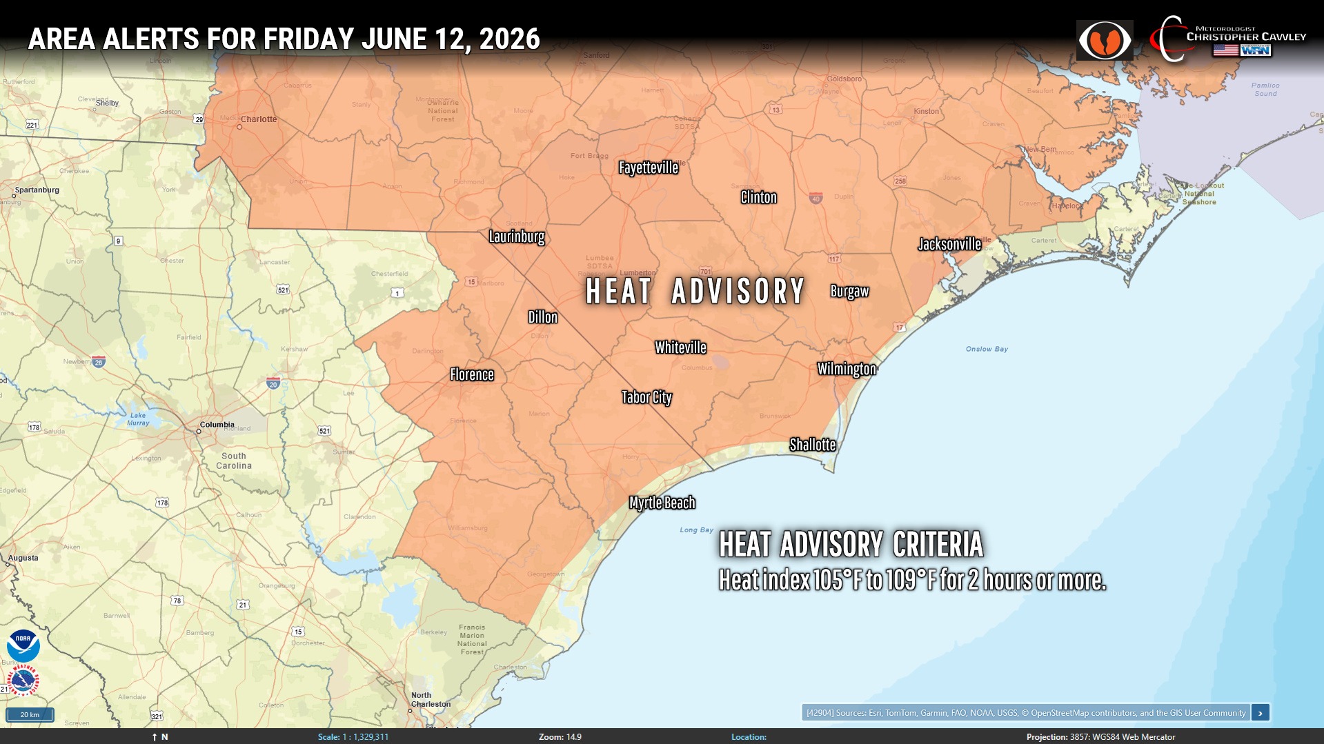
Our temps will be at or around the 100-degree mark this afternoon thanks to westerly winds and “compressional warming” thanks to high pressure. Heat index values will be in the 105°F to 109°F neighborhood this afternoon.
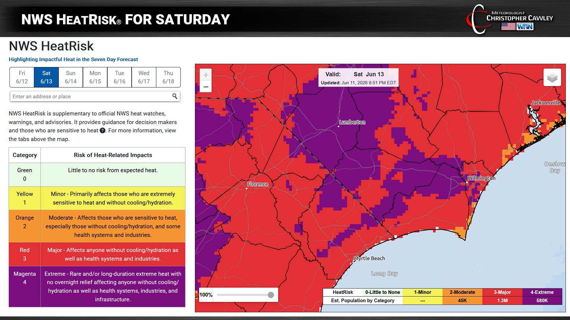
Over the weekend, the fact that there will be a frontal boundary nearby will lead to more cloudiness and a better chance for thunderstorms… which will mean temperatures run a degree or two cooler BUT heat index values will still be in the 105°F to 109°F range on Saturday and possibly even Sunday.
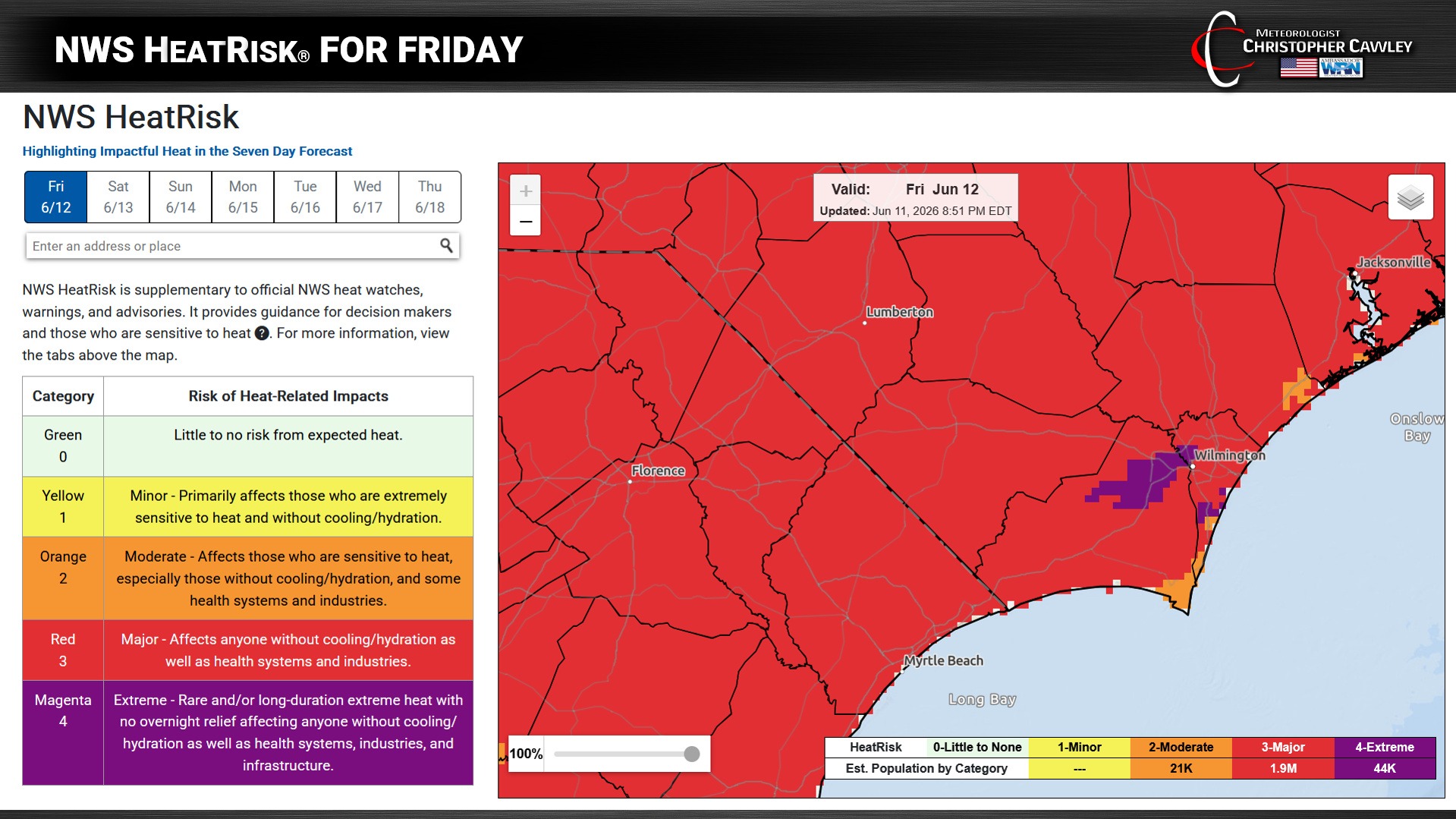
The NWS has a tool called “HeatRisk,” which illustrates the risks associated with heat levels, adjusted to regional areas. For our area, the HeatRisk is listed as “Major” for today and “Extreme” for portions of the area on Saturday.
If you have outdoor plans, sunscreen and hydration are going to be required. Absolutely vital.
Speaking of the frontal boundary, this will approach the heat ridge on Saturday but it’s not really going to penetrate very far before pushing back off to the north and west. The front in the vicinity over the weekend means slightly higher thunderstorm chances.
Any storms that develop could briefly pulse to severe limits with downburst winds, torrential rainfall, and nearly constant lightning. So in addition to being cautious of the heat, if you have outdoor plans this weekend, keep an eye/ear to the sky for changing weather conditions.
Some areas could touch 100 degrees on Saturday but some places that get storms will peak in the mid 90s.
As for next week, some broad-scale “troughing” will be over the eastern US. This will combine with a northward push of tropical moisture from the Gulf to bring scattered to numerous showers and thunderstorms throughout next week with somewhat cooler temperatures. Modeling is a bit inconsistent, but the stage could be set for some fairly significant rainfall in some areas.
Here is your Freedom Insurance Today-plus-Five Forecast:
–Meteorologist Christopher Cawley