
Columbus County NEWS Weather Update for Monday August 24, 2026.
This weather update is sponsored by Freedom Insurance of Whiteville. Trust Freedom Insurance to give you clear blue skies when it comes to home, car, boat, or whatever insurance you need. Let Freedom provide customized coverage to keep you and your family safe. Contact Freedom today at 910-640-2828!
Here’s today’s Bottom Line
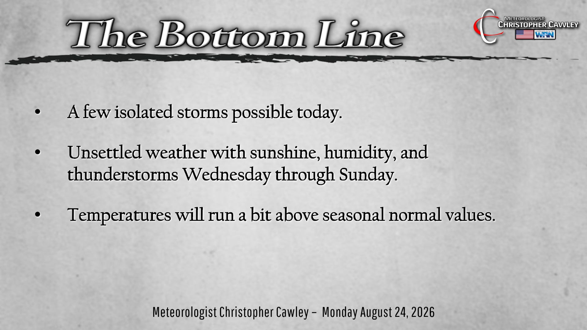
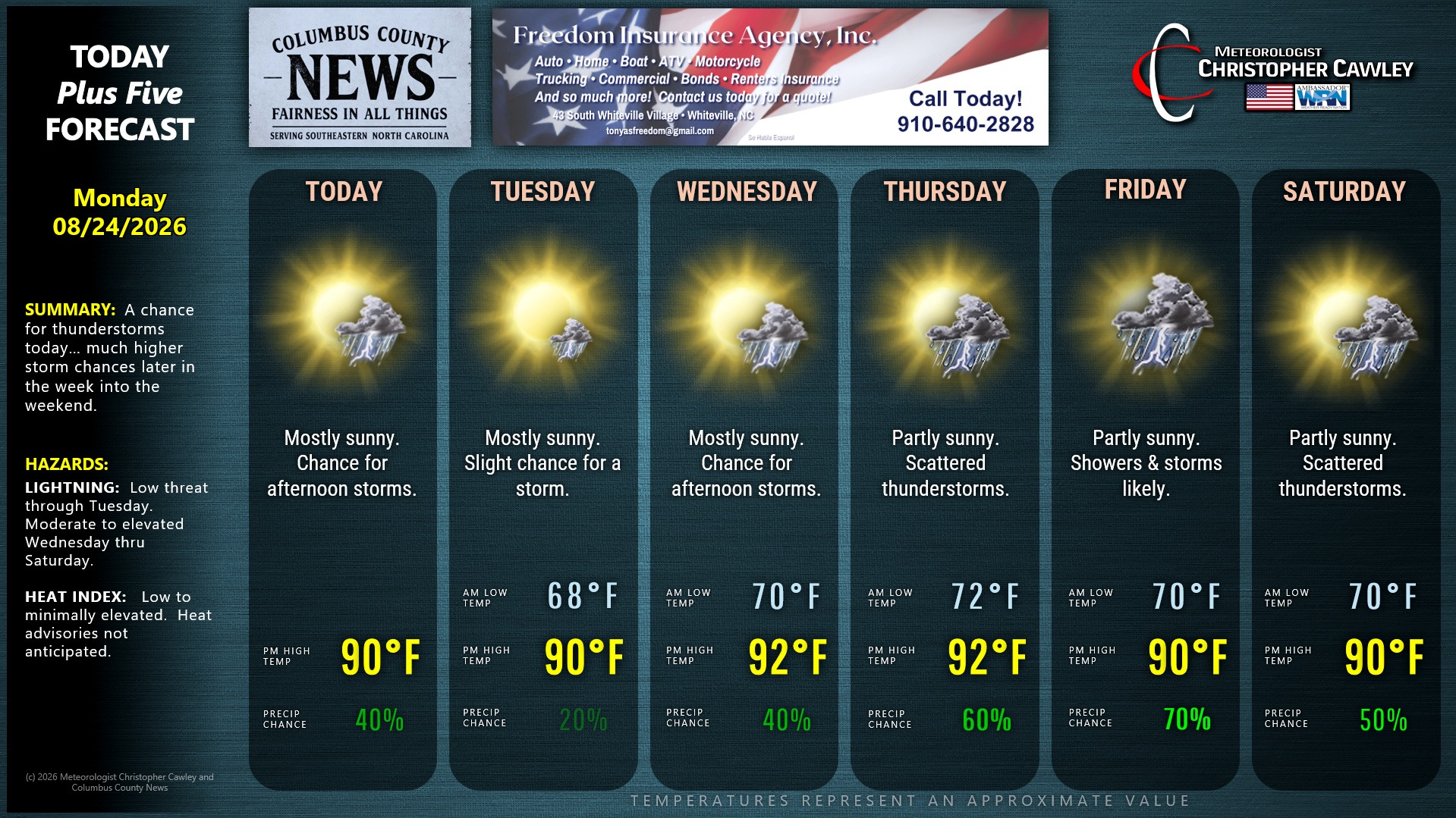
Unsettled weather at times can be expected for the next 7 days with particularly good rain chances Friday into Friday night.
The ghost of a cold front will remain in the area today, mainly along the coast. This will be the source of lift necessary to fire a few isolated to scattered thunderstorms this afternoon. There is a very low (but not zero) risk for isolated severe wind gusts, but I think the primary threat will be closer to the beaches (there’s also a 2% tornado risk along the coast today). The primary threat time will be from mid-afternoon through late-evening.
I believe that Tuesday will be mainly dry with weak high pressure in place. I can’t promise that, though, so I’m putting a tiny thunderstorm icon on the graphic for Tuesday.
Wednesday through the weekend start to look a bit more active. More significant moisture will lift northeast over the area. This will crank up the humidity values and lead to the development of afternoon and evening showers and storms through the period.
The best rain chances appear to be Friday into Friday night as a weak “trough” starts to push into the area. I’ll be watching this because if this slows down a bit, we could be looking at elevated rain chances into Saturday as well.
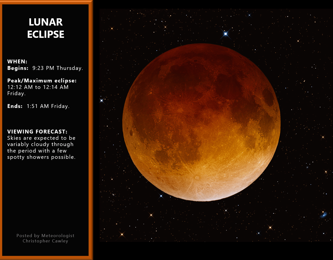
LUNAR ECLIPSE: There will be a lunar eclipse during the night Thursday night/Friday. Viewing is going to be a bit sketchy though, with some cloudiness in place and a chance for some showers.
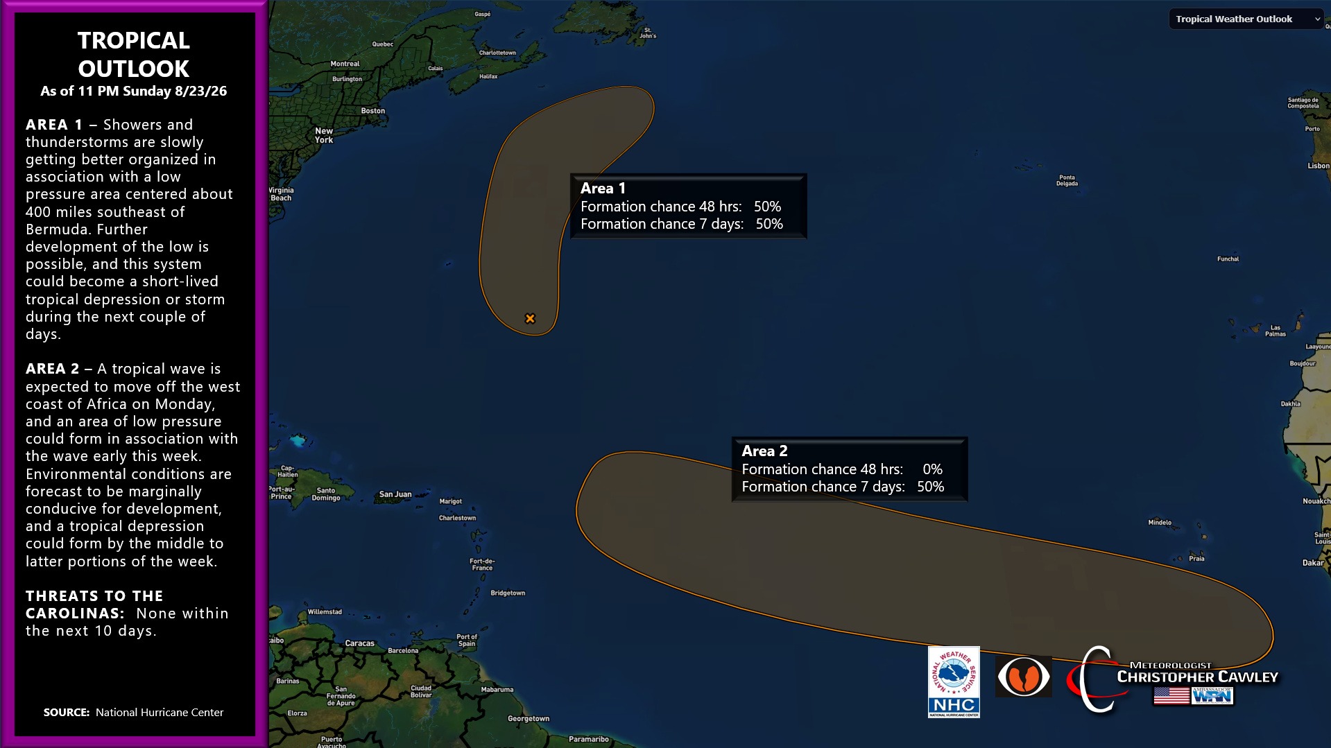
TROPICS: There are a couple of areas of interest in the tropics…. one to the east of Bermuda and the other that will be moving off the coast of Africa today. The first area may develop into a short-lived tropical depression or storm.
The more important entity is one that will come off the African coast. This has a pretty decent chance of forming … it’s a matter of timing when everything comes together. If this does develop, it’s very likely to take the north turn and stay safely out to sea as modeling shows a persistent trough just off the coast, which will act to “steer” whatever develops away from the coast. But we’ll watch this.
Here is your Freedom Insurance Today-plus-Five Forecast:
–Meteorologist Christopher Cawley