

Columbus County News Weather Update for Monday September 21, 2026, the final full day of summer 2026!!
This weather update is sponsored by Freedom Insurance of Whiteville. Trust Freedom Insurance to give you clear blue skies when it comes to home, car, boat, or whatever insurance you need. Let Freedom provide customized coverage to keep you and your family safe. Contact Freedom today at 910-640-2828!
Here’s today’s Bottom Line
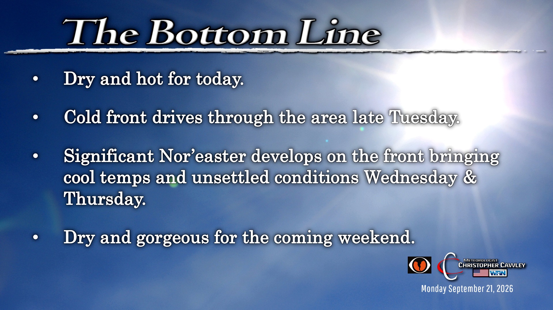
Sunshine and heat will dominate today. Today is the final full day of summer… and today likely (hopefully) going to be the final day with temperatures at or above 90 degrees until next year… although we may briefly touch 90 on Tuesday before a cold front pushes through.
Lots of sunshine for today, and with the hot temps comes triple-digit heat index values… again hopefully for the final time this season.
Modeling has the deep trough digging southward driving a cold front through the area… but the forward speed has been slowed a bit (by about 24 hours). Expecting the frontal passage later Tuesday afternoon; the front should clear the coast by Tuesday night.
Showers and thunderstorms are likely later Tuesday afternoon through about midnight. I don’t think we’re going to be looking at anything too significant though; severe weather parameters are not very interesting and while there may be a downpour or two, no significant widespread heavy rain is expected.
Then a somewhat unusual situation develops by midweek. A broad area of low pressure is expected to develop just off the coast on Wednesday. This will combine with strong high pressure over northern New England to funnel northerly winds down the coast. Most of the legacy and AI modeling shows this coastal storm becoming a significant Nor’easter — entirely nontropical in nature — while lifting northeast along the coast. Impacts here will include a “cold air damming” scenario, also known as a high pressure wedge, which is more typically found in the late winter and early spring.
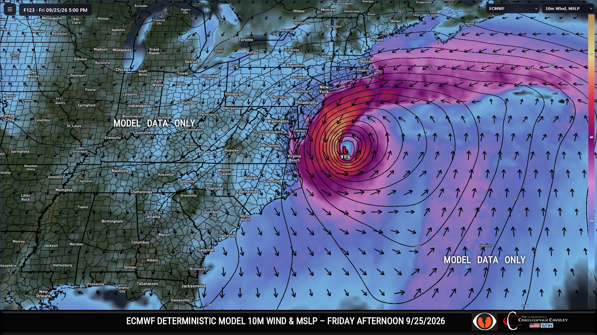
The CAD event means that Wednesday will likely be mostly cloudy with on-and-off showers and a high of 80 — that may be a bit optimistic.
Clouds will likely linger into Thursday with a few spotty showers, but we’ll be trending more to sunshine by the afternoon. Then Friday through the weekend will feature sparkling fall weather with sunshine, highs in the 70s, lows in the 50s….. truly “get out and enjoy it.”
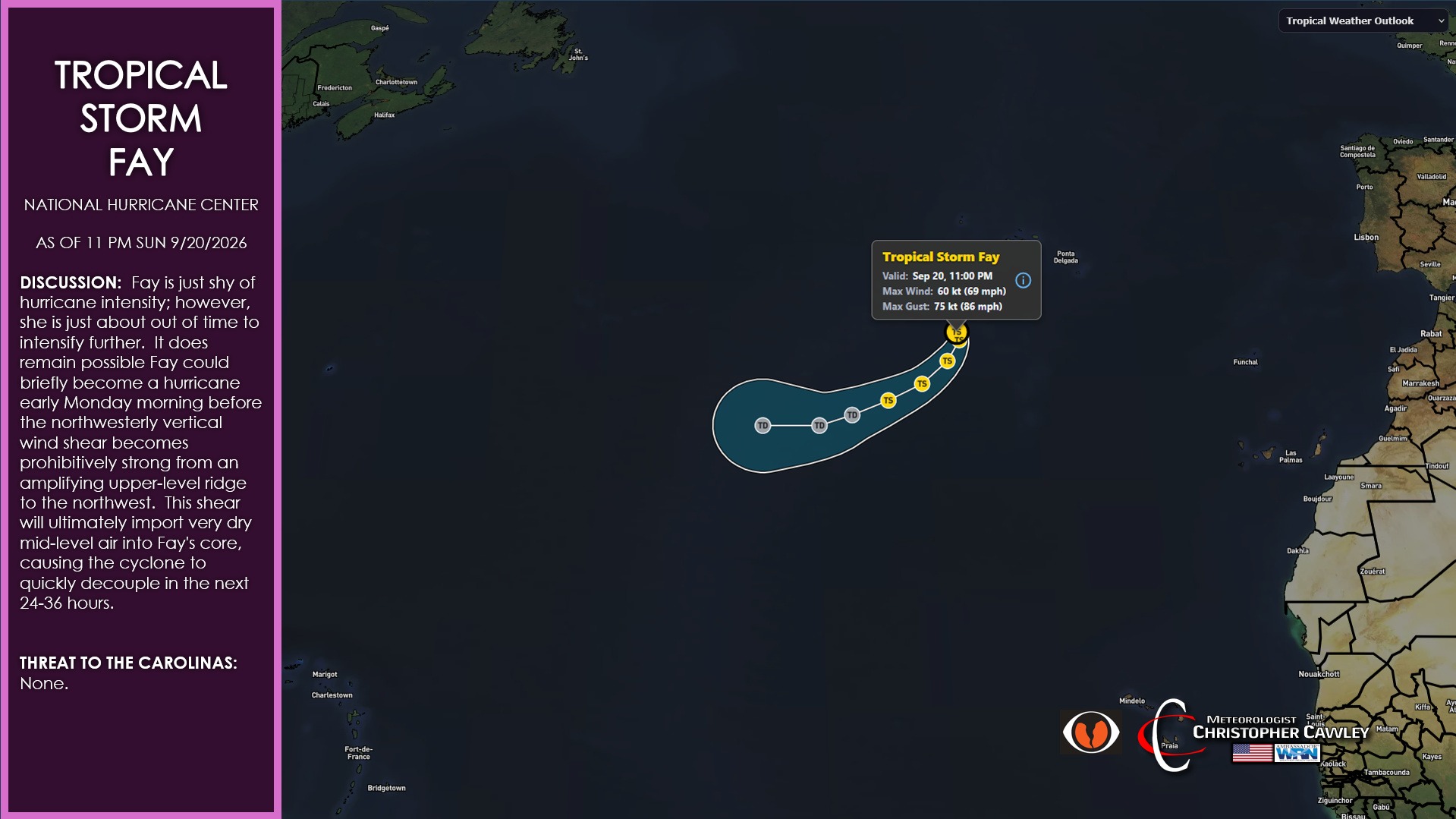
TROPICS: Fay is just shy of hurricane intensity; however, she is just about out of time to intensify further. It does remain possible Fay could briefly become a hurricane early Monday morning before the northwesterly vertical wind shear becomes prohibitively strong from an amplifying upper-level ridge to the northwest. This shear will ultimately import very dry mid-level air into Fay’s core, causing the cyclone to quickly decouple in the next 24-36 hours.
Before we get to the forecast graphic, do me a favor and SHARE this and other articles across social media. Help keep CCN on the map!
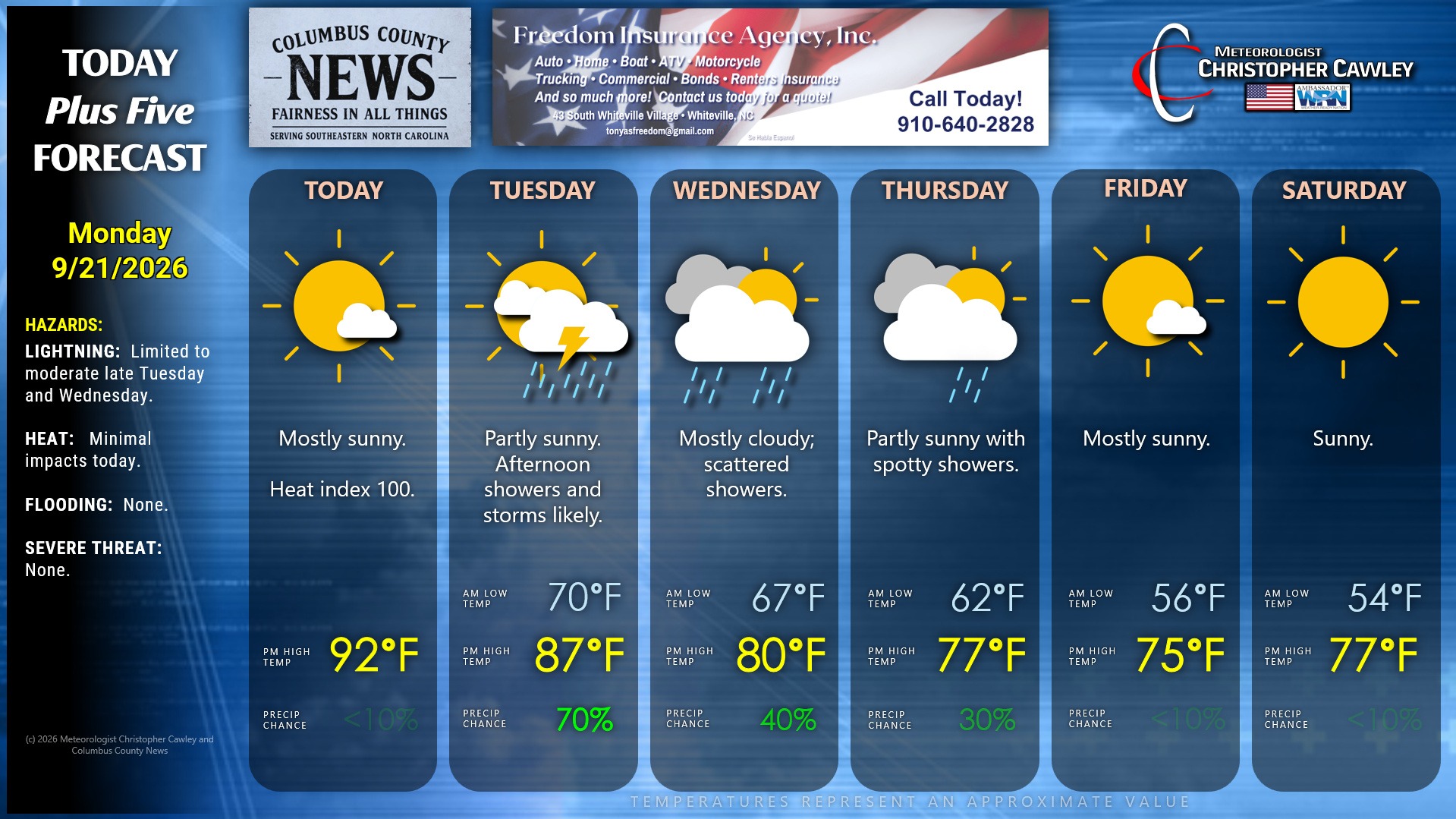
Here is your Freedom Insurance Today-plus-Five Forecast:
–Meteorologist Christopher Cawley