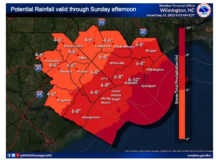
Hurricane Ian rapidly intensified this morning, and is taking aim at the Florida coast before knocking on the doors of Southeastern North Carolina later this week.
WTXY Meteorologist Christopher Cawley urged caution, not panic, in his forecast discussion earlier today.
“On a 1 to 5 scale, with 1 being minimal and 5 being “Florence-esque,” I think this is going to be about a 2.5,” he wrote. “This is highly dependent on Ian’s storm track. Based on current projections, Ian should lift northward through Georgia as a depression, then into the western Carolinas before curving northeastward and off the Virginia coast by Sunday.”
That means heavy rains are likely to interrupt football games and festivals Friday and Saturday.
On its current course, the collision between Ian and another weather system could bring strong winds, high gusts and potentially tornadoes to the area early Saturday. That potential has dropped some since Sunday, but again, Cawley said it is very early in the forecast to know exactly what will happen.
“Just prepare for a 12- to 18-hour period of rainy and windy conditions Friday into Saturday,” he said, “with a tornado threat on Saturday.”
WTXY and Columbuscountynews.com will run all closings and delays as soon as they become available. Email crystalfairloth@columbuscounty.news or call 910.914.6056. Be sure to include a telephone number in case we need more information.