Hello everyone and TGIF! Meteorologist Christopher Cawley here with today’s weather update.
Quiet conditions on the whole with warmer-than-normal temperatures through much of next week.
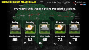
Today will actually be mainly seasonable, with highs running in the mid 50s with lows tonight in the mid 30s. That’s just a touch below normal.
We’ll see some scattered clouds around thanks to a northeasterly wind flow.
Saturday will be milder with sunshine, highs around 60. Temperatures rise into the mid 60s for Sunday, and then lower to middle 70s Monday and Tuesday.
A little frontal boundary will try to become established along the coast Sunday. Yesterday I mentioned the low-end chance for showers Sunday afternoon and Sunday evening. I think that’s even a stretch now, as moisture is going to be pretty limited. More clouds than sunshine for Sunday, but I think we’ll have dry conditions across ColCo.
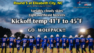
FOOTBALL FORECAST: Bundle up if you’re taking the road trip to Elizabeth City. Kickoff temps will be in the lower 40s, with temps falling to the upper 30s to around 40 by time the game ends.
CHRISTMAS WEEK SNOW POTENTIAL: Finally, I wish to address something I saw all over social media on Thursday. The potential for snow here along December 21-22. Reed Timmer, alleged “extreme meteorologist,” posted some model graphics indicating a potential winter storm for the Carolinas. Mr. Timmer’s credibility is questionable at best. His post, like many who post scary hurricane model images during the summer, has amassed numerous clicks. Ugh.
Listen. I’d love to see some snow here. I lived the first 30 years of my life in Otsego County, NY, which is just south of Utica, smack-dab in the center of the state. Snowstorms of 8-12 inches are common occurrences there, and at worst, they trigger a 1-hour school delay.
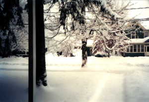
This was taken at my house in Laurens, NY, on Christmas Day 2002, on which we received just under 30 inches of snow.
Wouldn’t something like that be amazing here? Unfortunately it would absolutely cripple travel and commerce for an extended period of time.
But I digress.
I’d love to see a snowstorm in Columbus County, especially at Christmastime. BUT… there are no real signs of snow outside of the mountains right now.
Weather models have single-model (control) runs and a set of ensembles. The “ensembles” are runs of the model with one or two variables slightly tweaked to determine an outcome. Looking at a multitude of 80+ ensembles is far more useful than glancing at one single model run, such as what was shared by Timmer. When we examine the ensembles, we get a much better view of which way the wind is blowing.
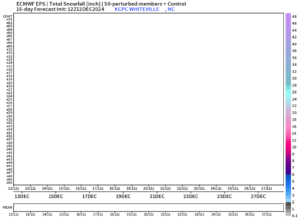
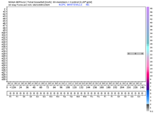
These two images are the ensemble snow forecast matrices for Whiteville (GEFS and Euro).
Yes, the pattern looks colder than average during the week of Christmas, but no, there is no storm or snow to speak of as of right now. A good pattern for snow would be, in my opinion, a large percentage of the 80+ ensembles showing something. Right now, as you can see, there’s just one.
Doesn’t mean it won’t happen. This is still more than 10 days out, and anything is possible. But if I were a betting man, I’d pass on this one.
Here’s your forecast…
Thanks for reading, I hope you have a wonderful day. Drive safe if traveling to Elizabeth City tonight, and GO PACK!!

