Hello everyone and good day to you! Welcome to the CCN Weather Update for Tuesday May 20, 2025.
This weather update is sponsored by Freedom Insurance of Whiteville. When severe weather strikes, with Freedom Insurance you will always be prepared. For home, car, boat, or whatever you need, Freedom can provide customized coverage to keep you and your family safe. Contact Freedom today at 910-640-2828!
STATISTICS for Monday 5/19/2025
High: 86.8°F at 5:01 PM (Normal 81)
Low: 65.6°F at 7:02 AM (Normal 58)
Precip: 0.00 in
Precip – Month: 6.37 in
View real-time data from the weather station at College Street Weather Station.
Here’s today’s Bottom Line
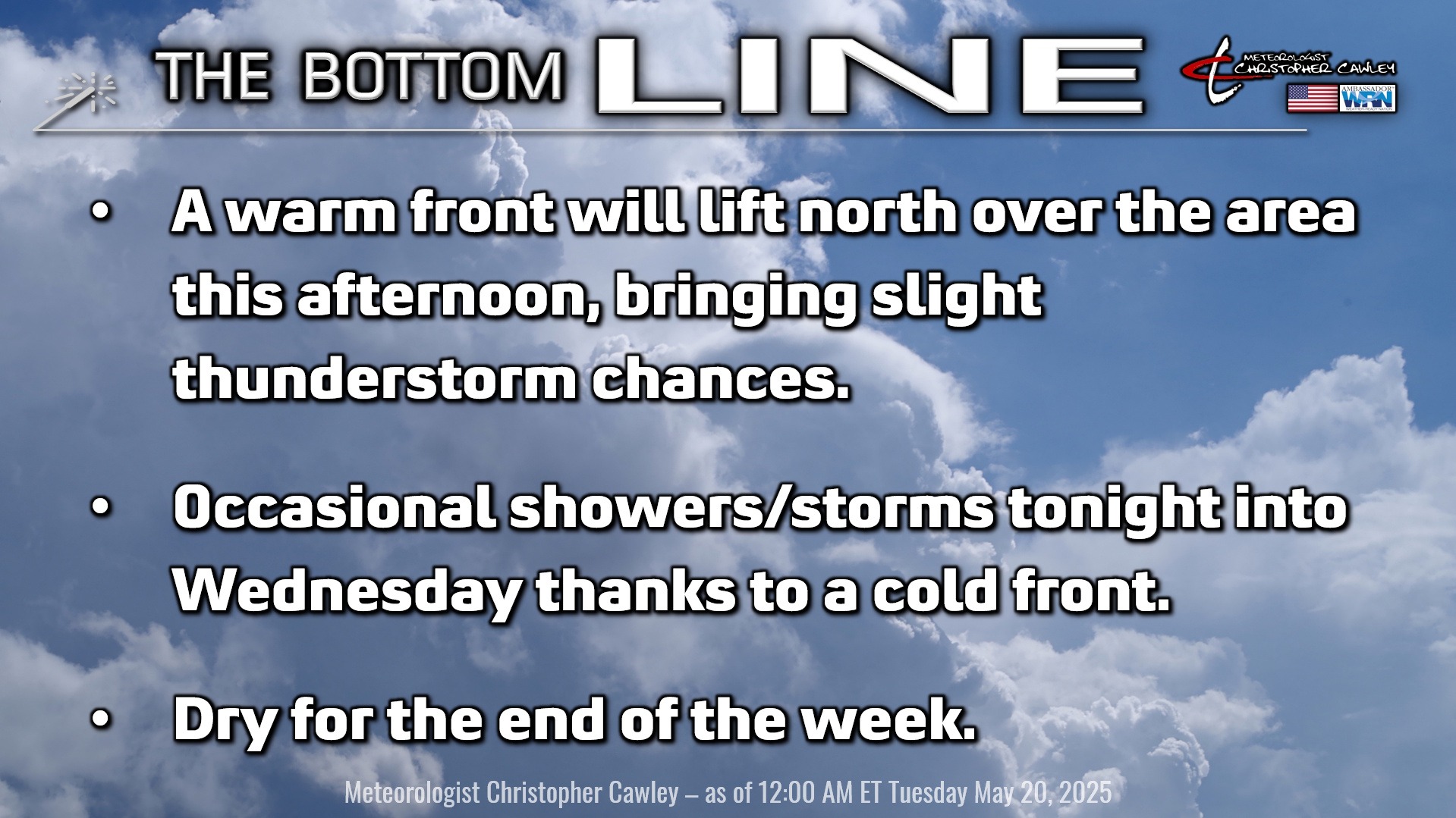
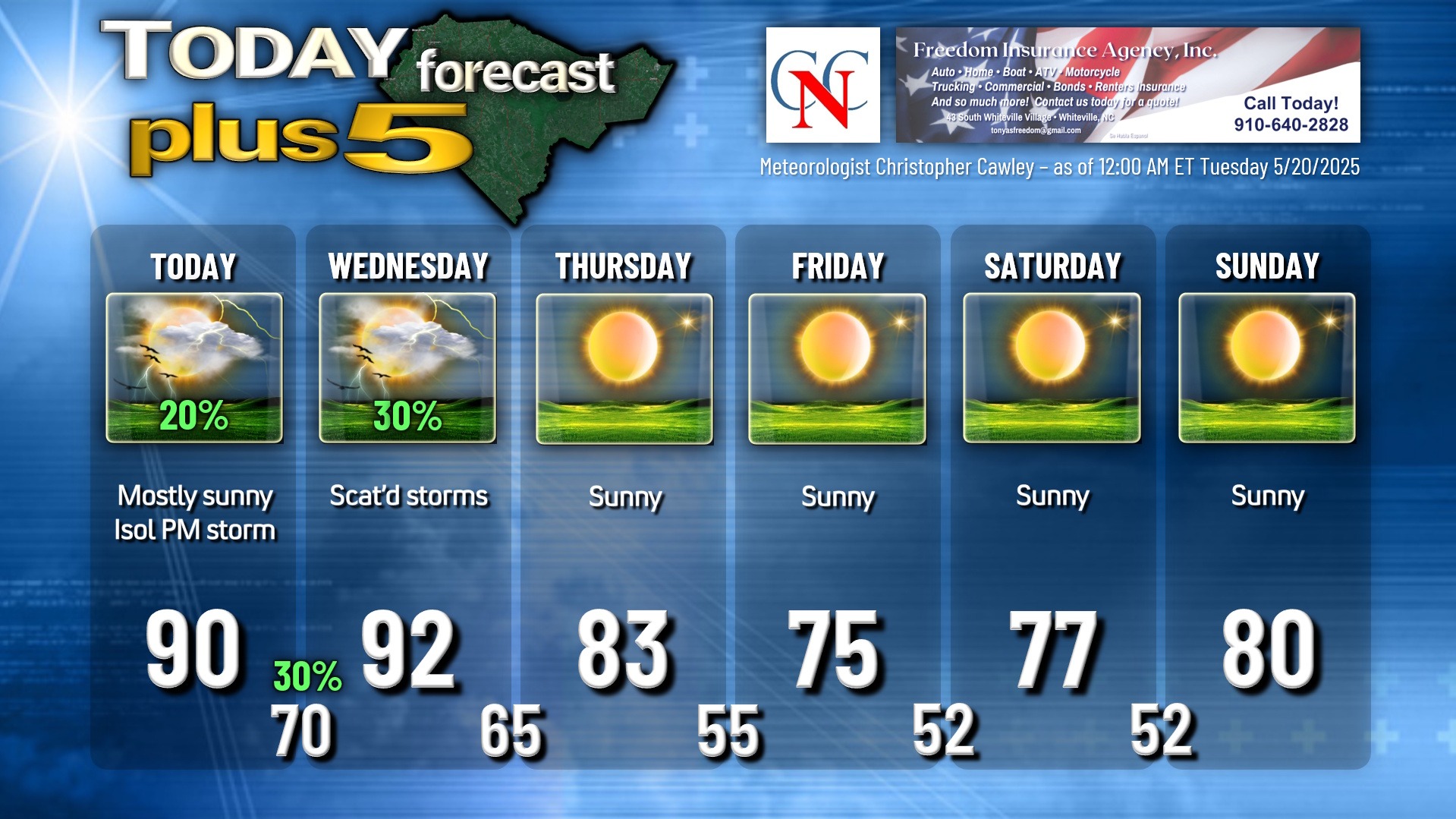
A warm front will lift north across the area this afternoon. On the whole this will be a rather unremarkable frontal passage, but a few spotty thunderstorms are possible. Any storm that does develop could produce intense rainfall and frequent lightning… so if threatening weather approaches, please take shelter quickly.
We’re in a warm and muggy sector for tonight into Wednesday. A strong cold front will cross the area late Wednesday evening — guidance has slowed this front down quite considerably since yesterday. Low-end thunderstorm chances continue tonight and Wednesday. Not a high overall coverage, but again, any storm that does pop could be rather caffeinated in nature.
After that, rain chances diminish to nearly zero through the Memorial Day weekend. We’ll see abundant sunshine, low humidity, and somewhat cooler-than-normal temperatures will persist through the weekend.
TROPICAL WEATHER FORECASTS are returning as of June 1st, the official start of hurricane season.
Here is your Freedom Insurance Today-plus-Five Forecast:
That’s going to do it for today’s report. As always, thank you for reading and for supporting Columbus County News. Have a great day!
–Meteorologist Christopher Cawley