CCN Weather Update for Saturday July 5, 2025.
This weather update is sponsored by Freedom Insurance of Whiteville. Declare independence from your worries with Freedom Insurance. For home, car, boat, or whatever you need, Freedom can provide customized coverage to keep you and your family safe. Contact Freedom today at 910-640-2828!
Sunday will be a Weather Action day.
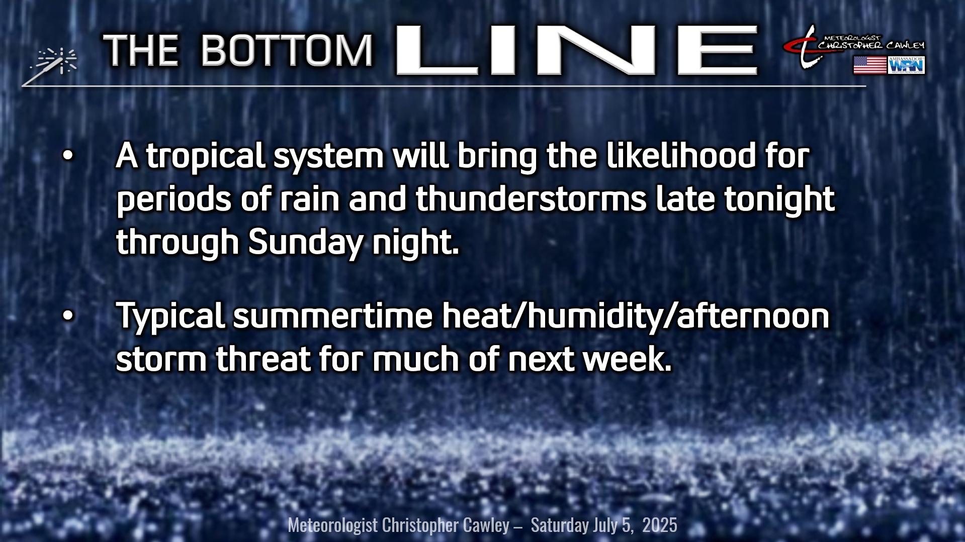
Here’s today’s Bottom Line
GENERAL FORECAST AND TROPICAL UPDATE — They’re one-in-the-same for today’s report as we’re focusing on what will become Tropical Storm Chantal and impacts to Columbus County.
The NHC forecast has Chantal making a landfall on Sunday morning somewhere near Charleston, SC. However, the cone of uncertainty is wide; the storm center could be anywhere from along the NC coastline to just north of Savannah, GA.
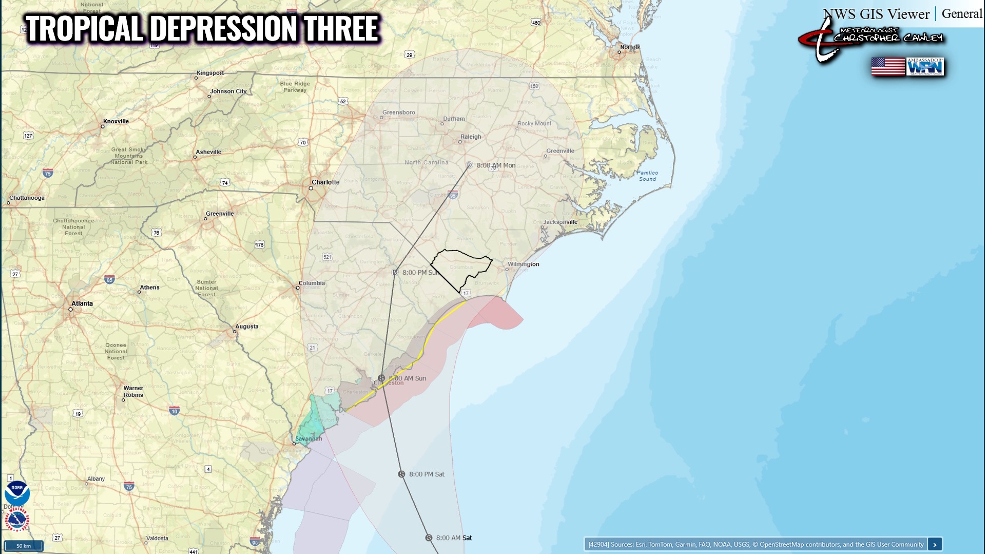
The centerline is projected to lift north through northeast South Carolina before turning northeast along the I-95 corridor Sunday evening into Monday morning.
Tropical Storm Warnings will likely be issued for the coastal Carolinas, likely by the time you read this update.
IMPACTS:
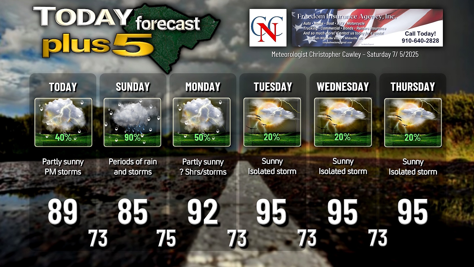
Rainfall: Periods of rain and thunderstorms can be expected late this evening through Sunday. Model blends show between 1.5 and 3 inches of rain for Columbus County, with most of the rain falling on Sunday. This rainfall could lead to spotty areas of flooding of poor-drainage and low-lying areas. Ponding of water on the roads is also a real possibility on Sunday. It won’t be raining constantly all the time; the precipitation mode should be intermittent rain and thunderstorms with each rain band that rotates in off the ocean.
Wind: Tropical depression-level winds can be expected over Columbus County. I would expect sustained winds in the 15-30 mph range with occasional gusts to 35-40 mph on Sunday from late morning through mid- to late-afternoon. There could be a few isolated/spotty power outages, in the worst-case scenario.
Tornado Threat: As each rain band pinwheels in off the ocean, discrete cells could produce funnel clouds along with weak, short-lived tornadoes. These spin-ups could occur in the 3-4 minutes between radar scans, and therefore could have very little advanced warning. The overall tornado threat, in my opinion, is low, but is not zero.
Listen… this is not going to be a memorable event. This will be a glorified shower-and-thunderstorm event. The potential for quite a bit of rain, yes, but again, nothing the area can’t handle with ease.
Don’t get into a panic, or “hyperfixate” on the centerline forecast (which will change several times before the actual landfall). The impacts will remain largely the same, even if the centerline traverses directly over ColCo. If the centerline pushes farther to the west, such as toward Rockingham and along US-1, our impacts become less.
After the storm passes, we return to a typical summertime pattern of sunshine, heat, and afternoon storms for much of next week.
Note – There will be a special Sunday edition of the Weather Update, with the latest on the tropical storm and expected impacts to Columbus County.
Here is your Freedom Insurance Today-plus-Five Forecast:
–Meteorologist Christopher Cawley