CCN Weather Update for Thursday July 10, 2025.
This weather update is sponsored by Freedom Insurance of Whiteville. No weather worries with Freedom Insurance. For home, car, boat, or whatever you need, Freedom can provide customized coverage to keep you and your family safe. Contact Freedom today at 910-640-2828!
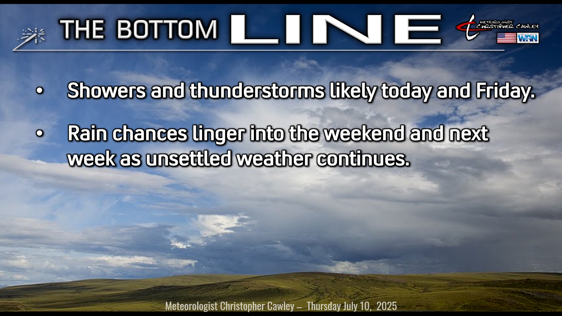
Here’s today’s Bottom Line
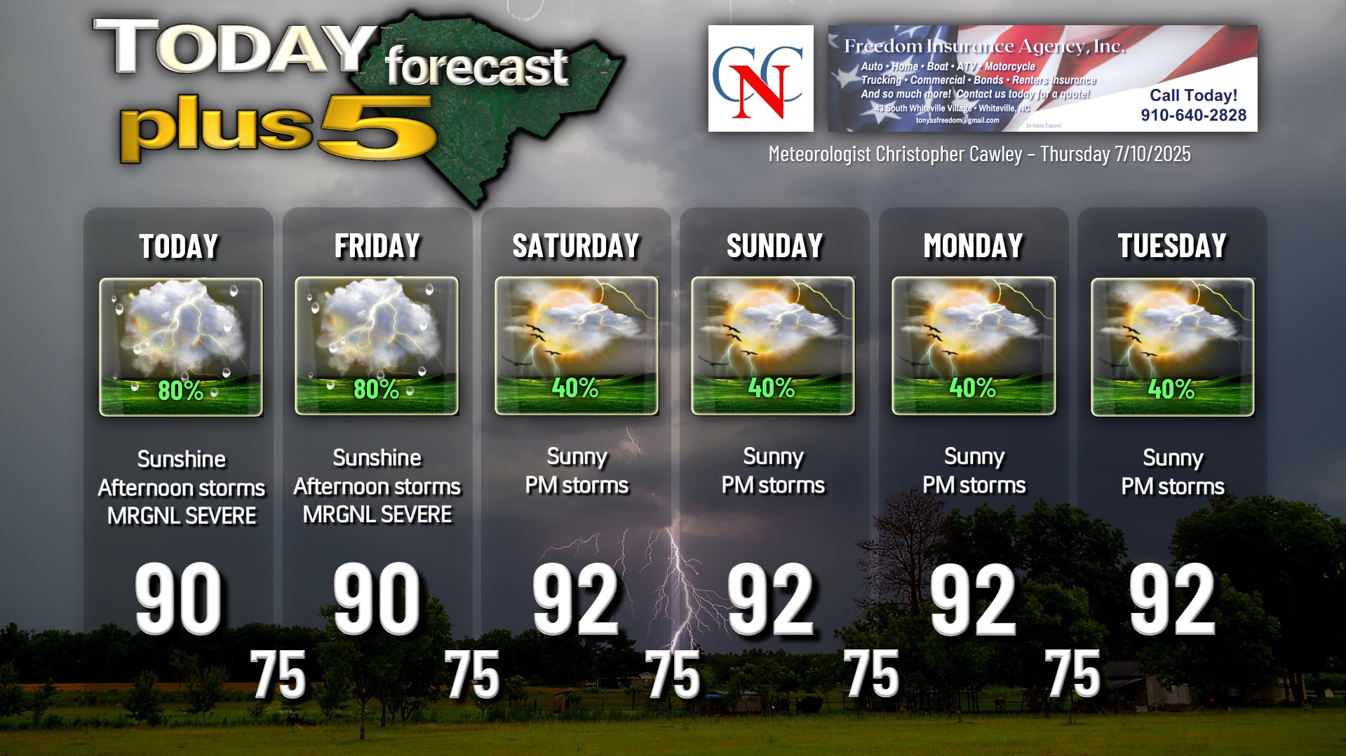
A very slow-moving trough of low(ish) pressure will continue to interact with the Piedmont trough and the sea-breeze boundaries to trigger scattered to numerous showers and thunderstorms this afternoon and Friday afternoon.
Much of central North Carolina experienced strong to severe thunderstorms on Wednesday, with areas of wind damage and areas of flooding from slow-moving storms. These storms are likely to fire again today as that trough just sort of lingers in our area, interacting with the Piedmont trough and the sea-breeze boundary.
Isolated storms should start to develop around or shortly after noon in a critically unstable atmosphere. Outflow boundaries (basically the edges of “pools” of cool air that rush out from storms) will be the foci of new storms. And the pattern will repeat. Numerous showers and storms are likely just west of the county, along the I-95 corridor as we work through the afternoon.
Something different today is a level of shear that is in place. Shear helps to keep thunderstorms going, it aids in organization to storm structures. Shear causes storms to “tilt,” and therefore move in a specific direction (whereas yesterday’s storms were essentially straight up-and-down with little to no movement). At any rate, the modest shear in place should allow these storms to move eastward toward ColCo later in the afternoon.
Any storm that develops will produce a blinding downpour along with nearly constant cloud-to-ground lightning. There is the low potential for some damaging winds in wet downbursts, and a few severe thunderstorm warnings will likely be issued. The SPC has Columbus County under a level 1 out of 5 risk (“marginal”) as of this writing.
It’s just a question of where these storms fire and move. That cannot be predicted with any degree of certainty. Columbus County dodged a bullet yesterday as the storms stayed well to our west (except for a few small cells that hit north of 74/76 and into Bladen county).
If you’re rooting for storms to hit here locally, I think today and tomorrow are our best options. If I were a betting man, I’d definitely put some odds on storm development.
Rain chances decrease over the weekend as the Bermuda high pressure ridge tries to kind of “wash out” the overall troughiness that is causing all of this. However, with high humidity, high instability, and sunshine, the typical summertime afternoon thunderstorm chances (isolated to widely scattered) will exist Saturday into next week.
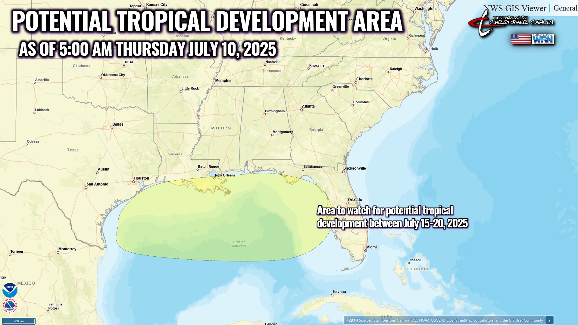
TROPICAL UPDATE: Global modeling is starting to “hint” at something coming together in the northern Gulf after July 15th. This is just speculation based on model trends, but the NWS CPC also has that area outlined for a 20% probability of something coming together in the July 15-20 timeframe. In the meantime, no tropical development is expected. The official NHC forecast is no development during the next 7 days.
Here is your Freedom Insurance Today-plus-Five Forecast:
–Meteorologist Christopher Cawley