CCN Weather Update for Tuesday August 5, 2025.
This weather update is sponsored by Freedom Insurance of Whiteville. No weather worries with Freedom Insurance. For home, car, boat, or whatever you need, Freedom can provide customized coverage to keep you and your family safe. Contact Freedom today at 910-640-2828!
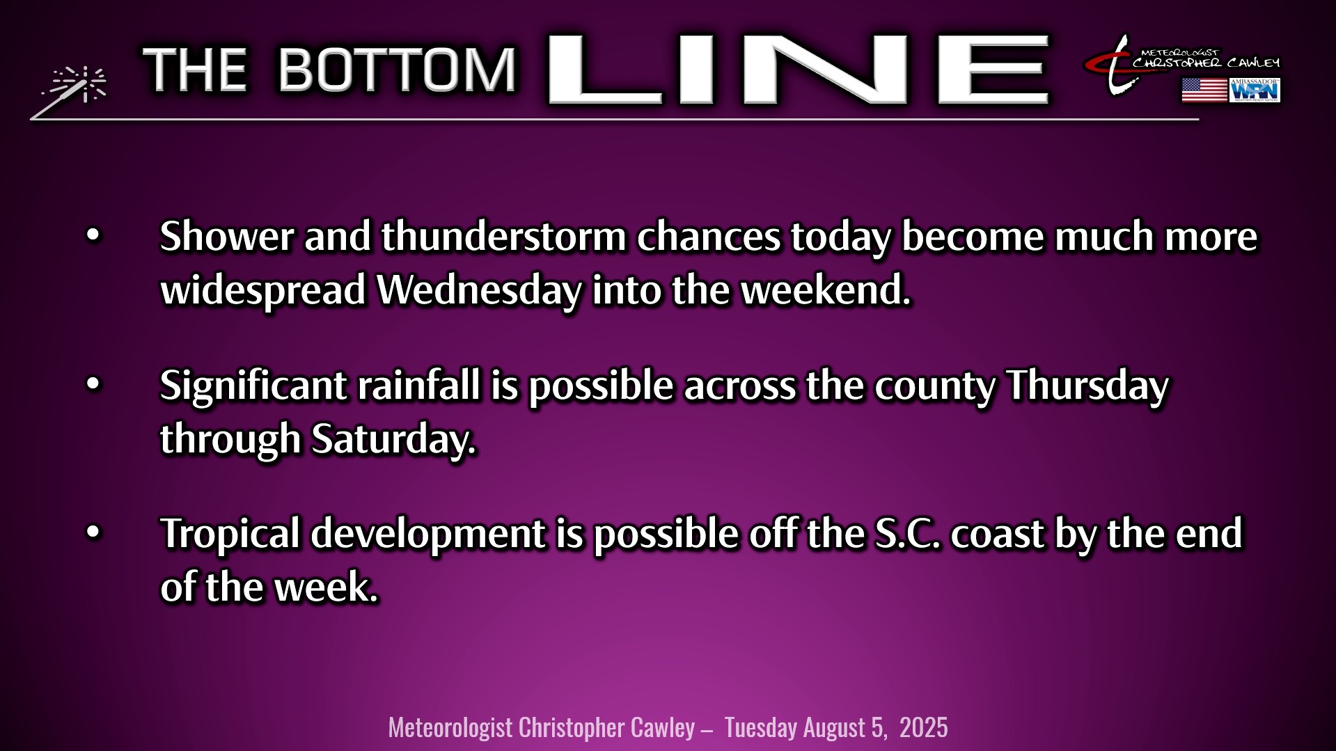
Here’s today’s Bottom Line
For today’s report I’m combining both the tropical update and the daily weather update.
First up, Tropical Storm Dexter will be absolutely no threat to the area, or to any land masses for that matter, and will continue to push east-northeast over the north-central open Atlantic ocean. For those interested, Dexter will remain a tropical storm.
The frontal boundary that moved through here on Friday remains stalled in place, extending from southern Mississippi eastward along the FL/GA line, and then off the coast. An area of high pressure remains in place well to our north, and the combination of the two has led to a northeast wind flow over the area Sunday and yesterday. A small area of low pressure will zip across far upstate New York this afternoon, breaking down the high pressure center. At the same time, an area of low pressure is likely to organize along the front over southern Georgia. A southerly flow and a more humid air mass starts to take hold today, and a few scattered showers are possible this afternoon into this evening.
By Wednesday morning, modeling has an area of low pressure right on the Georgia coastline, with a coastal trough extending northeastward from this low, right along the coast. This trough will be the source of lift needed for at least scattered showers and thunderstorms Wednesday afternoon into the evening hours.
The low is expected to linger just off the FL/GA coast into Thursday. A significant southerly flow of moist to saturated air takes shape, while this low potentially takes on tropical or subtropical characteristics. The National Hurricane Center says this has a 30% chance of developing into a tropical or subtropical storm by the weekend. Modeling suggests that the low–whatever becomes of it–slowly moves northeast along the South and North Carolina coastline. This brings the threat for widespread showers and thunderstorms to the region Friday through Saturday night.
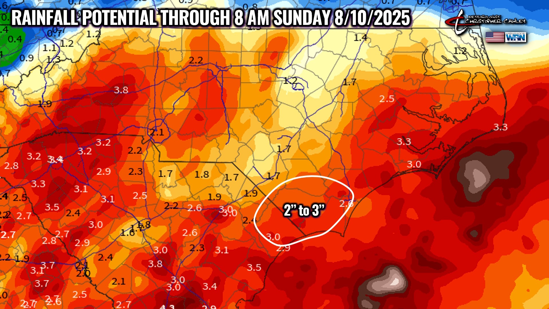
National Blend of Models paints 2-3 inches of rain for most of Columbus County from today through early Sunday morning, with most of this rain falling late Thursday through Saturday night. This will be highly dependent on the track of the low toward the end of the week. Whether or not it becomes tropical in nature is irrelevant to Columbus County… if current modeling verifies, scattered to numerous showers and thunderstorms will be the ultimate result.
The low takes its sweet time moving northeast along the coast so I expect shower and thunderstorm activity to continue Sunday into next Monday as well. Again, to reiterate, whether or not this becomes a tropical system means little when it comes to real-world impacts in Columbus County.
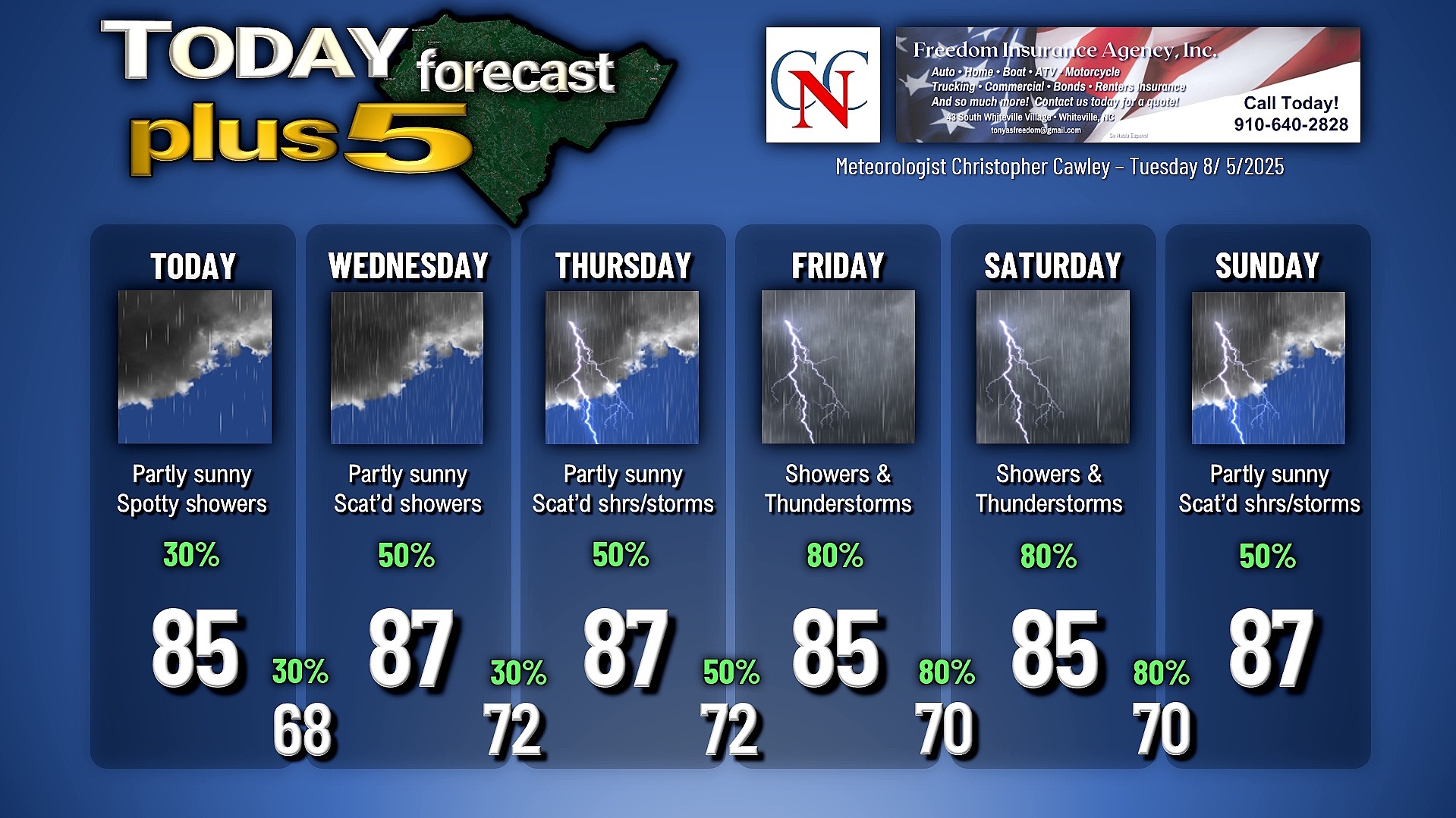
Here is your Freedom Insurance Today-plus-Five Forecast:
–Meteorologist Christopher Cawley