CCN Weather Update for Wednesday August 6, 2025.
This weather update is sponsored by Freedom Insurance of Whiteville. No weather worries with Freedom Insurance. For home, car, boat, or whatever you need, Freedom can provide customized coverage to keep you and your family safe. Contact Freedom today at 910-640-2828!
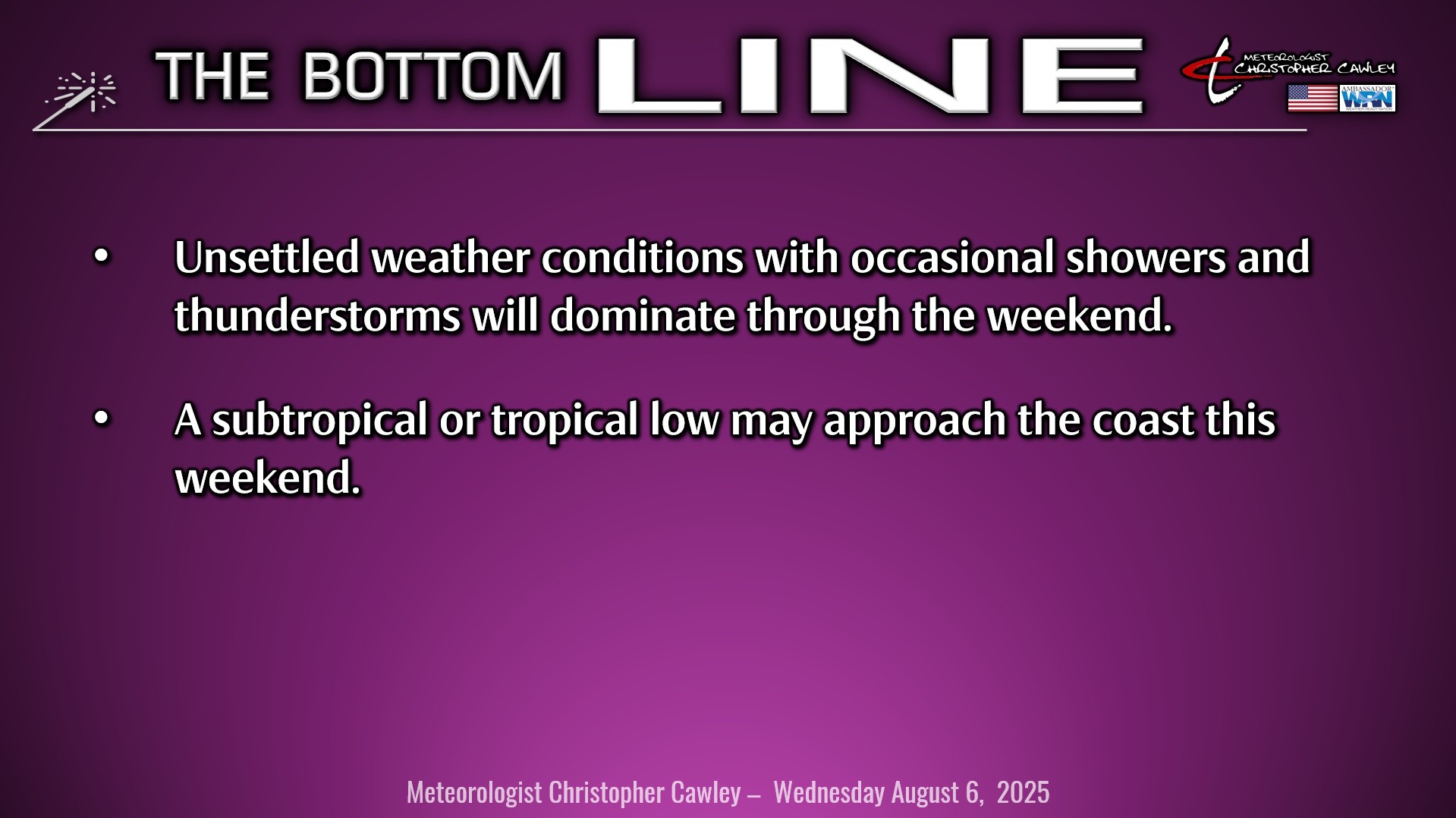
Here’s today’s Bottom Line
My “spotty showers” forecast yesterday turned into a mid-afternoon deluge as a strong jet streak brought a significant thunderstorm cluster northward from South Carolina across Columbus County. This wasn’t shown at all on any of the high-res modeling but I apologize for busting the forecast nonetheless. Rainfall from the storm was about 1.35″ on my weather station in Whiteville.
Unsettled weather conditions will be the rule through the weekend and into next week. The big picture is one of a cold front stalled well to our south with high pressure parked to our north. A lobe of this high will continue to keep a rare August “wedge” pattern in place. This means northeasterly winds at the surface, and ONLY at the surface, while deep southerly moisture pushes “up and over” this (relatively) cooler air trapped at the surface. This is called “overrunning.” Temperatures actually rise with height in this pattern, which is more commonly noted in late fall and early spring.
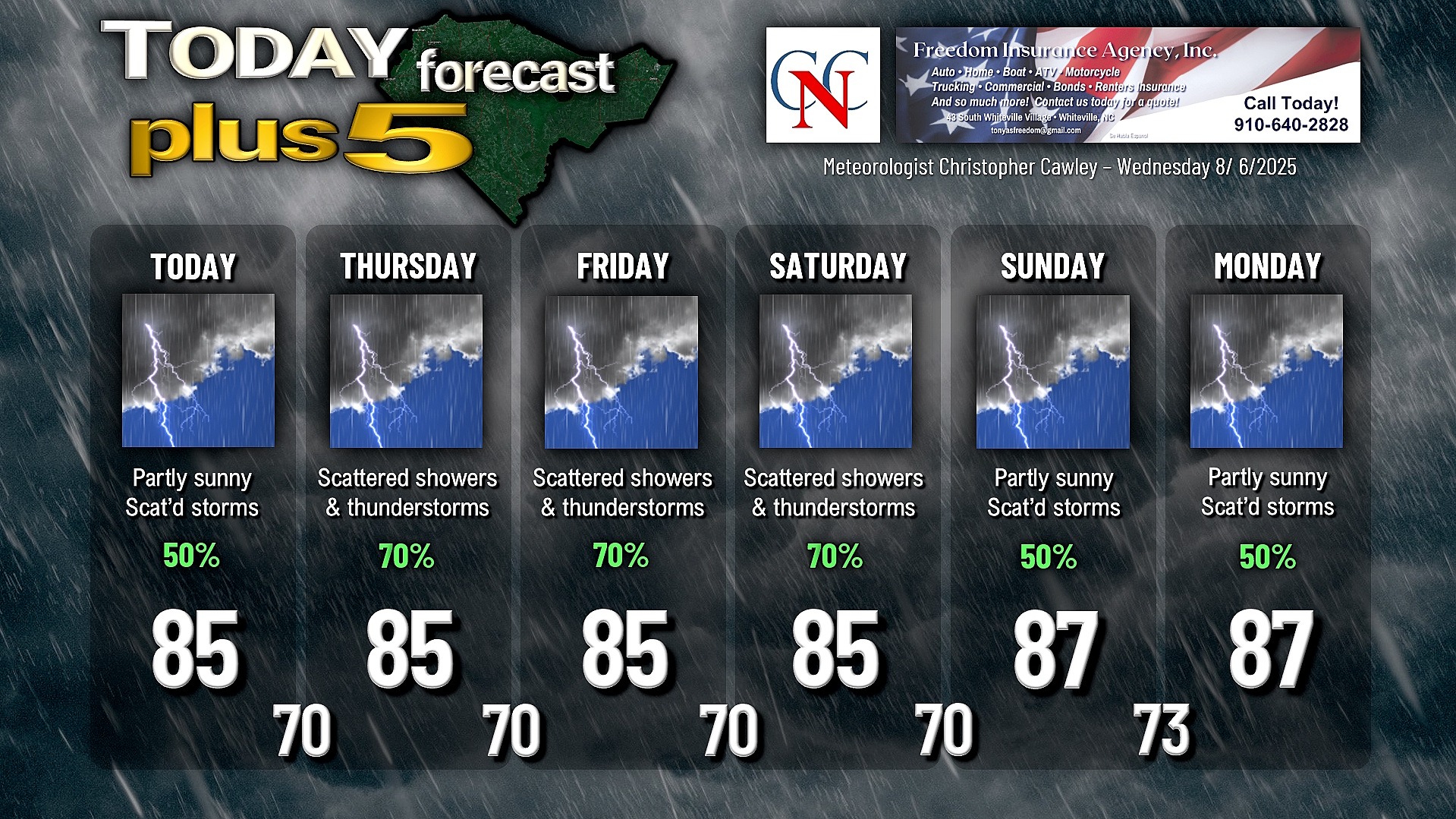
This overrunning will lead to lots of clouds and periods of rain and thunderstorms starting around noon and lasting through the afternoon and into the evening. The southeast-to-northwest (from 5 o’clock to 11 o’clock on a clock face) primary area of instability will remain locked in place, so situations like what we saw yesterday afternoon are probable again today. In addition, a little “shortwave” (basically a mid-level atmospheric disturbance) will move into the area tonight keeping rain chances in place.
A trough comes together along the coast on Thursday as another disturbance pushes into the area. A middle- to upper-level high pressure ridge near Bermuda will “push” against the coastal trough, and as a result a southerly flow of deep, moisture-laden air will continue. This means a likelihood of showers and thunderstorms on Thursday.
In the meantime, an area of low pressure a couple hundred miles off the South Carolina coast has the potential to develop into a tropical or subtropical storm as it drifts close to the frontal boundary. The National Hurricane Center states that this low will drift westward, potentially close to the coastal bi-state area, before turning and moving northward. The best chances for impacts from whatever develops from this will be along the Outer Banks. In terms of real-world impacts in Columbus County, we’ll hardly notice anything unusual as the deep southerly moisture in place means continued shower and thunderstorm activity Friday and Saturday.
As the low drifts northward, a more typical summertime pattern returns to southeast North Carolina Sunday into next week. The Bermuda high will once again become the dominant feature on the weather map which means less thunderstorm activity and temperatures pushing back above normal next week.
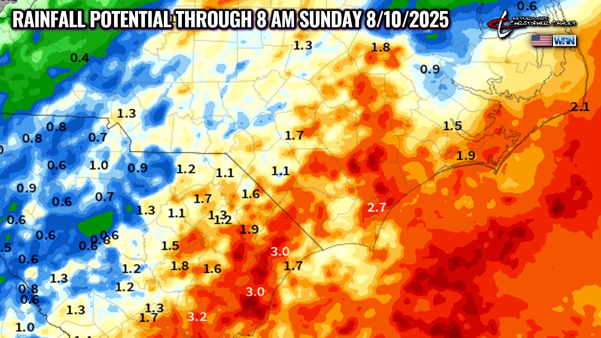
The National Blend of Models continues to indicate significant rainfall across the county through early Sunday morning.
Lastly, tropical storm Dexter will be of no influence to anyone on land, so don’t spend time worrying about that system. The National Hurricane Center is continuing to monitor the tropical Atlantic ocean for a wave that is likely to develop into something by the weekend or early next week. Modeling is largely unreliable and shows a wide range of solutions regarding this possible system, ranging from a Florida hit to a northerly track far out at sea. I’m only bothering to mention it here because people are posting graphics on social media about a hurricane striking South Carolina. A good rule of thumb when looking at weather stuff on social media — the sexier the graphic, the more “fearful” or “frightening” that it looks, the more likely it’s something you should laugh at and keep on scrolling, no matter what kind of “expert” posted it. Knowing a little bit about modeling helps as well. For instance, the GFS is notorious for developing monster hurricanes on one model run, and then 6-12 hours later the same model shows nothing whatsoever. I’ll be watching the developments over the central Atlantic, and if it’s something to worry about, you’ll read about it right here. We’ve got you covered.
Here is your Freedom Insurance Today-plus-Five Forecast:
–Meteorologist Christopher Cawley