
CCN Weather Update for Sunday September 28, 2025.
This weather update is sponsored by Freedom Insurance of Whiteville. No weather worries with Freedom Insurance. For home, car, boat, or whatever you need, Freedom can provide customized coverage to keep you and your family safe. Contact Freedom today at 910-640-2828!
Here’s today’s Bottom Line
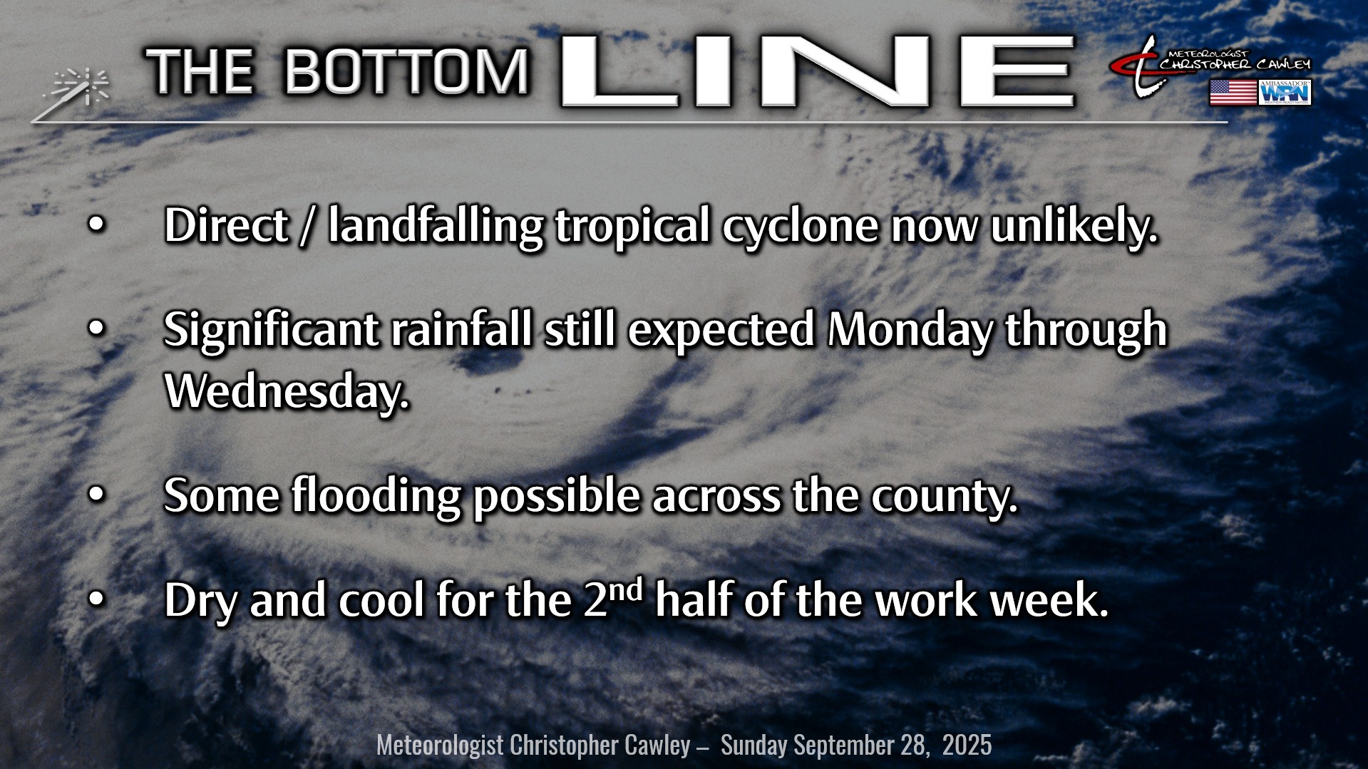
What a difference a day makes, right? My goodness. It’s all good news, that is if you didn’t want a direct strike from a tropical system.
The storm that will become Imelda will turn to the north-northwest within the wind flow between an upper-atmospheric trough (a “dip” or “kink” in the air stream) over the southeast US and a large ridge of high pressure over the central Atlantic. The “cone of uncertainty” lies completely offshore from beginning to end as of the time of this writing. Storm impacts, however, WILL be felt locally — more on that in a minute.
Imelda’s track runs parallel to the coast to roughly central Georgia or perhaps as far north as central South Carolina, before wobbling a little bit, meandering, taking her time, stopping for coffee… and then is forecast to make a hard right turn away from the shoreline.
Why the slow-down, and why the hard right turn? It all comes down to atmospheric steering currents. The upper-level atmospheric “dip” (trough) presents one steering current, but Imelda will be moving too slowly to be influenced by this current. However, we have big brother Humberto raging over the ocean, resulting in a weakening of the atmospheric steering currents. I know this is relatively confusing. Anyway, this is what will likely cause the brief cessation of forward motion and the meandering tendency.
The hard-right turn is due to Imelda feeling the effects from Humberto, thanks to a strengthening upper-atmospheric trough in Humberto’s wake.
There is still a LOT of uncertainty in this solution, and some of the modeling still suggests that during the slow-down phase, Imelda could meander dangerously close to the coast (a few of the hurricane regional models actually do brush the coast).
So. Don’t let your guard down. This storm still remains one of the most challenging forecast situations I’ve ever encountered, and I’m still not going to completely slam the door on a “brush with the coast” early to middle next week. The whole situation, while unlikely at this point, could still go sideways for us.
STORM IMPACTS
Now let’s talk about storm impacts in Columbus County. Imelda will be quite asymmetric, with heavy rainfall and storm risks for the area even though the actual storm center stays well out to sea.
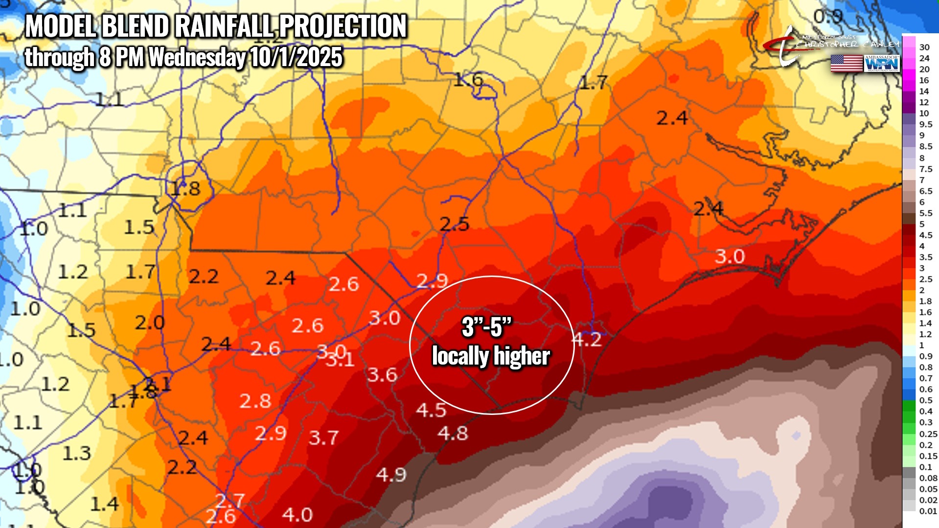
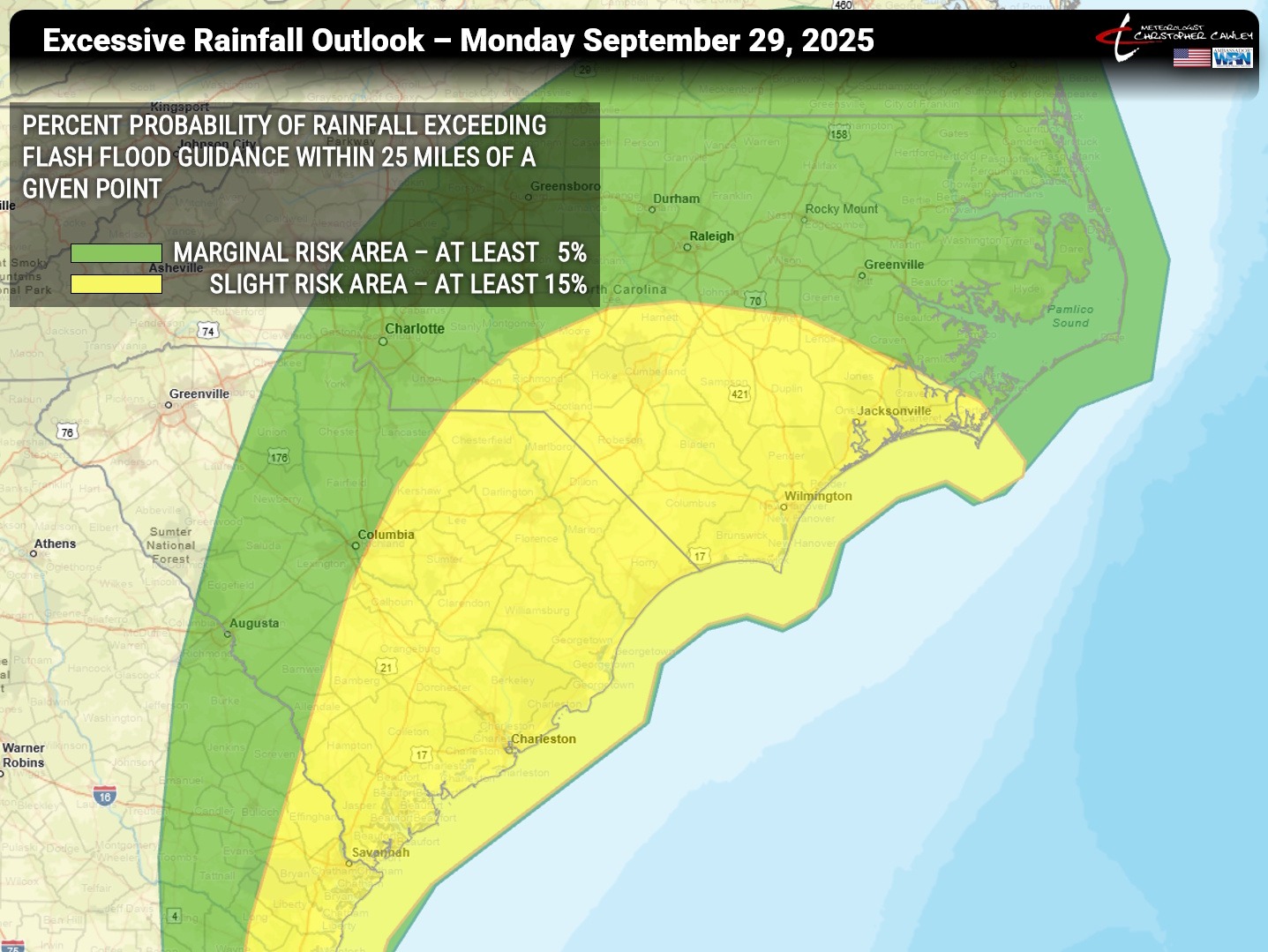
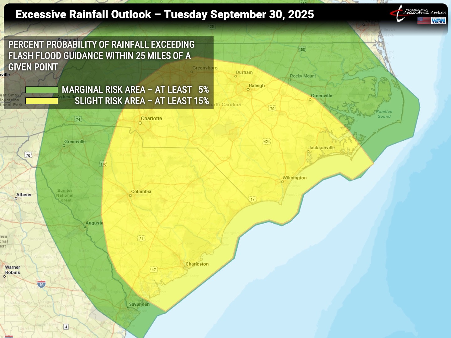
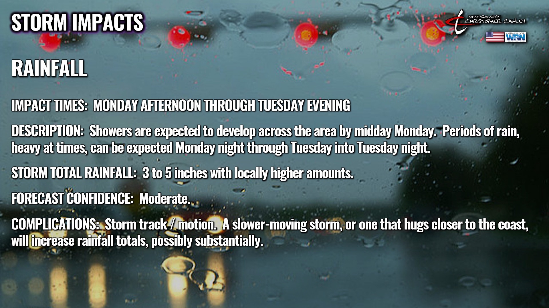
The latest model blend chart shows generally 3-5 inches of rain for Columbus county. The “model blend” is literally just that — a “blending” of all available modeling to present one chart. This means that some models have considerably more rainfall while others have barely any at all. The official NWS forecast, as of this writing, is 4-6 inches.
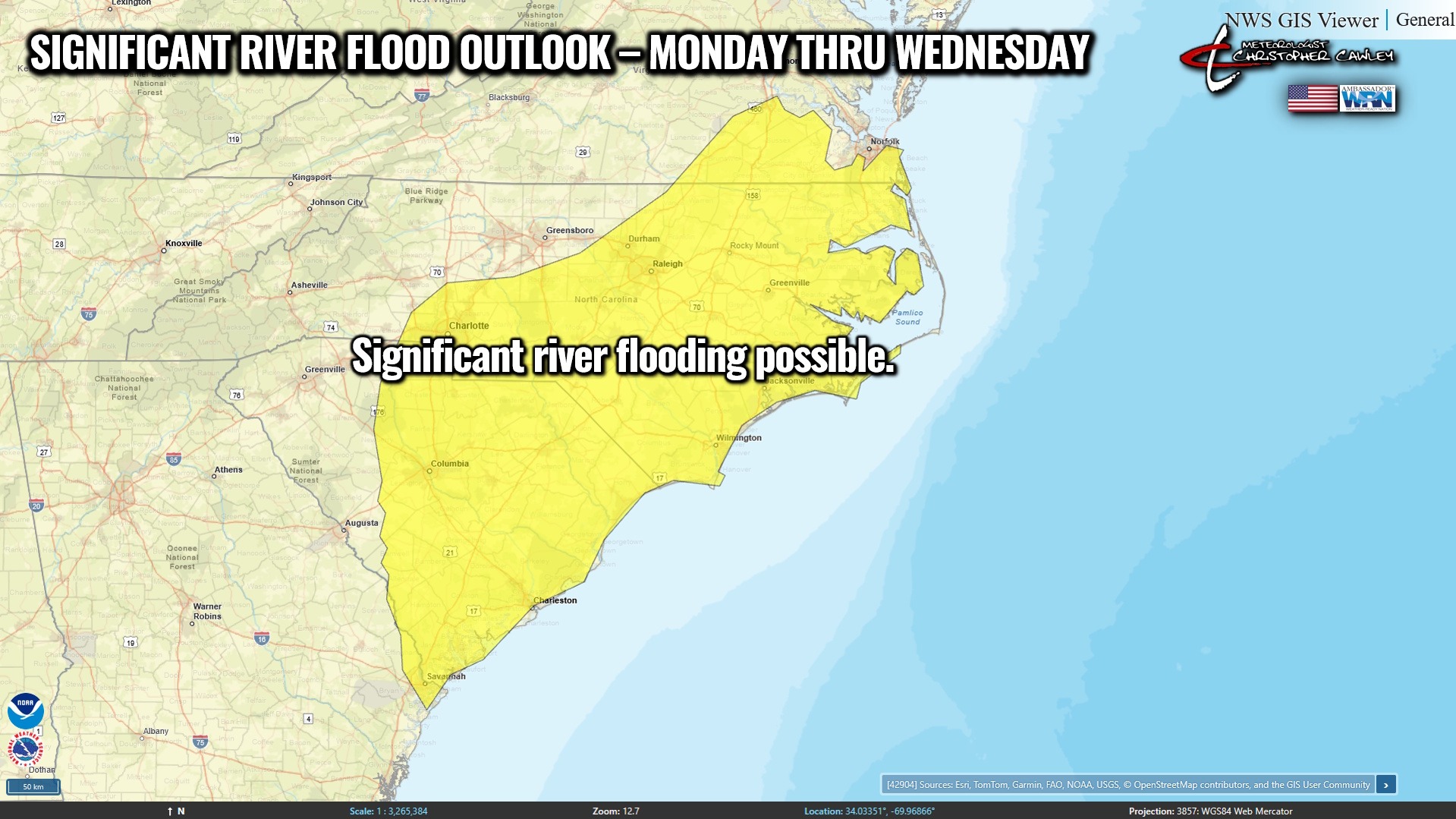
As for flooding… well… you know what that means in Whiteville.
As you can see by the charts above, Columbus County is under a 15% risk for rainfall exceeding flash flood guidance.
FIMAN information —
Soules Swamp @ S. Madison Street
• Current stage 2.5 feet
• Monitor: 5 feet
• Minor flood: 7 feet
Soules Swamp @ Slippery Log Road
• Current stage 2.2 feet
• Monitor: 7 feet
• Minor flood: 8 feet
Lumber River @ NC-904 in Fair Bluff
• Current stage 4.6 feet
• Monitor: 10.7 feet
• Minor flood: 12.7 feet
So as you can see, our rivers, creeks, swamps should be able to handle the rain that’s coming. Anything over 6 inches of rain will likely start to cause some flooding concerns.
However, like I said, those of you in downtown Whiteville know what’s going to happen with the arrival of between 3 and 6 inches of rainfall. That’s a debate for another time.

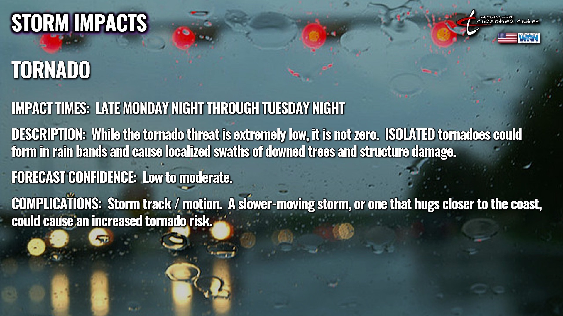
Wind and tornado risks are relatively low for Columbus County UNLESS Imelda makes a closer run at or up the coast.
As always, I will continue to monitor the latest information and data as it continues to pour in on an almost constant basis. Follow my Facebook page @Meteorologist Christopher Cawley.
You can also keep up to date with the current tracks by utilizing the National Hurricane Center’s website.
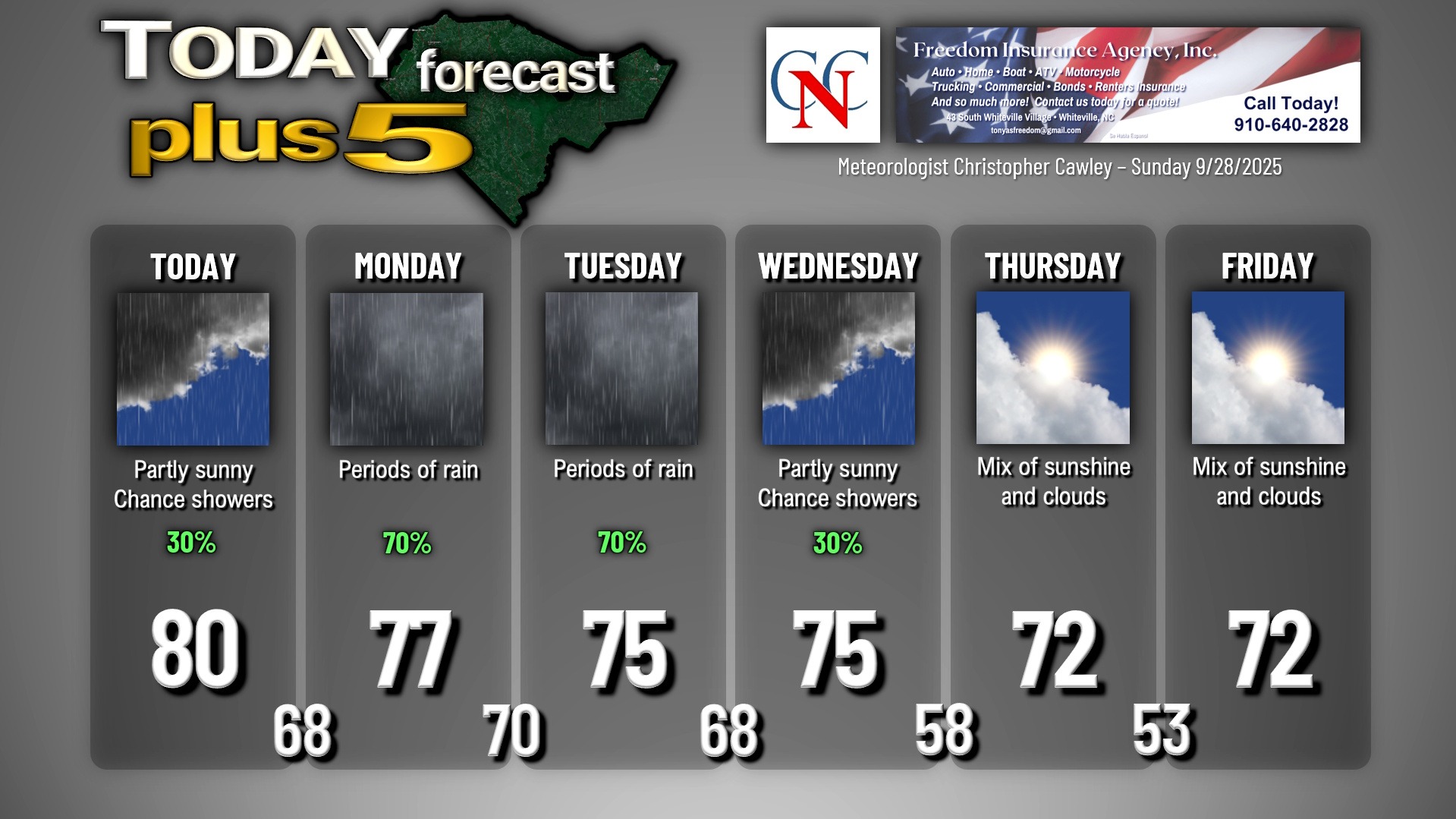
Here is your Freedom Insurance Today-plus-Five Forecast:
–Meteorologist Christopher Cawley