CCN Weather Update for Sunday May 10, 2026
This weather update is sponsored by Freedom Insurance of Whiteville. Trust Freedom Insurance to give you clear blue skies when it comes to home, car, boat, or whatever insurance you need. Let Freedom provide customized coverage to keep you and your family safe. Contact Freedom today at 910-640-2828!
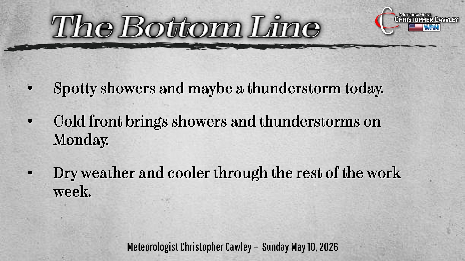
Here’s today’s Bottom Line
HAPPY MOTHER’S DAY!
Let’s talk quickly about yesterday’s reported tornado at Delco. It still hasn’t been officially confirmed by the NWS as of this writing; hopefully today they’ll get a survey team out to look at the damage.
The “storm” in question was nothing more than an isolated convective shower. There was no lightning with it whatsoever. It formed in a ribbon of weak instability, but there was just enough “storm relative helicity” present to get the cell to spin a bit. The NWS Storm Prediction Center had even made a short statement about it, labeling it a “sub-severe supercell capable of producing elevated wind gusts or possibly a weak tornado.” And that’s exactly what happened.
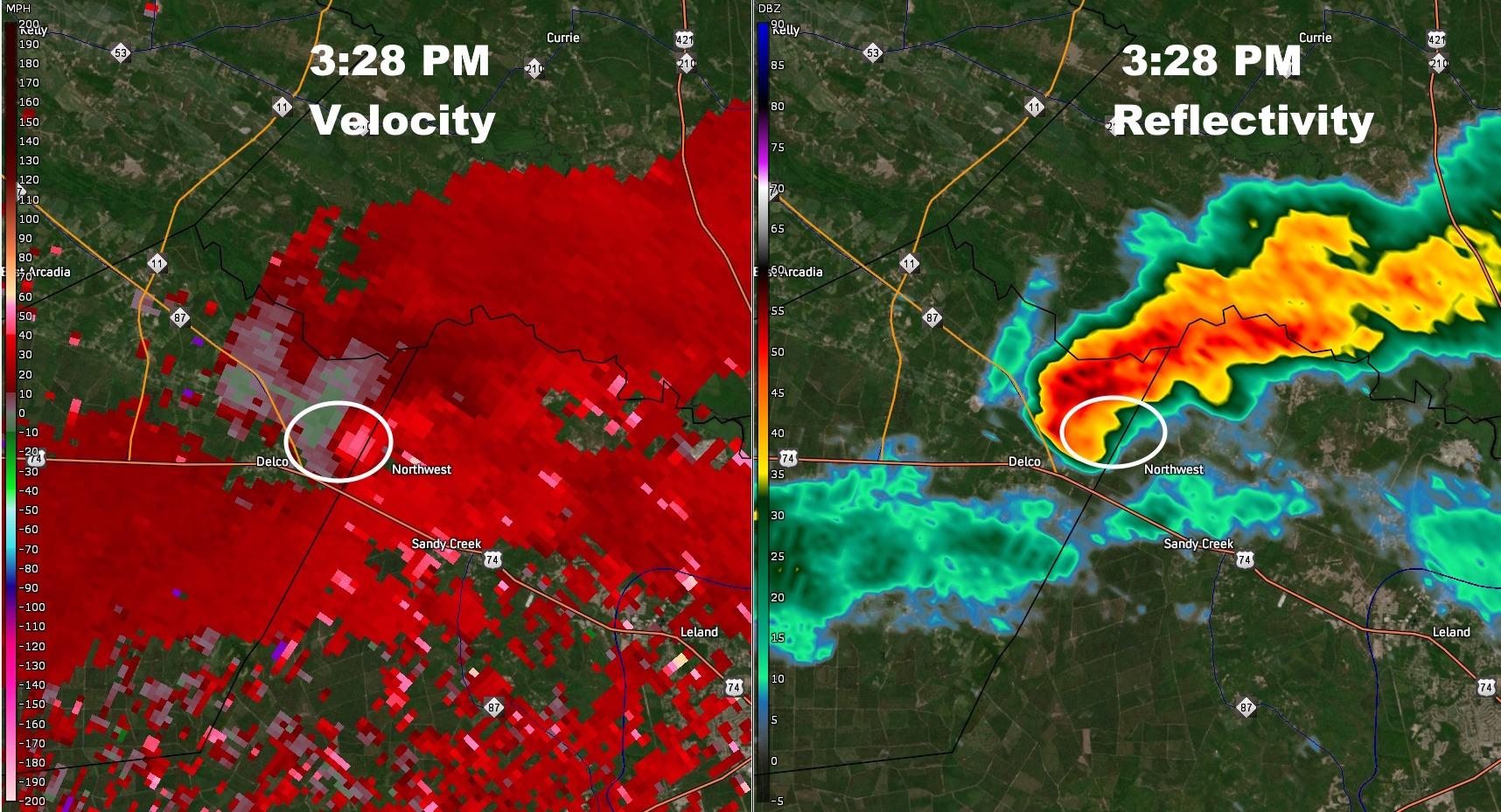
The NWS at Wilmington did not warn on the cell. While I can’t speak for the NWS forecasters, when I saw the shower on radar, I didn’t give it a second thought. Nature… had other things in mind.
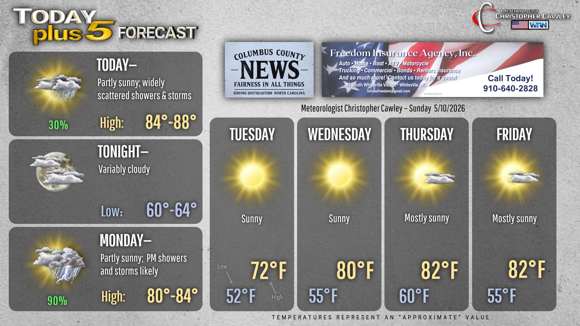
For today, we’ll see mainly dry and warm conditions… but there is the possibility for a few isolated showers and possibly a thunderstorm this afternoon. Temps will be in the mid to upper 80s. It’ll be noticeably more humid this afternoon as well.
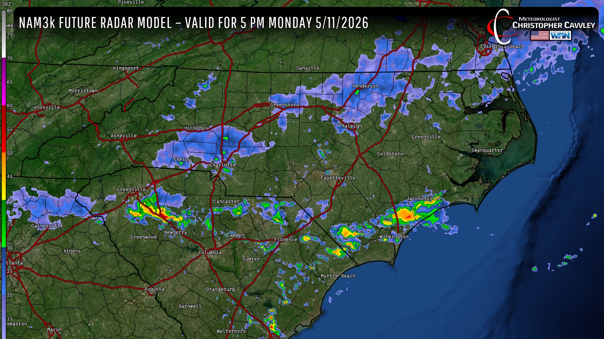
During Monday, a deep, moist southwest flow will push in ahead of a fairly strong cold front. The NWS Storm Prediction Center has our area under a level 1 Marginal Risk for Monday afternoon for severe thunderstorms. A strong jet stream will be over the area and that, along with good low-level convergence (more air entering an area than leaves it, or two air masses coming together) will cause a pretty strong upward vertical velocity (the lift necessary to generate stronger thunderstorms). The limiting factor will be the level of destabilization, but if we get enough sunshine on Monday… the afternoon hours could be quite bumpy indeed.
Things rapidly dry out Monday night, and dry weather will likely continue through the rest of the work week. A second, weak cold front looks to drop through late Wednesday night, and that might trigger a rain shower, but otherwise we’ll be dry with slightly below-normal temperatures.
Here is your Freedom Insurance Today-plus-Five Forecast:
–Meteorologist Christopher Cawley