Columbus County News Weather Update for Saturday September 5, 2026.
This weather update is sponsored by Freedom Insurance of Whiteville. Trust Freedom Insurance to give you clear blue skies when it comes to home, car, boat, or whatever insurance you need. Let Freedom provide customized coverage to keep you and your family safe. Contact Freedom today at 910-640-2828!
Here’s today’s Bottom Line
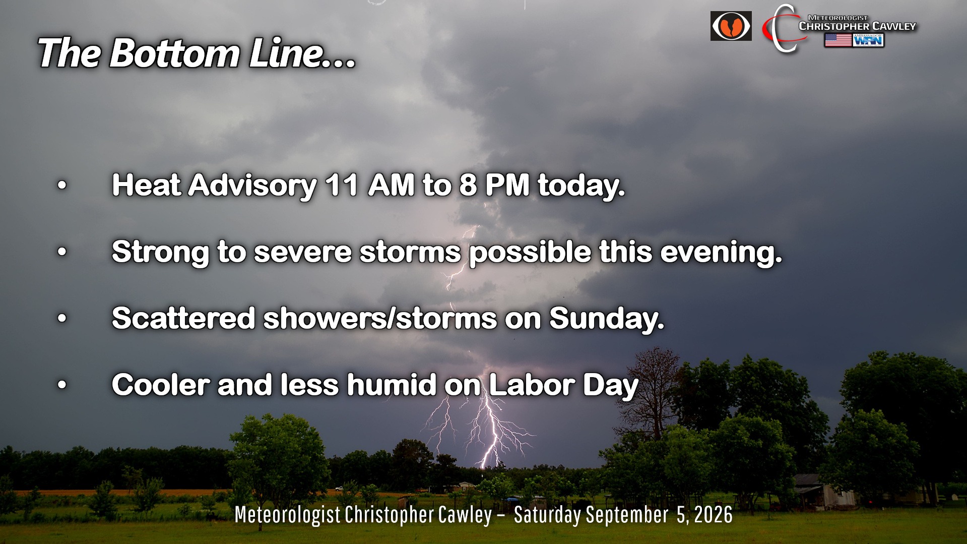
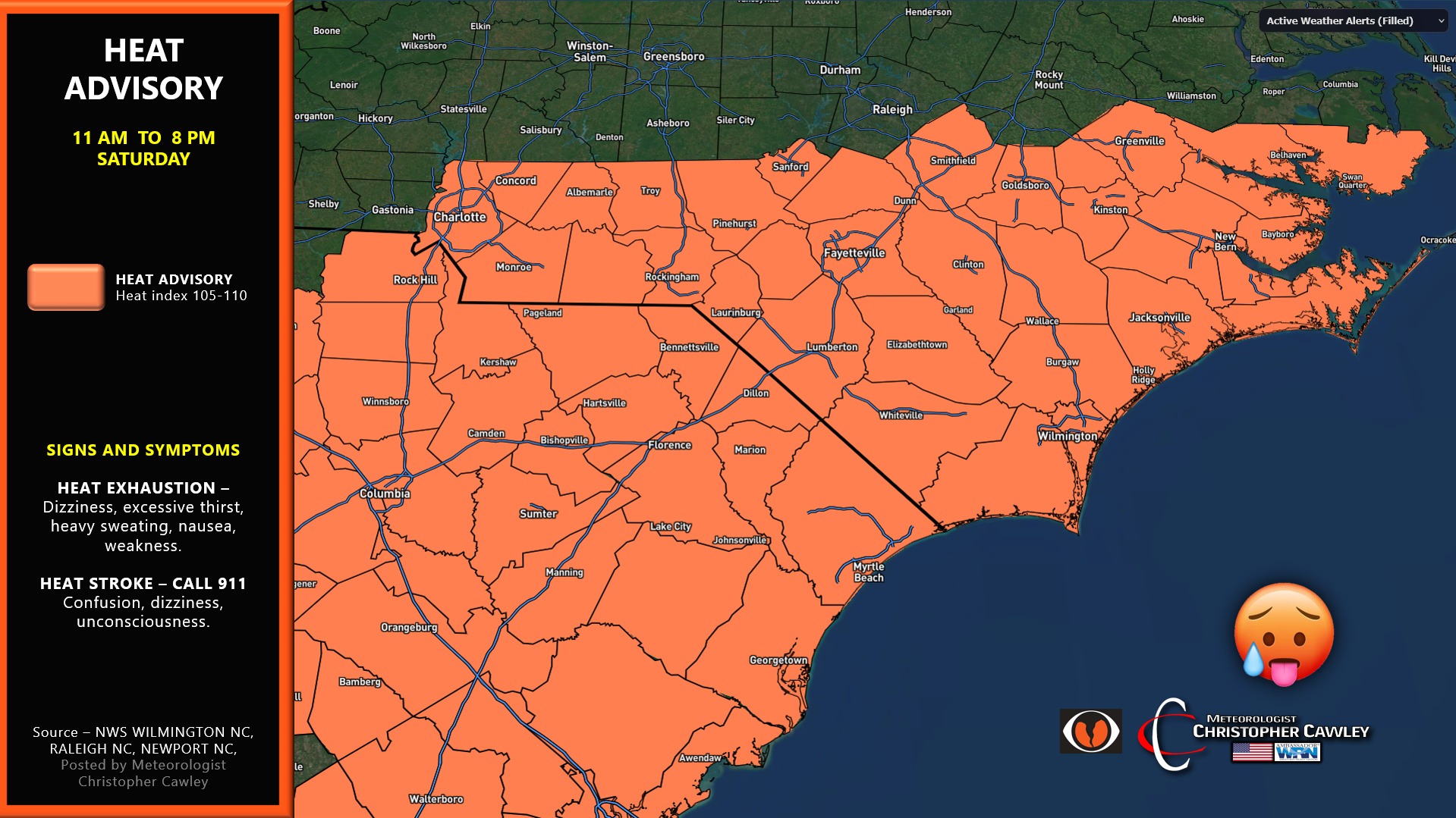
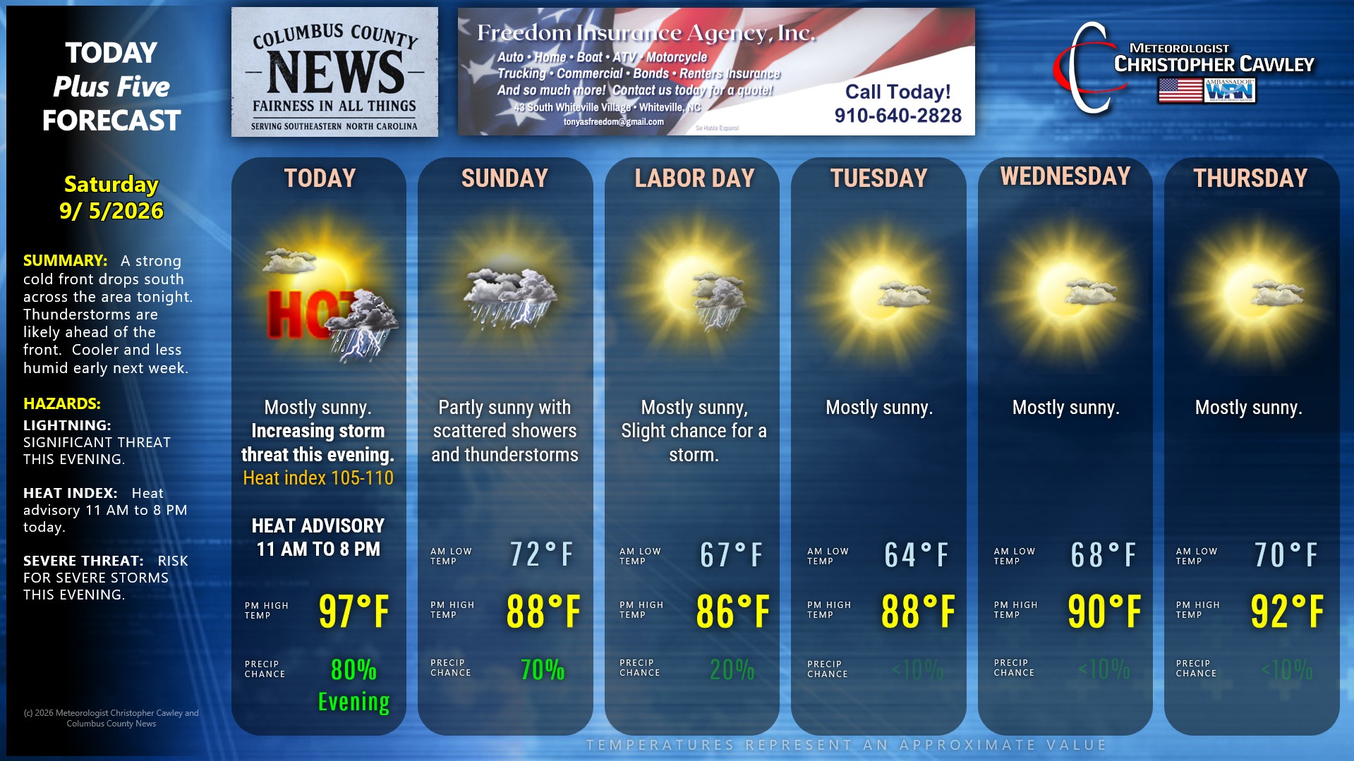
Heat advisory is in place once again for today.
That’s not the big story though. The big story is the cold front that will push down toward the area tonight. A line of significant thunderstorms is likely to develop ahead of this front and impact the area this evening.
The Storm Prediction Center has placed the entire region in a level 2 risk for severe storms. The primary risk will be that of damaging winds. Storms will also be capable of producing intense local rainfall and frequent to near-constant cloud-to-ground lightning.
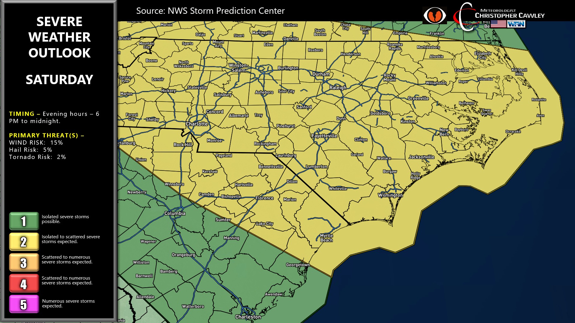
That all calms down around or shortly after midnight.
The front itself finally pushes all the way through on Sunday morning. The low-level moisture, however, is going to be very slow to scour out. This will likely result in low-topped showers and “thunderstorms” (convective, gusty showers) that could produce some hail.
Drier and more seasonable temperatures will arrive for Labor Day and persist through Tuesday… before temps start to push northward back into the 90s later in the week.
TROPICS: We are at the statistical peak of hurricane season in the Atlantic basin, and we’ve yet to have an Atlantic hurricane. VERY unusual, and almost exclusively due to the very strong El Nino that we’re in. There’s nothing doing at this time, no activity.
Here is your Freedom Insurance Today-plus-Five Forecast:
–Meteorologist Christopher Cawley