Good evening, Meteorologist Christopher Cawley here with today’s weather update. Wednesday October 23, 2024.
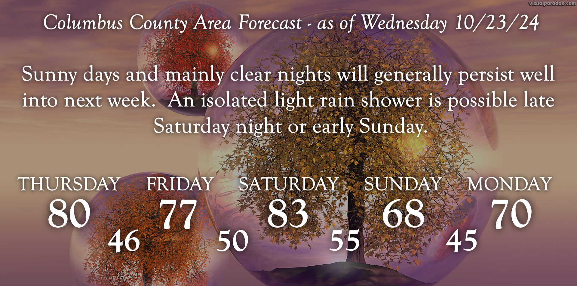
A cold front will cross the area Thursday. The only fanfare will be that of a wind shift to the northwest during the afternoon, along with slightly cooler temps for Thursday night and Friday.
Another cold front drops over the region late Saturday into Saturday night. The latest modeling shows that this might… possibly… maybe… if we’re lucky… bright an isolated light rain shower or two Saturday night. But I doubt it.
We’re much cooler on Sunday but temps begin a rebound once again as high pressure reasserts control through at least the first half of next week.
Here are the numbers…
The drought monitor will be updated on Thursday. It’ll be interesting to see whether or not we’ve developed some drought classification.
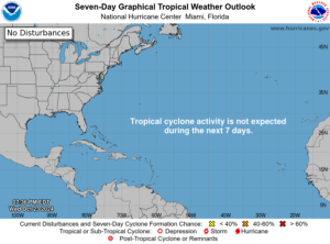
Tropics: Nothing doing, as indicated by the National Hurricane Center. The longer-range GFS modeling insists on something churning up south of Cuba around Halloween but this is not showing up on any of the other modeling right now. Conditions will be generally favorable in that part of the Atlantic for “something” to develop. We just need to see if all the ingredients come together.
Ok friends, that’ll do it for tonight. Thanks for reading, and as always, take care.