CCN Weather Update for Sunday June 28, 2026
This weather update is sponsored by Freedom Insurance of Whiteville. Trust Freedom Insurance to give you clear blue skies when it comes to home, car, boat, or whatever insurance you need. Let Freedom provide customized coverage to keep you and your family safe. Contact Freedom today at 910-640-2828!
Here’s today’s Bottom Line
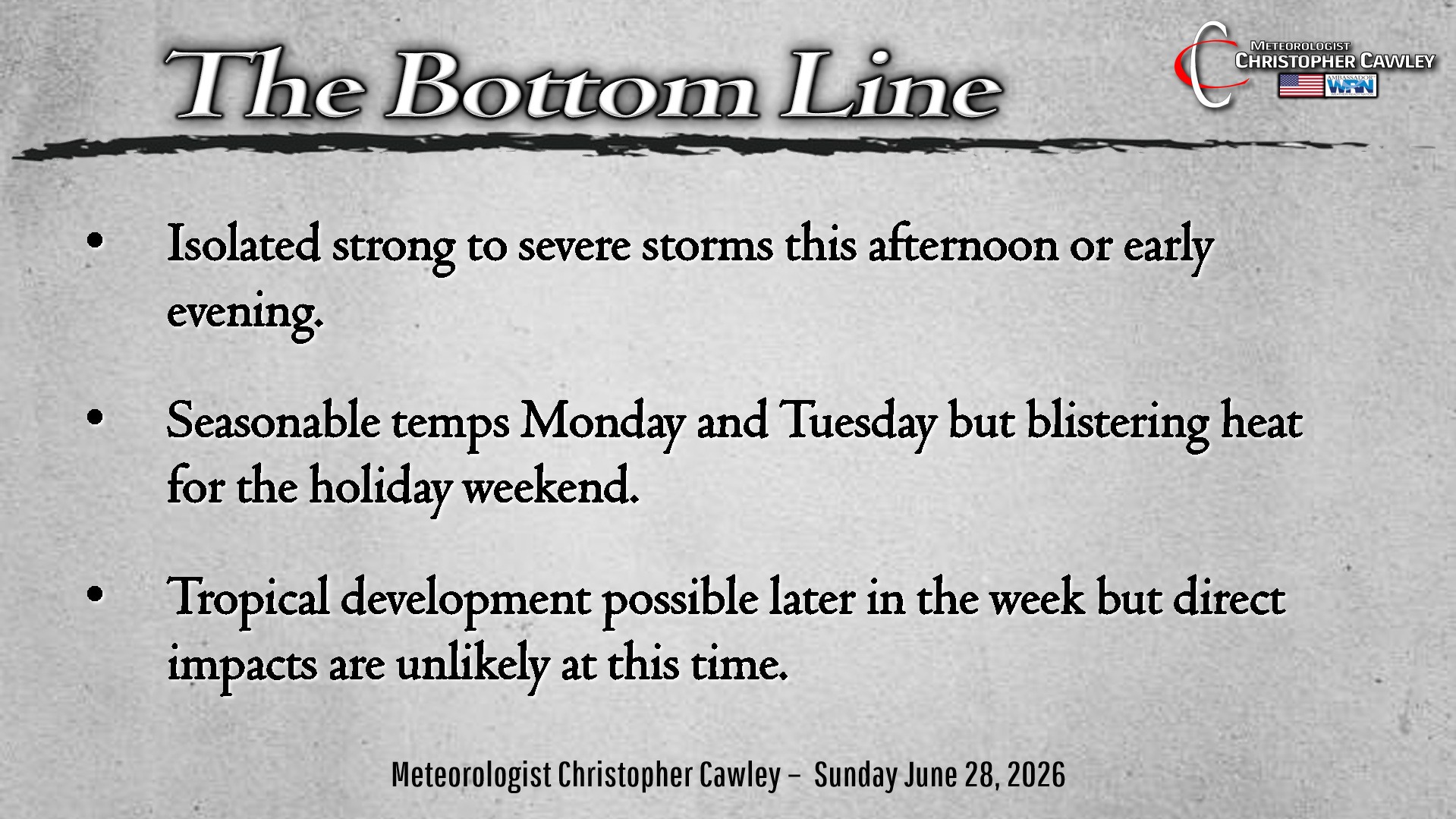
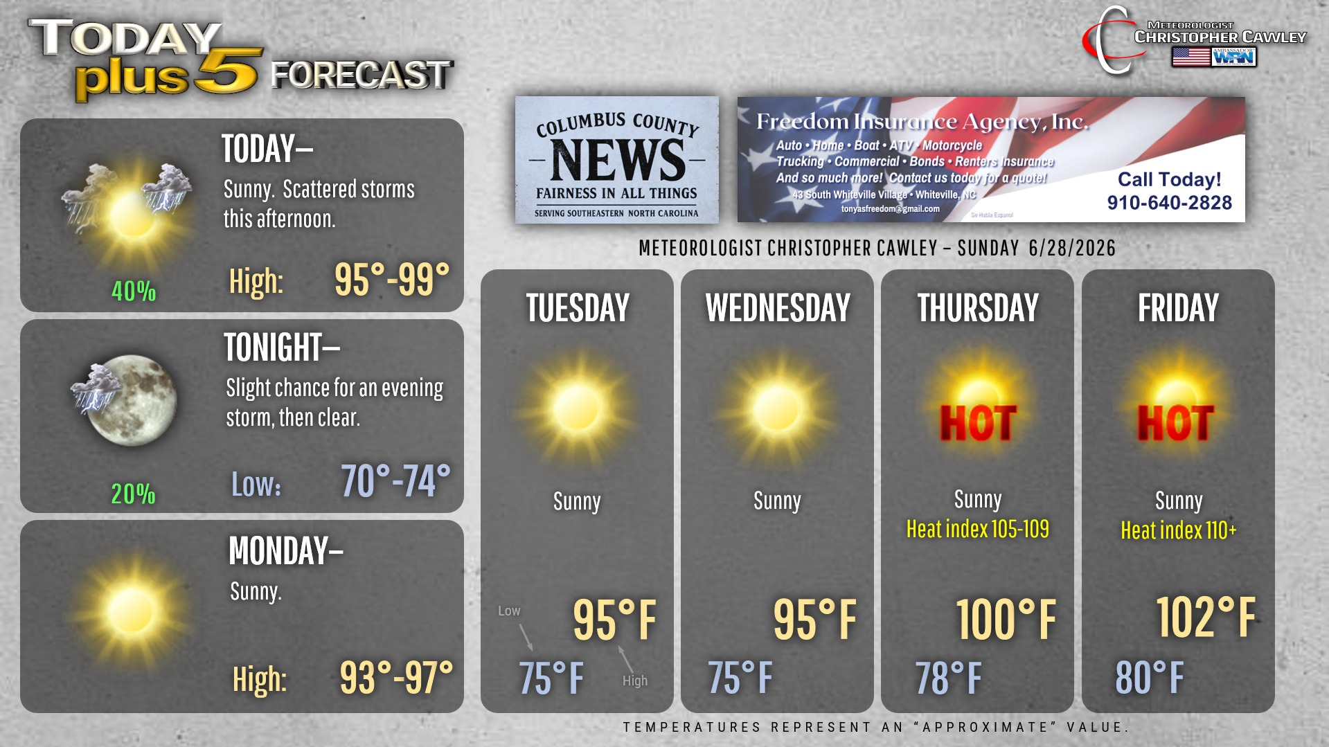
Strong thunderstorms possible this afternoon. A mesoscale convective vortex is expected to move across the state this afternoon. This is a small-scale spinning low-pressure center that develops in the middle levels of the atmosphere, typically measure 30-60 miles wide. Anyway, this MCV is expected to drop southeast with a weak frontal boundary. This will result in at least isolated to scattered thunderstorm development this afternoon. Any storm that develops could pulse to severe limits with damaging “wet downburst” winds along with frequent cloud-to-ground lightning. The coverage should be isolated to widely scattered… most of us will remain dry. And hot.
Dry and “seasonably hot” Monday and Tuesday. High pressure ridging just to our west, combined with Bermuda high pressure offshore, will bring dry weather to the area Monday and Tuesday.
Temps begin to rise on Wednesday as the ridge strengthens. Some forecasters in the media have referred to what’s developing as a “heat dome,” and that’s really not an inaccurate assessment. Much of the central and eastern United States will be impacted by record heat. Triple-digit heat is likely to bake the area through the entire holiday weekend. Heat index will likely reach dangerously high levels greater than 110 degrees over the weekend. We’ll focus more on this through the coming week.
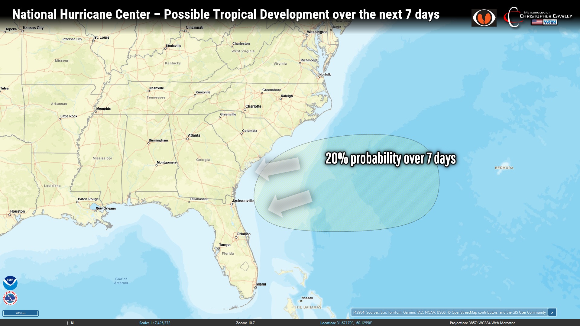
TROPICS: The National Hurricane Center has outlined an area off the South Carolina coast for a 20% chance of development over the next 7 days. It is possible that an area of low pressure develops on the weak front that will move through tomorrow, and if this low develops, it could quickly attain tropical characteristics. If anything develops, it will likely drift west-southwest toward southern SC, GA, or northern FL. Lots of uncertainty with this. Either way, it’s not likely to bring any direct impacts here.
Here is your Freedom Insurance Today-plus-Five Forecast:
–Meteorologist Christopher Cawley