Greetings readers, Meteorologist Christopher Cawley here with your CCN weather update for Monday December 23, 2024.
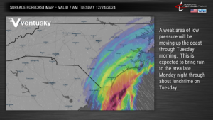
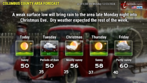
The biggest thing to talk about this week will be the area of low pressure that will quickly develop and move northeast along the coast tomorrow. This will bring a period of rain to the county late tonight through about noon on Christmas Eve.
There are several machinations in place driving this light, cold rain that we’ll experience. High pressure off to the north will keep a north to northeast wind flow, trapping cold air at the surface. If you go a couple thousand feet upwards in height, there is a fairly dramatic warming. Low- and middle-level moisture will increase from south to north tonight, with light rain pushing in mainly after midnight. With the lingering surface “wedge” of dry, cold air, cold rain will be what we experience at the ground. This will persist, again, until about lunchtime on Tuesday.
Temperatures are going to be borderline, but we should stay all liquid rain here in Columbus County. If you’re traveling to the north and west, you might encounter a bit of freezing rain early Tuesday morning. All of the available modeling suggests that if any freezing rain occurs, it will be relatively light and brief. A light glaze may accumulate for portions of central North Carolina, as shown by the map below from the National Weather Service.
Again… very, very unlikely that we see anything frozen here in Columbus County.
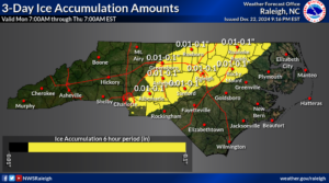
After that, high pressure dominates through the rest of the week, with a very slow warming trend. Our next weather system brings unsettled weather late this coming weekend. All indications are that temperatures run well above normal through New Year’s Day.
That’ll do it for this morning’s update. I hope yall have a fantastic day, and if you’re traveling, be safe.
Oh… one last thing… 11 out of 50 of the European ensemble models indicate accumulating snowfall here the week after New Years…..

