CCN Weather Update for Monday June 8, 2026
This weather update is sponsored by Freedom Insurance of Whiteville. Trust Freedom Insurance to give you clear blue skies when it comes to home, car, boat, or whatever insurance you need. Let Freedom provide customized coverage to keep you and your family safe. Contact Freedom today at 910-640-2828!
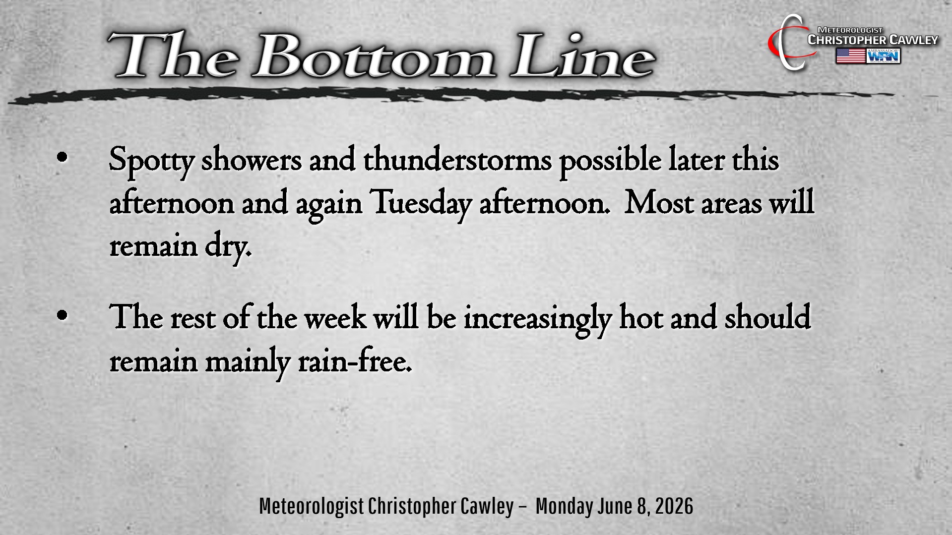
Here’s today’s Bottom Line
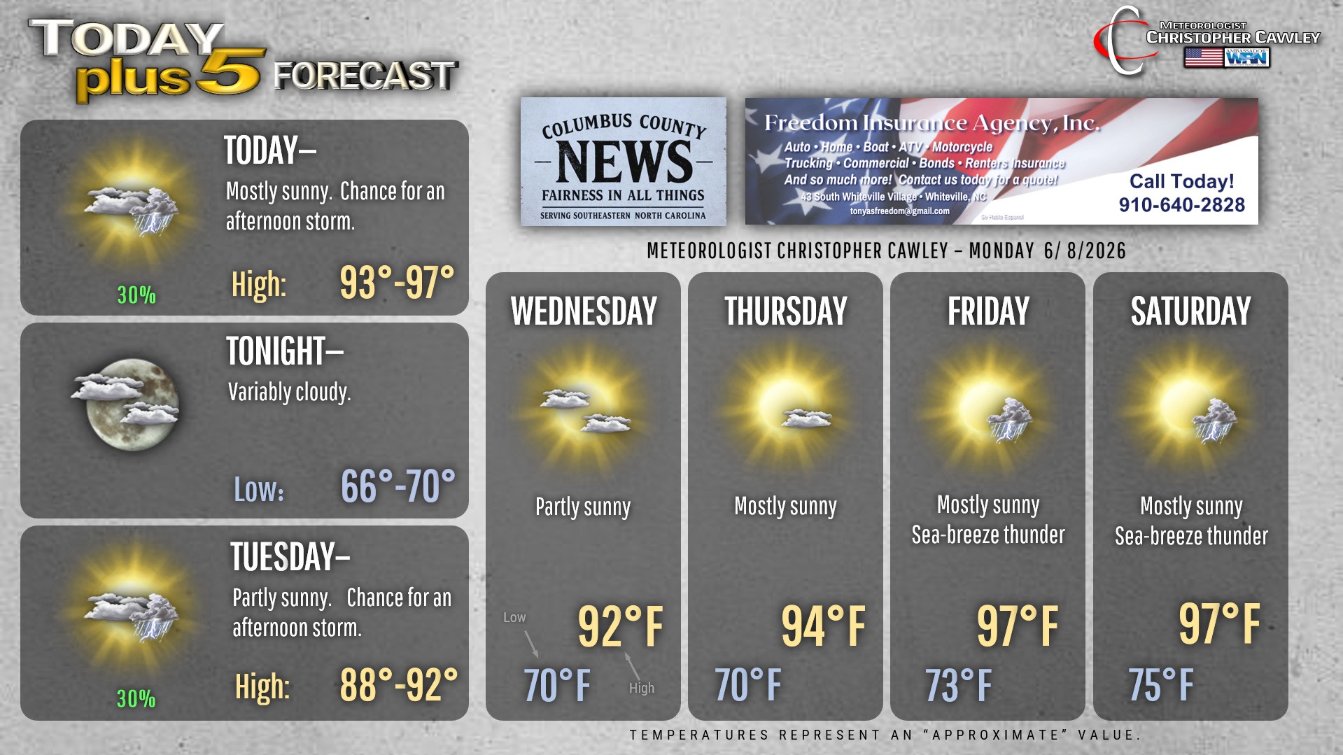
Hydrate… hydrate… hydrate.
Sunscreen… sunscreen… sunscreen.
True summertime heat today ahead of a weak cold front that will drop south over the area late this afternoon. Plenty of heat and humidity about the area will create for significant atmospheric instability, but the lack of lift and buoyancy along the front means that any thunderstorms that develop will be isolated at best. Those who DO get a storm, plan on buckets of rainfall and frequent cloud-to-ground lightning, but again… that will be the exception, not the rule.
Front briefly drops to our south late Monday night into Tuesday before it lifts back to the north and dissipates, being eaten by the strengthening Bermuda high pressure ridge.
Wednesday through Saturday will be mainly dry and very hot with the strengthening ridge. Afternoon highs coast into the upper 90s, possibly flirting with 100 by the weekend, with heat index values at or above 100 through the period. Heat Advisory criteria is a heat index of 105 or greater for 3 consecutive hours… it remains to be seen if we hit the advisory numbers but it’ll be the hottest of the year so far.
Isolated sea-breeze storms are possible Friday and over the weekend providing brief, fleeting relief from the oppressive heat.
Here is your Freedom Insurance Today-plus-Five Forecast:
–Meteorologist Christopher Cawley