Hello everyone and good day to you! Welcome to the CCN Weather Update for Wednesday May 14, 2025.
This weather update is sponsored by Freedom Insurance of Whiteville. When severe weather strikes, with Freedom Insurance you will always be prepared. For home, car, boat, or whatever you need, Freedom can provide customized coverage to keep you and your family safe. Contact Freedom today at 910-640-2828!
STATISTICS for Tuesday 5/13/2025
High: 86.8°F at 2:11 PM (Normal 82)
Low: 67.4°F at 6:25 AM (Normal 60)
Precip: 0.85 in
Precip – Month: 6.05 in
View real-time data from the weather station at College Street Weather Station.
Here’s today’s Bottom Line
Well if I’m going to “bust” a forecast, it’s good to bust in a positive way. We experienced much more in the way of sunshine and much less in the way of thunderstorm activity on Tuesday, at least here in the city of Whiteville. Still, I measured 0.85″ rainfall on my weather station on College Street, bringing the monthly rainfall total to 6.05 inches.
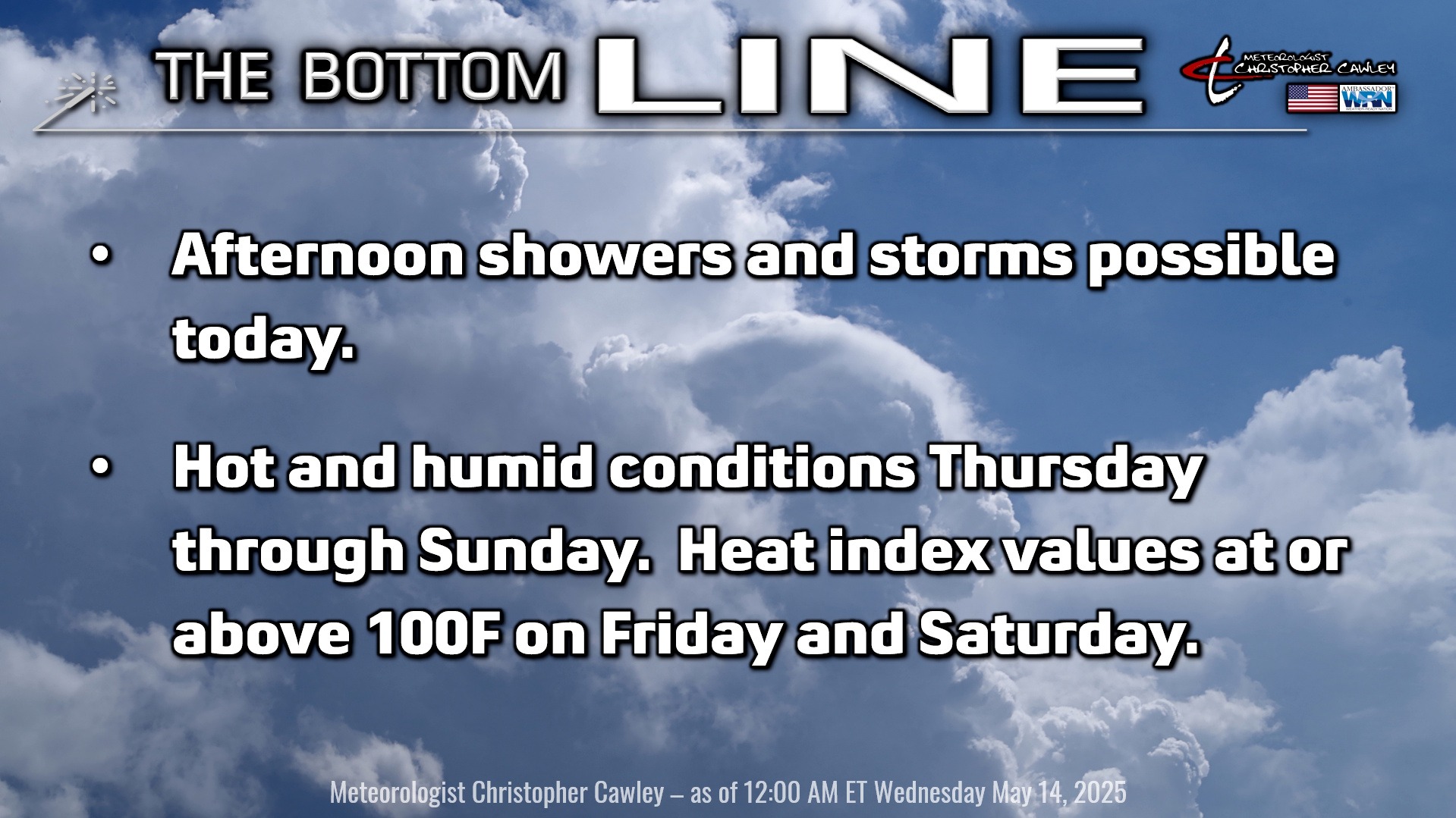
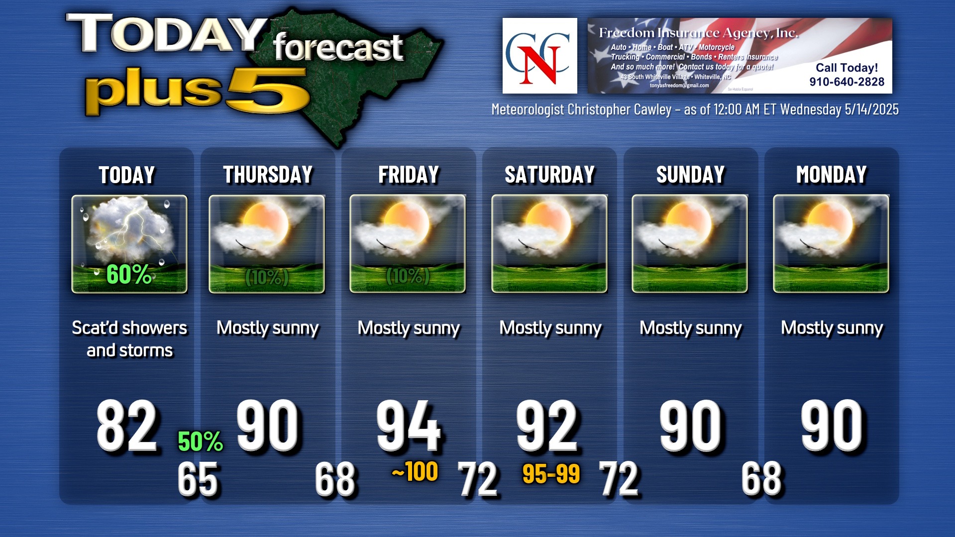
We do have one more day today with the potential for scattered thunderstorms. A frontal boundary will pinwheel around an upper-level low located over West Virginia. This boundary will move across the area later this afternoon and will be the focus for what will probably be a line of showers and thunderstorms. The storms may produce some locally intense downpours once again, similar to what we’ve experienced the last several days.
Then, a switch is flipped, and summer gets turned on “high.” A broad area of high pressure will become locked just off the southeast coast. This will pump in a hot and humid air mass, bringing our first true summer heat wave of the season Thursday through at least Saturday. Heat index values on Friday will flirt with the 100-degree mark, with heat index values in the upper 90s are likely on Saturday.
A weak cold front drops down from the north late Saturday or Saturday night. At first I thought this might bring a thunderstorm threat, but all of the available guidance points to dry conditions and only slightly cooler temps behind the front. Eventually as we get into next week, the front lifts back north, and while not shown on the graphic below, next Tuesday could roast back into the mid 90s.
Longer range, though, through Memorial Day weekend, shows that our temps could trend back closer to where they should be — NOT in the 90s.
Here is your Freedom Insurance Today-plus-Five Forecast:
That’s going to do it for today’s report. As always, thank you for reading and for supporting Columbus County News. Have a great day!
–Meteorologist Christopher Cawley