Hello everyone and good day to you! Welcome to the CCN Weather Update for Monday May 19, 2025.
This weather update is sponsored by Freedom Insurance of Whiteville. When severe weather strikes, with Freedom Insurance you will always be prepared. For home, car, boat, or whatever you need, Freedom can provide customized coverage to keep you and your family safe. Contact Freedom today at 910-640-2828!
STATISTICS for Sunday 5/18/2025
High: 91.8°F at 1:44 PM (Normal 81)
Low: 68.8°F at 6:41 AM (Normal 58)
Precip: 0.00 in
Precip – Month: 6.37 in
View real-time data from the weather station at College Street Weather Station.
Here’s today’s Bottom Line
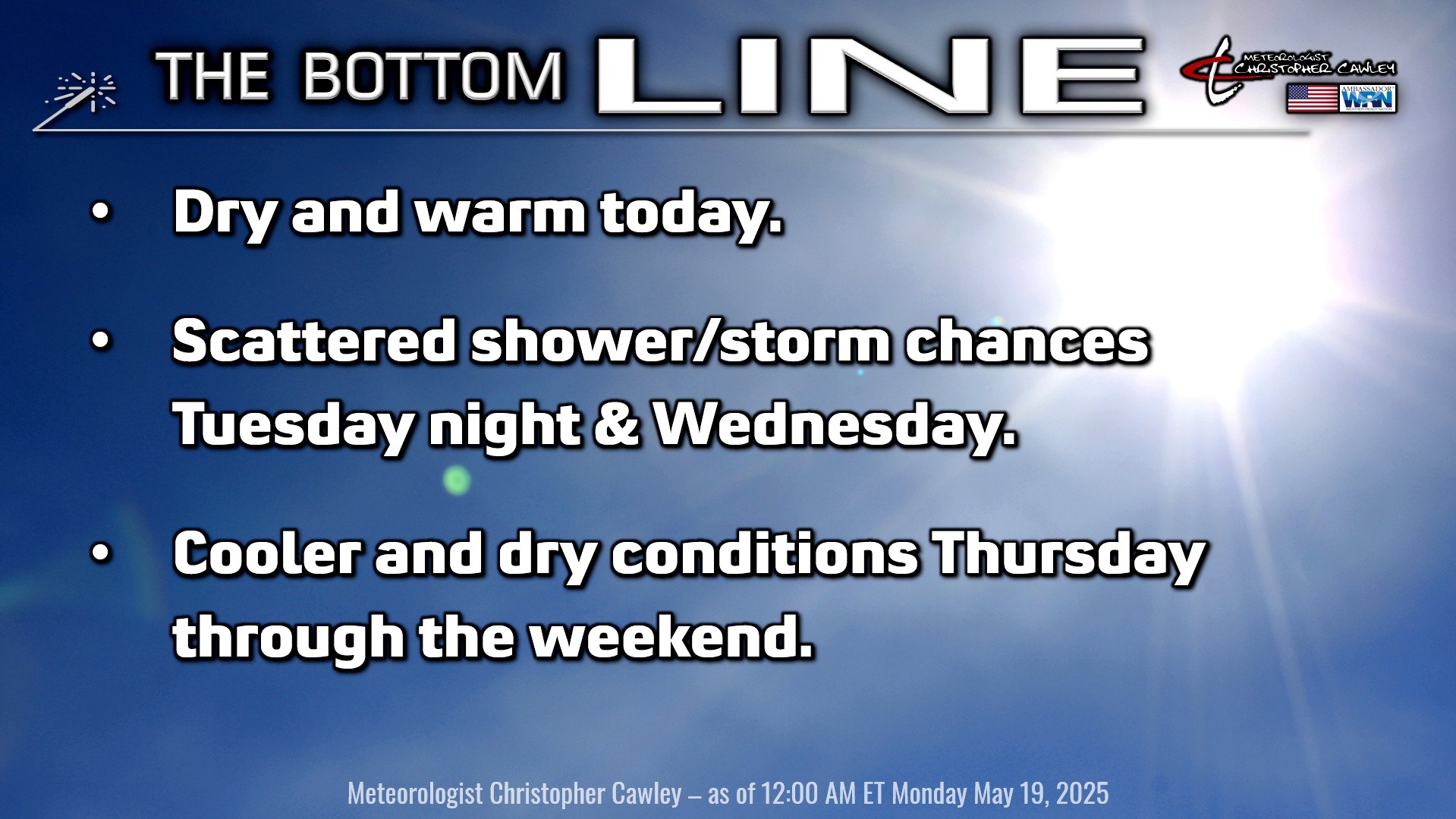
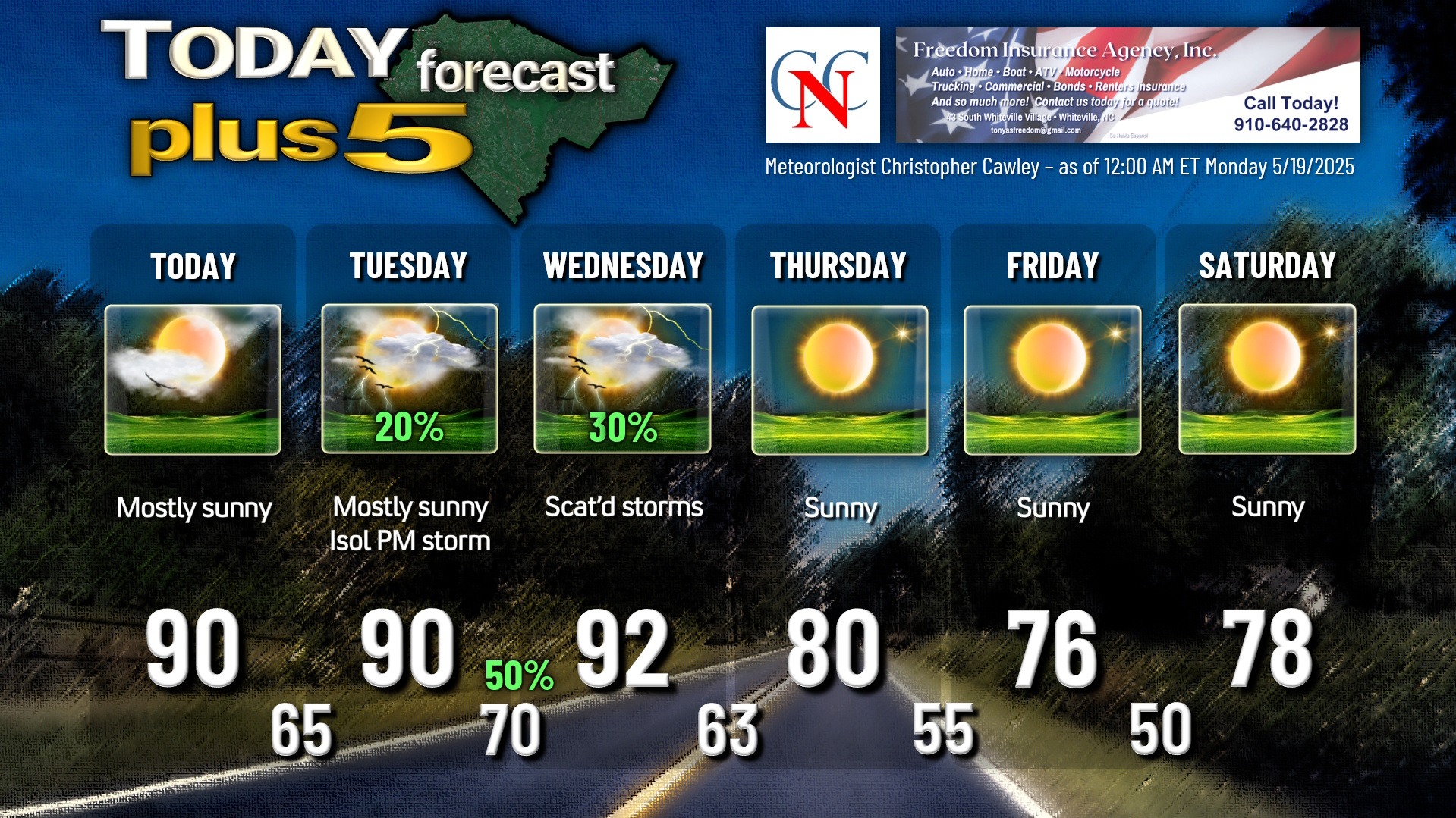
High pressure ridge remains in control today, bringing lots of sunshine, light winds, and warm temps to the area… our highs will be around 90.
Remember the cold front that moved through on Saturday? It continues to remain draped across southern South Carolina. This front lifts northward as a warm front on Tuesday, and depending on the arrival time, this may trigger a shower or thunderstorm in the afternoon. Portions of South Carolina are under a marginal severe risk for Tuesday, but not Columbus County. That being said, the atmosphere will be jacked up on some Monster energy drink, so any storm that does fire on Tuesday could definitely be one that gets your attention.
Scattered showers and thunderstorms are possible Tuesday night ahead of a rather strong cold front. This front will move through on Wednesday, and this could trigger additional thunderstorm activity, but I just don’t think the atmosphere is going to be conducive for the development of any widespread activity on Wednesday. Therefore, I think we’ll see a good deal of sunshine for Wednesday, but an isolated to widely scattered storm may bring a brief downpour and lightning to the area on Wednesday. Highs will jump into the lower 90s ahead of that front, which is ultimately expected to push offshore by Wednesday night.
Strong high pressure ridge builds in for Thursday through the weekend. Precipitation chances drop to near-zero for the entire period with temperatures running somewhat below seasonal normal values, especially at night… some upper 40s are possible early Saturday morning.
TROPICAL WEATHER FORECASTS are returning as of June 1st, the official start of hurricane season.
Here is your Freedom Insurance Today-plus-Five Forecast:
That’s going to do it for today’s report. As always, thank you for reading and for supporting Columbus County News. Have a great day!
–Meteorologist Christopher Cawley