CCN Weather Update for Tuesday August 19, 2025.
This weather update is sponsored by Freedom Insurance of WhitevilleFreedom Insurance of Whiteville. No weather worries with Freedom Insurance. For home, car, boat, or whatever you need, Freedom can provide customized coverage to keep you and your family safe. Contact Freedom today at 910-640-2828!
Here’s today’s Bottom Line
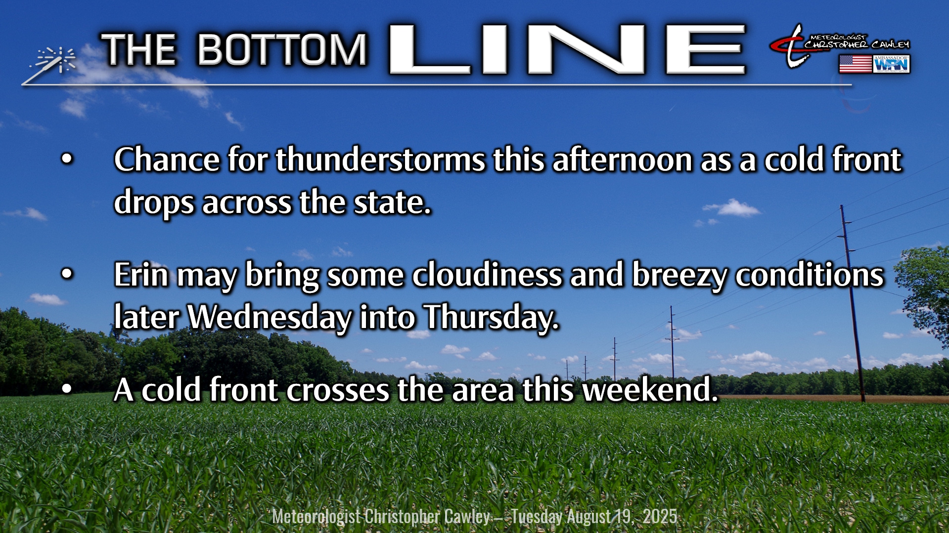
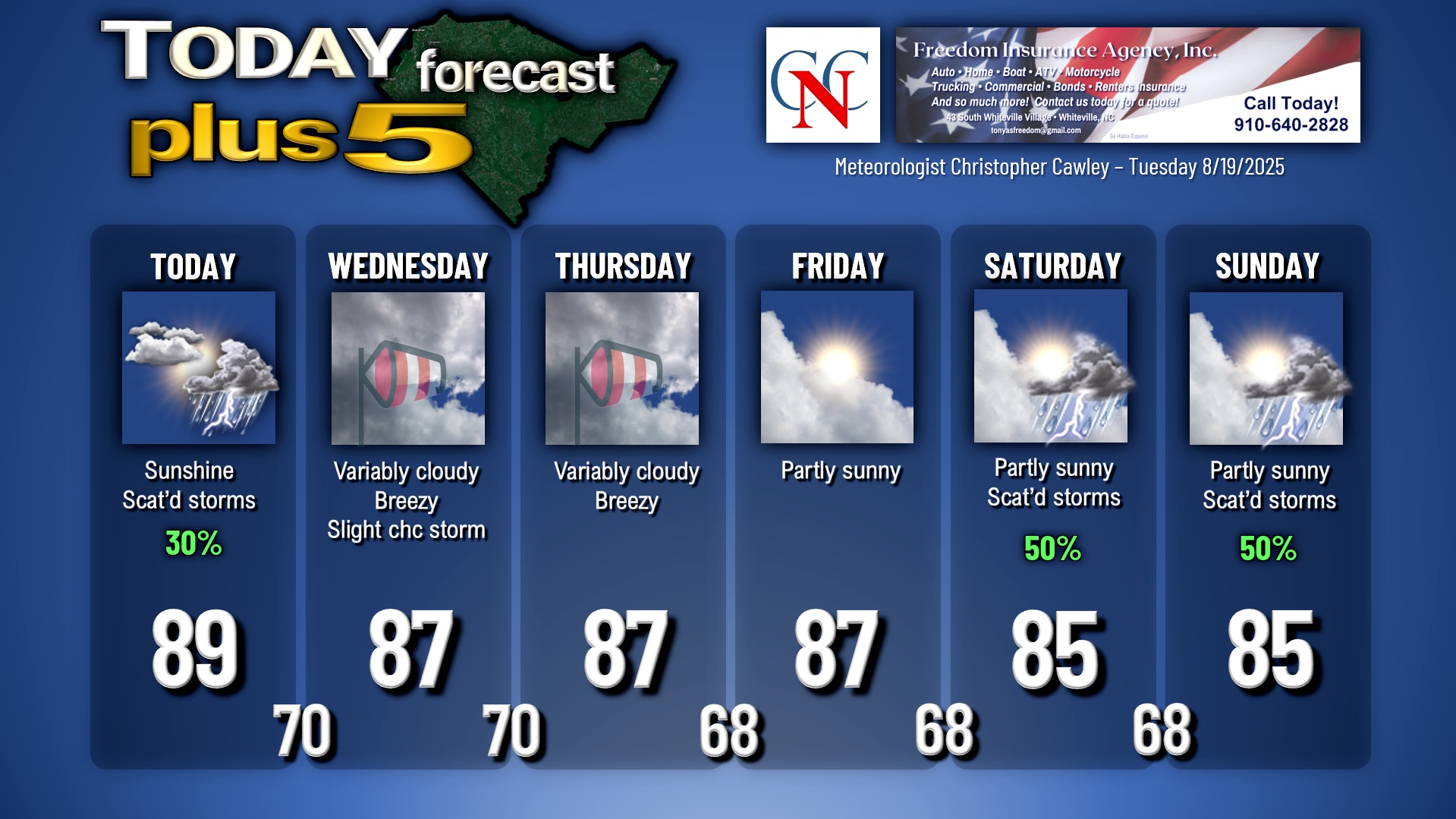
A weak backdoor frontal boundary snaking across the state will be the focus for a few scattered showers and thunderstorms this afternoon. We won’t be quite as hot today, highs will be around 90 (we hit 96 on my weather station yesterday before those surprise storms hit). Any storm that forms could produce locally torrential rainfall and isolated flooding.
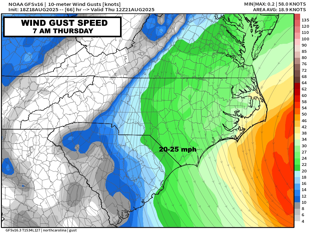
Erin’s course is just a smidge closer to the coast… but the center is still going to be a good 300-400 miles away. Still no significant impacts across Columbus county but I imagine that Wednesday afternoon through about noon on Thursday will feature some breezy conditions… the latest modeling suggests winds average out in the 20-25 mph range with perhaps a gust or two around 30 mph. We’ll also see some relatively cloudy skies Wednesday afternoon through about noon Thursday as Erin passes well to our east.
Benign conditions will NOT be the case at the beaches. Significant storm conditions are expected at the beaches with deadly rip currents and some rather tall waves expected. Some beach erosion is possible and I wouldn’t be surprised to see some overwash on the beach roads during high tides. Evacuation orders in place for our friends in the OBX where there are tropical storm warnings posted.
There are no watches, warnings, or advisories in Columbus County with regard to Erin. Again, at WORST, we’ll see some cloudiness and breezy conditions Wednesday into Thursday.
Erin quickly becomes yesterday’s news after that as she rapidly pulls away and a cold front approaches our area by the weekend bringing a return to showery-and-thunderstormy conditions.
Tropics: I’ve already discussed Erin and her impacts here, so on to the next potential system(s). The National Hurricane Center is monitoring two separate waves, one over the south-central Atlantic and one just coming off the African coast.
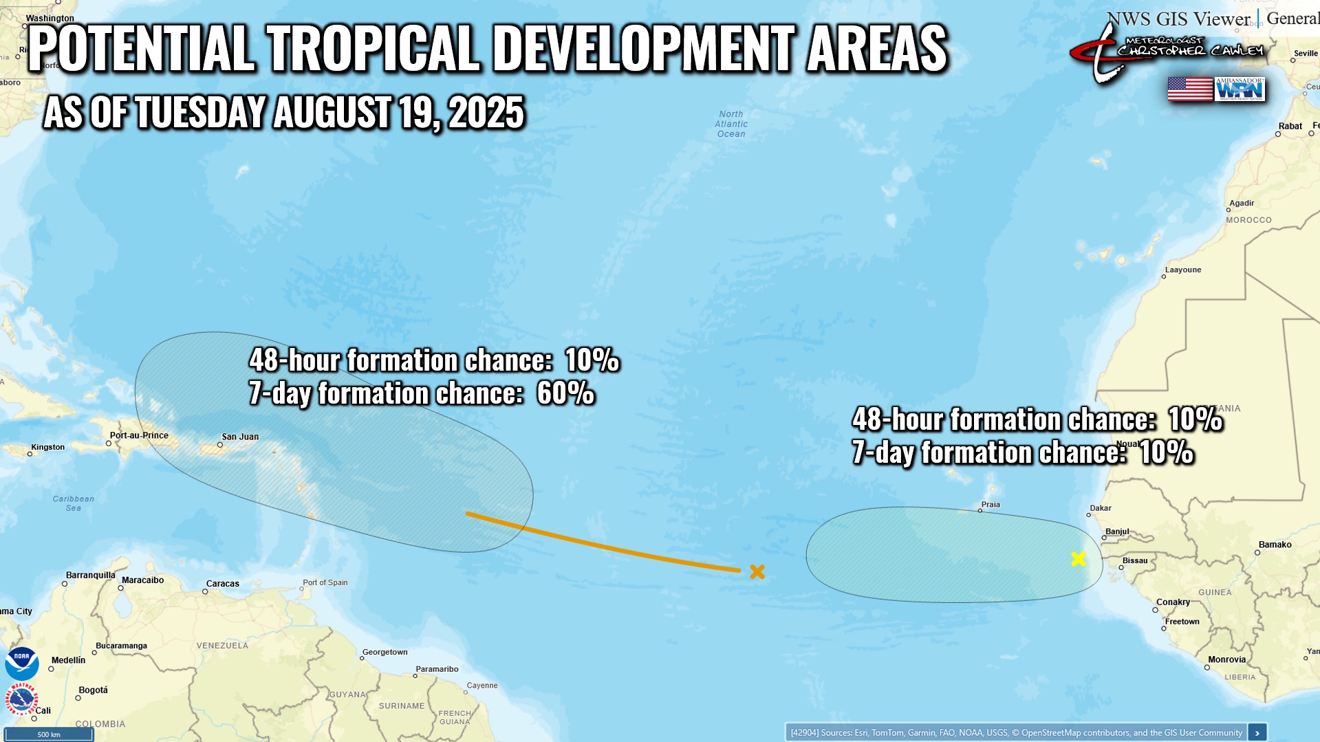
The first system is now up to a 60% chance of becoming a tropical depression or tropical storm within the next 7 days, and is following almost the same path Erin took. Erin caused a lot of churning of the ocean and upwelling of cooler water, so that may play a role in how this next system develops. It’s too early in the process to even begin to speculate how strong this becomes or where it goes until more data becomes available for modeling. My guess is that it takes a track a bit to the south of Erin. Should that be the case, this could definitely be a system to watch as we look at the last week of August. If it takes a track south of Erin, it could… COULD (not a guarantee) make a run at either the east coast or the Gulf.
The second system is just now coming off the Africa coast and at this point is only worth mentioning because it’s there and wants to play as well.
The one to watch is this next system behind Erin. Stay tuned.
Here is your Freedom Insurance Today-plus-Five Forecast:
–Meteorologist Christopher Cawley