CCN Weather Update for Tuesday September 2, 2025.
This weather update is sponsored by Freedom Insurance of Whiteville. No weather worries with Freedom Insurance. For home, car, boat, or whatever you need, Freedom can provide customized coverage to keep you and your family safe. Contact Freedom today at 910-640-2828!
Here’s today’s Bottom Line
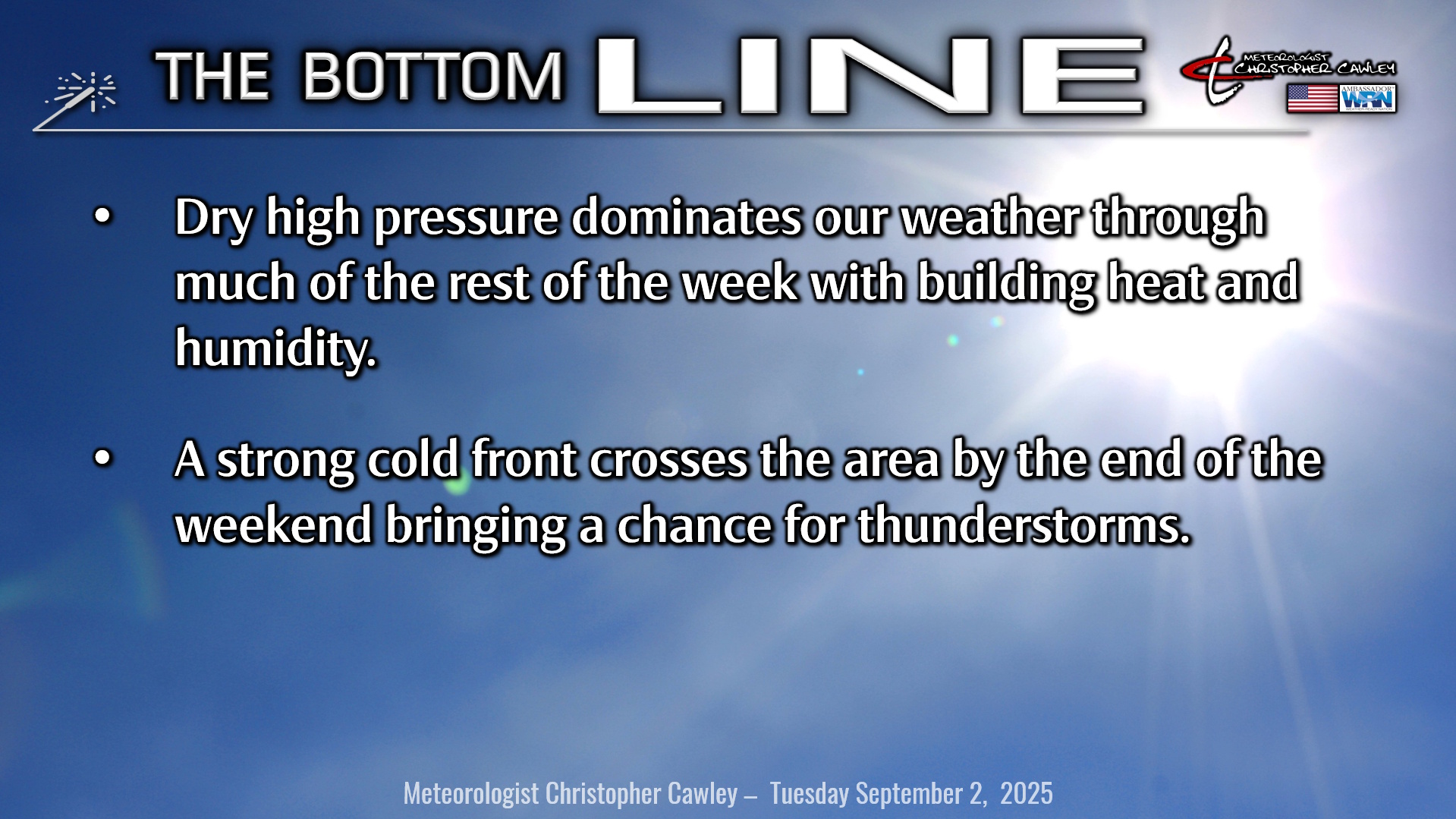
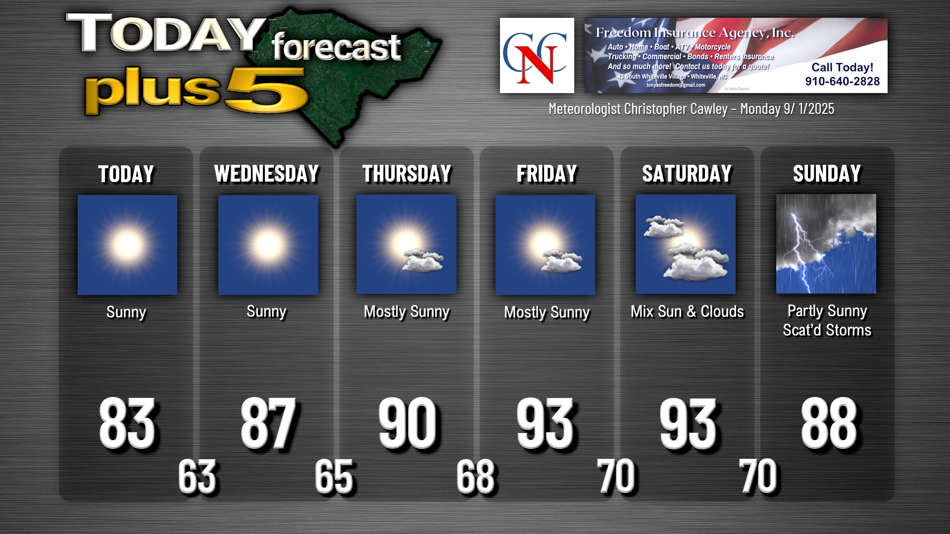
Quiet weather will be the rule for ColCo this week thanks to strong high pressure in place. This high slips off to the east toward the end of the week allowing a (brief) return to hot and humid conditions by the end of the week.
Our next rain chances come Sunday as a rather strong cold front is likely to push through the area and off the coast by next Monday. This front will then hang around well offshore deep into next week, which will have some tropical implications — see below.
I’m going to watch the timing of the front for Sunday for a severe weather threat. Until then, we’re high-and-dry with lots of sunshine and building heat/humidity.
TROPICS: It’s becoming more and more likely that our next tropical system of the season will take shape in the south-central Atlantic over the next several days. A tropical wave off the Africa coast is continuing to become more organized and will drift west-northwest into an area favorable for development. The NHC now gives this a 60% chance of becoming a tropical system over the next 7 days.
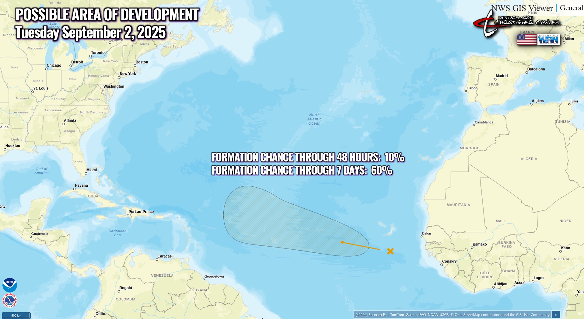
I don’t believe this will be any threat to the continental United States because the cold front which I mentioned earlier will tend to linger off the coast well into next week, steering whatever develops off to the north, similar to Erin. This is demonstrated in the latest modeling as well. So, while I will be watching this, as will everyone, I don’t believe we have anything to be concerned about at the present time.
Here is your Freedom Insurance Today-plus-Five Forecast:
–Meteorologist Christopher Cawley