CCN Weather Update for Thursday June 11, 2026
This weather update is sponsored by Freedom Insurance of Whiteville. Trust Freedom Insurance to give you clear blue skies when it comes to home, car, boat, or whatever insurance you need. Let Freedom provide customized coverage to keep you and your family safe. Contact Freedom today at 910-640-2828!
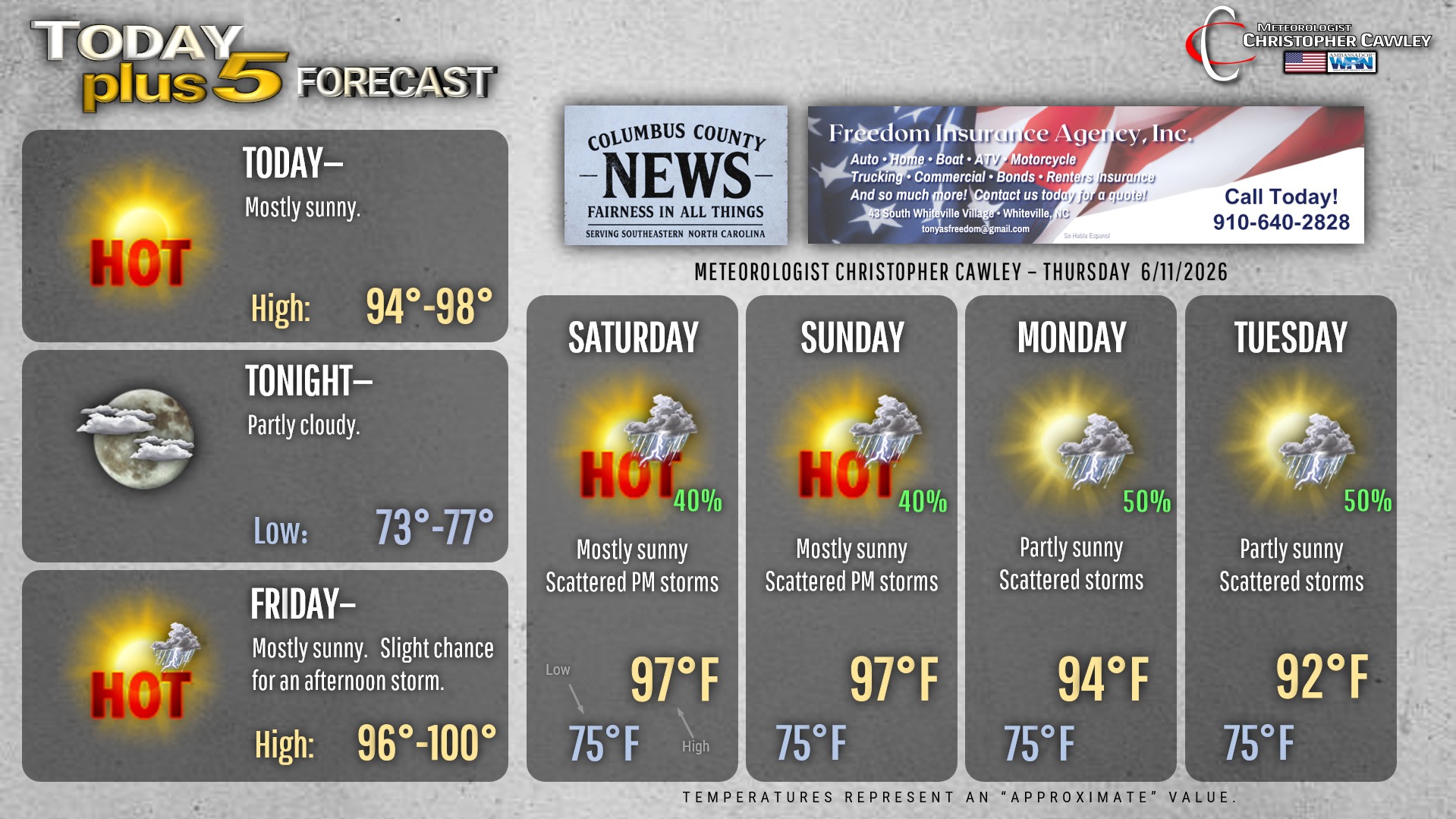
Here’s today’s Bottom Line

Ridging high pressure, both offshore and to our west, will bring striking heat and humidity to the area through the weekend.
The hottest temps of the year are likely to occur today through Sunday thanks to this ridge. Heat index values may approach advisory criteria on Friday and Saturday.
Thunderstorm chances today are essentially zero. Friday’s are only about 10%, but with impressive instability in place (including downdraft instability values) and modest shear, any storm that develops may produce damaging downburst winds and nearly constant lightning.
A frontal boundary tries to push into the high pressure ridge over the weekend, but it’s not really going to win the battle. It will, however, add to the source(s) of lift available to get thunderstorms going… so I’m putting in a 40% for storms over the weekend. Definitely not a washout by any means, but you’ll want to keep an eye and ear to the sky (and wear sunscreen and stay hydrated).
Going into next week (and possibly beyond) with that front pushing farther north, that’s going to open the door to the potential for deep tropical moisture to pump northward over the southeast. This COULD lead to numerous daily thunderstorms and locally significant rainfall.
Here is your Freedom Insurance Today-plus-Five Forecast:
–Meteorologist Christopher Cawley