CCN Weather Update for Monday December 8, 2025.
This weather update is sponsored by Freedom Insurance of Whiteville. You can trust Freedom Insurance to give you clear blue skies when it comes to home, car, boat, or whatever insurance you need. Let Freedom provide customized coverage to keep you and your family safe. Contact Freedom today at 910-640-2828!
Here’s today’s Bottom Line
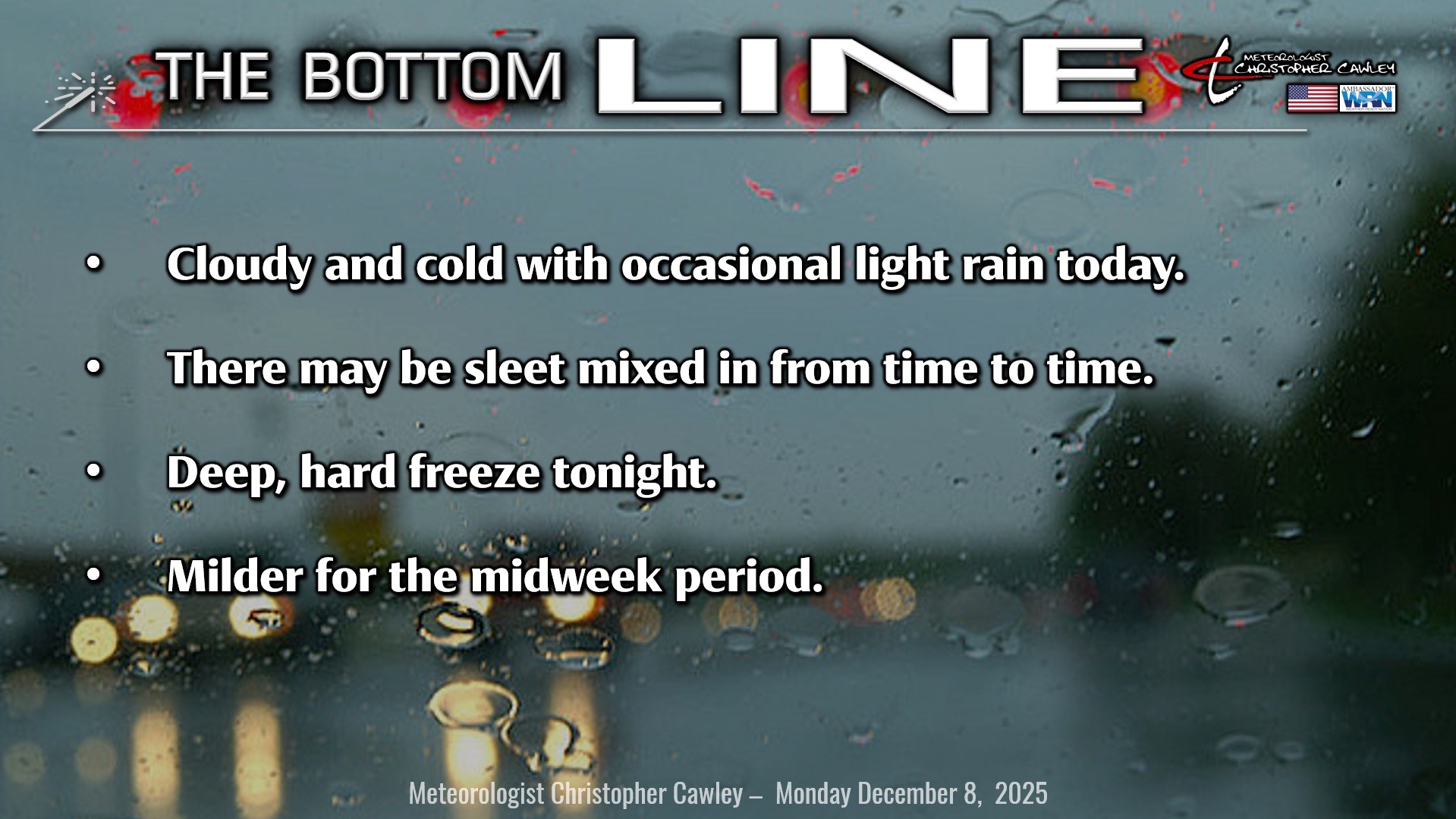
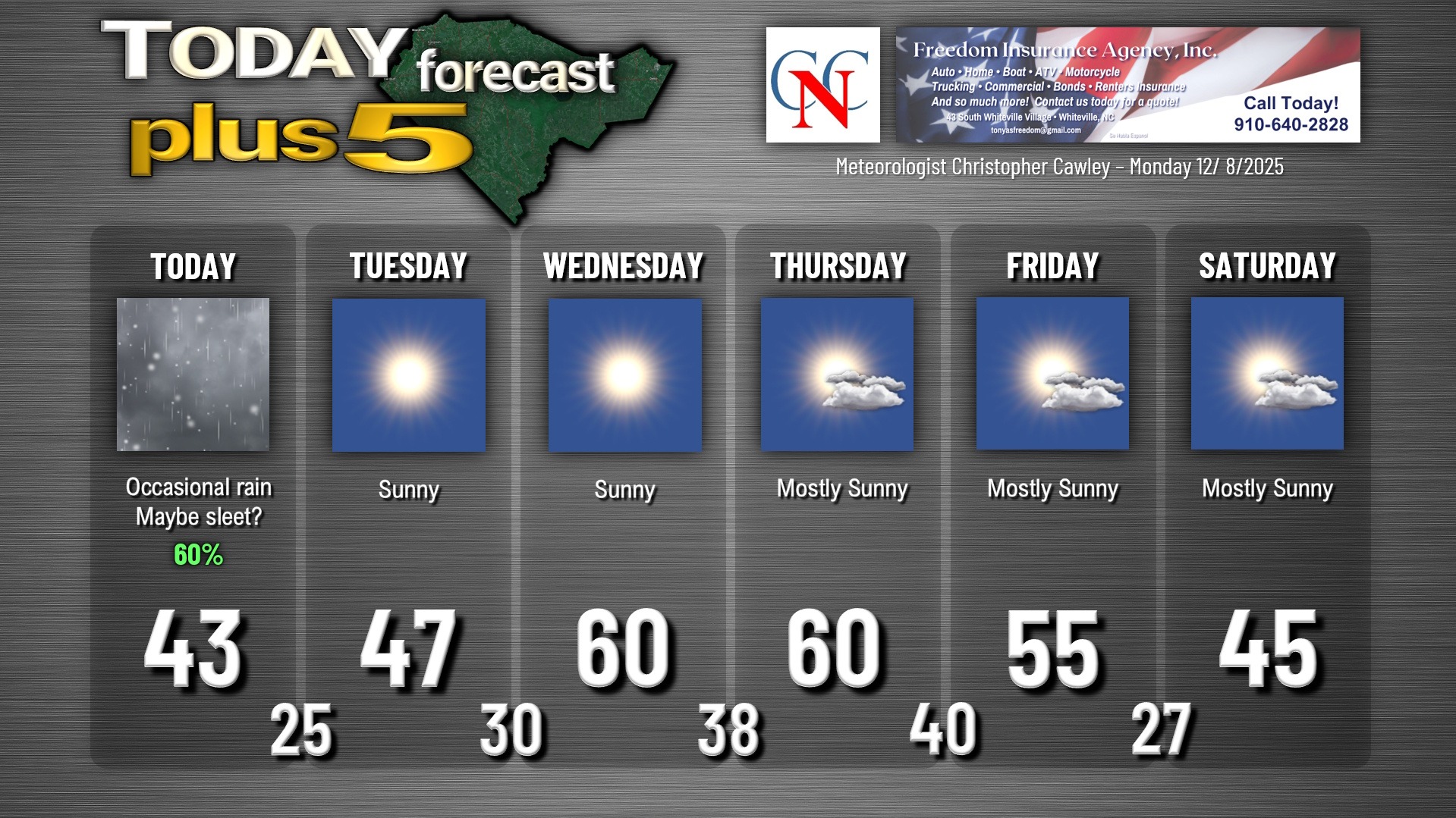
Yet another (but the final) damp, dreary day across the area for today. A little atmospheric disturbance will zip across northern NC/southern VA today, while high pressure over central New York pushes chilly air toward the surface across the Carolinas. Abundant moisture with the disturbance (a shortwave) will move “up and over” the colder air at the surface, resulting in a light but cold rain here locally. Heavier precipitation is expected just to our north, with accumulating snow across a good portion of north-central North Carolina.
Looking at the model soundings, I wouldn’t be surprised to hear the “tick-tick-tick” of some sleet pellets mixed in with the rain on occasion. Portions of northern Robeson and Bladen county may see some snowflakes mixed in, but the best chances for snow are farther to the north, mainly north of a line from Sanford, Dunn, Goldsboro. If you want to see accumulating snow, head north on the 95.
The shortwave pushes off the coast later this afternoon into the evening. Cold air quickly rushes in behind the departing precipitation, but there may be enough moisture leftover that even here we see a snowflake or two.
Skies rapidly clear tonight and temperatures absolutely tumble. A deep, hard freeze will occur, and temperatures at the bus stop tomorrow morning will be in the lower to middle 20s. Watch out for some patchy black ice late tonight as well, although I believe the road surfaces will quickly dry.
Tuesday will feature an abundance of sunshine for a change, but the chill will continue as highs only reach the upper 40s. Much warmer temperatures (actually back to “normal”) move in for Wednesday and Thursday as high pressure moves to our south, allowing a southwesterly flow to become established.
A large, sprawling storm system will impact the Great Lakes and northeast on Thursday, and a “backdoor” cold front will drop south over the area Thursday afternoon. We’ll have slightly cooler temps during the day on Friday with dry weather continuing.
A much stronger cold front moves through late Friday, and frigid Arctic high pressure takes hold as we move into the weekend. Low temps Friday night will drop deep into the 20s… modeling suggests that highs on Saturday and Sunday struggle to reach the 40s, even with full sunshine. Brrr….
Here is your Freedom Insurance Today-plus-Five Forecast:
–Meteorologist Christopher Cawley