CCN Weather Update for Friday February 6, 2026.
This weather update is sponsored by Freedom Insurance of Whiteville. You can trust Freedom Insurance to give you clear blue skies when it comes to home, car, boat, or whatever insurance you need. Let Freedom provide customized coverage to keep you and your family safe. Contact Freedom today at 910-640-2828!
Here’s today’s Bottom Line:
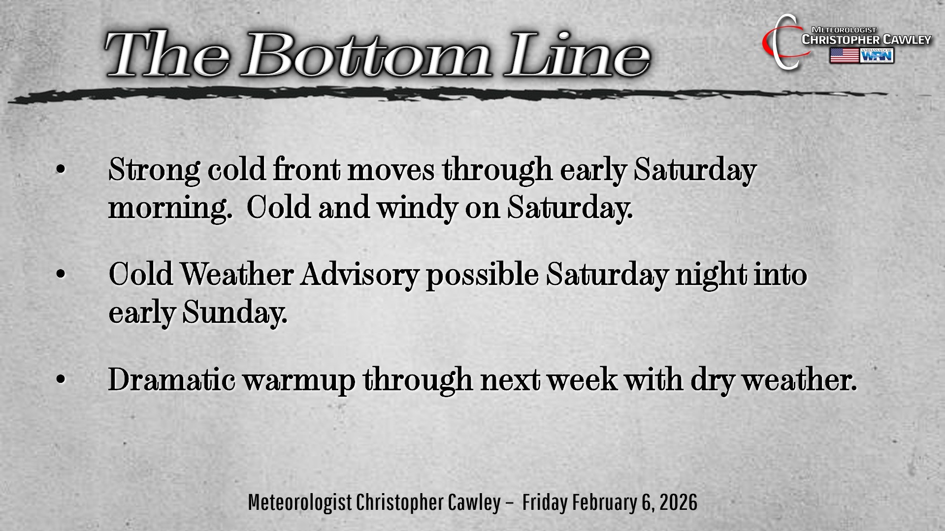
Two key things to talk about in this morning’s report: The strong cold front that will move through late tonight / early Saturday…. and then the big-time warm-up next week.
An Arctic front will whisk across the area late tonight into the predawn hours Saturday. This will bring gusty winds and a very cold weekend. The National Weather Service may issue a “Cold Weather Advisory” if the wind chill (the ‘feels like’ temperature) drops below 15 degrees.
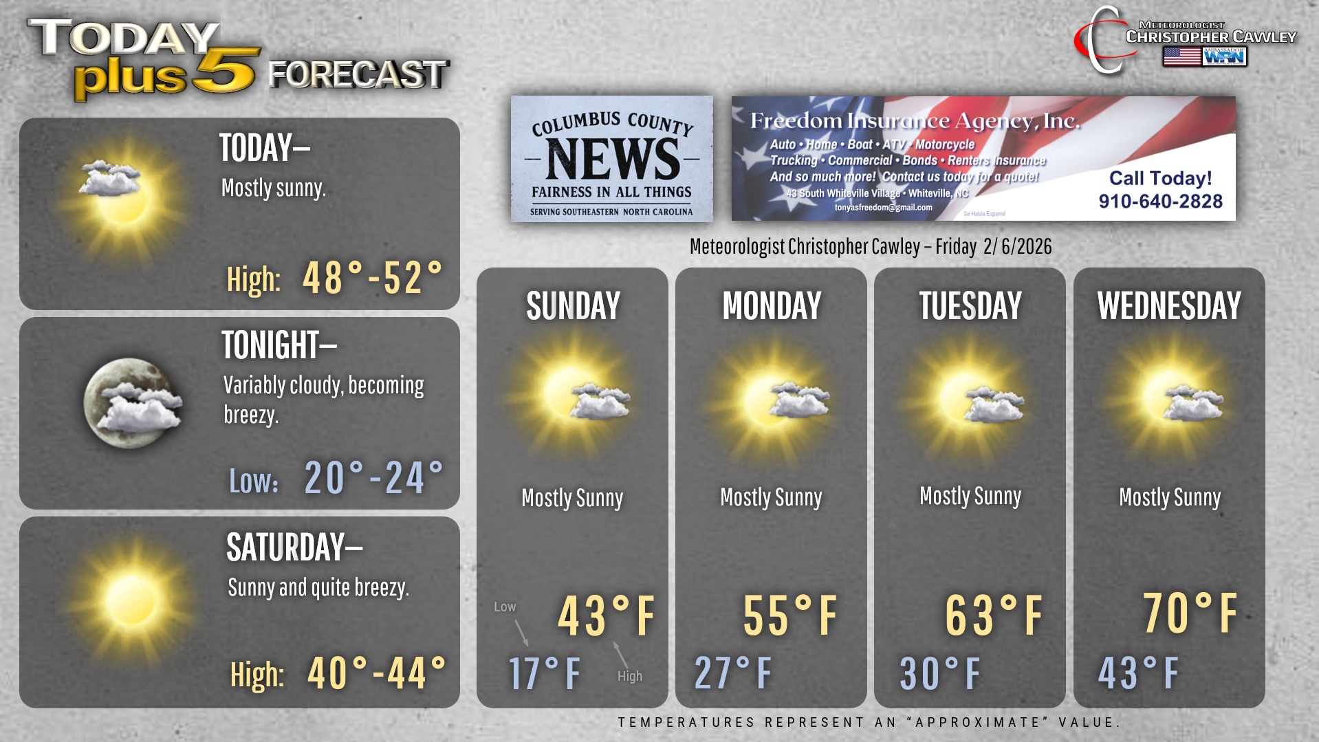
Deep northwest winds will occur throughout the day Saturday, with winds gusting 25-30 mph at times. We’re going to have lots of sunshine over the weekend, but high temps both Saturday and Sunday will struggle to the lower 40s, while lows Saturday night / early Sunday drop back into the mid and upper teens.
Then… a remarkable warm-up takes place starting on Monday. High pressure will shift off the coast and our wind flow becomes southwesterly. This high pressure center will keep us dry through most of next week. Highs will flirt with 70 the second half of the week, while lows will be warmer than our highs this weekend.
Looking long-range, the next strong front is likely to cross the area sometime around the Valentine’s Day weekend. This will likely return temps back to “normal” for mid-February (upper 50s by day, mid 30s by night).
Here’s your Freedom Insurance Today-plus-Five Forecast!
–Meteorologist Christopher Cawley