CCN Weather Update for Thursday March 12, 2026.
This weather update is sponsored by Freedom Insurance of Whiteville. You can trust Freedom Insurance to give you clear blue skies when it comes to home, car, boat, or whatever insurance you need. Let Freedom provide customized coverage to keep you and your family safe. Contact Freedom today at 910-640-2828!
Here’s today’s Bottom Line:
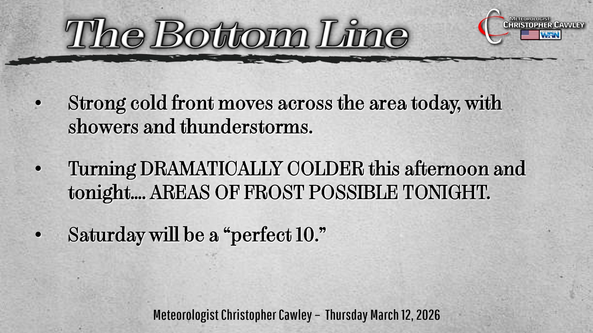
From record-breaking heat … to FROST potential!!
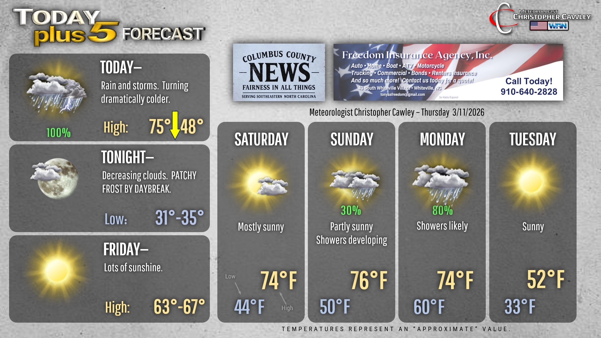
Change is in the air today as a powerful cold front slams across the area early this afternoon. Rain and thunderstorms can be expected with the frontal passage and for a few hours behind it. While the overall severe threat is low, there is the potential for some isolated damaging wind gusts with the front. The NWS SPC does have our area outlined in a “Marginal Risk” (level 1 out of 5) for severe weather. Again, this will be an isolated threat.
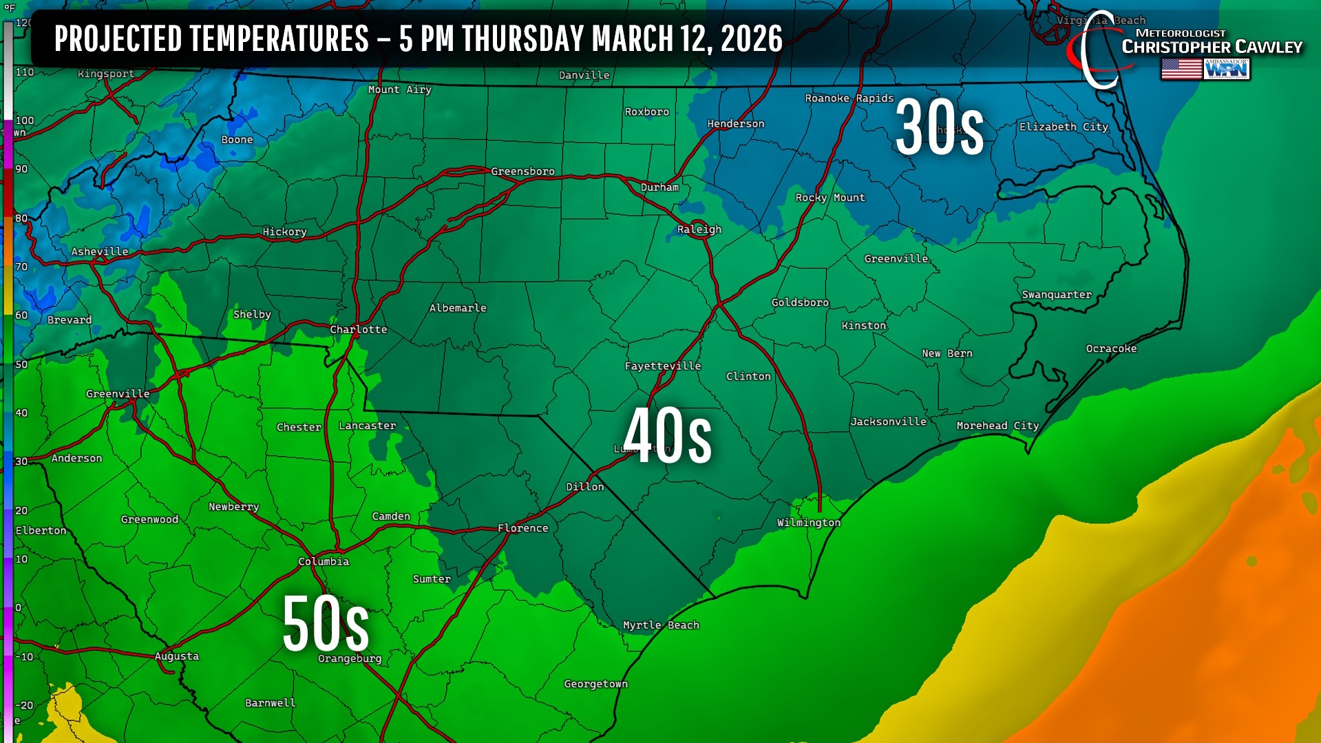
We’ll have highs into the 70s by lunchtime… but by suppertime we’ll be in the upper 40s. No, that’s not a typo.
Isolated to patchy areas of frost are possible early Friday morning under clear skies with temps in the lower 30s. Make sure the kids are ready for this dramatic change at the bus stop on Friday!
Saturday will be a true winner with bright sunshine, highs in the 70s… get out and enjoy it.
Our next system approaches late Sunday into Monday with showers and thunderstorms, breezy conditions as well.
Then the bottom drops out on our temps once again, and this one is for real, folks. HIGH temps on Tuesday will struggle to the reach the lower 50s, even with full springtime sunshine. FROST POTENTIAL exists late Tuesday night and Wednesday night before temps slowly moderate.
Here’s your Freedom Insurance Today-plus-Five Forecast!
–Meteorologist Christopher Cawley