CCN Weather Update for Saturday March 14, 2026.
This weather update is sponsored by Freedom Insurance of Whiteville. You can trust Freedom Insurance to give you clear blue skies when it comes to home, car, boat, or whatever insurance you need. Let Freedom provide customized coverage to keep you and your family safe. Contact Freedom today at 910-640-2828!
Here’s today’s Bottom Line:
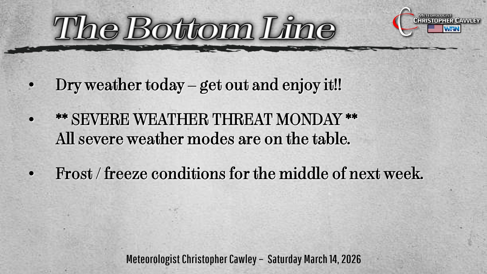
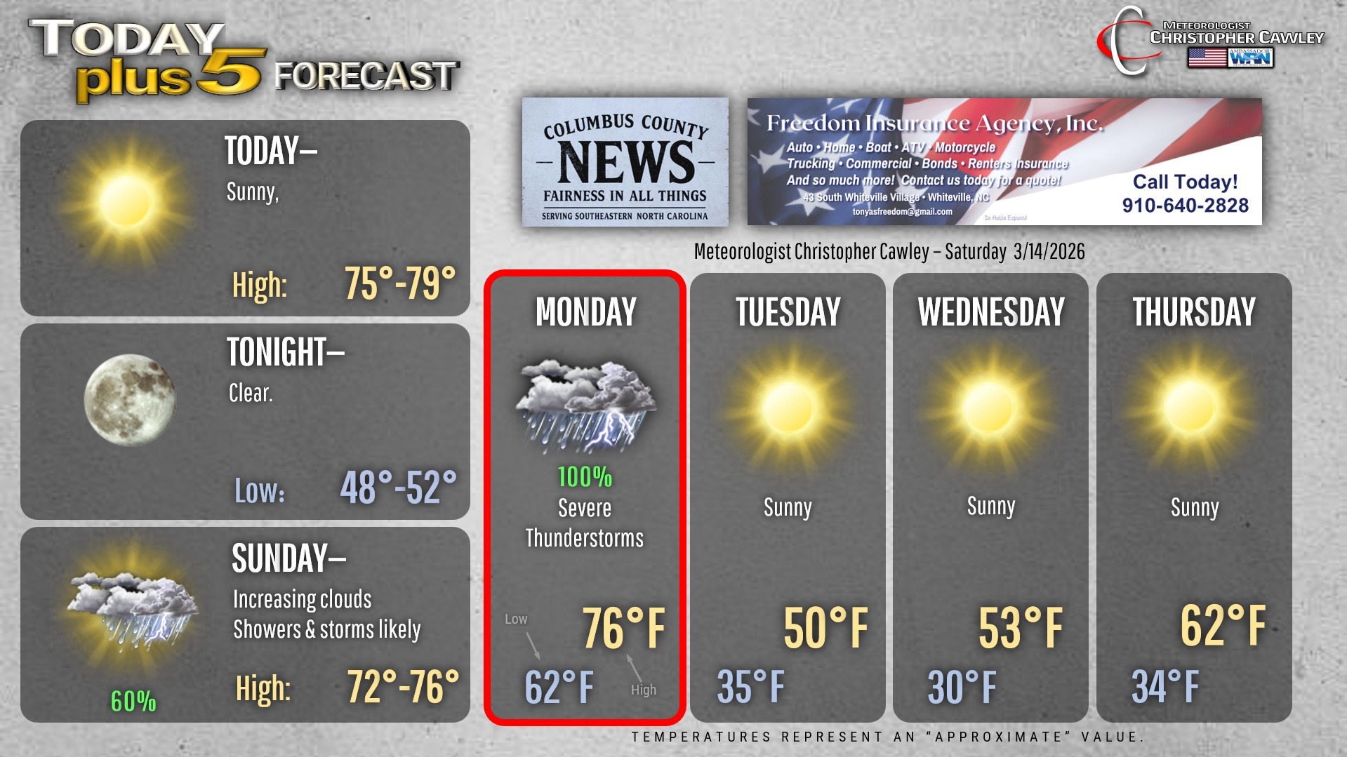
A beautiful, perfect 10 weather day today. Chamber of Commerce conditions. Get out and enjoy it!!
Clouds will be on the increase early Sunday; showers and thunderstorms are expected during the afternoon as a warm front lifts south to north. The shower and storm threat will persist into Sunday night before tapering off a bit during the overnight hours.
Then comes Monday. If there was ever a need for a “weather alert day,” it’s Monday.
Our area will be firmly in what is known as the “warm sector” on Monday morning. While there will likely be mid- and high-level cloudiness, atmospheric instability will be fairly robust. Conditions may become favorable for the development of supercell thunderstorms Monday from mid-morning onward until the cold front passage … which will likely be sometime during the afternoon hours.
Potential hazards with supercell thunderstorms include damaging winds, hail, and tornadoes.
Then we have the frontal boundary itself. There is likely to be a squall line of severe thunderstorms with the front. As this will (likely) be in a line, the primary threat will be that of damaging to destructive straight-line winds, especially right with the frontal boundary.
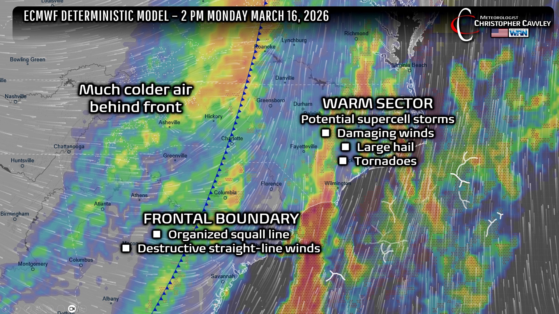
TIMING: Still “TBD” but the supercell threat will be from mid- to late morning until the mid-afternoon. Second threat comes with the front itself, likely in the mid-afternoon hours.
SEVERE WEATHER MODES: All modes of severe weather are on the table for Monday including damaging to destructive winds, hail, and tornadoes.
Behind the front comes a push of unseasonably cold weather for late Monday night through Wednesday night. Frost and freeze conditions are becoming more and more likely, especially Tuesday night as temps drop into the upper 20s across the area. It’ll be important to protect any tender plants that you may have started.
Please take the severe weather threat seriously for Monday. This is no joke.
Here’s your Freedom Insurance Today-plus-Five Forecast!
–Meteorologist Christopher Cawley