CCN Weather Update for Monday March 23, 2026.
This weather update is sponsored by Freedom Insurance of Whiteville. You can trust Freedom Insurance to give you clear blue skies when it comes to home, car, boat, or whatever insurance you need. Let Freedom provide customized coverage to keep you and your family safe. Contact Freedom today at 910-640-2828!
Here’s today’s Bottom Line:
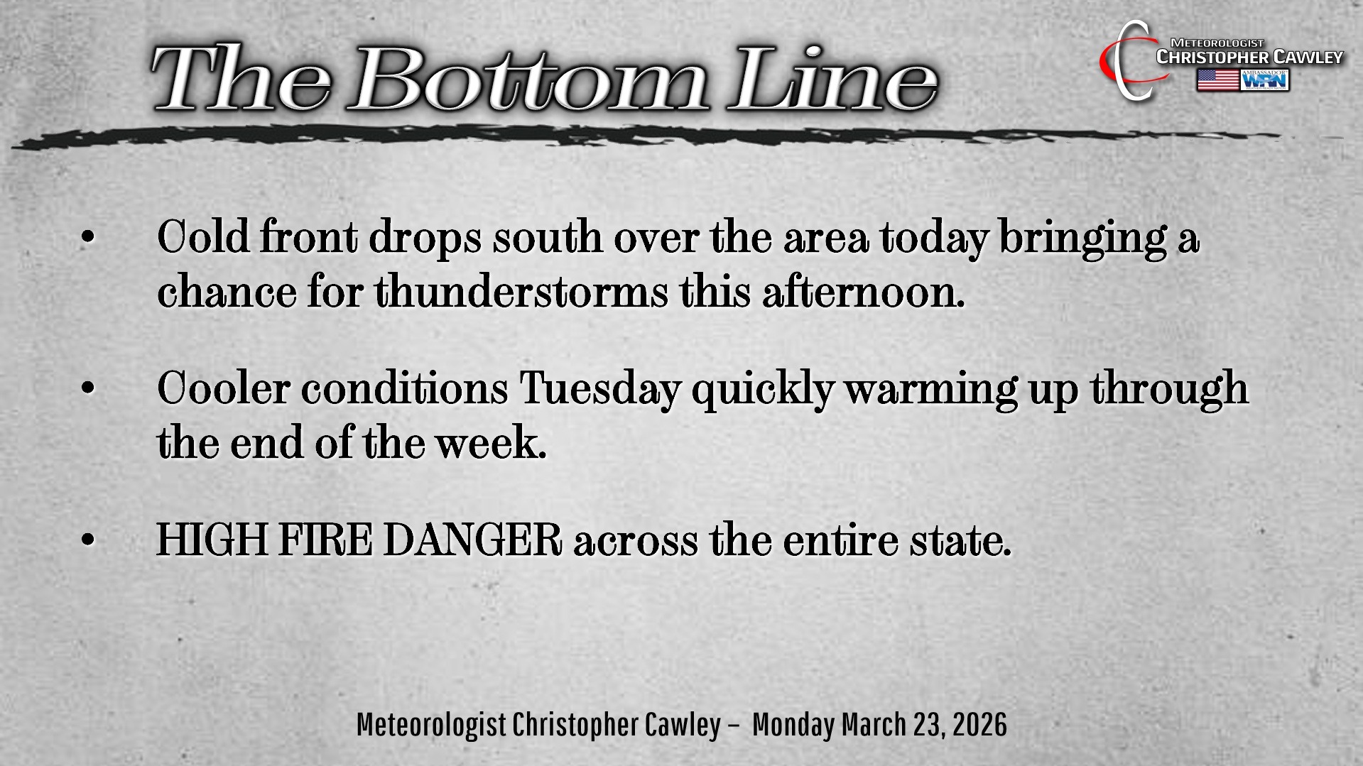
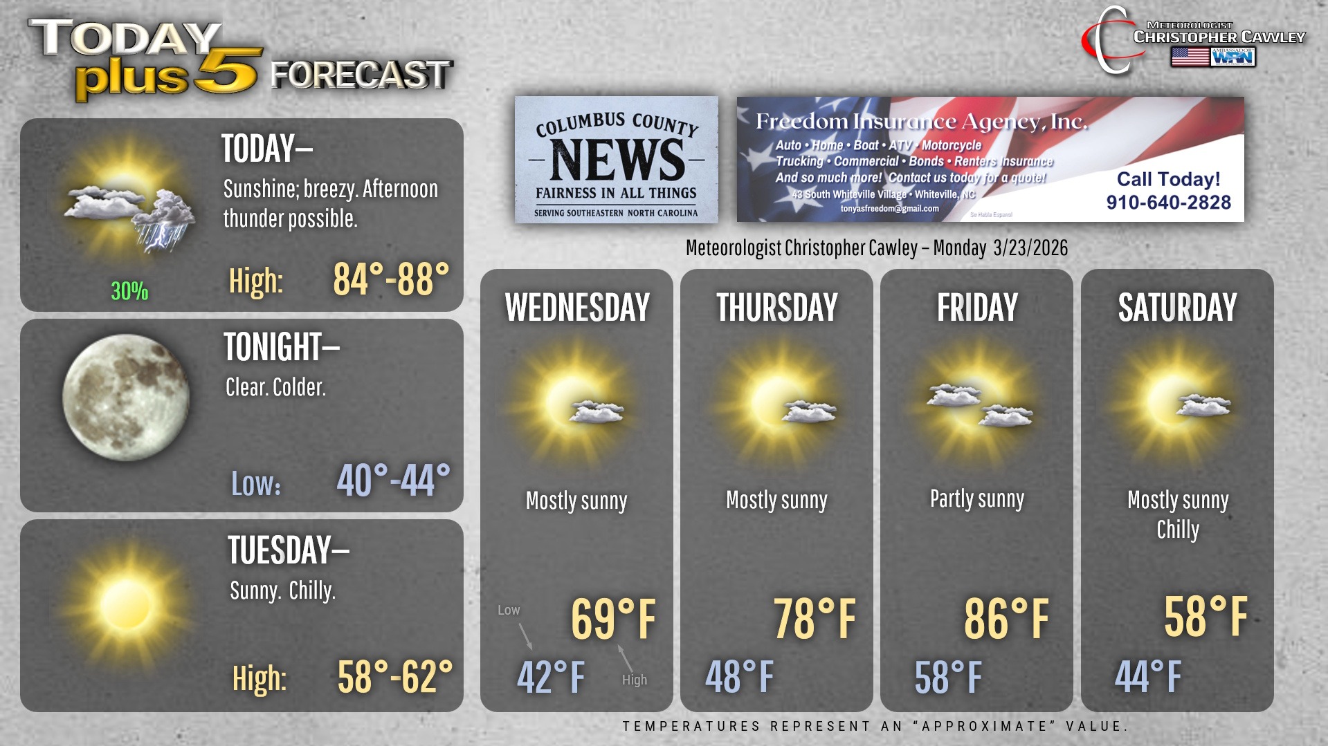
Like yesterday, there’s not much to talk about in today’s blog. We do have a cold front which will drop down over the area, right during the heating of the day today, and then we’re high-and-dry through the end of the work week.
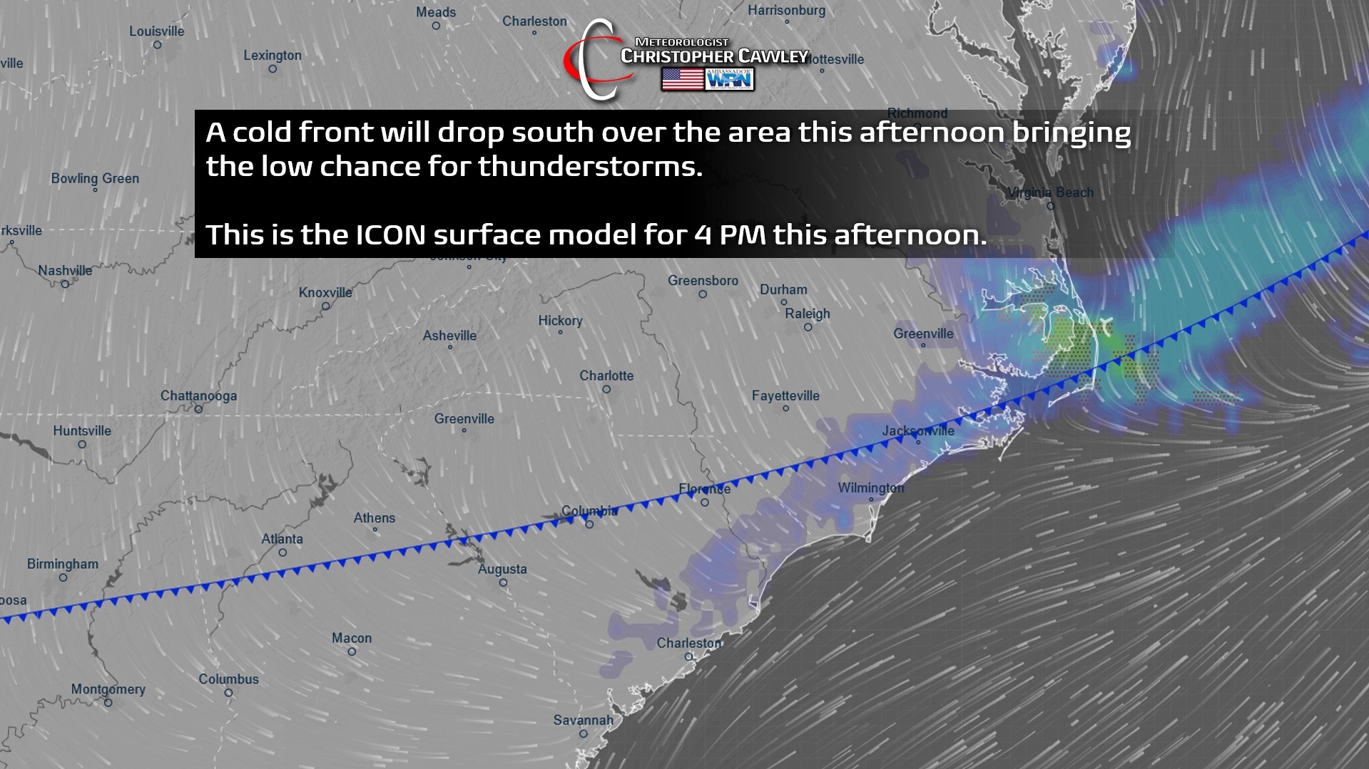
The cold front won’t have much fanfare with it… but convergence along the front combined with the peak heating of the day may trigger a few thunderstorms with the frontal passage. There is a low-end severe risk; an isolated damaging wind gust is possible (but I highly doubt it). I think the coverage will be isolated at most.
It turns much colder tonight on a northerly flow behind the front and temps fall to the lower 40s by sunrise on Tuesday.
Despite full sunshine on Tuesday, cold air advection will keep our highs a tick or two either side of 60. Another chilly night on tap Tuesday night as we drop to the lower 40s, but by Wednesday we’re back up to 70.
Strong warming occurs Thursday and Friday ahead of the next cold front. That front moves through Friday night with a few showers or perhaps a thunderstorm, and then another cool trend arrives next weekend.
I’m watching the threat for FROST late next Saturday night/early Sunday morning. Some modeling suggests temps drop to about 36-37 degrees, and 37 is that “magic number” where surface frost begins to form. It’s a bit too early to make anything for certain, but have that on your radar going forward.
Here’s your Freedom Insurance Today-plus-Five Forecast!
–Meteorologist Christopher Cawley