CCN Weather Update for Friday April 3, 2026.
This weather update is sponsored by Freedom Insurance of Whiteville. You can trust Freedom Insurance to give you clear blue skies when it comes to home, car, boat, or whatever insurance you need. Let Freedom provide customized coverage to keep you and your family safe. Contact Freedom today at 910-640-2828!
Here’s today’s Bottom Line:
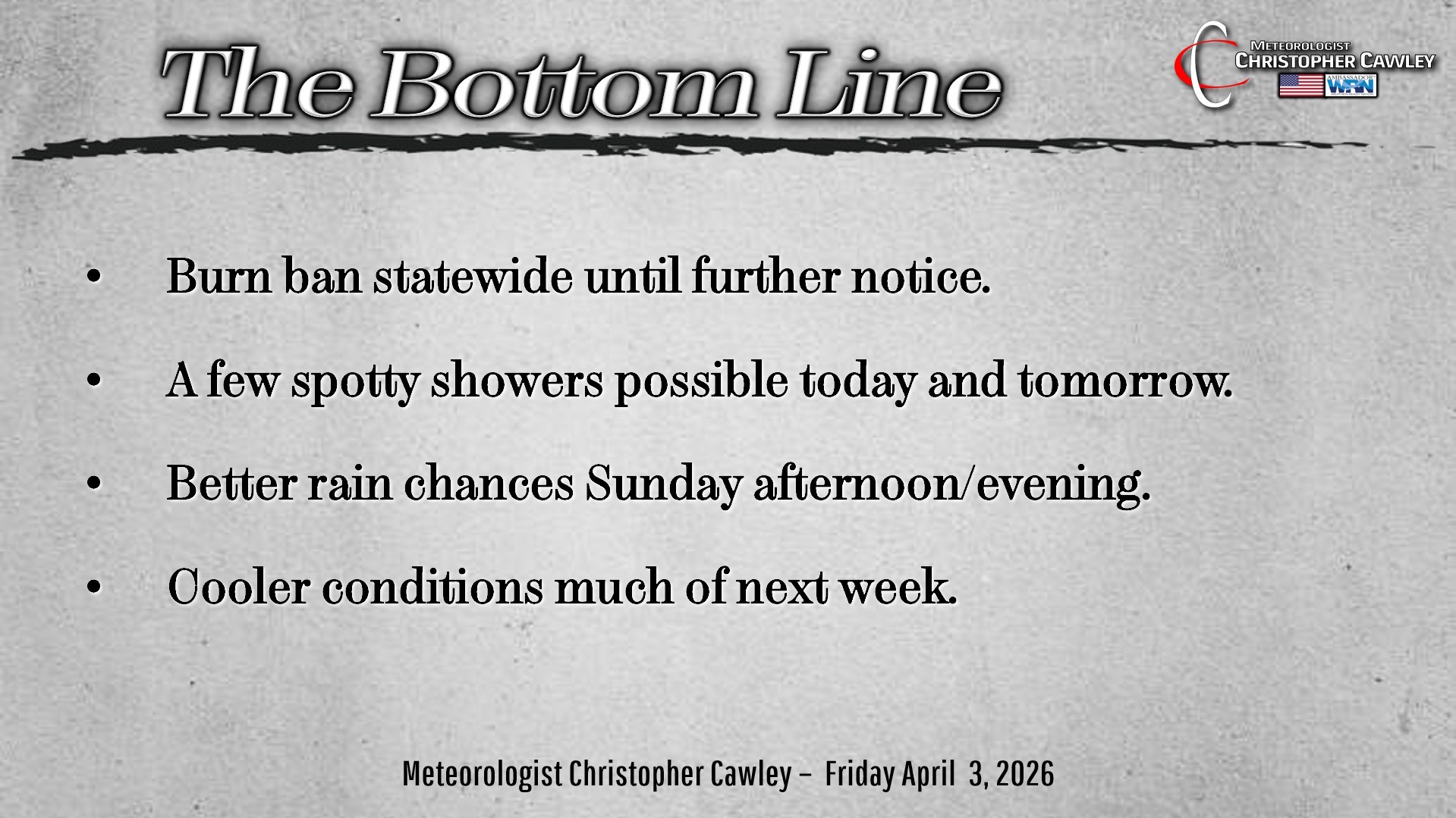
The burn ban remains in place for the time being, at least as of the time of this writing.
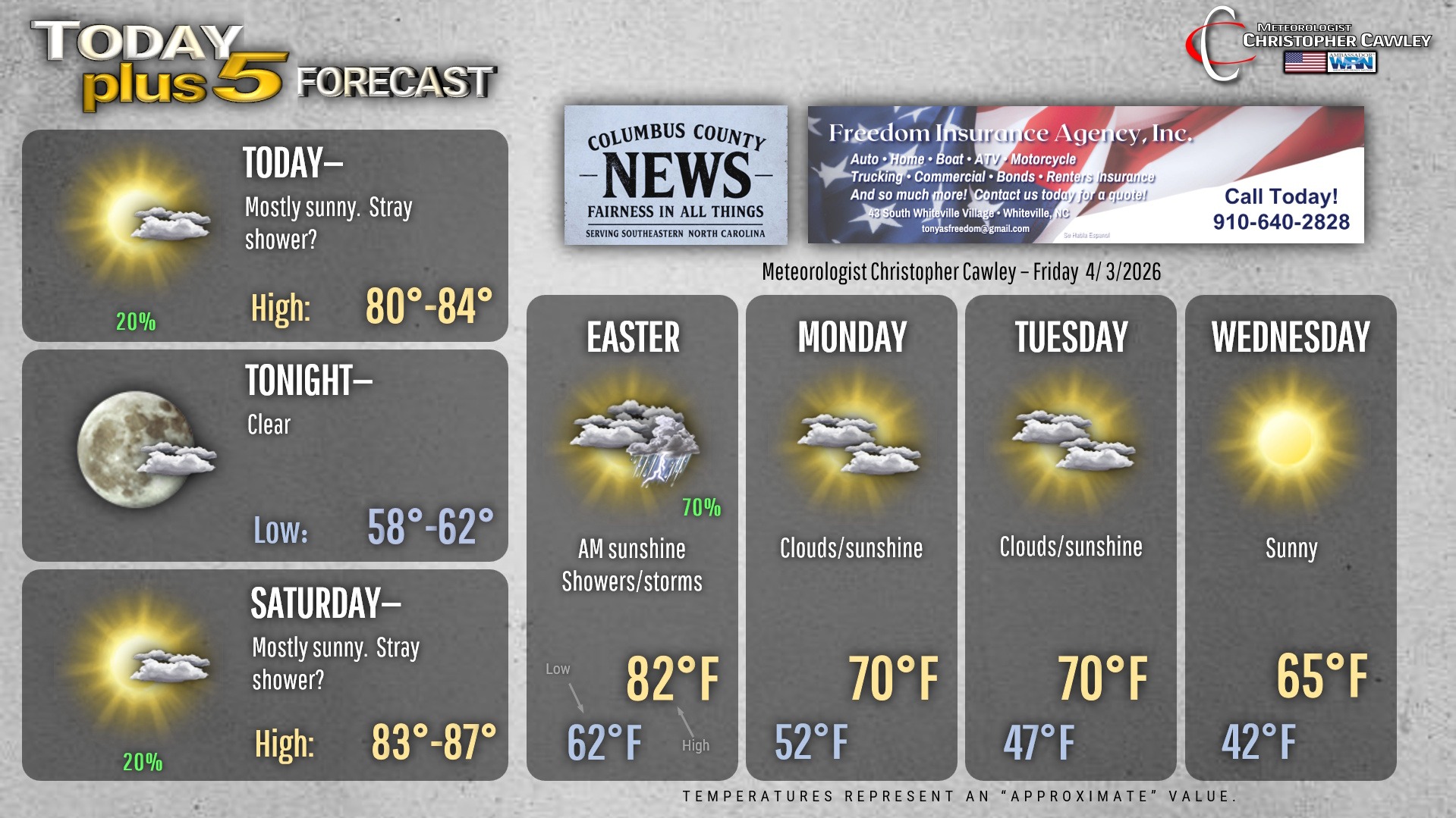
Another warm and (mostly) dry day is upon us thanks to a ridge of high pressure just offshore. However in this southerly flow there is the potential for a few isolated, spotty, stray, rogue rain showers that won’t amount to much… perhaps a few wipes of the windshield wipers. That’ll be the case this afternoon and Saturday afternoon.
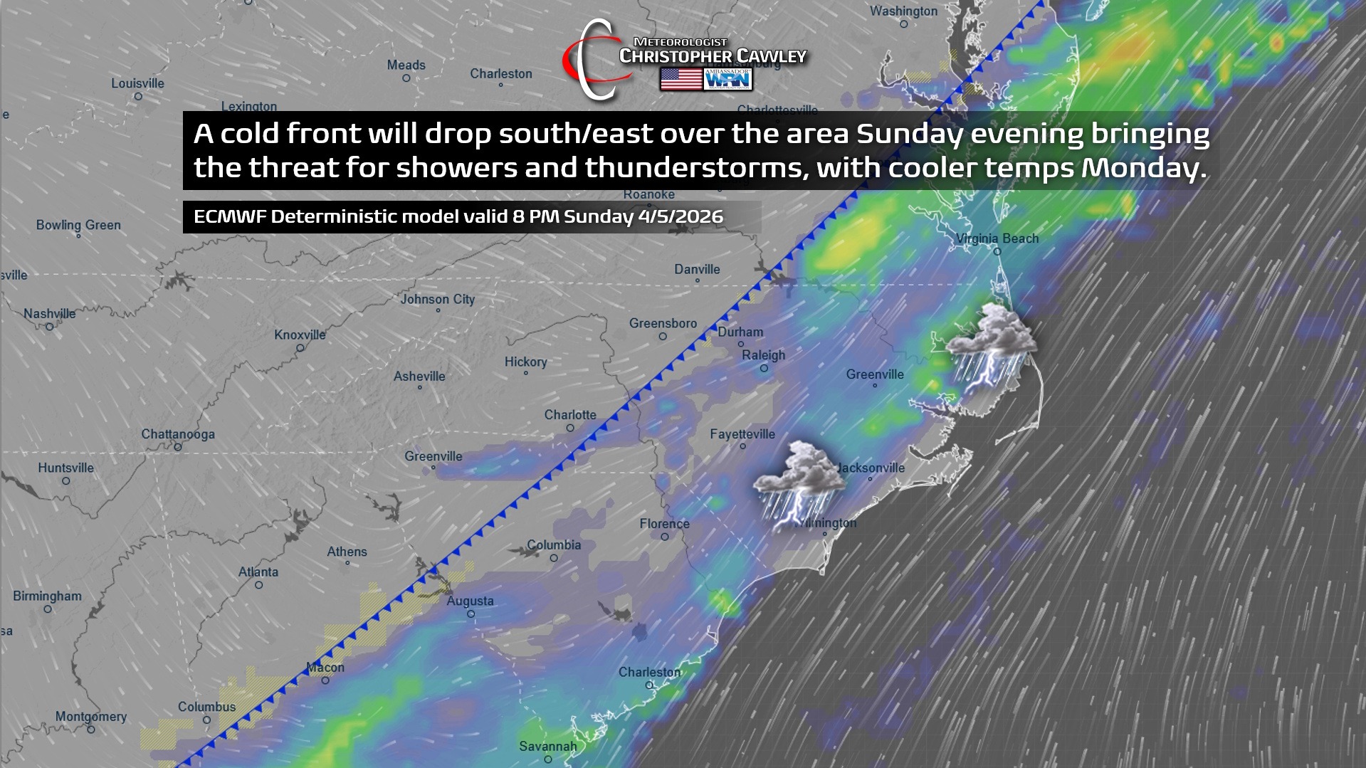
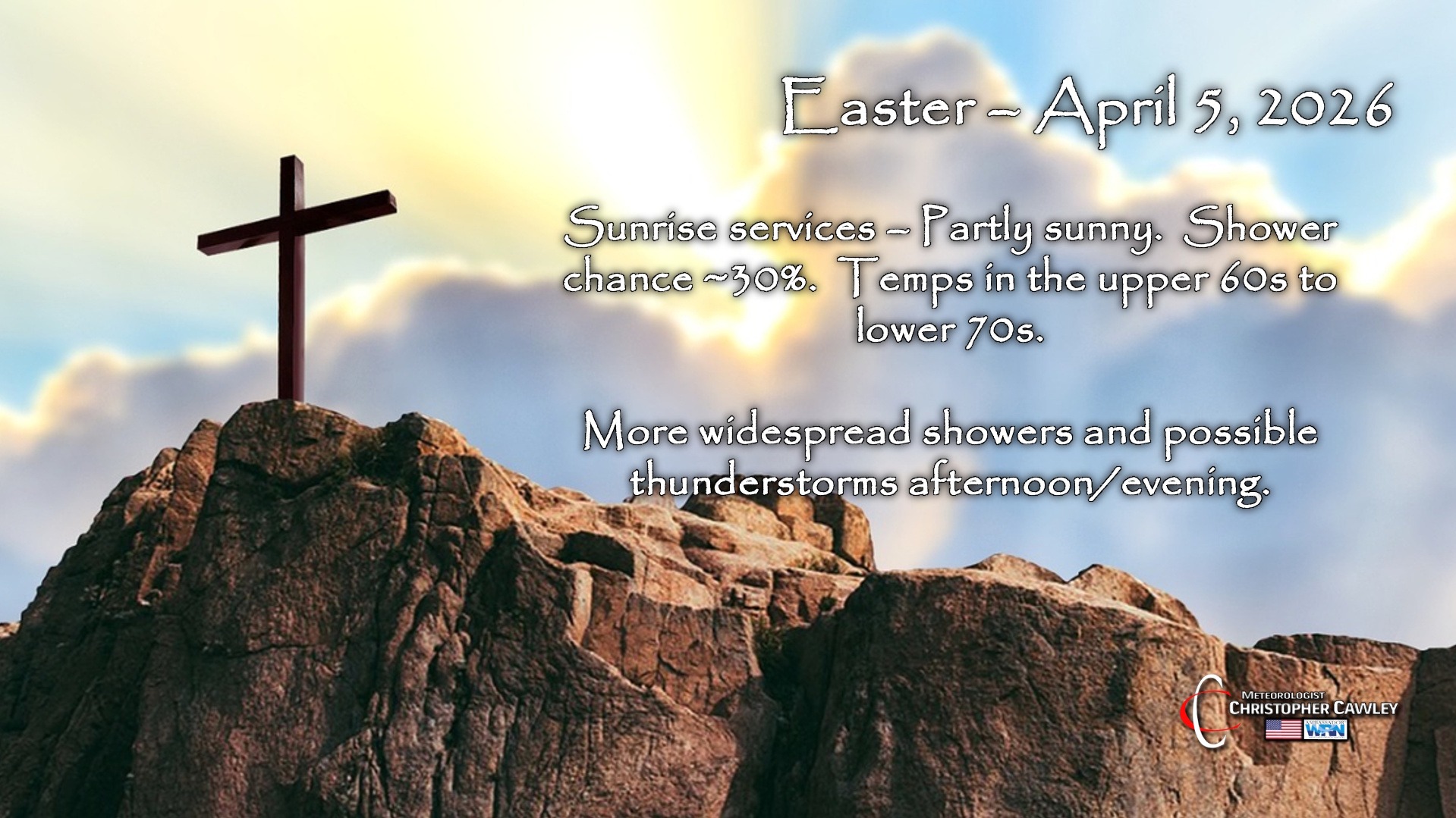
Our cold front is slated to drop through a bit earlier during the evening on Easter… sometime between suppertime and midnight… with an increasing threat for showers and perhaps a few thunderstorms from mid-afternoon onward. We won’t see an awful lot of rain from this, perhaps a quarter inch at the most, so this won’t be a drought-buster by any means. At this time I don’t anticipate any severe weather.
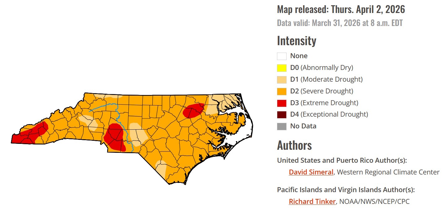
Speaking of the drought, the latest drought monitor has hit the street, and it doesn’t show good news for North Carolina. Columbus County is between “moderate” and “severe” drought (west to east, respectively), and that’s really not going to change anytime soon.
As mentioned, cold front drops through during the evening hours on Sunday, with scattered showers and thunderstorms.
Next week is looking like more dry weather and cool temps. A secondary (dry) cold front will push through late Tuesday night bumping our temps down a little more. No frost threat.
Here’s your Freedom Insurance Today-plus-Five Forecast!
–Meteorologist Christopher Cawley